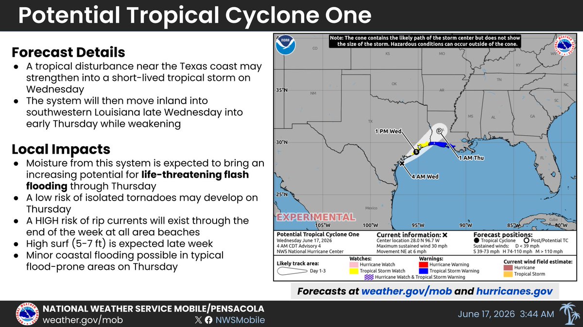
A system on currently on the Texas coast will move northeast across Louisiana in the next day or so, bringing more rounds of rain to the area, along with a continued High Risk of Dangerous Rip currents and rough surf on area beaches.
The risk for severe storms has increased across the northern half of the area for this afternoon and tonight. Both the Enhanced Risk and Slight Risk have been shifted southward. Damaging wind, large hail and a few tornadoes area possible late this afternoon into tonight.
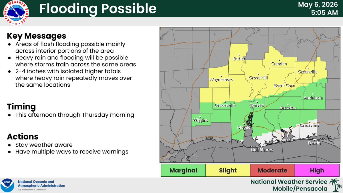
🛑 HEADS UP - #RipCurrent Risk quickly increases to a HIGH RISK by mid-week at coastal Alabama and northwest Florida beaches.
🌊 HIGH Risk means the surf is dangerous for *ALL LEVELS* of swimmers.
🏖️ Be #BeachSmart! https://t.co/EQbbwg6mIQ
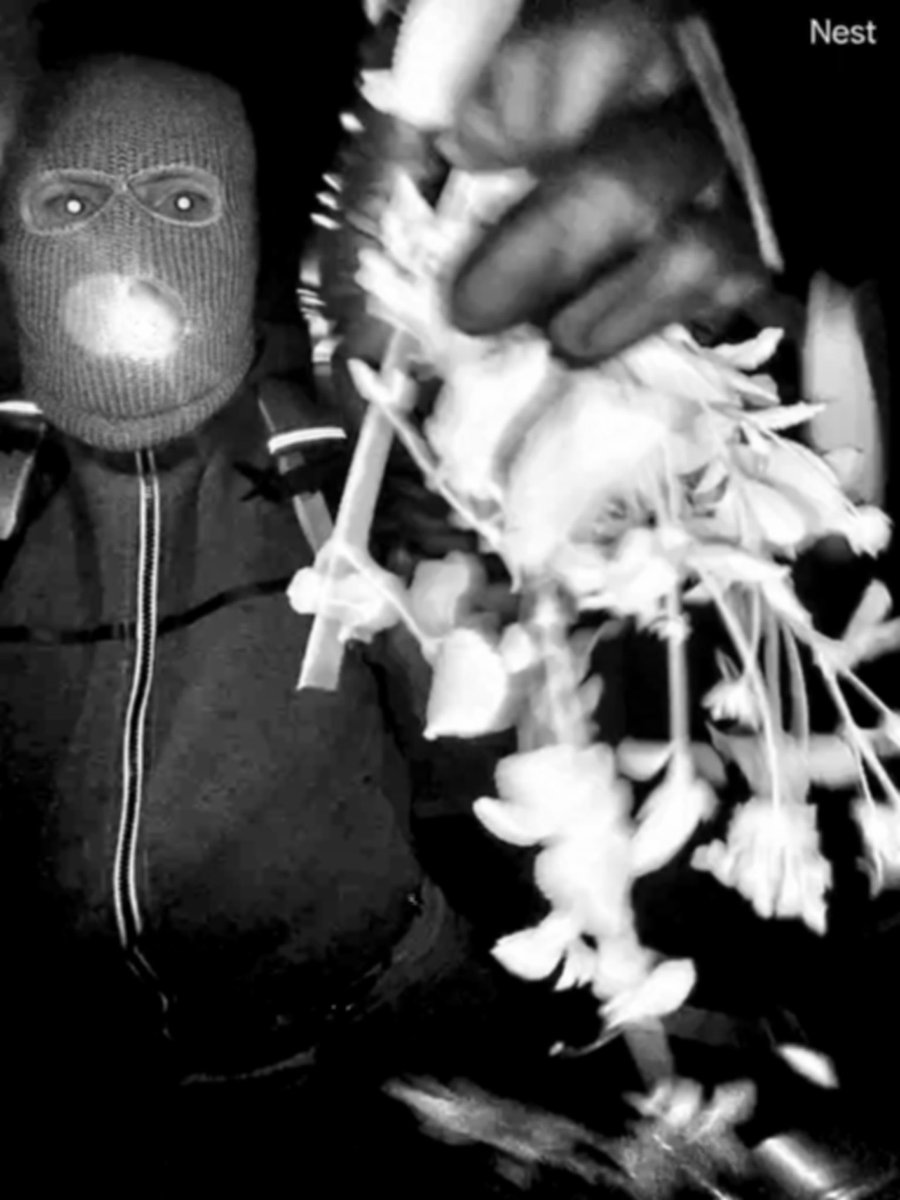
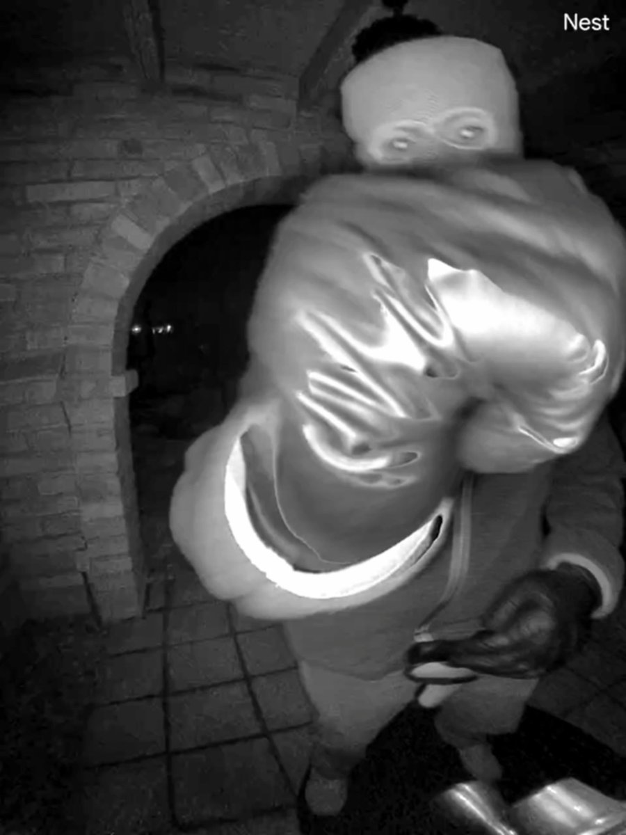
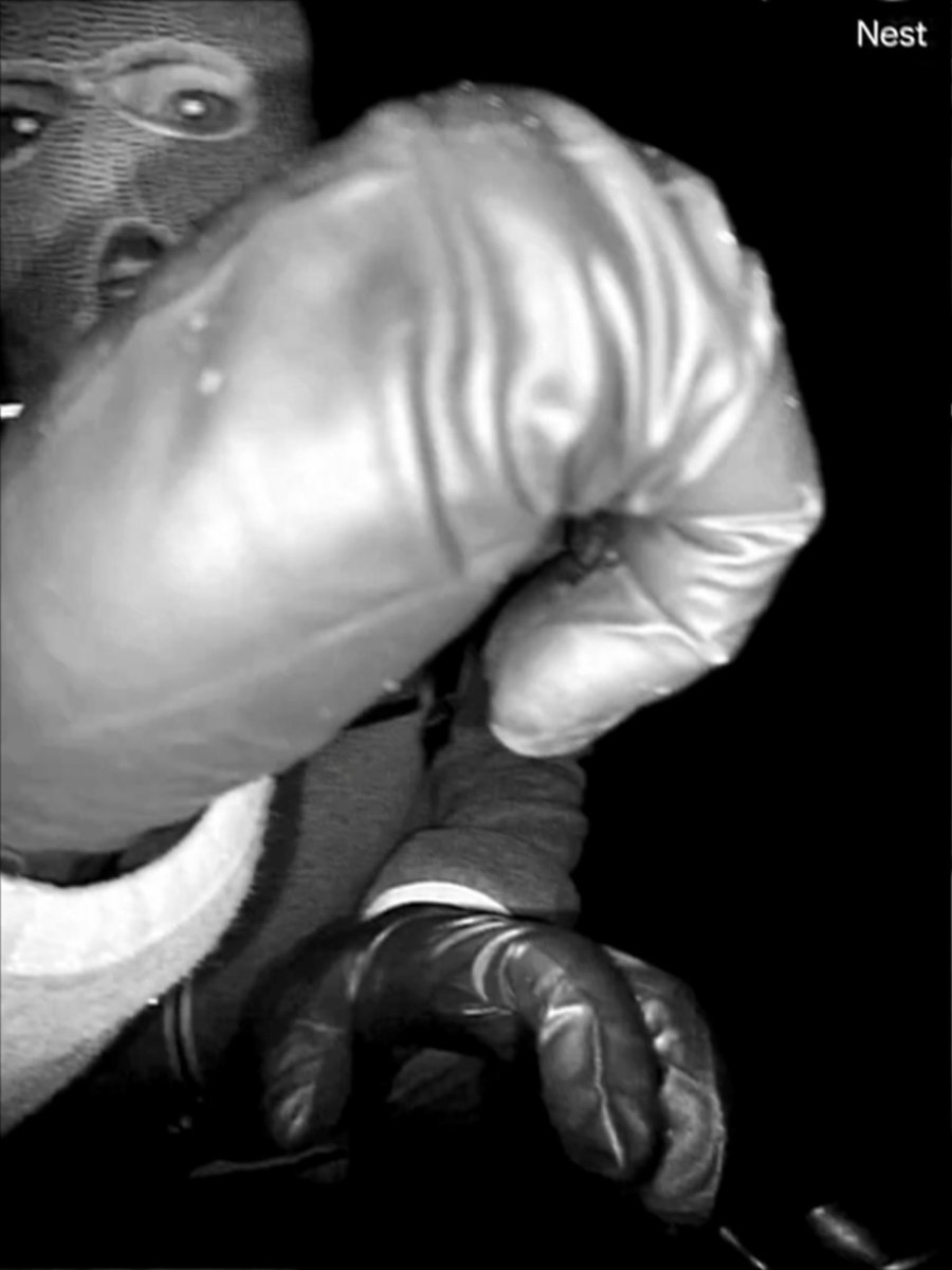
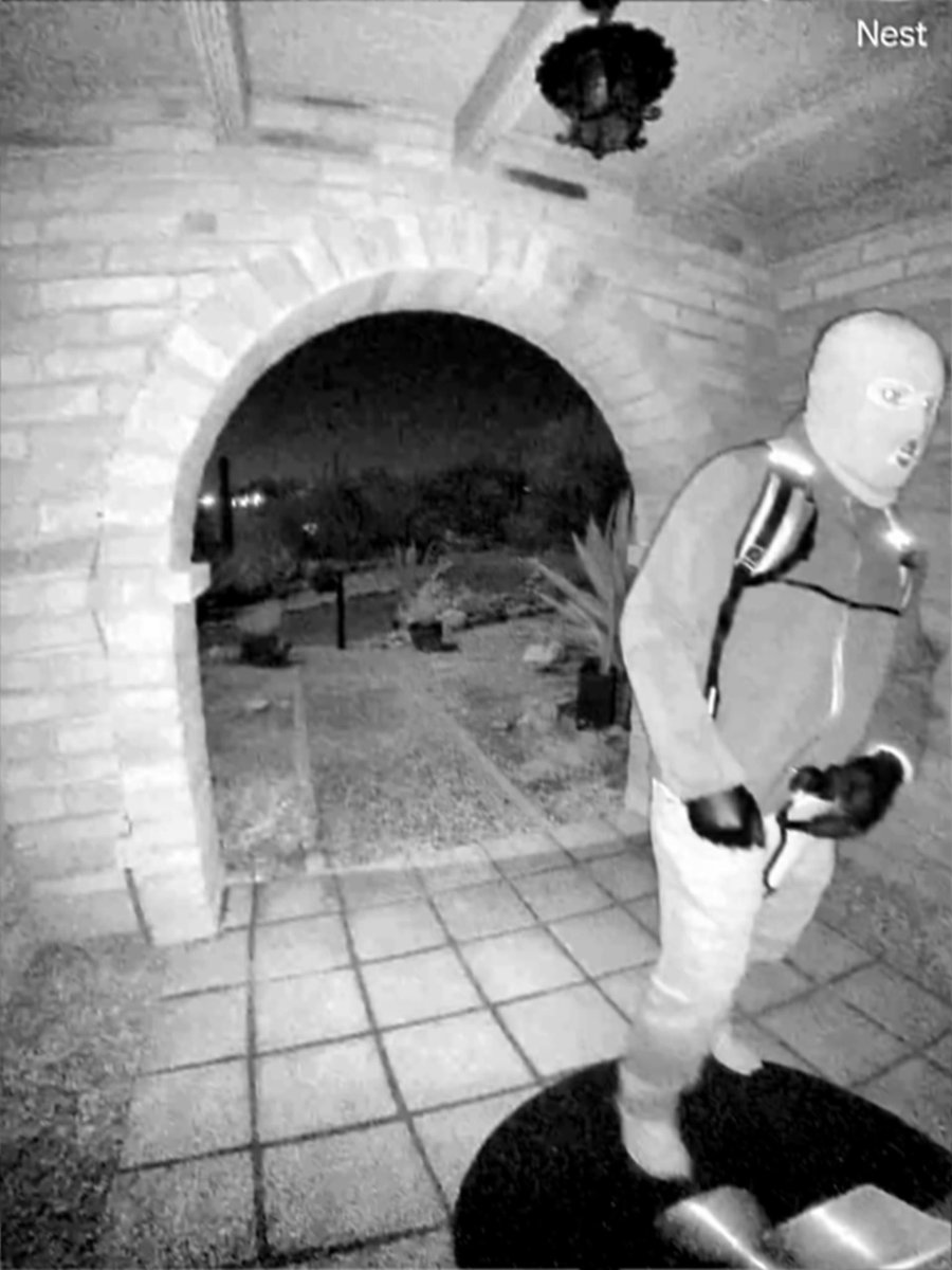
New images in the search for Nancy Guthrie:
Over the last eight days, the FBI and Pima County Sheriff’s Department have been working closely with our private sector partners to continue to recover any images or video footage from Nancy Guthrie’s home that may have been lost, corrupted, or inaccessible due to a variety of factors - including the removal of recording devices. The video was recovered from residual data located in backend systems.
Working with our partners - as of this morning, law enforcement has uncovered these previously inaccessible new images showing an armed individual appearing to have tampered with the camera at Nancy Guthrie's front door the morning of her disappearance.
Anyone with information, please contact 1-800-CALL-FBI or visit https://t.co/m55w5cqC7Y
CHRISTMAS CRASH: Dramatic video from Texas shows a car slamming into an 18-wheeler after officers tried to get a sleepy driver's attention, officials said.
"This crash is a strong reminder of how dangerous driving while fatigued can be, especially during the holidays," authorities said.
"Fatigue slows reaction time, affects judgment, and can be just as dangerous as driving impaired."
A few isolated showers will continue across the area overnight. Expect an increasing coverage of showers and even a few thunderstorms toward sunrise Sunday, particularly over southeast MS and southwest AL. Low temperatures tonight will fall to the middle 60s for most locations.
Pope Francis' condition remains stable and the swelling in his hand seen in the photo released on Sunday is due to reduced mobility, according to the Holy See Press Office on Monday evening.
https://t.co/t4QfU2jJKR
Widely scattered thunderstorms continue across the region late this evening. Any of the storms will be capable of producing gusty winds of 30 to 40 mph and small hail, and a few may briefly become severe, with large hail up to around 1 inch in diameter being the primary threat.
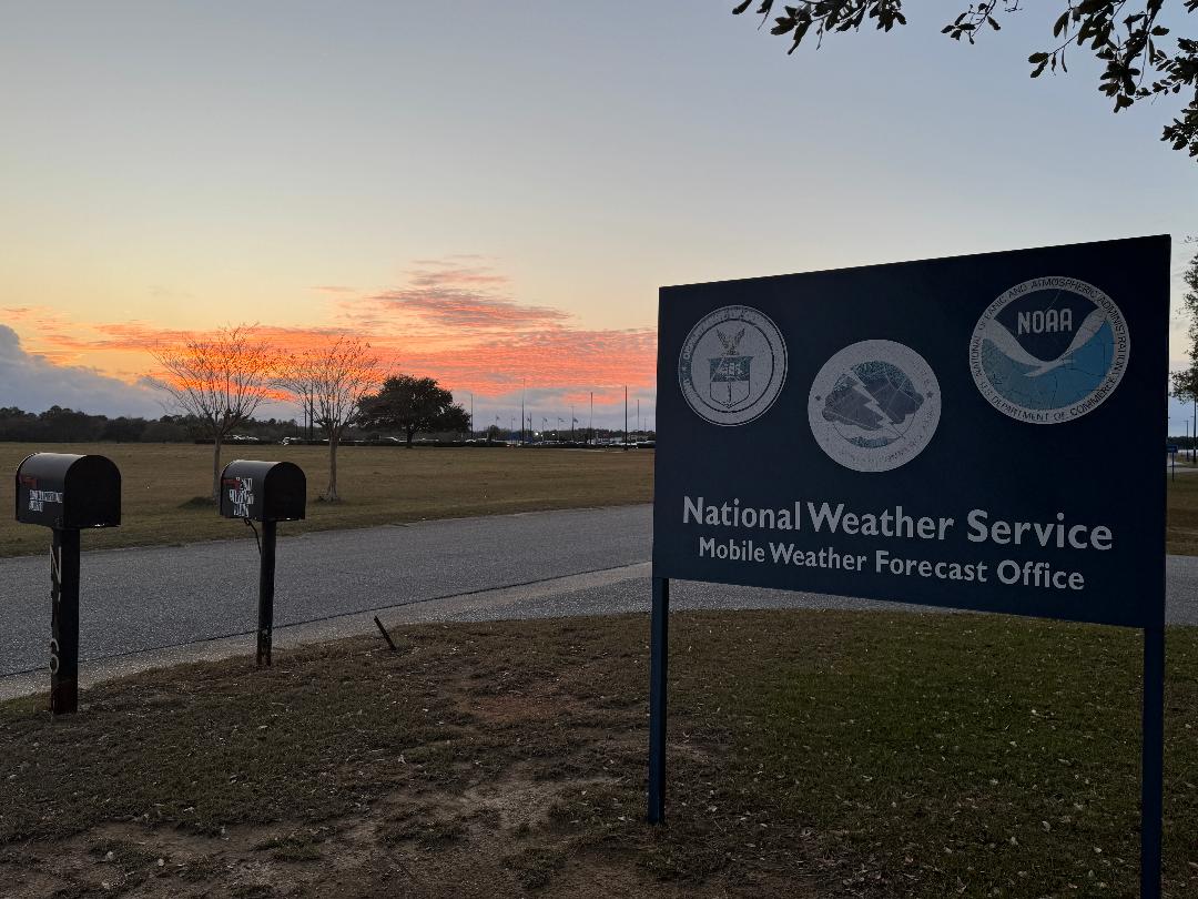
After a nice sunset earlier this evening, expect increasing clouds and warmer temps tonight, with
a slight chance for rain toward daybreak Saturday. Lows will range from the low to mid 50s over most inland areas to the upper 50s to lower 60s closer to and along the coast.
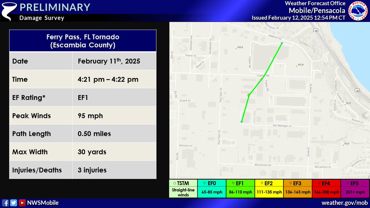
We have completed our survey of the Ferry Pass, FL tornado. It has been rated an EF-1 with a half mile path length. Here is the full survey report:
https://t.co/1cZDh6bNYZ
Severe Weather Update: Forecasters anticipate storms to begin increasing in areal coverage over the interior this afternoon. Storms will have the capability to become tornadic. Ensure you have multiple ways to receive warnings.