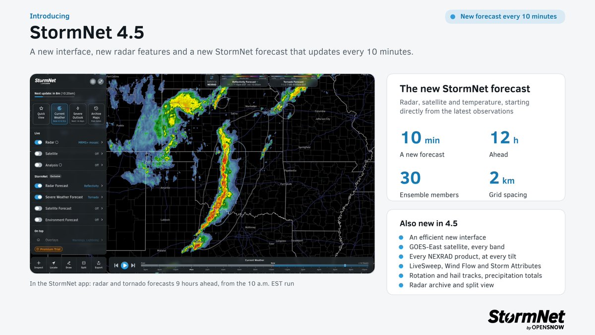
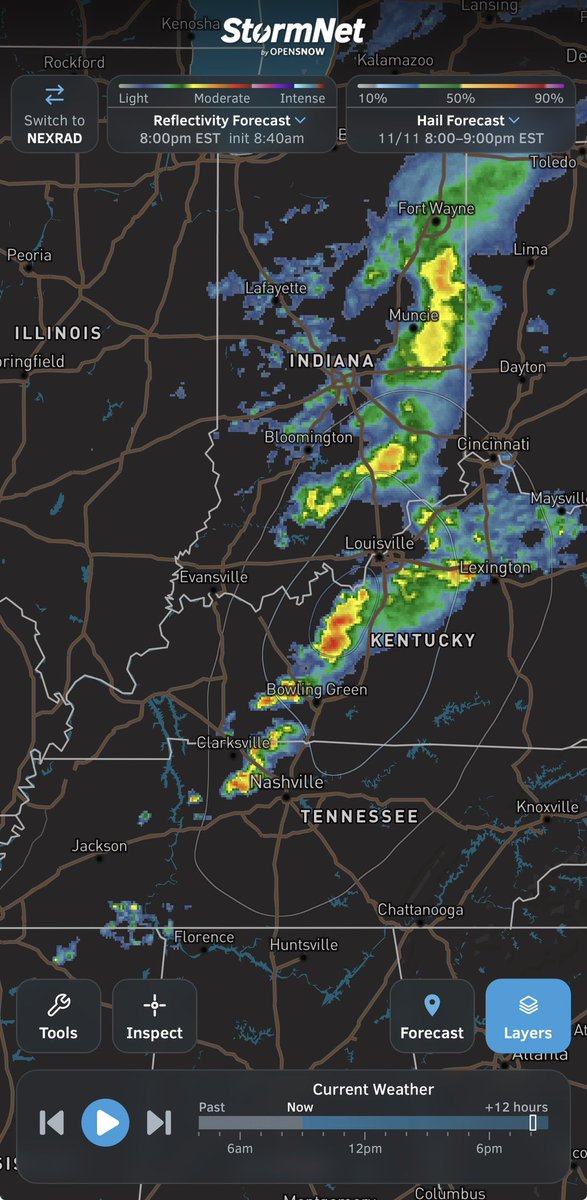
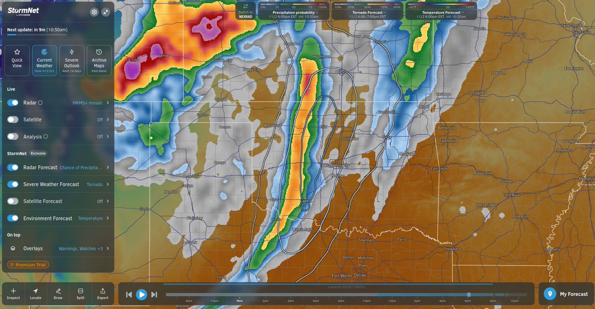
Today, we are unveiling StormNet 4.5. This update includes a new interface, new radar features, and a new StormNet model capability.
After several breakthroughs and tons of R+D, we are excited to announce that we have developed a SOTA short-range weather prediction model.
StormNet's AI-mesoanalysis updates every 10 minutes and uses a novel machine learning algorithm to rapidly assimilate observations from across the US.
This exclusive tool is available for all users in the StormNet app!
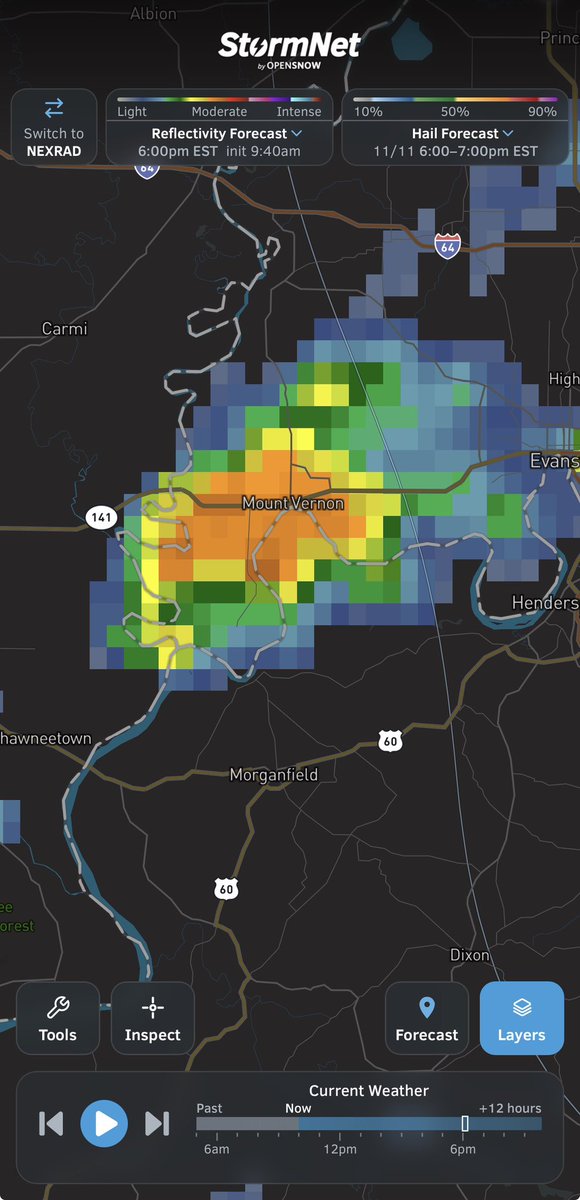
Q: Can StormNet’s radar prediction resolve supercells structures?
A: Absolutely! The model predicts base reflectivity at a 2km resolution and can sharply resolve supercells.
Keep in mind that this is just one of 30 members!
Scattered storms are likely this evening w/ a low end threat of hail and strong winds. an isolated tornado cannot be ruled out.
Radar forecast 30-member ensemble updates every 10 minutes @StormNetWx
We've received tons of questions about StormNet 4.5, so I wanted to clarify some details.
All critical data from StormNet will remain available for everyone for free, including the next 2hrs and daily.
All premium features are free as a preview for the next several weeks.
Thunderstorms are likely on Wednesday across parts of the Midwest and Southeast. Isolated hail is possible. The tornado threat is very low.
See the latest in the StormNet app!
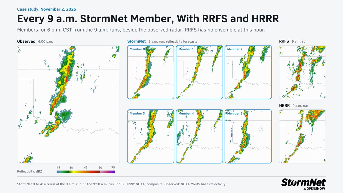
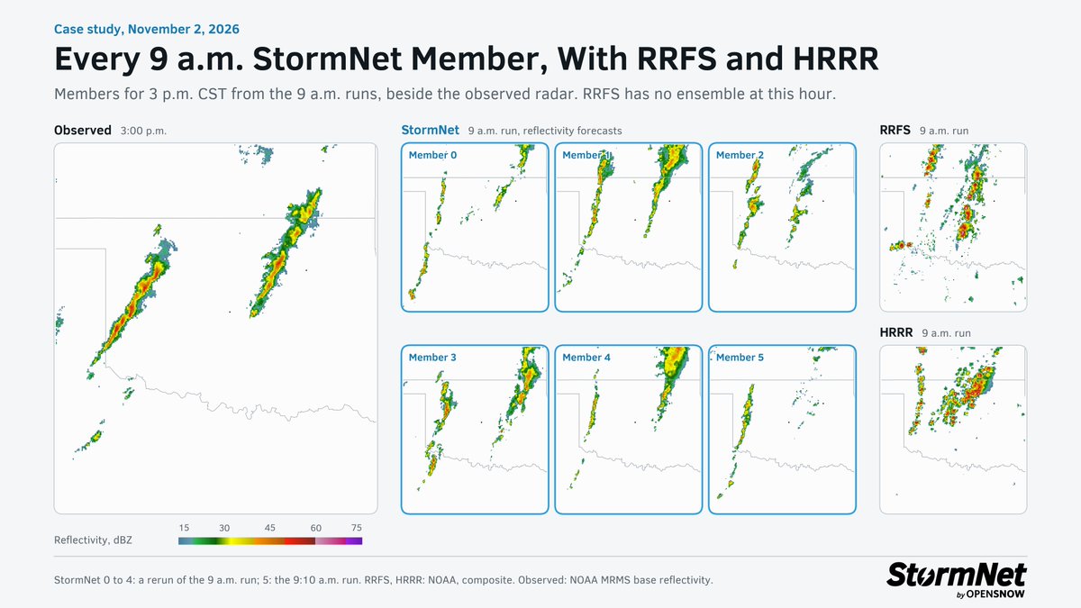
Comparing StormNet's radar forecast members yesterday against HRRR and REFS. MRMS is actual radar (ground truth).
These are at 3-9hr lead-times, valid around storm initiation and around storm maturity.
Comparing StormNet's radar forecast members yesterday against HRRR and REFS. MRMS is actual radar (ground truth).
These are at 3-9hr lead-times, valid around storm initiation and around storm maturity.
Today’s tornado threat didn’t exactly materialize across Oklahoma. Convective mode ended up being very messy.
I did find it interesting that the StormNet radar forecasts, even from 10-12 hours out, were very messy which ended up verifying.
HRRR, for comparison, was more discrete.
The 4.5 update today didn’t include changes to the daily severe weather probabilistic forecasts, though upgrades to that component are in the works.
Today, we are unveiling StormNet 4.5. This update includes a new interface, new radar features, and a new StormNet model capability.
After several breakthroughs and tons of R+D, we are excited to announce that we have developed a SOTA short-range weather prediction model.
Our research efforts continue and we have a ton of projects in the works for the next few months.
The premium subscription which we are adding soon will help support our research efforts while we keep the most critical info (short range data & daily forecasts) free.
There are several other new features and enhancements as well that are now live on the website and on the mobile app (iOS and Android).
Read more here https://t.co/vF3i4IjXqW