Live emergency update targeting three days in a row of significant #tornado potential across Nebraska, Iowa and eastern Kansas! Big problems through Monday
#stormchasing#Dominator
A severe weather outbreak is possible this Monday across the central Plains, including Omaha, Kansas City, Wichita, and northern Oklahoma. The Storm Prediction Center warns of potential strong to intense tornadoes Monday afternoon into the night. Have a shelter plan ready today.
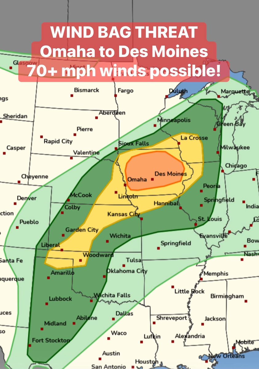
MAJOR WIND BAG IN IOWA THIS EVENING!
While the #tornado threat will be very low today, the Storm Prediction Center has added an enhanced risk for big straight-line winds including I-80 from Omaha to Des Moines!
Storms will form by 3-4 pm near the Iowa/South Dakota border and expand into a squall line with mainly a damaging wind threat.
This is ahead of #tornado outbreak potential on Sunday-Monday.
We usually don't see this much confidence five days out, but the atmospheric setup for Monday is leaning toward a likely severe weather outbreak. Tornadoes and very large hail are the main concerns from Kansas up through Wisconsin.