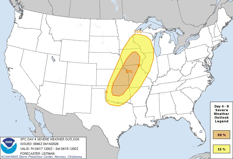
May 18 may see a large severe weather outbreak in Oklahoma. Time will tell. If the pattern for the OKC metro this year holds, the predictions will be higher than the result. But, again, time will tell. It's still early. Prepare now and ensure batteries & emergency kits are ready.
You may have seen this graphic on our website. What actions do we (NWS) want you to take based on this information? Well, no action right now.
But, weather should be on your mind beginning tomorrow and lasting until at least Monday. Keep up with the forecast. #okwx#texomawx
Again, to be clear... Oklahoma City will not see any organised severe weather tonight. The persistent cloud cover over most of the state has and will continue to prohibit anything more than heavy rain and thundershowers.
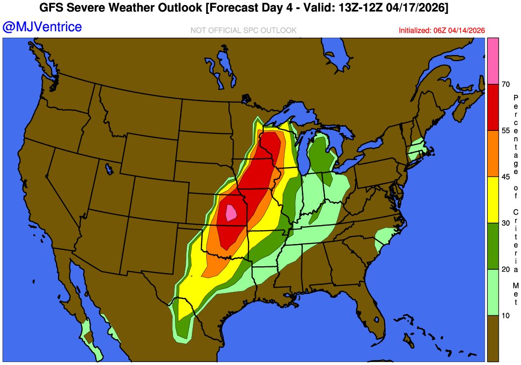
This setup is the real deal. The past several days have been a bust for organized severe weather in this area. But when the dryline & cold front are positioned this way, we would hazard a prediction: Topeka to Wichita to Stillwater will see organized activity in the next 18 hrs.
UPDATE: Kansas City is now in an UPGRADED level 4 out of 5 severe weather risk. Storms tonight will congeal into a squall line with widespread 60-80+ mph wind gusts. A few embedded brief tornadoes are also possible.
Farther south, we’re also monitoring potential for very large/giant hail with initial supercells in northern Oklahoma and southern Kansas. That’s where there’s a better chance of storms remaining as discrete supercells for longer, giving them a window to rotate and produce hail/a couple tornadoes. By sunset, they’ll likely merge into a windy line.
Oklahoma City won't be seeing significant severe weather development due to heavy cloud cover. However a large tornado outbreak is occurring in the upper Midwest at this time.
This setup is the real deal. The past several days have been a bust for organized severe weather in this area. But when the dryline & cold front are positioned this way, we would hazard a prediction: Topeka to Wichita to Stillwater will see organized activity in the next 18 hrs.
@MattKoket Exactly.
I'm always surprised when weather teams ignore cloud cover when issuing forecasts over the next few hours. It matters and any place with this much cloud cover is not going to see rapid build on any organized activity.
@MikeMorganKFOR@kfor Eastern OK..not central OK. The showers that are forming along the line are dissipating as soon as they form. The only cells that are growing are by Tulsa & NW of Dallas (ending up in SE OK). Not the right conditions for any organized outbreak in OKC. Not enough daytime heating.
Again, conditions simply are not right for any type of widespread outbreak of severe weather in the OKC area. Again, areas east will likely see something marginally organized.
No change so far to the severe outlook for today.
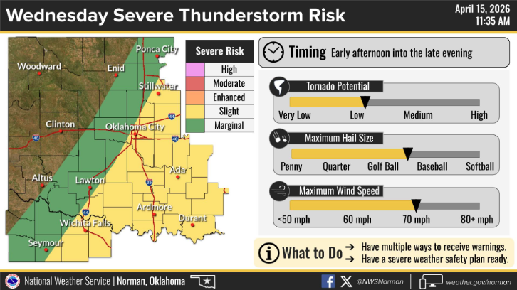
Very large hail, damaging winds, and locally heavy rainfall are the main concerns with a low tornado threat.
#okwx#texomawx
1/3 🚨 **OKC/YUKON STORM UPDATE** If storms will develop today, we are looking for them to form starting in the next 60 to 90 minutes along a line near Lubbock (or east) up to about Elk City and Enid (or just west of there).
@invertv_dcape This is the same thing we were saying earlier. The motion of the storms would kill central OK's storm chances because of this morning's persistant cool / cloudy environment.