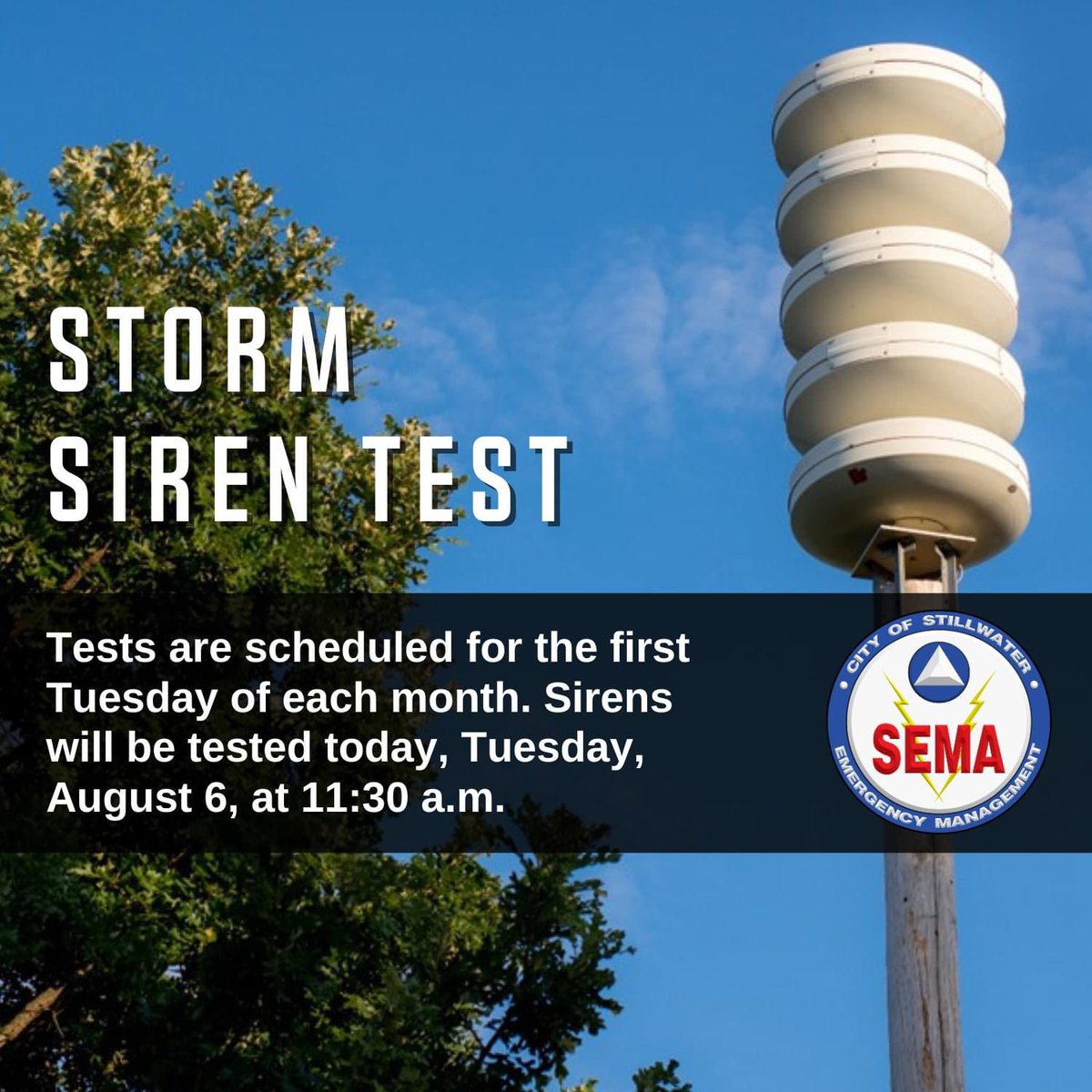
Storm Siren Test 🚨
Tests are scheduled for the first Tuesday of each month. Today is an alternate test day. Sirens will be tested today, April 17, at 11:30 a.m.
ALERT: The Payne County Board of Commissioners has issued a BURN BAN effective immediately. The burn ban will be in effect until November 7, 2024.
To learn more: https://t.co/JnFsjAS3tw
ALERT: National Weather Service (NWS) has issued a Red Flag Warning until 10 p.m. for gusty winds, hot temperatures, low humidity and dry vegetation. Any fires that develop will likely spread rapidly. Outdoor burning is not recommended.
#SFD#SFDALERT
ALERT: National Weather Service (NWS) has issued a Red Flag Warning until 9 p.m. for gusty winds and low humidity for north central Oklahoma. Any fires that develop will likely spread rapidly. Outdoor burning is not recommended.
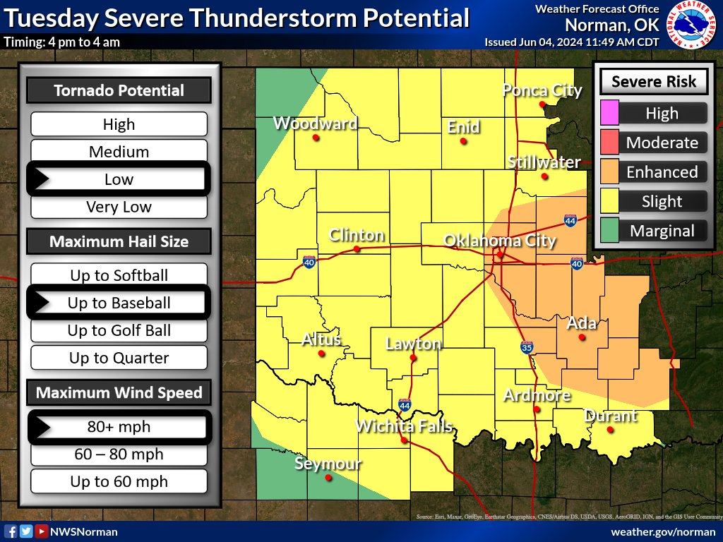
Storms are expected to develop late this afternoon along and ahead of a cold front and dryline. Large to very large hail and damaging wind gusts will be the main hazards, with a low tornado risk early this evening. #okwx#texomawx
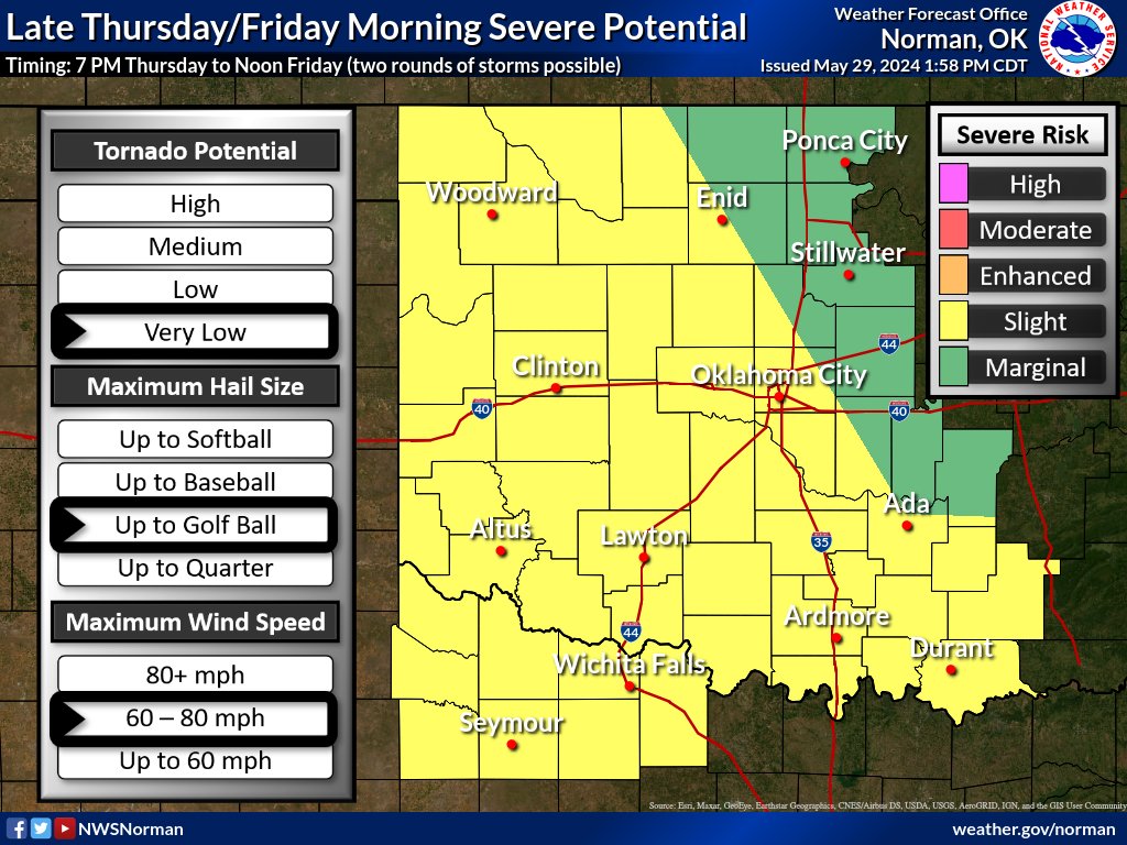
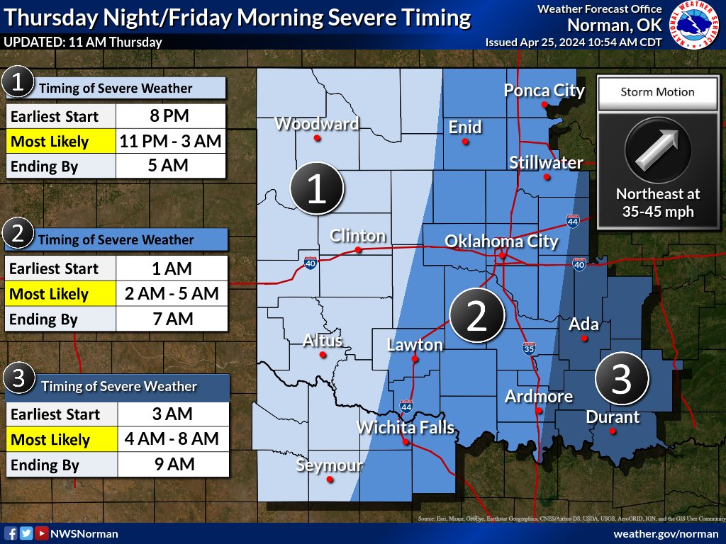
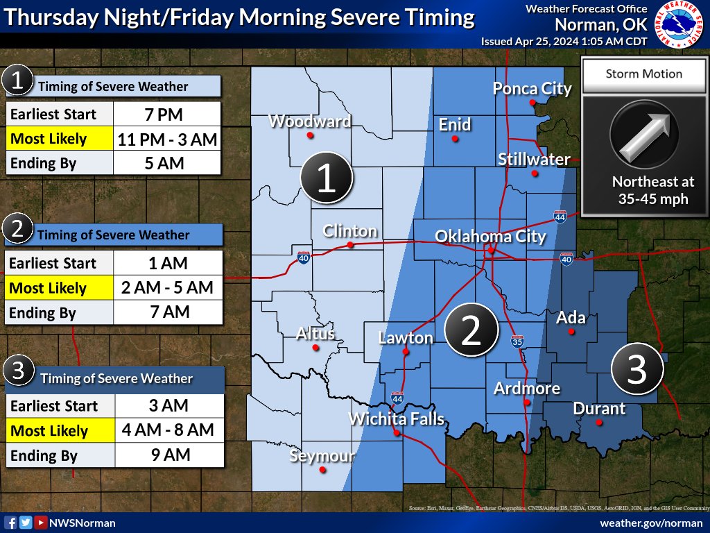
There will be greater risk of severe weather Thursday evening through Friday morning with at least a couple rounds of thunderstorms possible. Large hail, damaging wind gusts, and heavy rainfall are potential hazards. #okwx#texomawx
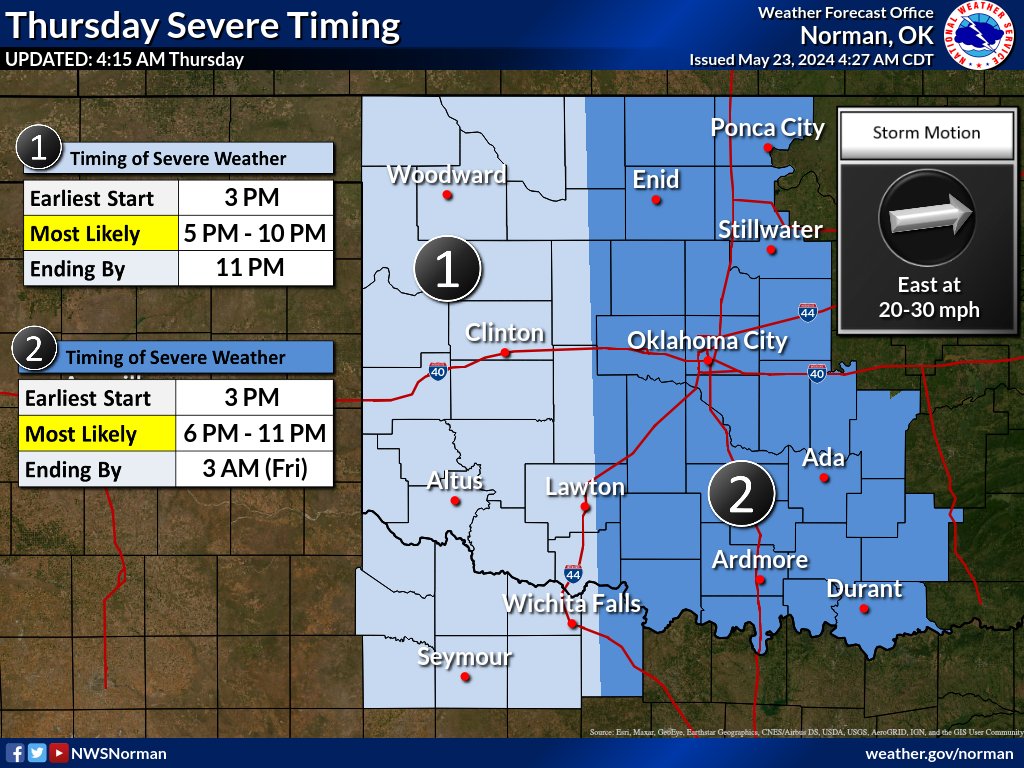
5:30 AM Thursday:
With our morning round of severe potential coming to a close, attention turns toward another expected round this afternoon/evening. This includes potential for large hail, damaging winds, and a low tornado risk. Remain aware and check back!
#okwx#texomawx
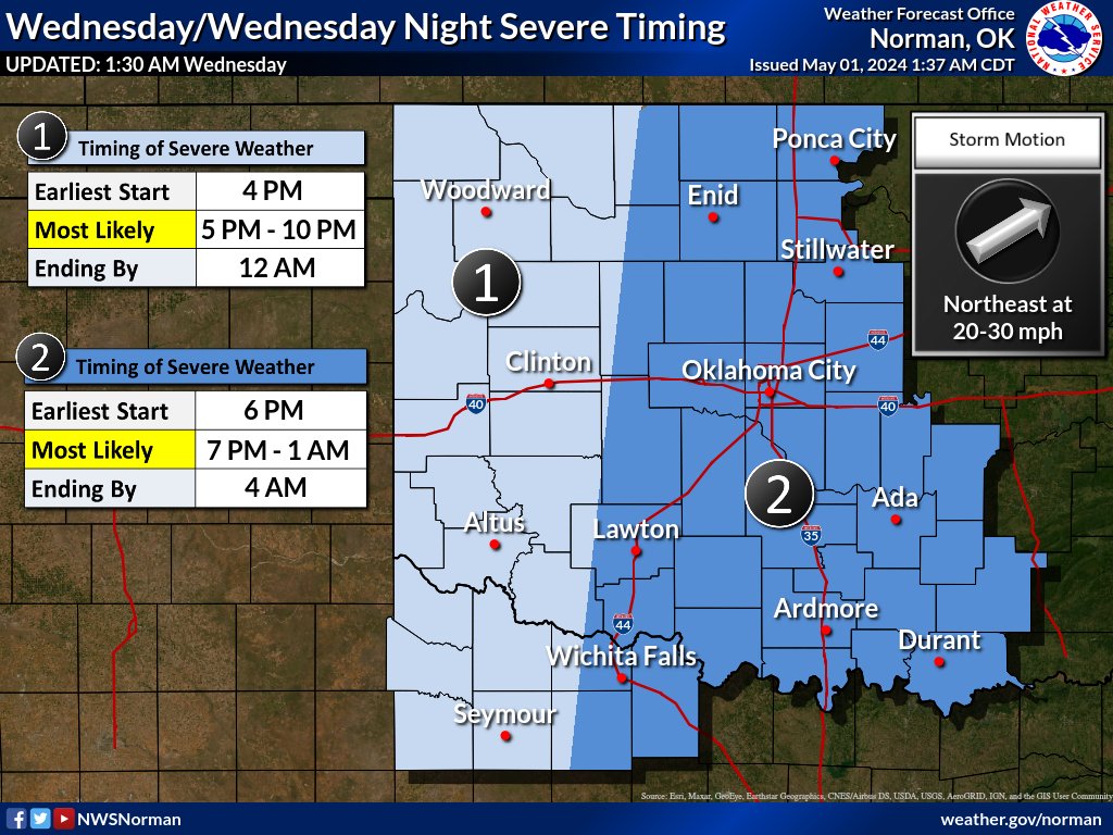
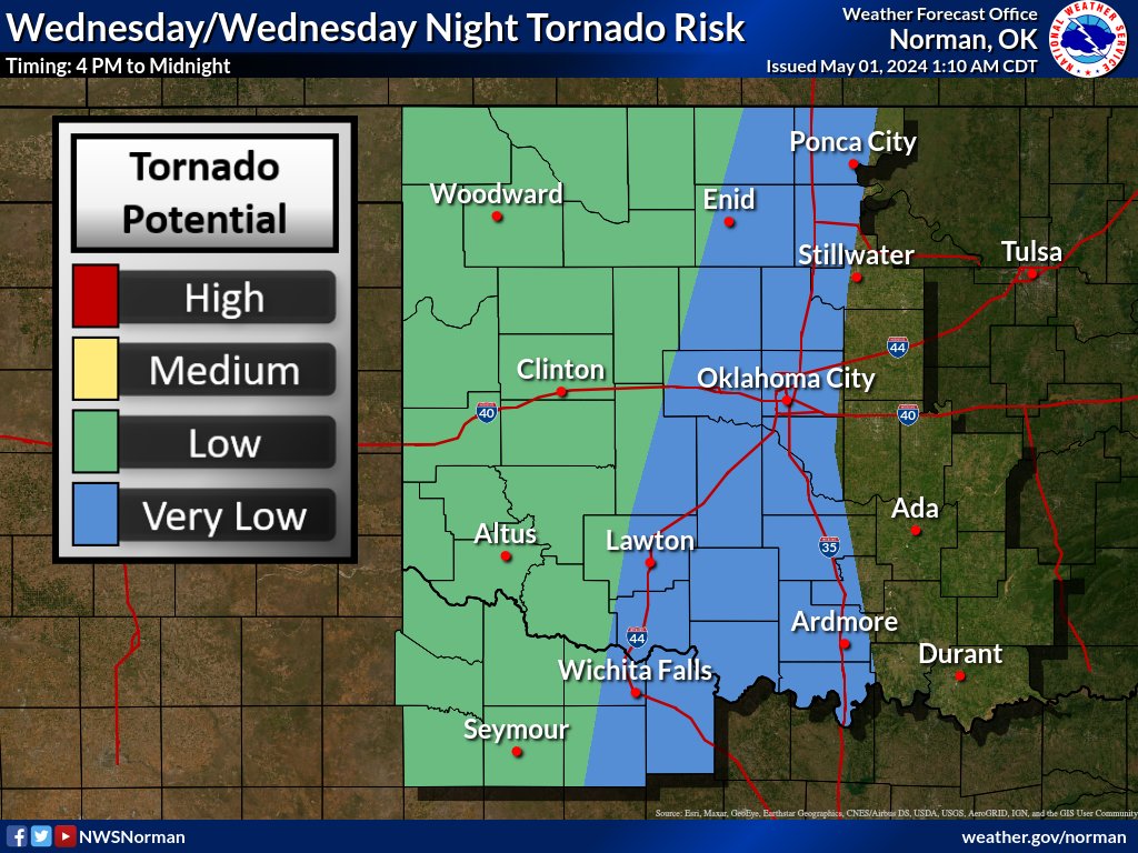
Forecast is still on track for strong to severe storms across a large portion of the area Wednesday afternoon into the overnight hours. Large hail, damaging winds, and flooding are the main concerns. #okwx#txwx
1130 AM UPDATE: Key messages today: 1) most people will not see a storm, but IF you do, it will be likely be dangerous; and 2) the potential for tornadoes will INCREASE after dark, so do not let your guard down!
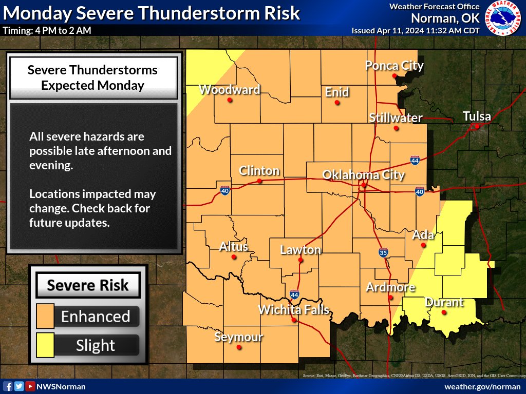
Up to a moderate risk for severe storms on Monday afternoon through the evening hours with large hail, damaging wind gusts, and a medium risk for tornado's as the hazards. Should be a fast moving system coming through.
#okwx#texomawx
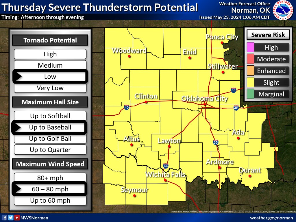
Severe weather potential is once again expected later this afternoon through early Thursday morning. All severe weather hazards (hail/wind/low tornado risk) are expected. Remain aware and check back!
#okwx#texomawx
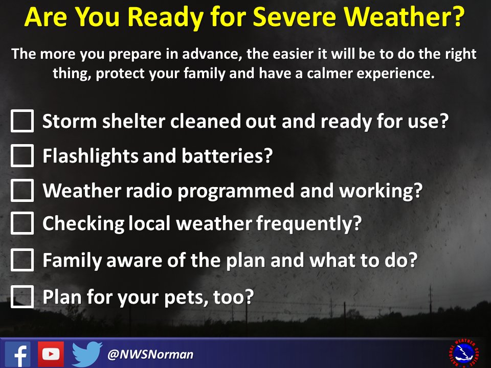
We expect multiple rounds of severe storms later today, with all severe hazards possible, including the potential for strong tornadoes. Be prepared, have a place to shelter, and have multiple ways to receive warnings if storms should threaten your area. #okwx#texomawx
A reminder: We're not expecting severe weather before sunset tonight, but the potential *will* increase overnight. If you have a weather radio, it'll be a good night to check those batteries. #okwx#txwx
The latest severe storm outlook focuses on the potential for a line of severe storms across western-north TX into central OK early Fri morning.
Low probability for severe weather will also exist across northwestern OK towards sunset this evening.
Stay aware!
#okwx#texomawx
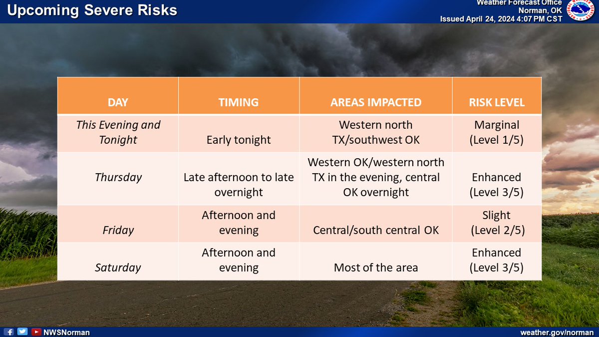
Hey, we know how easy it is for severe risks on consecutive days to start to blend together. We put this table of severe risks between now and Saturday together to hopefully help you keep track of the when, the where, and the what. #okwx#txwx
OKC! There is a chance of severe weather overnight in the metro. The most likely timing for the metro will be between 4am and 7am (4/16/24), which could impact rush hour commuter traffic. All hazards are possible.
#okc
Our next risk of severe weather is Monday (April 15th). Large hail, damaging winds, and tornadoes are possible.
With the risk of storms, it's good to be prepared. There'll always be another risk of severe weather even if you don't use these tips on Monday! #okwx#texomawx