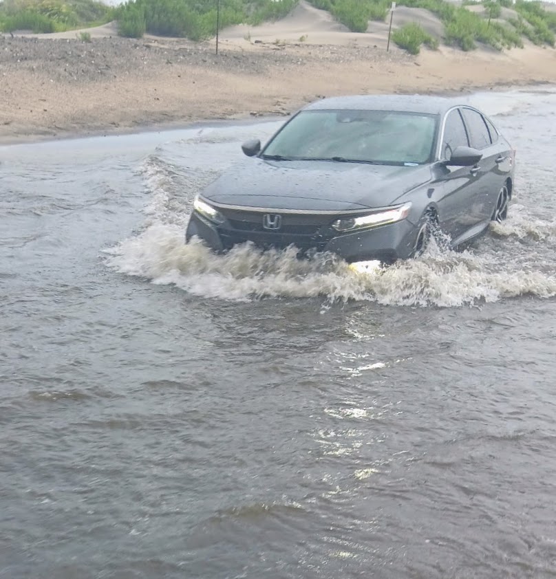
A couple of photos from earlier on Pea Island. NC12 remains CLOSED between the Basnight Bridge and Rodanthe due to deep standing water from intense rainfall. Some areas have received as much as seven inches of rain over the last 36 hours. #ncwx
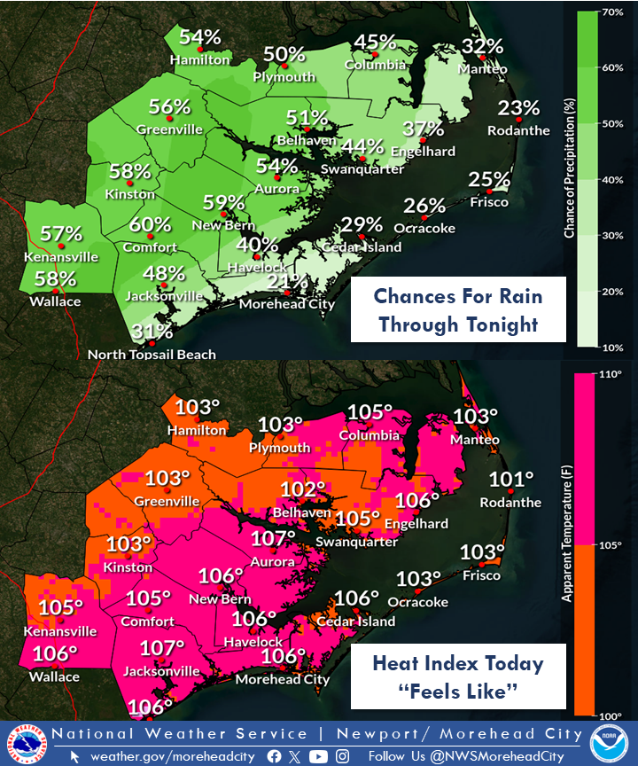
**HOT and HUMID again today. **
*Many places already feel like above 100 degrees as of 9 AM!
Some good news. Showers and thunderstorms are possible as early as midday, and should increase by this afternoon/early evening. We can use the rain for our ongoing drought. #nws
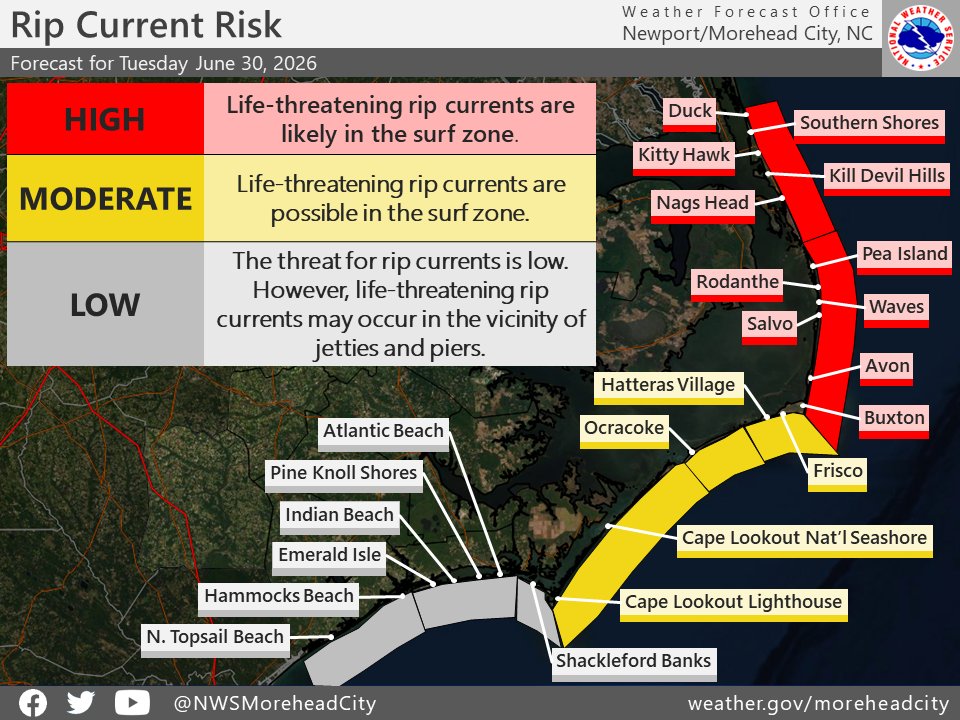
After receiving reports from lifeguards this morning, the beach forecast has been updated for today. We now have a high risk for rip currents between Duck and Cape Hatteras, a moderate risk from Cape Hatteras to Cape Lookout, and a low risk from Cape Lookout to Surf City. #NCwx
Dangerous heat is expected across much of ENC today, with impacts peaking late this morning into early this evening. Please plan accordingly if spending time outdoors. #ncwx
🚨Severe weather possible today! Have a plan & know where to go. Have multiple ways to get warnings!
🔴Hazards: 60+ mph wind gusts and tornadoes
🔴Timing: Early afternoon into this evening
More info: https://t.co/CAZ6pY0eg1
A State of Emergency is in place for all areas of Dare County due to an impactful winter storm. Now is the time to finalize preparations—secure food, medications and supplies, and protect pets and property.
Read more: https://t.co/NZLLIJEogk
❗️Winter Storm This Weekend❗️
📌For more graphics visit: https://t.co/CAZ6pY0eg1
➡️Trends have been increasing for SIGNIFICANT amounts of snow.
➡️This is expected to be a mostly snow event
➡️Localized blizzard conditions POSSIBLE along the coast.
❄️ Winter Storm Update ❄️
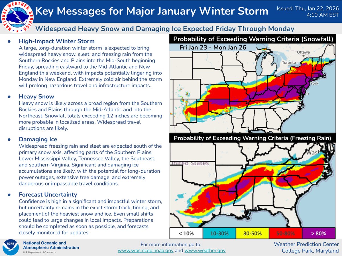
Here's the latest on the impending winter storm set to begin across the south-central U.S. on Friday. Confidence continues to increase for damaging ice accumulations across parts of the South. Preparations should be completed as soon as possible.
What we know👍: A winter storm will unfold across ENC this weekend, with the potential to cause significant impacts.
What we don't know🤷♂️: Whether we see snow, sleet, freezing rain or all three, how much, and the exact timing of the storm.
Stay tuned for further updates. #ncwx
Happy 155th anniversary to the Cape Hatteras Lighthouse! Lit for the first time on December 16, 1870, this OBX icon is currently undergoing extensive restoration work. We look forward to seeing the lighthouse shine again✨
We are expecting yet another storm system to impact the NC Coast beginning tonight and lasting through the day on Wednesday. Drive with extreme caution if using NC12 during this time, as there will likely be blown sand and water in several spots, and ocean overwash is possible.
A strong cold front will cross ENC on Wednesday and a coastal low may develop this weekend. Prolonged northeasterly winds as well as elevated seas and coastal flooding, exacerbated by king tides, are likely. #ncwx
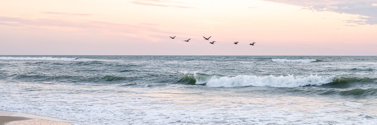
There will be a high risk of rip currents North of Cape Hatteras today. Otherwise expect partly cloudy skies with high temperatures in the low 80s. #ncwx
Dare County remains under a State of Emergency, and a Mandatory Evacuation order is in effect for all areas of Hatteras Island (Zone A).
NOTE: There are no Mandatory Evacuation orders in effect for any other areas of Dare County at this time.
https://t.co/1BSsk8RRsA
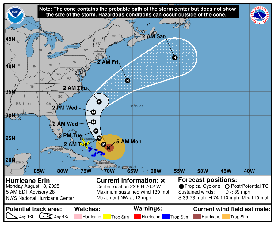
8/18/25 - 530am: Hurricane Erin has once again strengthened overnight, and is a very powerful Category 4 storm. Despite the storm still forecast to remain offshore, impacts will be extremely dangerous for parts of Coastal Eastern North Carolina.
⚠️Dare County Emergency Management has issued a State of Emergency county-wide and a Mandatory Evacuation for visitors and residents of Hatteras Island, beginning tomorrow, Monday August 18th at 10 am (visitors) and Tuesday, August 19th at 8 am (residents).