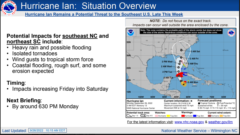
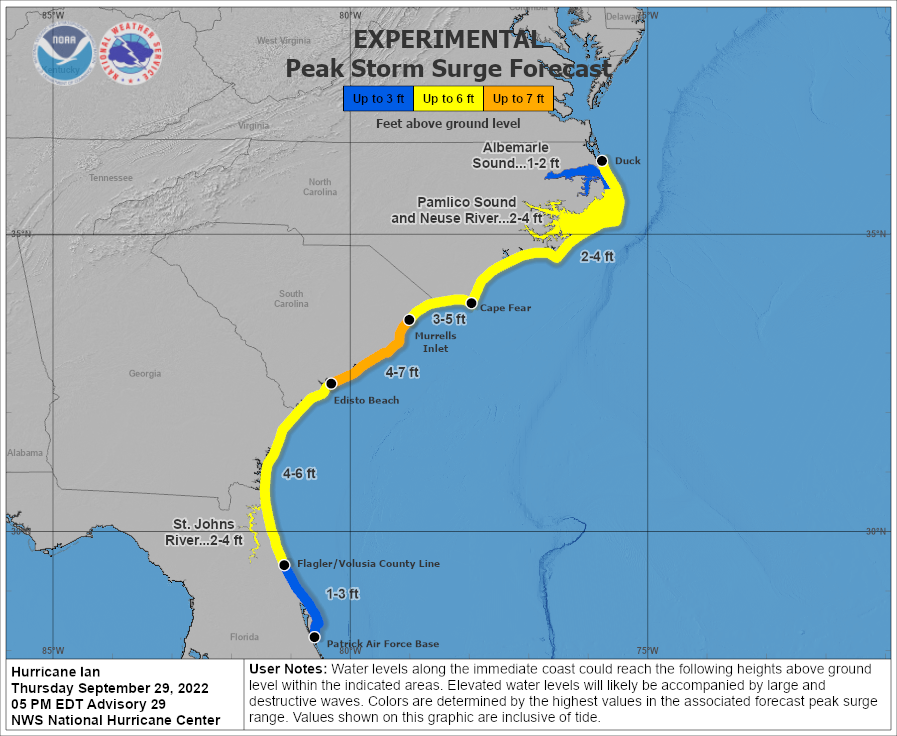
Hurricane #Ian Advisory 30: Ian Expected to Cause Life-Threatening Flooding, Storm Surge And Strong Winds in the Carolinas Tomorrow. https://t.co/tW4KeFW0gB
9/29 5pm EDT: #Ian is a hurricane again! The danger of life-threatening storm surge continues through Friday along the coasts of northeast FL, GA, SC, and NC. Residents in these areas should follow any advice given by local officials & check https://t.co/0BMJEA5Wz0 for updates!
Hurricane #Ian Advisory 29: Ian Becomes a Hurricane Again. Taking Aim At the Carolinas and Georgia With Life-Threatening Flooding, Storm Surge and Strong Winds. https://t.co/tW4KeFW0gB
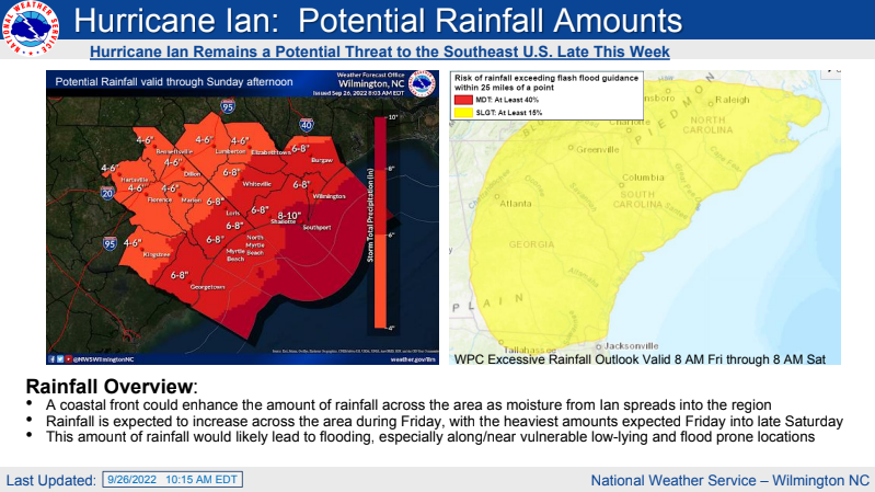
Quiet weather early this week and cooling off after today. Heavy rain is expected late this week into the weekend. There may also be isolated tornadoes. Heavy surf and beach erosion are also expected.
Southeast NC and Northeast SC will need to monitor Tropical Cyclone Ian's future progress which potentially could affect the area later this week. #ilmwx#ncwx#scwx
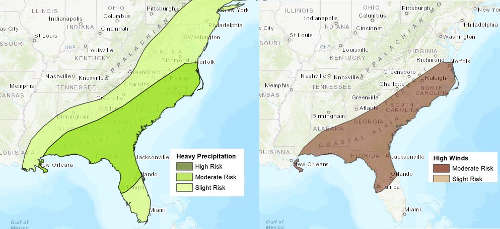
The Climate Prediction Center has placed our area in a "moderate risk" for both high winds and excessive rainfall in the 6-10 day outlook, associated with possible impacts from current Tropical Depression Nine. Continue to follow the latest forecasts at https://t.co/lgMVAclTkY
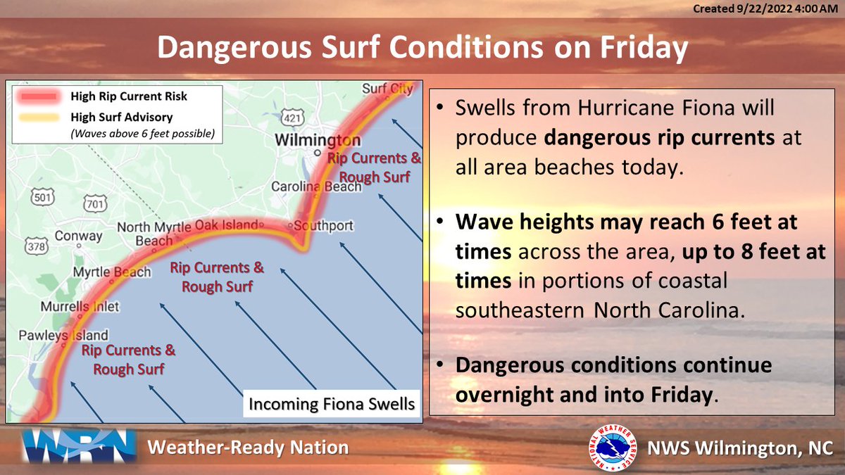
Swells from Hurricane #Fiona will bring dangerous rip currents and rough surf today. If you are not a strong swimmer, considering staying out of the water and always have flotation! #ncwx#scwx
Our partners at Wrightsville Beach Fire & Ocean Rescue have shared phenomenal drone footage of the rip currents at Wrightsville Beach today. These rip currents are a result of large swells from distant Hurricane Fiona! The risk for strong rip currents will exist into the weekend.
Multiple beach hazards continue across area beaches tomorrow & likely through end of the week, including elevated rip current risk and strong longshore currents. Be sure to check the surf forecast before heading to the beach. #KnowBeforeYouGo https://t.co/BFUrmK31zu
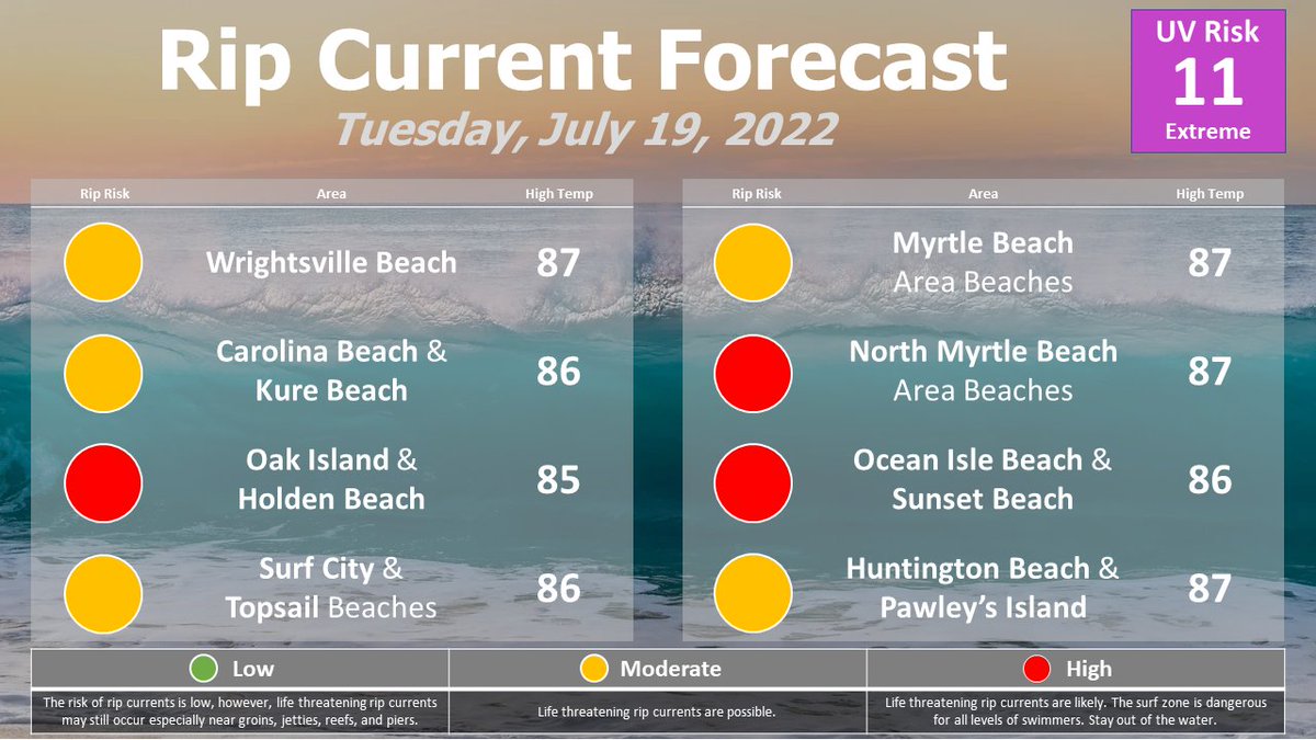
Warm today with mid-90s inland and heat indices likely to be at or above 100 along and west of I-95. Slightly cooler along the coast with a Moderate Risk of rip currents for North Myrtle Beach, the Brunswick beaches, and Bald Head Island. #ncwx#scwx
🏖️ It looks like a great beach day, but watch for a lingering rip current threat for the areas in yellow. Visit https://t.co/BFUrmK31zu for a complete forecast at your destination any time! #ncwx#scwx
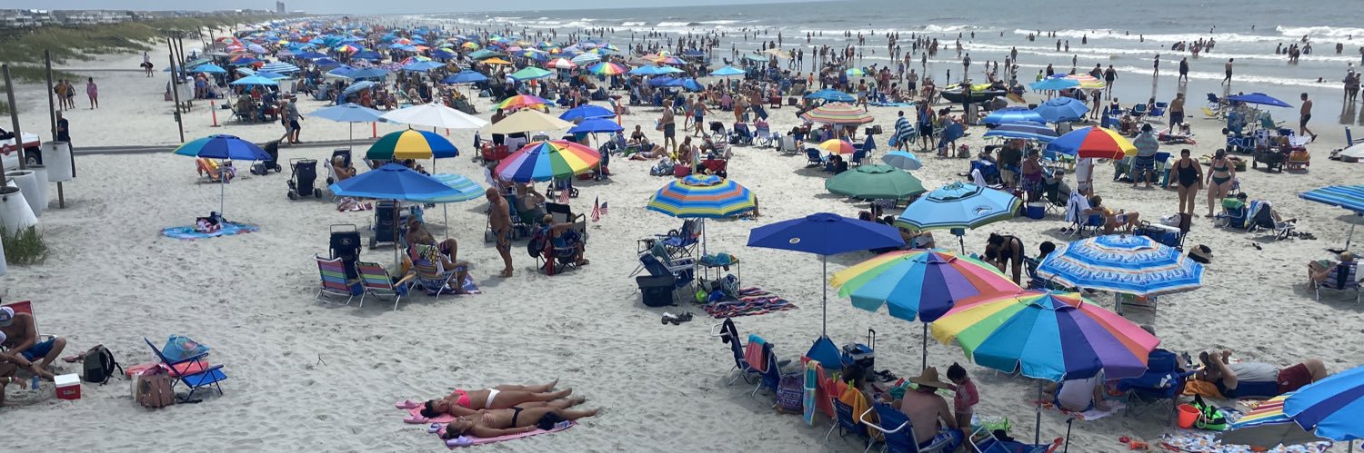
It’s a beautiful day on the beach, but the water conditions are predicted to be hazardous. Wave action, rip currents, and longshore currents are already present across the strand. @NWSWilmingtonNC@BrunswickGovt@WWAY@wectnews
Strong rip currents will continue to be a threat today, especially for areas north of North Myrtle Beach to Bald Head Island. Breezy southerly winds will lead to a strong south to north longshore current for NC beaches from Kure Beach to Surf City. #ncwx#scwx