With the peak #NEM period approaching, stay prepared for possible heavy rainfall events and localized flooding in some areas. Let's hope for a productive and safe season ahead! 🌧️☔ (8/9)
Keep an eye on updates and stay weather-aware! (8/8)
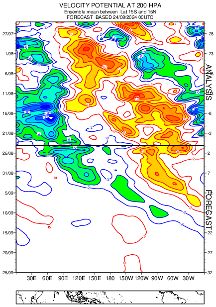
What a month it has been for Peninsular India, with almost daily rainfall over the interiors and some unusual downpours in #Chennai and #Bengaluru. The #MJO's timely entry into the Indian Ocean has boosted the transition rains 🌧️. Couldn't have asked for a better start !! (1/8)
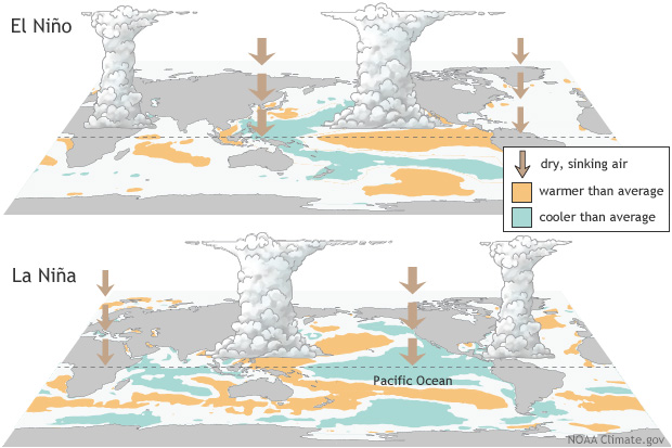
During La Niña, cooler Pacific waters support increased rainfall over southern India by enhancing cloud formation and moisture transport.
In contrast, El Niño tends to suppress monsoon activity with warmer Pacific waters and sinking air, disrupting rainfall patterns.(7/8)
Severe cyclonic storm #Dana is moving in tonight and landfall process is about to start in a few hours from now close to #Paradip as of now. Beauty and a beast in making. However uncertainty in its track remains after the landfall . #Cyclone#BayOfBengal#Odisha
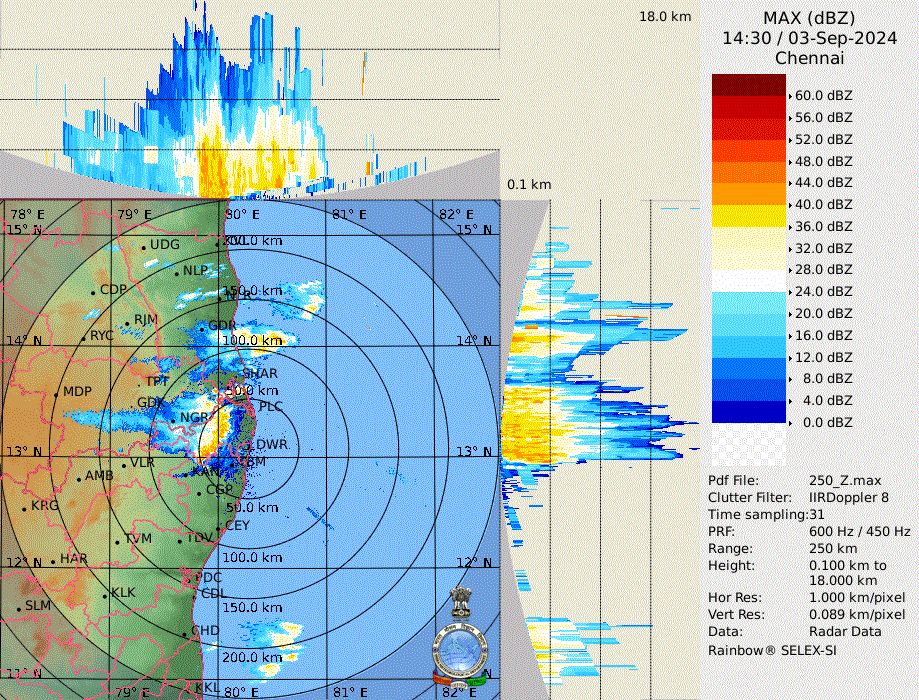
Intense thunderstorms over #Vellore and adjoining areas. Likely to drift further ESE/SE and therefore bringing heavy rains to #thiruvannamalai#kanchipuram#tiruvallur#Chennai . The storms intensity looks crazy. This is just the start. Stay safe and away from lightnings !! #NEM
With 37.1C recorded as max temperature at both Nungambakkam and Meenambakkam observatories, Nungambakkam has recorded 5th hottest day in October and Meenambakkam it's 4th. An end to this very soon , perhaps tonight with heavy rains. #Chennai#heatwave#thunderstorms#chennairains
As #SWM 2024 ends, let's look at the toppers of #TamilNadu
1. Chinnakalar 4075mm
2. Avalanche 3608mm
3. Pandalur 3522mm
4. Devala 3283mm
5. Valparai 3023mm
6. Cincona 2807mm
First half until July was good, but a subdued Aug and Sep ensured it ended just par. Good nos overall
A depression has formed off #Odisha and #AndhraPradesh coasts. It has been lingering over that area for past 48 hours and is expected to intensify into DD and move further WNW towards Odisha.Very heavy rains likely . SWM to start bidding adieu from NW India soon. #SWM2024 DC:IMD
Good September continuing over parts of #Chennai after late night storms moved in . Seems to be a quick moving one. Will be very windy and intense while it lasts. #ChennaiRains#Thunderstorms#Chennai
No wonder #Krishna river at #PrakasamBarrage crossed Highest Flood level set at 2009 October. Pretty much expected where every tributary river has got exceptional rainfall. Hopefully doesn't rise any further . Stay safe . #Vijayawada#TelanganaRains#andhrafloods
It's a bit of hit or miss as far as #Hyderabad is concerned. But can't rule out the possibility of extreme when system has still not crossed Hyderabad. Increase in rains over #Marathwada and North Karnataka in next 24 hours. #Floods
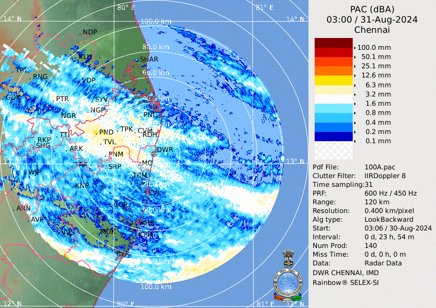
And finally #Chennai also received good rains yesterday thanks to this developing depression . If luck permits we might be second day lucky. Good rains possible next week one or the other day . Yesterday PAC . #Chennai
As MJO moved into phase 4 finally , in response to it a Depression has formed off #Vizag coast. It is likely to move in further west . #Hyderabad#Telangana#Andhra likely to face the brunt of this. North #KA too in line. #Floods#SWM2024 DC:IMD
@Aditya_paatil This system is expected to move in towards Marathwada and from there towards Gujarat perhaps. Still early days. Models are not consistent with the forecast. But heavy rainfall for sure over #Marathwada and #Vidarbha regions irrespective of the movement now
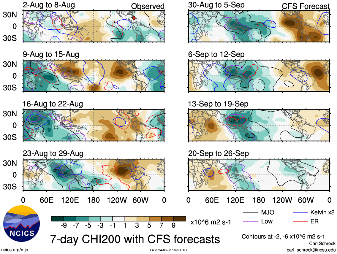
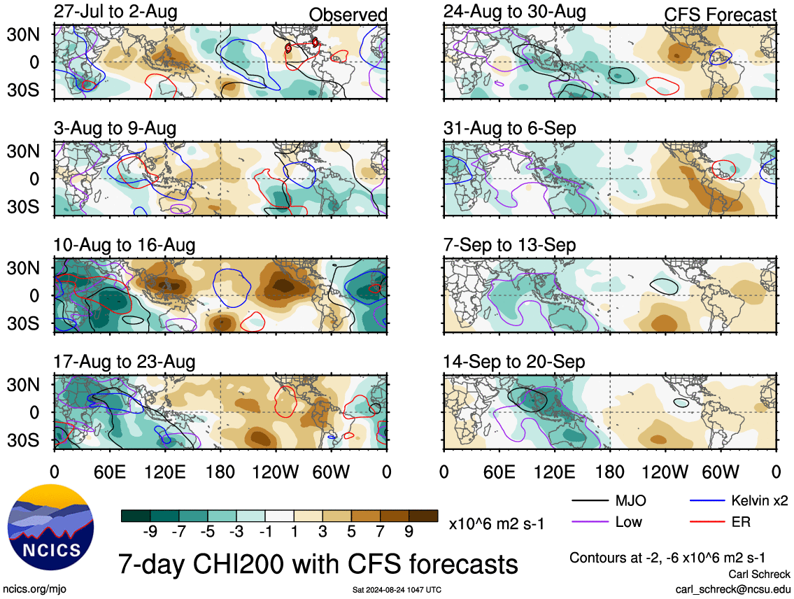
This would also mean that #Thunderstorms might return over #TN owing to break phase . But the monsoon would be subdued all over India. Upcoming week is critical as far as what this MJO does. Still models are going haywire as far as MJO forecast is concerned. Let's see #Monsoon
Crucial days ahead as far as monsoon goes. #ECMWF is still sticking to a likely global circuit whereas #CFS is still persistent . Global circuit is good as far as TN goes because it might keep the withdrawal option wide open from North India (1/n)
Numerical global models are still diverging on the MJO movement. Where CFS shows a forcing over Eastern Indian Ocean which would mean good rains and ECM hinting a global circuit and might reach IO around Sep last week . Tussle between global models (6/n)