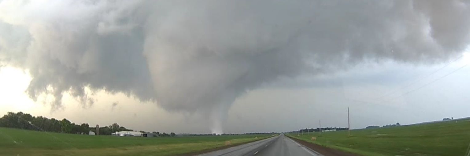
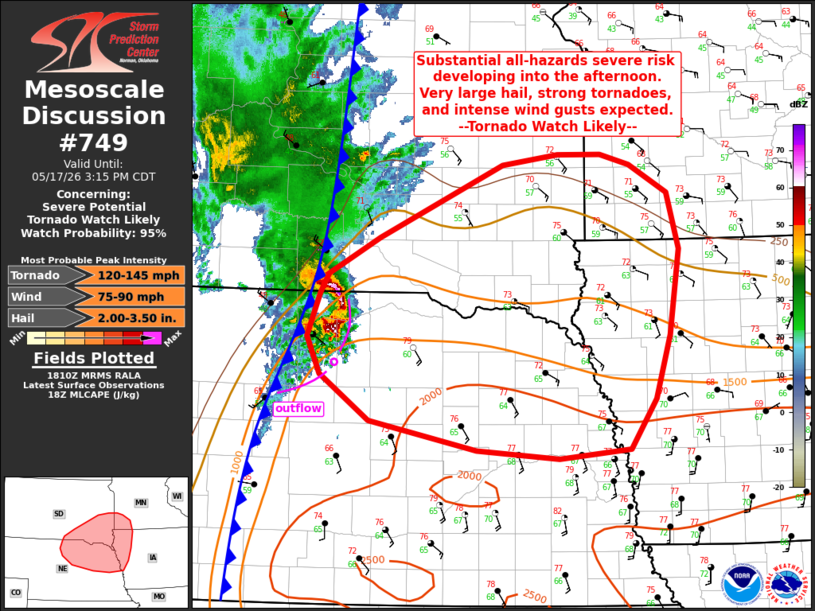
Heads up tomorrow! First round will come early Wednesday morning. These storms clear out and set the stage for possibly a more dangerous line of storms in the afternoon including strong tornadoes. We will be tracking these storms. Stay tuned to @FOX9 and @ian_leonard for updates.
May 6, 1965:
Six significant (F2+) tornadoes struck areas west of and in the Twin Cities, Minnesota, metropolitan area. Four tornadoes were violent F4s, at least two of which ripped through parts of Fridley. Thirteen people were killed and nearly 700 were injured.
#wxhistory
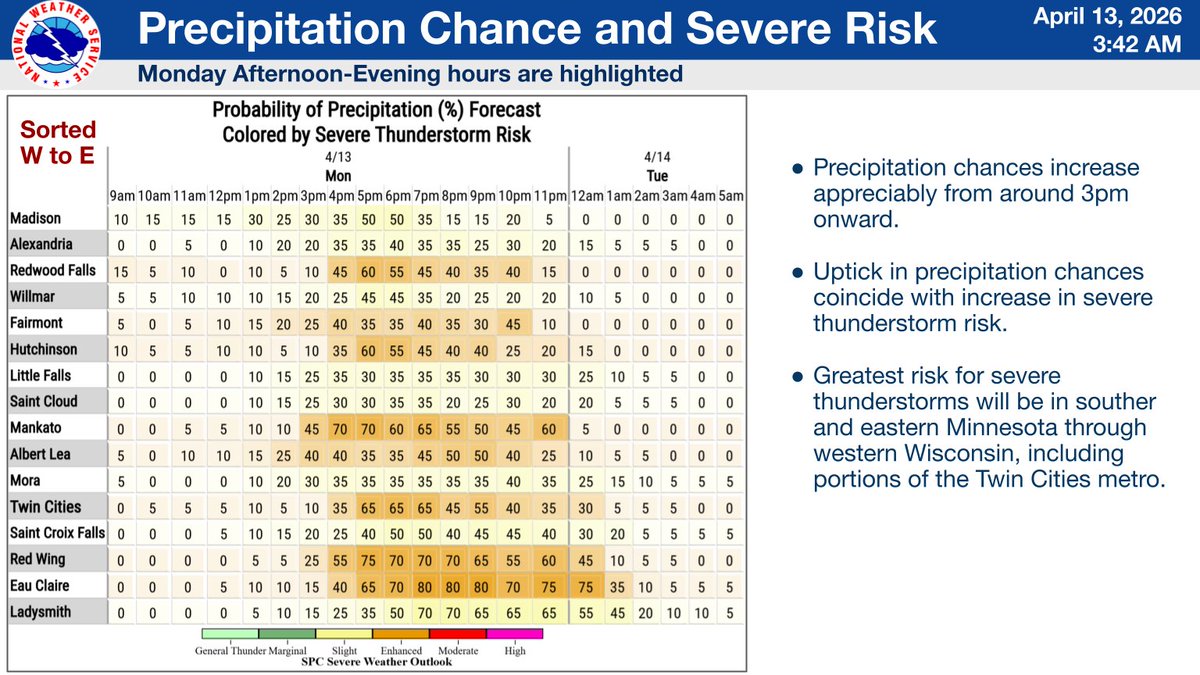
Another unseasonably warm day will lead to our first severe weather risk of the year. Thunderstorms will form along a warm front between 3pm & 6pm, with all severe weather hazards possible. Make sure you have multiple ways to receive warnings and stay weather aware! #mnwx#wiwx
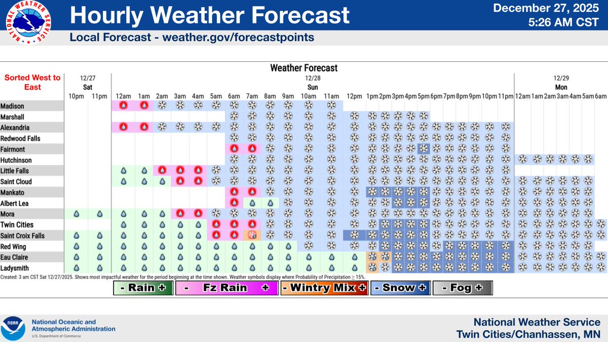
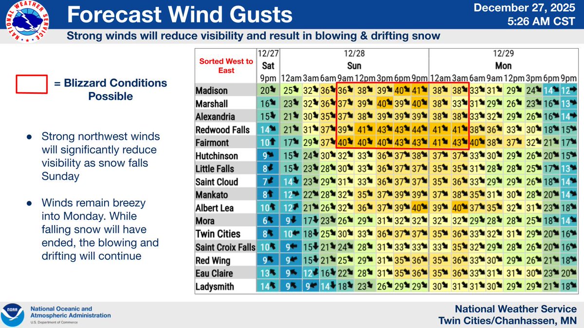
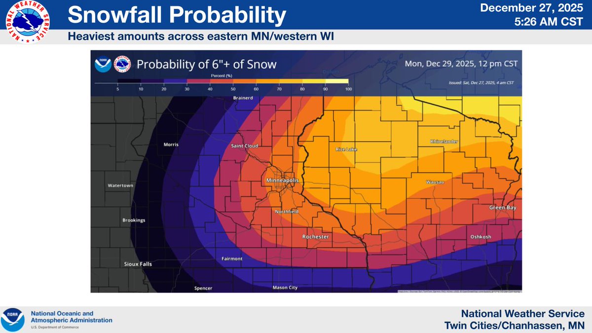
WINTER STORM WATCH issued for the entire forecast area Sunday into early Monday. A very dynamic winter storm will bring several inches of accumulating snow, strong northwesterly winds, and significant impacts to travel to close the holiday weekend. Plan ahead!
#mnwx#wiwx
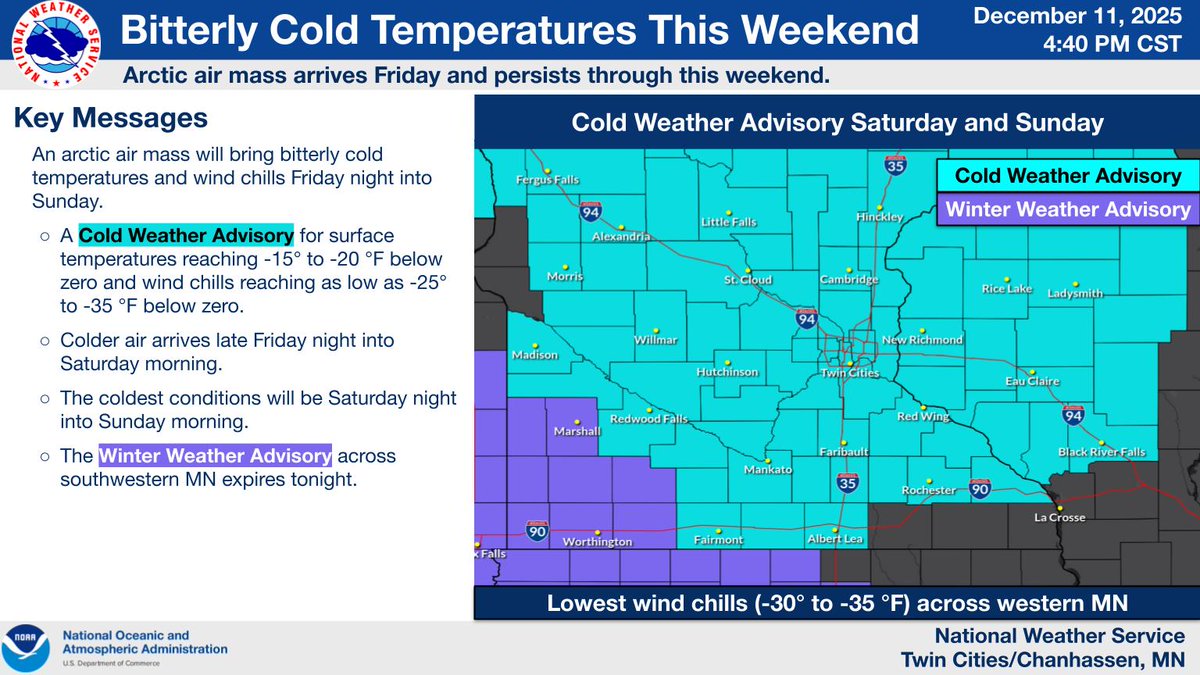
An arctic air mass this weekend will bring bitterly cold air temperatures and wind chills beginning Friday night and lasting through Sunday. Light snow is possible during Friday morning's commute. An inch or less of snow is expected. #mnwx#wiwx
If you have travel plans ahead of Thanksgiving, the best advice we can give, especially if traveling north of the Twin Cities, is to leave Tue morning, or wait until Wed afternoon. It would be best to avoid non-essential travel Tue night through Wed morning. #mnwx#wiwx