🔹Support disaster recovery
🔹Assess damage
🔹Analyze forest canopies
Sign up for Esri's Imagery Analysis in ArcGIS Pro course to work with imagery and explore deep learning workflows that help turn observations into something you can act on. 🛰️ Register: https://t.co/Dy5NS5xUgR
Build a strong foundation for #ArcGISEnterpriseonKubernetes with this instructor‑led training, covering cloud‑native concepts, Kubernetes tools, and proven infrastructure practices for scalable, high‑availability enterprise GIS.
Sign up here ➡️ https://t.co/GWQqVzR8rf
🗣️ Calling devs with two or more years of experience using ArcGIS Maps SDK for JavaScript for visualization, analysis, programming patterns, and UI/UX! Help validate content for our newest certification exam by participating in our survey!
Take survey ➡️https://t.co/bMS8PXHlFq
Put your data on the map—right from Excel.
Use ArcGIS functions to turn spreadsheets into geographic data you can visualize and explore.
Start learning with Esri’s course: https://t.co/hAjB4IEqSf
The Esri User Conference is almost here! With hundreds of sessions and activities available, there are plenty of ways to explore Esri products and discover what’s new. Here is a list of offerings from the ArcGIS Instant Apps team.
https://t.co/dvzCH0rUaz
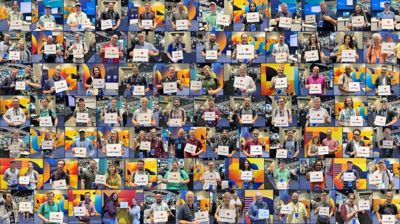
Are you ready to level up your enterprise #GIS? Join us at #EsriUC2026 to learn all about #ArcGISMonitor and how it can help prevent costly system downtime and improve #ArcGISEnterprise performance!
Explore resources ➡️ https://t.co/0n4B3lQcOD
What can students uncover with drones, GIS, and curiosity? At Johns Hopkins, they’re revealing the hidden causes of shoreline erosion, mapping environmental change, and building career-ready geospatial skills 🚁
Read their story: https://t.co/hKp1wTsWOt
ArcGIS StoryMaps is the professional tool for harnessing the power of maps to communicate your work using geospatial storytelling. Check out what’s new in May 2026!
https://t.co/lfMN0EoTFK
Looking for new strategies for managing your #enterprise#GIS with #ArcGISMonitor? Join us for a webinar on June 9, where you'll learn from esteemed speakers from #CloudpointGeospatial and #Dymaptic.
Don't miss out - register now ➡️ https://t.co/EeHewrJMsw
Are you a developer headed to #EsriUC2026? Check out the customized agenda so that you don't miss a single session covering the latest in our APIs and SDKs. https://t.co/h07e19AExG
How can a carefully constructed map strengthen your story? 🗺️
See how configured popups, simple legends, and symbols transform sample stories - then apply those techniques to your own projects. https://t.co/3hUYseQpa1
#GIS#StoryMaps
A clip from a recent WhereNext webcast shows how GIS professionals at Disneyland, Grapery, and Walgreens support their colleagues and help create more efficient organizations. https://t.co/qucGBHEJBK
Reserve your seat for this spotlight session at #EsriUC2026. See live demonstrations of workflow automation using both GeoAI and Agentic AI, productivity-enhancing AI Assistants, and emerging MCP technologies. https://t.co/yQTsvwJu5R
Dr. Satish Sankaran, leader of Esri’s Open Platform initiatives, shares about the state of decentralized collaboration worldwide and the digital transformation underway, as well as Esri’s commitment to openness and interoperability.
https://t.co/UEhwG1milI
Excellent insights from Scott Weisman, GIS program coordinator for Tallahassee-Leon County GIS on management strategies to build a highly productive and skilled team.
https://t.co/WyKsf58Seo
Analytical AI tools such deep learning models deliver bottom-line impact from structured business data. And with generative AI, users can explore insights through natural conversation. Esri's Jay Theodore describes the best of both worlds with GIS. https://t.co/j57ngUkmRX
What perspectives can we gain from the Freedom of Informatin Act, 50 years later? Ralph Nader shares his perspective on how a strengthened FOIA laid the foundation of the open data movement. https://t.co/S6nco3P5IN #GIS#data
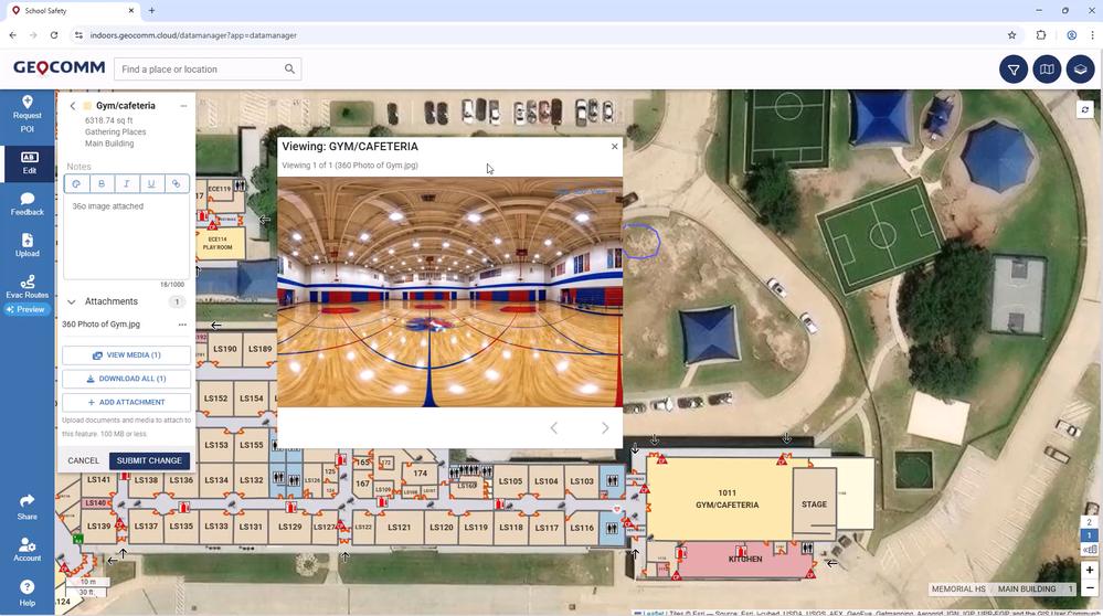
Ensuring safety across a large school district requires more than traditional emergency plans. See how Palm Beach County School District partnered with GeoComm to bring indoor mapping into their emergency response strategy 👉 https://t.co/LKK5x5D35x
How can cities use #AI to fight urban heat?
🌳🏠 See how Chattanooga mapped 5.3 million trees with @USDA data and created a heat index to plant 5000 trees where they matter the most. https://t.co/ihivKrw1Ex
#ArborDay#StoryMaps#Forests250
Organizations can’t scale automation or AI without treating imagery as a core GIS data asset. An imagery foundation reduces cost and complexity while enabling faster decisions, enterprise-wide access, and future-ready IT modernization.
Read the article ➡️ https://t.co/QH0desjmeF