#DavisFire Quick Facts - Morning of September 16, 2024
5824 Acres
85% contained
526 personnel
Weather can be a definitive factor in fighting wildfires. Wind, temperature, and even cloud cover play a role in fire behavior. One critical factor is RH, or relative humidity, which measures water vapor relative to the temperature of the air. Measuring this can help firefighters understand how likely fuels are to ignite.
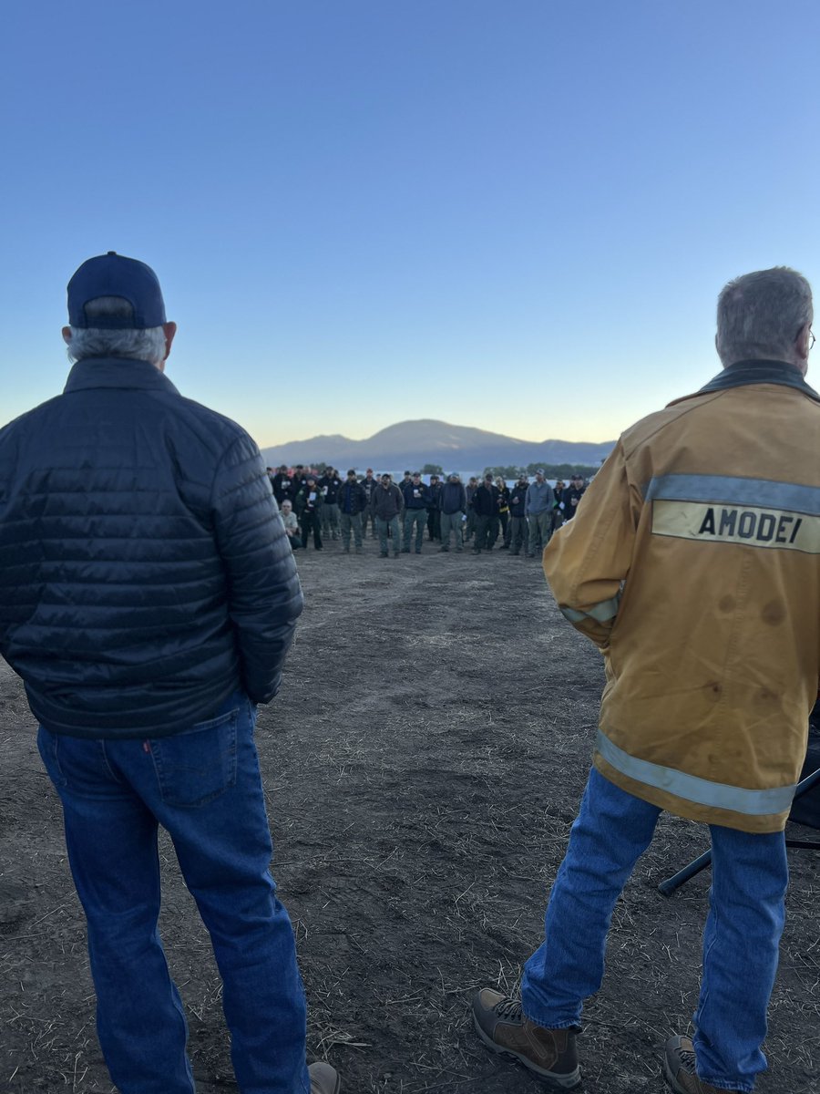
It was an honor to thank our firefighters and first responders at the Incident Command briefing this morning.
They’re hard at work protecting our state and community every single hour.
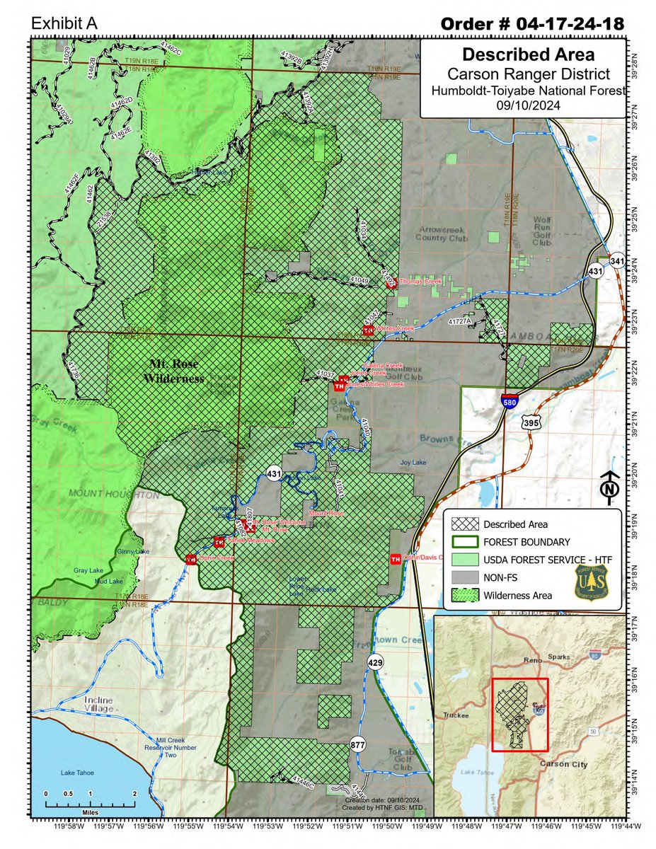
Effective immediately, an emergency closure is in effect for all roads, trails, and develop recreation sites within the Davis Fire area, including northeast access points for the Tahoe Rim Trail. Full story: https://t.co/VP1ZTnOJFW. @TahoeRimTrail#DavisFire
Davis Fire Quick Facts- Evening of September 11, 2024
5,824
37% contained.
631 Personnel
Thanks to the exceptional efforts of firefighters on the ground during today’s wind event, the fire experienced minimal growth. Aircraft operations were grounded after 9:00 AM due to winds reaching 40-60 MPH on the ridges, yet the fire remained in check. Firefighters will continue to work through the night.
Today, we remember those who lost their lives in the September 11 attacks and reflect on the privilege we have to serve our community and our country. This Incident Management Team was among the first to respond to the World Trade Center, a responsibility we carry with deep respect and dedication.
We’re making progress fighting the #DavisFire, and we’re continuing to deploy every possible federal, state, and local asset in this fight.
Thank you for your continued cooperation as local jurisdictions ensure safety throughout the evacuation process.
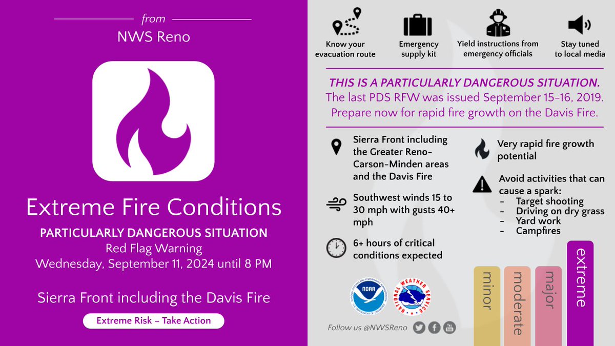
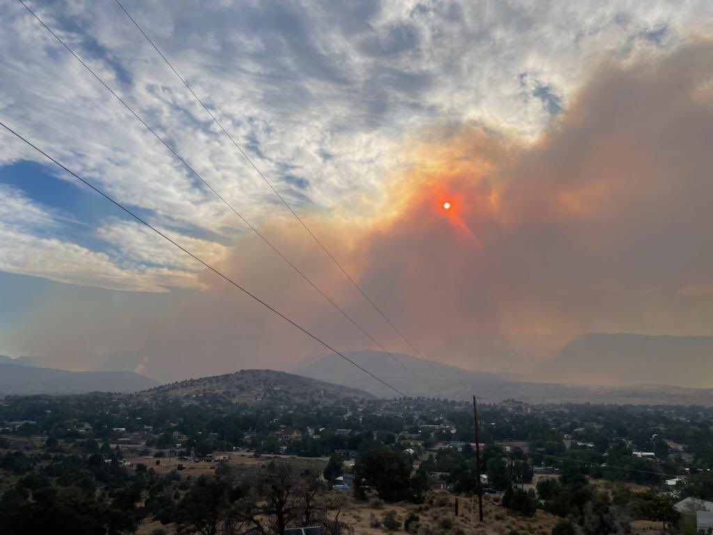
A PDS Red Flag Warning is in effect Wednesday from 11 AM to 8 PM for the Sierra Front including the #DavisFire. This is a PARTICULARLY DANGEROUS SITUATION. Gusty winds & dry conditions will lead to very rapid fire growth. #nvwx
Davis Fire Update - Sept. 10, 2024
Reno, Nevada
Community Meeting Scheduled for Tuesday, September 10th – 7 p.m. at Depoali Middle School
RED FLAG Warning in effect beginning at 11:00 a.m. today
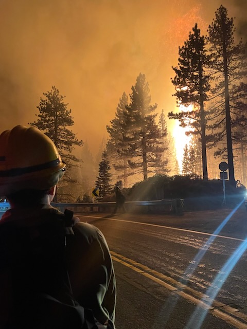
Highlights: Southwest Area Incident Management Team 1 assumed command of the #DavisFire at 6 p.m. on Monday, September 9th. Active fire behavior was seen along the southwestern portion of the fire yesterday in the vicinity of Mount Rose Highway. Aircraft were limited due to wind and smoke conditions, but crews were able to take advantage of natural features and roadways to directly attack the fire. Strike teams and engines from local jurisdictions were able to continue structure protection in and around all impacted communities and additional resources begin to arrive from around the country to support. Four super scooper aircraft have been assigned to the incident, increasing the speed at which water can be delivered to support firefighting efforts across the fire area.
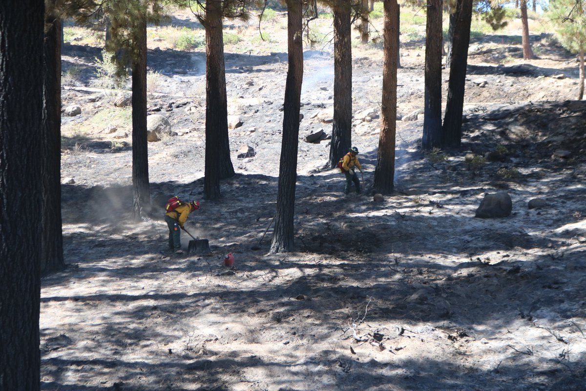
Fire Activity: Overnight, crews and engines worked to construct direct line in areas around the south and western flanks of the fire but were challenged by very active fire behavior. A spot fire established in the lower portion of Browns Creek, east of Hidden Lake and crews were able to gain access and begin building line. Engines were also closely monitoring fire activity in and around communities, extinguishing any heat that could pose further risk to homes and property. Today, along the north and eastern edges of the fire, crews and engines will continue to monitor and mop up heat sources near the line, working to gain containment in the areas along Interstate 580. On the southern perimeter of the fire, Interagency Hotshot Crews will continue to go direct, building line directly on the fires edge, preventing any continued growth to the south. The southwestern corner of the fire is expected to continue to see extreme fire behavior today with spotting potential up to ½ mile. A mix of aircraft, supported by crews on the ground, will work to check the fire up along Mount Rose Highway, while also scouting secondary containment options.
Weather: A Red Flag Warning has been issued for the area beginning at 11:00 a.m. on September 10th. Expect wind gusts up to 35 mph and relative humidities dropping to single digits at lower elevations. The temperatures will range from 92 at the lower elevations to 74 at the high elevation. A thermal belt will establish overnight, keeping humidities lower than normal.
Evacuations: For updated on evacuation statuses please visit: https://t.co/WmLAGTWl8U
More Information:
Email: [email protected]
Fire Information: 775-446-5520
Inciweb: https://t.co/52RKevvm3z
@TMFPD@washoecounty@CityofReno
Davis Fire Update
Reno, Nevada
Sunday, Sept. 9, 2024 @ 6:30 p.m.
More Detail Fire Information: https://t.co/E1QvR0JgCm
The #DavisFire is estimated at 5,000 acres, containment remains at 0%. Southwest Area Incident Management Team 1, a Complex Incident Management Team, assumed management of the fire at 6 p.m. this evening. A community briefing is being planned for Tuesday, Sept. 10, 7 p.m. at Depoali Middle School, 9300 Wilbur May Parkway, Reno, NV 89521.
Firefighters’ main objective today is working to keep the Davis Fire south and east of the Mt. Rose Highway. On the northern flank of the fire, crews continue to construct hand line and secure the fire perimeter. On the southern boundary of the fire, crews continue to mop up hotspots and around structures. The west and north flank of the fire remains active, dozers and hand crews are constructing fire line and going direct when possible. Scooper aircraft assisted on the fire today, dropping water in conjunction with hand line and dozer line construction.
Video of AEU's Strike Team 9272C & 9270C, working alongside firefighters from @CALFIRESHU & an inmate hand crew from @CALFIRELMU, earlier this week in Tehama Co. on the #ParkFire. The fire is currently the largest in the state, & the 5th largest in CA history in only 7 days.
Here is a video that shows why I am not concerned with the #ParkFire reaching Chester and Lake Almanor.
Much of the space between the fire and Chester has been salvage logged following the Dixie Fire and looks like this:
Today's livestream looks at possibile strategies to control the N and NE sides of #ParkFire. We reconstruct a major firing operation from Dixie Fire that went bad, and talk about how Dixie colored willingness of firefighters to do big firing operations.
https://t.co/tmMe5EQB8U
Are YOU ready for 2024? With your new calendar, you will get contest-winning photos of the breathtaking wilderness locations around Tahoe. Order today while supplies last!
https://t.co/uujvxpedxX