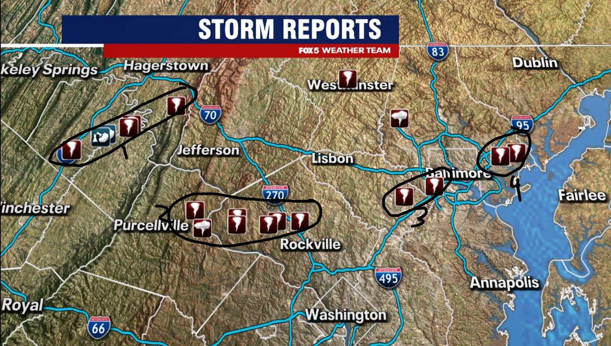
We are sending out 4 different survey teams today to investigate damage across 9 counties across West Virginia, Maryland, and Virginia.
We will release our findings later this afternoon and evening!
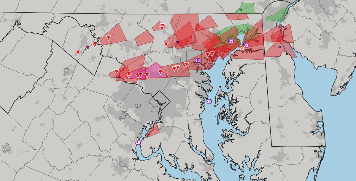
A bit of an update to the reports map yesterday. Adding a few more tornado reports and shading for urbanized areas.
Green on this map is Flash Flood Warnings and reports
Blue squares are the handful of wind damage reports
Purple triangles are the funnel cloud rpts
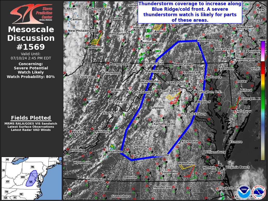
Also, one thing to remember: In SPC terminology, storm coverage does influence the risk level. So, was marginal the correct category, given a handful of tornadic supercells? I'm sure that'll be debated.
I can see the case for SLGT, but hindsight is 20/20
Been a long time since I've seen this many tornado reports in our region, as tornadoes here are typically not long track. When all is said and done, we're likely talking about multiple reports from 3-4 different tornadoes, but survey teams will determine this in the days ahead.
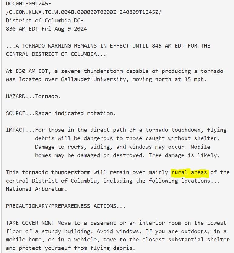
Just a warning that the algorithms that control our social media lives will be regurgitating stuff about the warning in Montgomery Co for days.
There is no further active threat