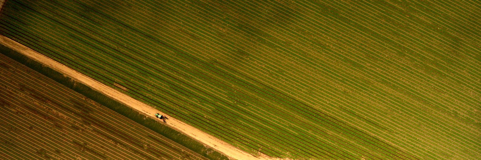
TerrAvion provides high-resolution subscription aerial imagery for agriculture. We help growers protect their investments and make their farms more profitable!
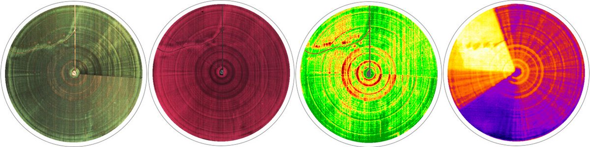
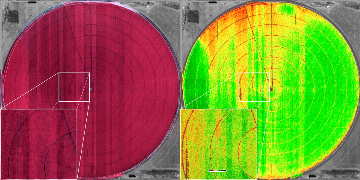
Support your irrigation system with Thermal image data to manage it easily during the season and optimize water use #watermanagement#irrigation#thermaldata#SDI https://t.co/Sl9Ixlh5Z3
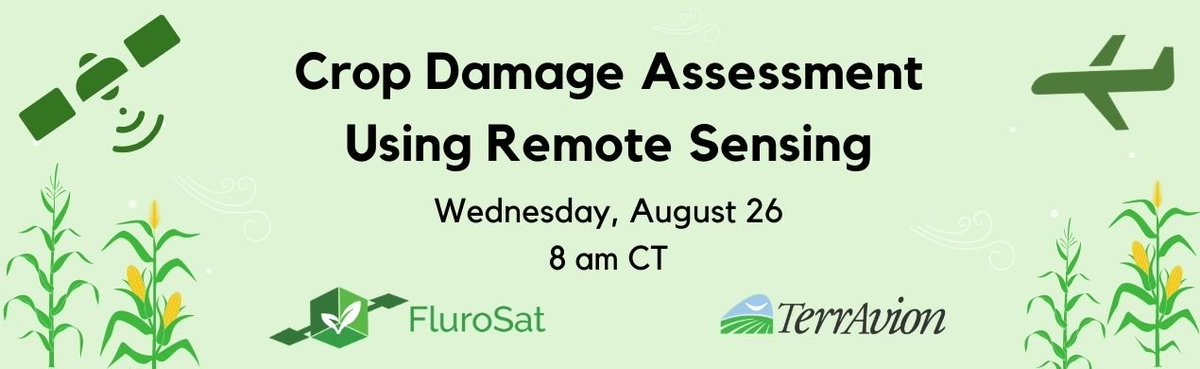
Weather events ⛈️🌪️💦💨 can have a severe impact on agricultural results. Watch the Crop Damage Webinar to learn what can be recovered and how to make the best of the situation. #storm#cropdamage#derecho#HurricaneLaura2020#frost#agtech @FluroSat https://t.co/UMKEYeYRTC
Identificar y corregir fallas de siembra -Los datos recopilados con una suscripción de imágenes de toda la temporada optimizan el retorno de la inversión para cada campo, comenzando por corregir los saltos de las sembradoras con mapas de tasa variable. https://t.co/tIpZPDopKC
Use case: Identify and correct planting failures blog post - The data collected with a season-long imagery subscription optimizes ROI for each field, starting with fixing planter skips with variable rate maps. #remotesensing#agtech#agriculture#ROI
https://t.co/BxAcDGBfjx
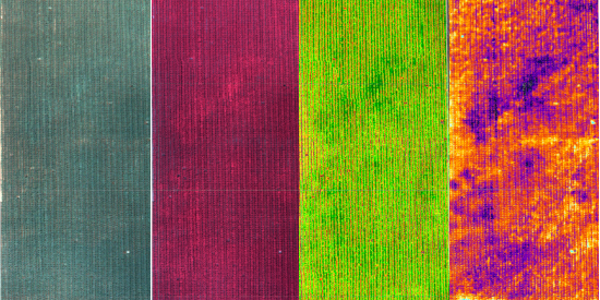
Vigor (#NDVI) e imágenes infrarrojas ofrecen un valor inmenso al proporcionar conocimientos y oportunidades agronómicas para aumentar las ganancias y limitar las pérdidas para la uso de datos de #imagen de #infrarrojos x vigor https://t.co/ttFo7ni5Tp #agricultura#agtech
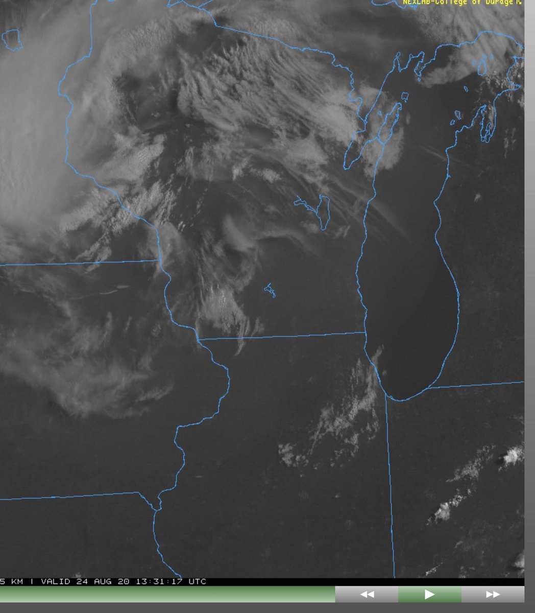
@mwimageryguy@TerrAvion Had planned on flying a few flight lines in Illinois with my Cessna this morning - check out the clear 'smoke front' moving over Lake Michigan.
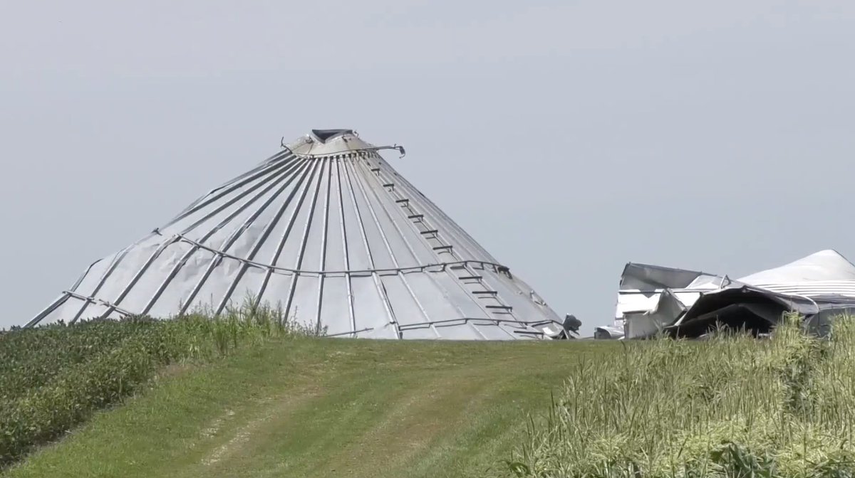
The USDA has stated that the storm in Iowa last week affected 8.18 million acres of corn and 5.64 million acres of soybeans. Register today for our Crop Damage Assessment Webinar to assess the damage done to your crops! @TerrAvion#agtwitter https://t.co/JlRGMPQxJL
Img (C) Who13
A recent study found that crop loss by pest and pathogens in the USA MidWest and Canada alone annually is for #Wheat 17.9%, #Corn 21.3%, #Potato 8.1%, and #Soybean 25% on average. And that does not include crop loss from weather events. #cropdamage#IAwx https://t.co/aw3q2MYPD4
TerrAvion believes in a future where software services in the cloud and in the field deliver data growers need, seamlessly. As the largest aerial imagery provider, we offer very high-resolution imagery that provides actionable data for agriculture. https://t.co/g4wY2vsa23 #api
Severe weather can destroy crops, prevent planting, or prohibit harvesting. Major events like devastating wind #storms and #flooding can put farm operations out of business. Learn how remote sensing can help #recovery from crop damage. Register now: https://t.co/PVBTVfyooA
Suffering crop damage no matter what the cause can be devastating. See how remote sensing and timely aerial imagery can identify and locate the affected areas, quantify the range of affected acres and assess the severity of damage in each area https://t.co/34zUmEMDFR #agriculture
Whether you already use a digital agronomic platform or are interested in finding out which one would work best for your operations, TerrAvion data is an affordable addition to many ag platforms and helps you to see what is going on in your fields. https://t.co/eOnMqF7CAJ
Severe weather can destroy crops, prevent farmers from planting or prohibit them from harvesting. Major events like floods and hurricanes can put farm operations out of business. Learn how remote sensing can help recovery from crop damage. Register now: https://t.co/jvdsVhnzd6