Mine Boundary Survey Completed
A clear boundary is the foundation of good mine planning.
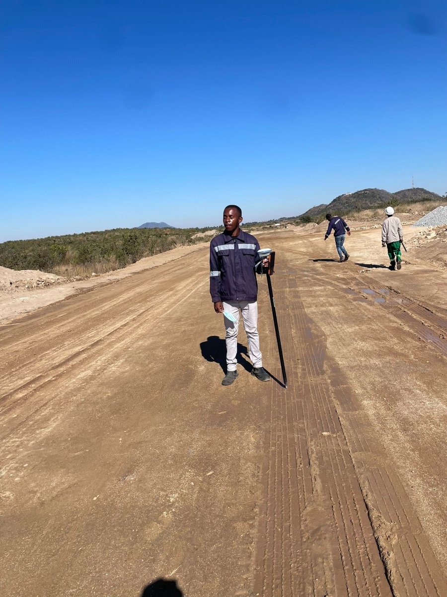
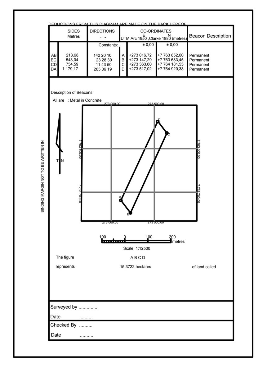
Last week Saturday, our surveying team carried out a detailed topographic survey to establish the mine boundaries.
The captured survey data was processed and plotted in Surpac, providing an accurate spatial foundation for mine planning, design and future volume calculations.
📍 Survey → Data Processing → Surpac → Mine Planning
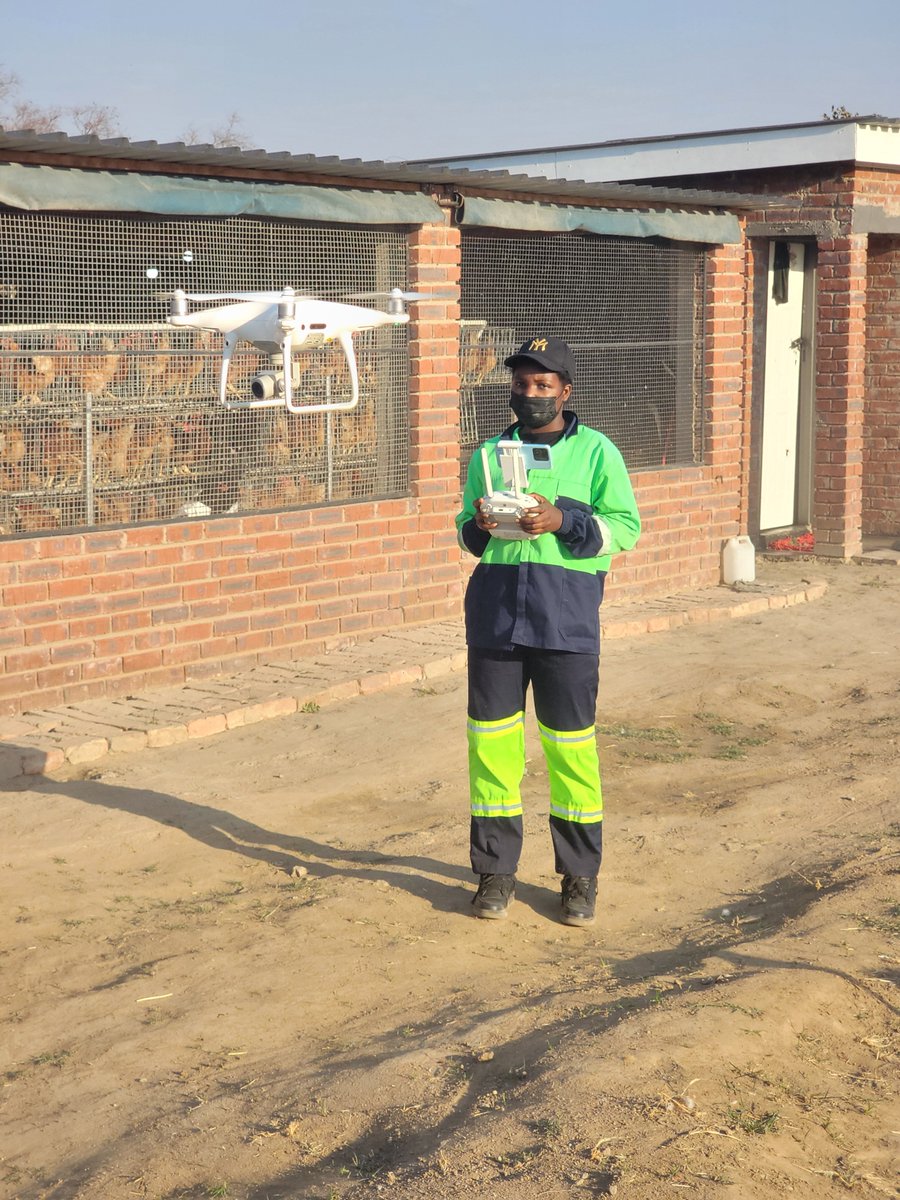
At TerraCore Aerial Intelligence, we turn field data into accurate spatial information that supports better decisions in mining.
Precision in the field. Intelligence in the plan.
#TerraCore #Mining #MineSurvey #TopographicSurvey #GIS #MinePlanning #Zimbabwe
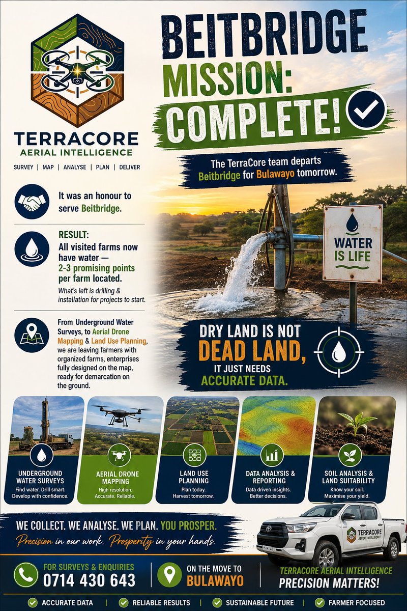
BEITBRIDGE MISSION: COMPLETE! ✅
The TerraCore team departs Beitbridge for Bulawayo tomorrow.
It was an honour to serve Beitbridge.
Result: All visited farms now have water — 2-3 promising points per farm located. What’s left is drilling & installation for projects to start.
From Underground Water Surveys, to Aerial Drone Mapping & Land Use Planning, we are leaving farmers with organized farms, enterprises fully designed on the map, ready for demarcation on the ground.
Dry land is not dead land, it just needs accurate data.
TerraCore Aerial Intelligence | Precision Matters!
📞 0714 430 643
https://t.co/MOwQbZ6q2n
Today we drilled in Domboshava, for this site we surveyed it last week. We recommended 90m but the client drilled 60 and struck water💦 tho he had no money to continue driling, nemu 60m imomu mvura yatamubatira it's enough for domestic and commercial water. Vati vakuda kutotang kuita horticulture mangwana chaiye. He trusted us with his land and also believe in our scientific methods, here is the result.
Do you have a piece of land/ plot/ residential stand? Contact us nhasi chaiye and be a satisfied client mutotangawo mixed farming 🔥
0714430643
Follow our Whatsapp group 👇 👇
https://t.co/MOwQbZ6q2n
Terracore precision matters! Survey First!Drill Once. 🤗🔥
Today we were in Snake world pamamonya on a hectare farm, running full technical ground checks. The client have one borehole of low yield which cannot sustain and support ongoing projects on the plot, poultry farming and horticulture. So sad 😢. He decided to call us to do a comprehensive underground water survey so we could identify and peg better sites which can yield excellent results.
Out of 4 borehole points surveyed:
· 3 sites locked in with excellent projected yields.
· 1 point was discarded due to low water reserves.
👉🏿however from the 3, 1 looked good but we discarded it since it was too close to an existing borehole. We've seen those dry up within a year or less.
What's next?
Tuesday,will be back in the office processing the drone data and ground profile maps.
We'll share the final report with exact drilling depths, coordinates, and stream analysis maps to guarantee long term water security.
💧
Follow group for more updates
https://t.co/MOwQbZ6q2n
For inquiries and bookings 0714430643
Terracore precision matters! Trusted since day 1# Survey First.#Drill Once!!
Happy client happy Sunday, we've struck it again 💦.. Terracore we did it again!!!😊😊 As promised a client got water this is what we mean precision, accurately mapped underground reserves and bringing joy and happiness onto people faces .
We did Drone based water survey for this client last month and he finally decided to drill this month and he's happy he struck water for commercial use yet he wanted for domestic use 😂 That's precision!!!
That's why we say precision matters!! Survey first and drill right 👍
We also have a Whatsapp group 👇👇
https://t.co/MOwQbZ6q2n
For bookings and inquiry contact Noleen on
0714430643
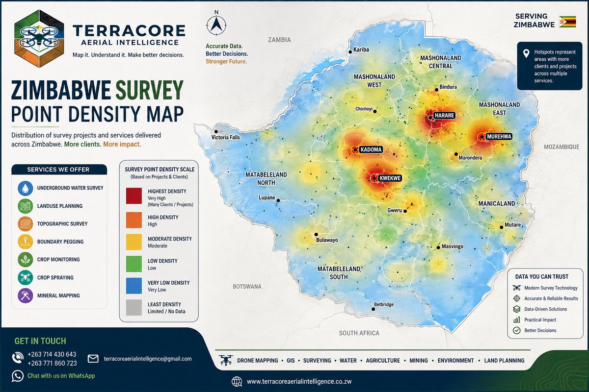
💧 WHERE TERRACORE HAS BEEN AND WHERE WE’RE GOING NEXT.
Every point on this map represents more than just a location.
It represents a property assessed, data collected, ground investigated, decisions made, and clients who trusted TerraCore Aerial Intelligence with one of their most important investments water.
From Harare to Murehwa, Macheke, Kwekwe, Kadoma, Gweru, Chiredzi, Bulawayo, Beatrice, Mvuma, Mutoko, Karoi, Magunje, Mutoko, Odzi, Chegutu and beyond, our survey coverage continues to grow.
But this map is not just about how many places we've visited.
It represents our approach:
Survey before you drill.✅
Understand the ground before you invest. ✅
Use data before making the decision.✅
Our underground water surveys combine GIS, remote sensing, ground profiling and field-based investigation to identify and rank promising drilling locations and provide informed depth recommendations. Integrated geospatial and hydro-geophysical approaches have also been shown in Zimbabwe research to improve groundwater exploration outcomes and reduce the risk and cost associated with poorly targeted drilling.
And we're not stopping here. 🤗
More locations. More data. More experience. More precision. 🔥
If you're planning a borehole, don't start with the drilling rig.
Start with the data.
📍 TerraCore Aerial Intelligence
💧 Underground Water Surveys | GIS | Land Use Planning | Topographic Surveys
https://t.co/MOwQbZ6XRV
📞 +263 714 430 643
📧 [email protected]
DON'T DRILL BLIND. DRILL WITH INTELLIGENCE.
TerraCore Precision Matters.
Midlands yabva ratotanga with great results. We can't say we do drone based underground water surveys tisingabate minyatso yamvura 😂
Imagine drilling a borehole with this yield unozodei. Zvakawanda chisiirai mumaoko edu and we deliver the best!
Terracore Aerial precision matters and we do not guarantee water where there's no water! Ukaona tasiya peg, tato sign nekupasisa kuti mvura iripo uye taiwana.
Ne drone survey tinopedza basa 🔥🔥. Book your survey today
0714430643
Do follow our Whatsapp group for more information
https://t.co/MOwQbZ6q2n
At Terracore we say Survey First. Drill once. Struck water at first attempt. Mvura kuvanhu !!
Trusted since day one 🤗
Midlands yabva ratotanga with great results. We can't say we do drone based underground water surveys tisingabate minyatso yamvura 😂
Imagine drilling a borehole with this yield unozodei. Zvakawanda chisiirai mumaoko edu and we deliver the best!
Terracore Aerial precision matters and we do not guarantee water where there's no water! Ukaona tasiya peg, tato sign nekupasisa kuti mvura iripo uye taiwana.
Ne drone survey tinopedza basa 🔥🔥. Book your survey today
0714430643
Do follow our Whatsapp group for more information
https://t.co/MOwQbZ6q2n
At Terracore we say Survey First. Drill once. Struck water at first attempt. Mvura kuvanhu !!
Trusted since day one 🤗
🙏 THANK YOU, MIDLANDS! 🇿🇼💚
Our Midlands trip has come to an end, and we want to sincerely thank everyone who welcomed the TerraCore team along the way. 🤝🏾
From Norton → Murombedzi → Chegutu → Nyabira → Inkomo Barracks → Kwekwe → Gweru, we met incredible people, worked on different projects, and most importantly, built new connections.
To every client who trusted us with their land, groundwater, surveying, GIS and development needs thank you. 💧
This trip reminded us why we do what we do:
We don't just travel to places. We bring precision, technology and solutions closer to you. 🎯
Midlands, thank you for having us. Until next time! 🇿🇼
TerraCore Aerial Intelligence
Map it. Understand it. Make better decisions.
📞 +263 714 430 643
📧 [email protected]
https://t.co/MOwQbZ6q2n
#TerraCoreAerialIntelligence #Midlands #Zimbabwe #GIS #Surveying #Groundwater #DroneMapping #LandUsePlanning #PrecisionThatDelivers
FIELD UPDATE KWEKWE 📍
Today, the TerraCore GIS Team is on the road from Bulawayo to Kwekwe for a major 400-hectare land-use planning and underground water survey. 💧
Our goal is simple: get on the ground early, maximise field time, and collect the right data from the very start ehezveee kaa basa mangwanani we ready and full geared kuti basa rifambe 😂
Project details:
📐 400 hectares
🗺️ Land-Use Planning
💧 Underground Water Survey
📍 Bulawayo → Kwekwe
Early start. Detailed data. Better decisions.
TerraCore Aerial Intelligence
Map it. Understand it. Make better decisions.
https://t.co/MOwQbZ6XRV
📞 +263 714 430 643 | +263 771 860 723
📧 [email protected]
#Kwekwe #GIS #LandUsePlanning #GroundwaterSurvey #Surveying #Zimbabwe #TerraCoreAerialIntelligence
RIVERSIDE, BULAWAYO: THE $4000 LESSON
Today our TerraCore team was called to a site in Riverside.
The problem:
Borehole drilled to 90m deep
Thousands of dollars spent
Result: COMPLETELY DRY ❌ Not even a trickle
Why? No survey. Just guesswork.
The TerraCore Difference:
We use 3D Electrical Resistivity , drones & GIS to map underground water fractures BEFORE drilling. We see where the water is hiding. We give you exact drill coordinates + depth.
We’ve done it in Chivhu at 16m. We’re doing it now across the Midlands and we’re in BULAWAYO TODAY Riverside, Gravestone Park, and surrounding areas.
The Promise:
Drill Once. Strike Water. First Time.✅ be
Don’t lose another dollar to a dry hole.
�� CALL/DM NOW: 0714430643
Also join our Whatsapp group for more updates
https://t.co/MOwQbZ6q2n
FIELD UPDATE MIDLANDS TRIP
Chegutu DONE! ✅
Another stop completed, another project ticked off.
We’re now heading to Kadoma for the next stop on our Midlands trip. If you're in kadoma and you want us to do water survey for you, here's the chance book with us on 0714430643 and we've got you covered
The TerraCore team is on the move, bringing surveying, GIS, groundwater survey and spatial intelligence solutions closer to you.
📍 Next stop: KADOMA
Different places. Same precision. One mission.
TerraCore Aerial Intelligence
Map it. Understand it. Make better decisions.
https://t.co/MOwQbZ6q2n
FIELD UPDATE THE JOURNEY CONTINUES!
We’re continuing with our trip today!
📍 Today: Chegutu
➡️ Next stop: Kadoma
➡️ Then: Gweru
If you’re in Chegutu, Kadoma, Bulawayo or along the route, this is your chance to get your property surveyed while our team is already in your area.
Need an underground water survey?
A land or boundary survey?
Topographic mapping?
Drone mapping?
GIS & land-use planning?
Or another spatial solution?
📲 Register with us and let’s put this trip to good use!
Don’t wait for us to pass you by get your survey on the list.
TerraCore Aerial Intelligence
Map it. Understand it. Make better decisions.
Kindly join our group for more updates
https://t.co/MOwQbZ6q2n
📞 +263 714 430 643
📧 [email protected]
#TerraCore #Chegutu #Kadoma #Bulawayo #FieldUpdate #GroundwaterSurvey #LandSurvey #DroneMapping #GIS #Zimbabwe
Imagine drilling a borehole and hitting high-pressure water on the very first attempt💦
We surveyed this property last month, and they drilled yesterday they got water. The same scientific process that worked for them is the same one we will use for you.
How do we conduct our surveys?
Drone Surveying: We use aerial stream and deposition analysis to map your land’s layout from above
Ground Profiling: We use ground-level profiling to identify the specific aquifers, depth, and pressure points.
Dry holes are expensive. For a 75m hole, you are looking at $750 for the first 40m, plus $770 for the remaining 35m (at $22 per meter). That is $1,520 gone if you hit nothing.
.And just to be clear, if our survey shows no water, we tell you that upfront so you don't waste your money drilling.
Get the data. Get the water.
For inquiry and bookings contact us on 0714430643 and follow our channel for more updates https://t.co/PWDKc72lHs
FIELD UPDATE CHIREDZI 💧
Yesterday, the TerraCore Aerial Intelligence team was on the ground in Chiredzi.
Our client engaged us for 3 critical services,:
1. Underground Water Survey - To identify promising drilling targets
2. Land-Use Planning- To understand the landscape for smarter development
3. Existing Borehole Verification - The client suspected the borehole was yielding low water
FINDINGS & SOLUTION
During the Borehole Verification, our assessment revealed that the low yield was not due to lack of water.
The main issues were: wrong pump selection and incorrect installation depth.
The client has now entrusted us to provide the right solution. We will be going again next week for borehole installation and for helping him put drawn enterprises on to the
This is what we stand for at TerraCore:
Don’t just identify the problem deliver the right solution.
Next: We will be going back to Chiredzi for Borehole Installation* and to help put on the ground the planned land-use enterprises from the land-use map we produced.
Survey. Verify. Solve. Deliver.✅
Different challenges. One approach: PRECISION.
TerraCore Aerial Intelligence
Map it. Understand it. Make better decisions.
Precision That Delivers.
📞 +263 714 430 643
https://t.co/PWDKc72lHs
📧 [email protected]
#Chiredzi #GroundwaterSurvey #LandUsePlanning #BoreholeVerification #GIS #Zimbabwe #TerraCoreAerialIntelligence