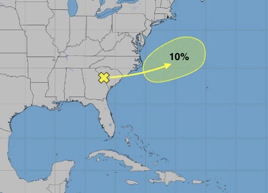
SW Atlantic AOI down to 10%. Models losing interest, particularly DeepMind which was once strong on it, now about to drop it entirely. #Tropics#Tropicalwx
Fresh lemon just dropped in SW Atlantic. AI models particularly DeepMind with strongest signals. Operationals not on it yet. Euro has things very dry in the timeframe Google is slamming this thing into Georgia. #Tropics#Tropicalwx
@JonnyTheWX Technically correct as El Niño threshold wasn’t achieved until August, but ‘86 is still considered an El Niño season. Late June was a plus neutral though.
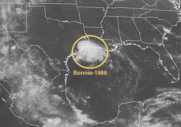
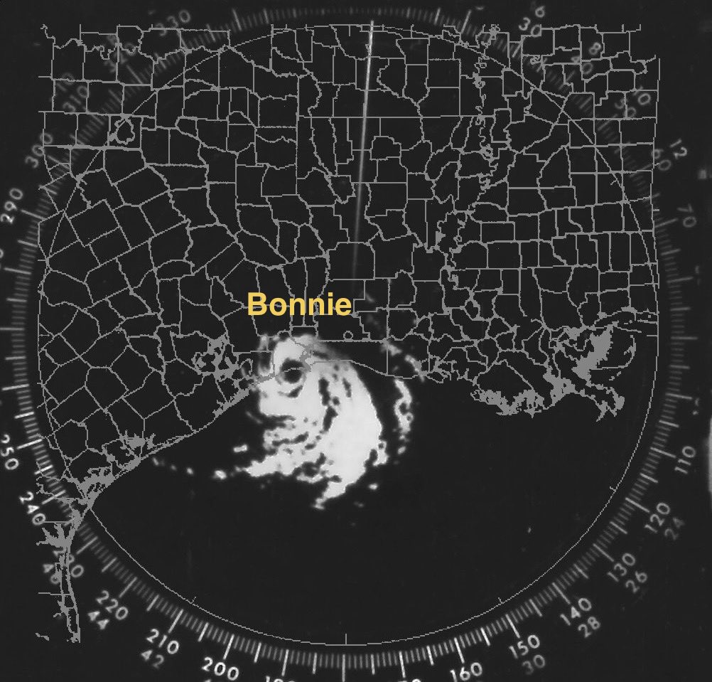
40th anniversary of Hurricane #Bonnie, the last hurricane to make TX landfall in June and the only hurricane to strike Texas in an El Niño year (since 1950). #OTD#WxHistory#TXwx
175 years ago today (June 25, 1851) the very 1st official tropical storm which became the very 1st official hurricane, in the very 1st official hurricane season in the #HURDAT databse, makes the very 1st official landfall, in Texas, near Matagorda Bay. #OTD#WxHistory
Things very quiet and expected to stay that way for a while. CPC map is clean thru mid-July. Models showing nothing of significance at the moment. #Tropics#Tropicalwx#ElNiño
East Coast AOI (remnants of #Arthur) still
at 10%. ECENS the only models hanging on right now and it’s got members dropping. Can never rule out Gulf Stream effects but this isn’t looking too likely to redevelop at the moment. #Tropics#Tropicalwx
Part 3? Remnants of #Arthur have a chance to redevelop off the east coast late in the week into the weekend. Euro ensembles showing the strongest signals with GEFS coming around. #Tropics#Tropicalwx
#Arthur has been downgraded to a post tropical low. Arthur is the first 1st storm of the season to make Texas landfall since Allison whose 25th anniversary was recognized 12 days ago. #TXwx#Tropics#Tropicalwx
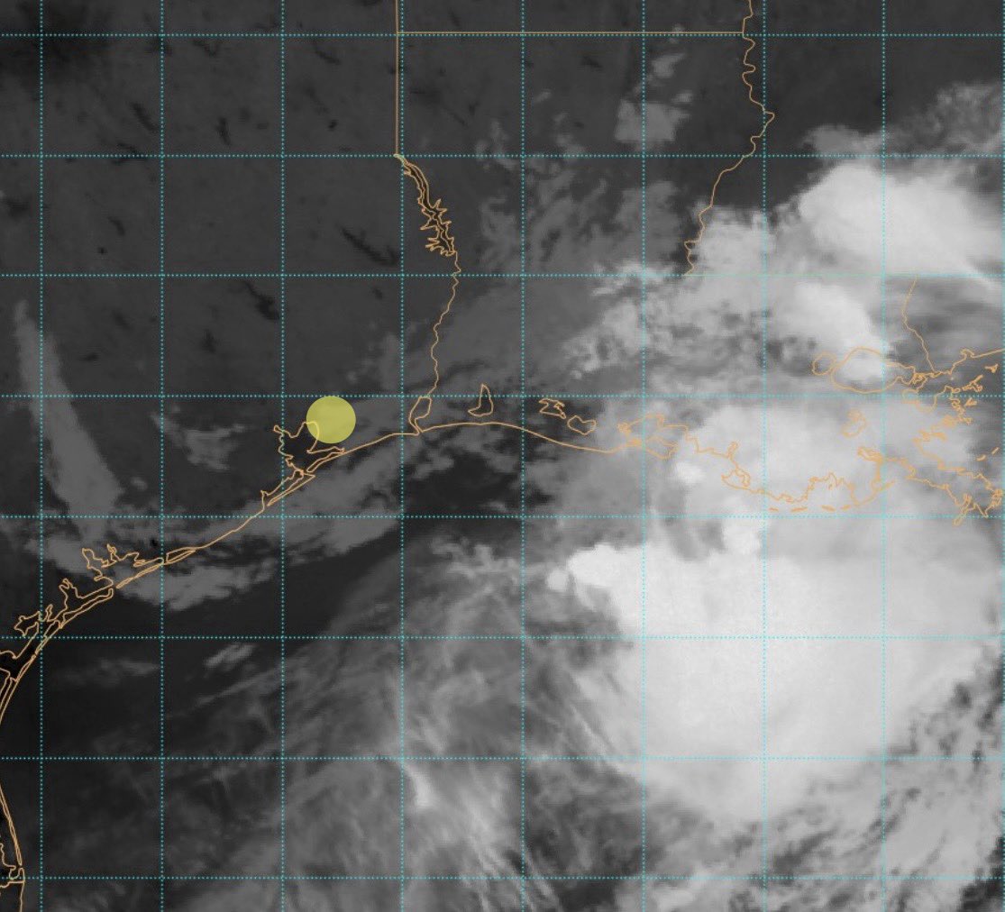
TS #Arthur is said to have made landfall in Matagorda County, TX. Since that update 2 hours ago the center appears to be near Galveston Bay. Strong shear continues to keep convection far away from center. Strange storm. Looking forward to TCR. #TXwx#Tropics#Tropicalwx
@JonnyTheWX That doesn’t bother me as much but you’re right. A PTC is not a cyclone and probably shouldn’t be numbered like it is. Perhaps use the recently retired Greek alphabet for these? PTC Alpha?
#PTC1 dealing with strong westerly shear pushing convection far east of the center. Formation chances have dropped to 60% as shear should remain in play. Inland rain building back up this morning along mid to upper TX coast. Flooding still the main threat. #TXwx#Tropics
#PTC1 about to see sunset. Latest NHC plot has it right at the coast. Satellite showing some midlevel swirl to the west moving almost due south. Vorticity is actually stacked pretty well, it’s just elongated. Rainfall really diminished over land. #TXwx#Tropics#Tropicalwx
#PTC1 technically becomes our 1st cherry of the year. Now at 70% chance of formation. Looks like a fun day across most of the Gulf coast. #TXwx#LAwx#Tropics#Tropicalwx
In order to get watches and warnings issued the NHC has tagged Invest #90L as Potential Tropical Cyclone #01L. A TS Watch has been issued from Sargent, TX to Morgan City, LA. Development of #PTC1 remains at 60%. #TXwx#LAwx#Tropics