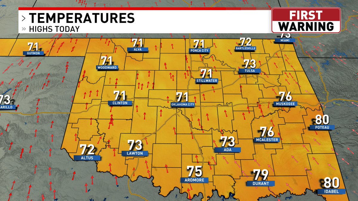
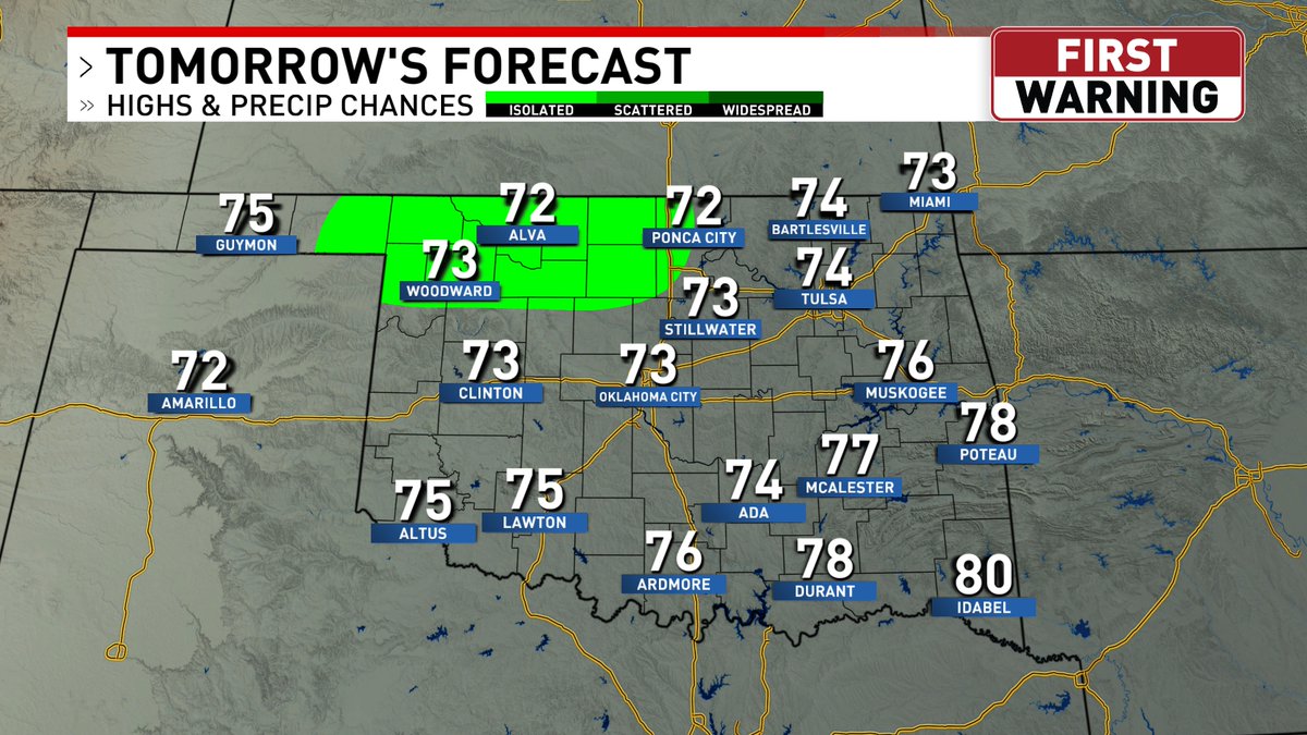
Another comfortable day in the forecast today. High temperatures will be in the 70s with lots of sunshine. If you have allergies, be on alert. Allergy levels for the day show a high count of weeds, moderate count of mold, and a low count of grass and trees.
#okwx
Clouds will break up & sunshine will return today as high temperatures rise into the mid to upper 70s. Our record high temperature for today is 90°, which was set back in 2004. We're not going to get close to that, but we will be above average since our average high is 71°.
#okwx
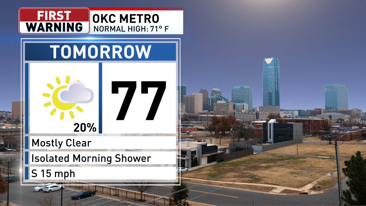
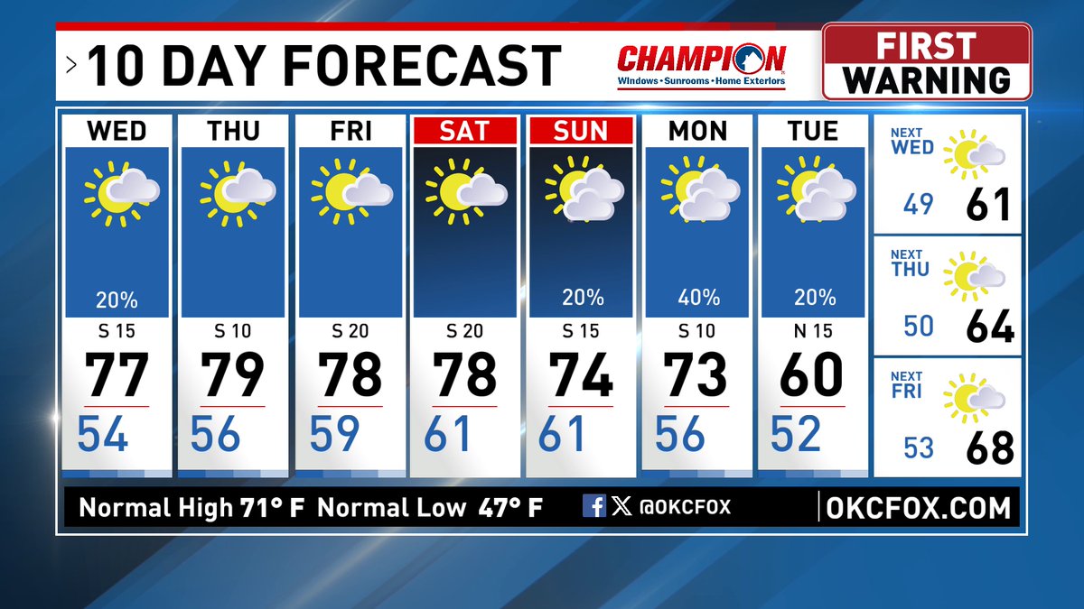
We could see some isolated showers popping up in NW & N OK from about 5 AM through noon tomorrow. After the showers we'll clear out to mostly sunny skies with highs in the upper 70s. The beautiful forecast looks to continue through Saturday.
#okwx
NBA season opener is today for the OKC Thunder. OKC Thunder VS San Antonio Spurs game is scheduled for an 8:30PM tipoff @ Frost Bank Center in San Antonio. If you're going to watch the game anywhere in the metro today, expect dry weather and cooling temperatures in the 60s.
#okwx
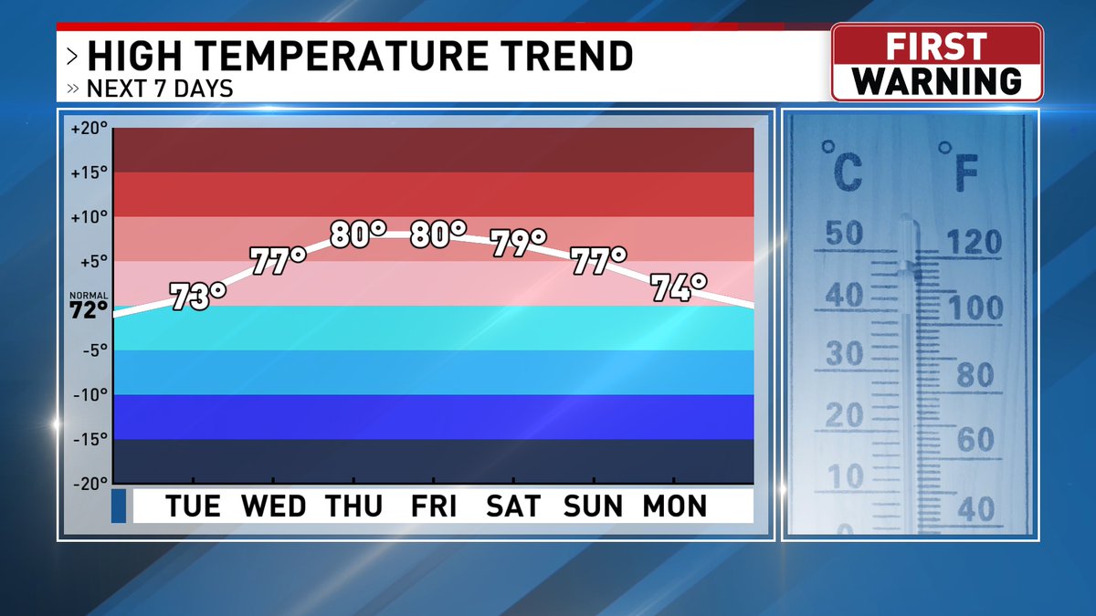
We've had a rollercoaster ride with temperatures this month. This past friday, we saw the coolest high temperatures since middle parts of March. We're now on a warming trend this week with highs in the 70s. High temperatures will continue to rise near 80° later this week.
#okwx
We're starting off Tuesday with a few isolated sprinkles & temperatures mainly in the 50s. The sprinkles will continue to dissipate later this morning as temperatures warm back up into the low to mid 70s in the afternoon. We'll see lots of sunshine in the region later today
#okwx
There might be a few light showers/sprinkles Tuesday morning across portions of northwest Oklahoma, but we're looking at another great day with highs similar to today!
#okwx
A cooler start to the week with highs near 70°, but a big warmup is in the forecast this week. Highs will hover near 80° later this week with mainly dry weather conditions. Rainfall chances increase as we head closer to the weekend with above average high temperatures.
#okwx
We're looking ahead to a beautiful fall week. Sunny to mostly sunny skies will be joined by highs slowly warming to 80 by Thursday. We could see some more cloud cover move in Friday with isolated rain chances Saturday. #oklahoma#weather#fallweather#okwx
Frost Advisories and Freeze Warnings are out for western, northwestern, and northern Oklahoma Saturday morning where lows will dip into the upper 20s and low to middle 30s. If you live in ones of these counties, bring your plants in or try to protect them from the cold.
#okwx
Frost Advisories have been issued NW of the OKC metro from 1AM-9AM Saturday for temperatures in the low to mid 30s. Freeze Warnings have been issued in far NW Oklahoma from 1AM-9AM Saturday for lows in the upper 20s to low 30s. Get those outdoor plants ready for the cold!
#okwx
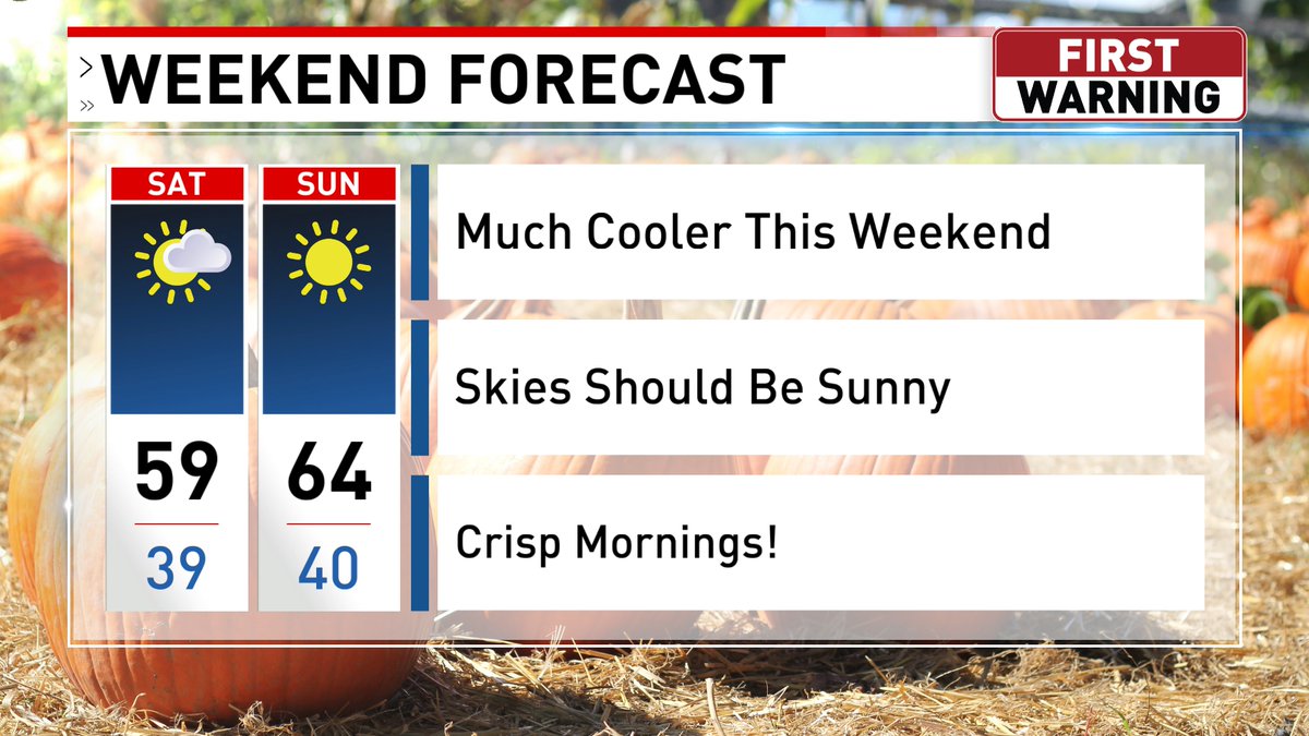
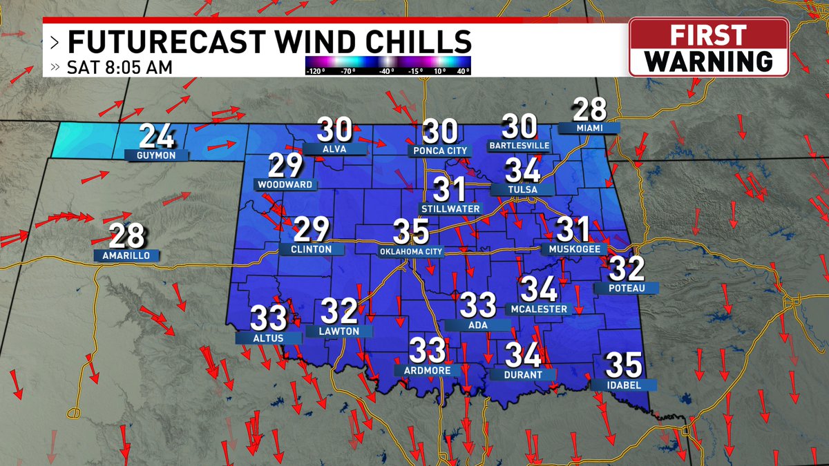
A cold front moved through the state & will keep us in the upper 50s today with a gusty north wind. Freeze Watches are in effect from 1AM-9AM Saturday in NW Oklahoma. Temperatures will be in the 30s Saturday AM with a wind chill in the 20s & 30s. Don't forget your jacket!
#okwx
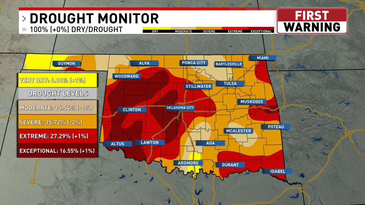
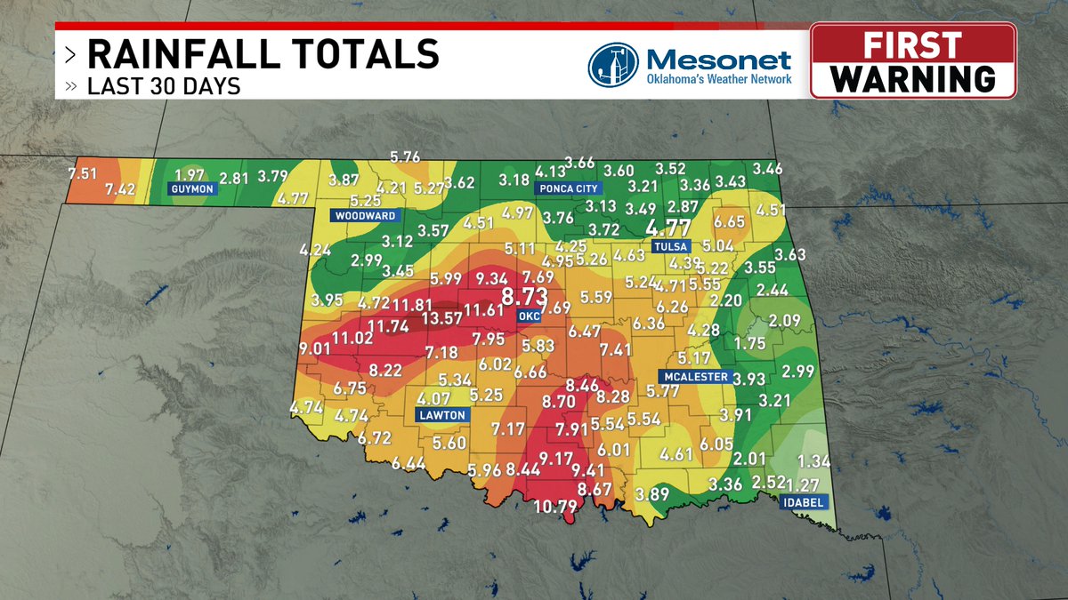
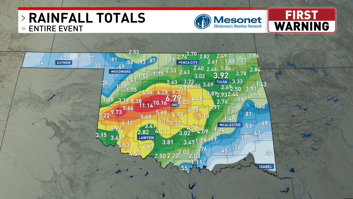
The Hinton Mesonet site had the lead yesterday and that continues into today with 11.12" in total! There is light rain ongoing which will help to slightly raise these amounts into tonight. Since this rain fell AFTER the cutoff, it is not reflected on the drought monitor.
#okwx
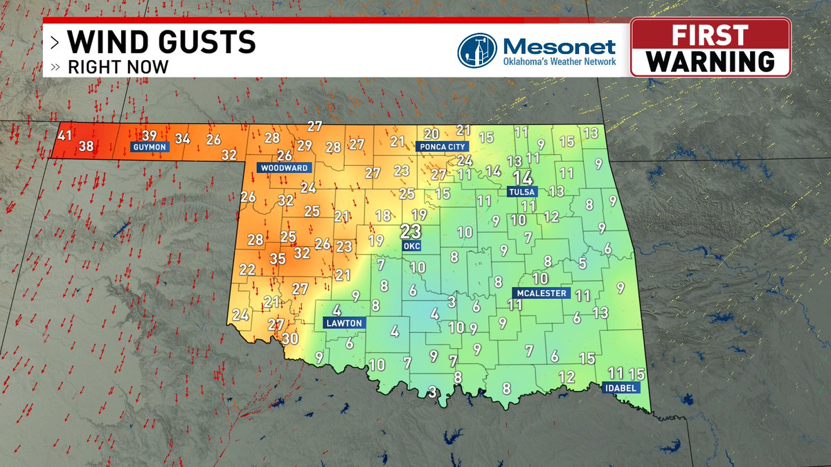
We'll show rainfall totals here shortly, but as the rain winds down throughout the evening, our attention will be turning to the temperatures! Already, we have temperatures falling into the 50s behind our cold front with wind gusts near 40 mph!
#okwx
A cold front is bring in the coolest temperatures since middle of March. Low temperatures will be in the 30s and 40s Friday morning through Monday morning. Our Wind Chill will be in the 20s and 30s, so make sure you bring that jacket or coat because you will need it.
#okwx
A Flood Advisory is in effect through 10AM today in the OKC metro. We've already seen more rainfall in the last 48 hours than the last 4 months combined. This is a video of the flooding near Yukon this morning. Turn around and don't drown.
#okwx
A Flash Flood Warning has been issued for Cleveland County including Norman until 7:30AM today. Rain is currently falling as of 5:40AM with a break in the precipitation after 8AM. Rainfall will ramp back up closer to lunch time & that will continue into the afternoon hours.
#okwx
An Areal Flood Advisory has been issued for the OKC metro until 6:00AM. Moderate to heavy rainfall is falling in the region thie morning cause some flooding conditions. Additional rainfall will continue to fall the next few hours.
#okwx
The Severe Thunderstorm Warning has been expanded as far east as Seminole County until 11:30 for 60 mph winds, especially watching that little feature near Eason where that most likely heavier pocket of wind is. Moving northeast at 35 mph.
#okwx