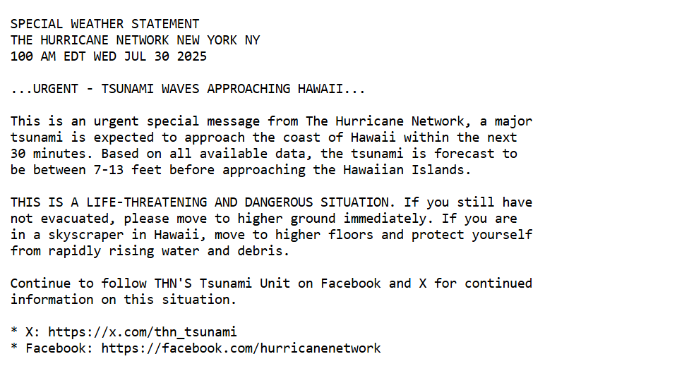
A widespread tsunami is expected across the entire Pacific ocean basin with Tsunami Watches in effect for Hawaii and the entire U.S. West Coast. Please refer to @thn_tsunami for updates on this event.
THN Tsunami Unit (@thn_tsunami) is updating conditions relating to an ongoing #Tsunami Warning in #Alaska with a tsunami being confirmed. A tsunami warning means life-threatening inundation is expected.
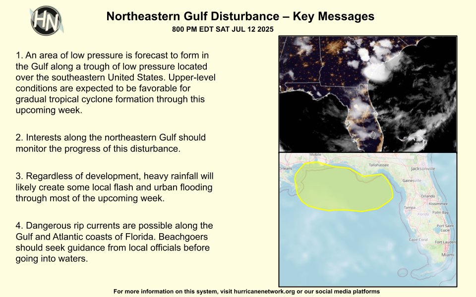
There is a low chance of tropical cyclone formation in the next seven days but a low pressure system could form over the next couple days that could lead to tropical cyclone formation. Here are the Key Messages about this disturbance:
https://t.co/OOuCj1m9BE
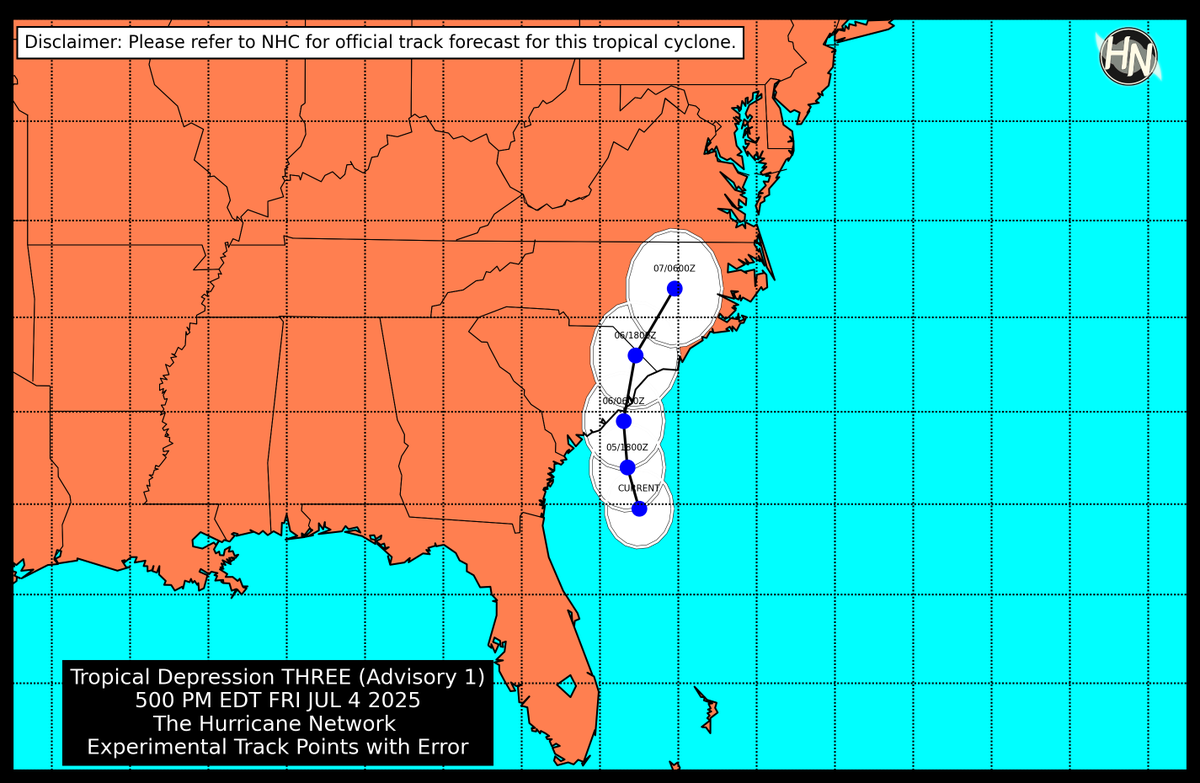
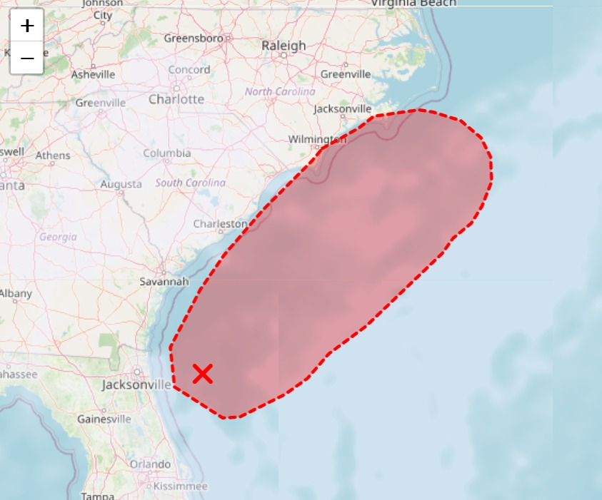
Here is The Hurricane Network's experimental track forecast on TD #Three based on the recent 500 PM EDT advisory package. It should be reminded, impacts will likely be felt outside of this track.
More on T.D. Three: https://t.co/UJveYvorez #scwx
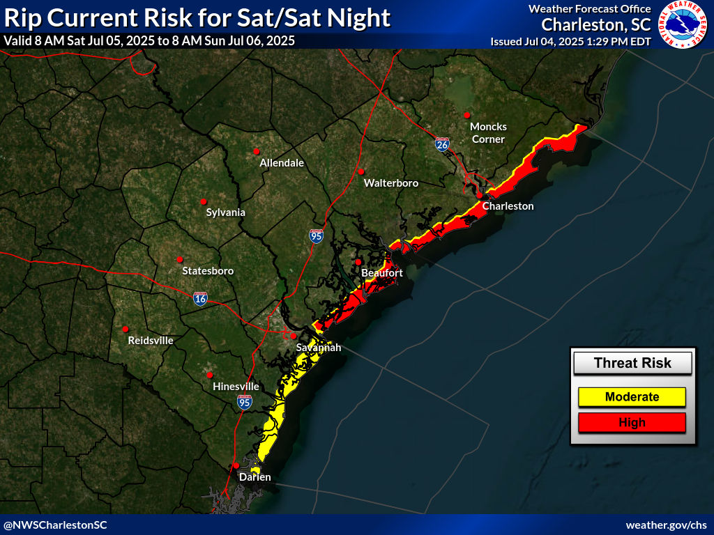
There is a moderate to increasingly high risk of rip currents along the coast of South Carolina due to Tropical Depression #Three on Saturday. It will be dangerous for anyone entering the waters and could risk injury or death, don't let this holiday turn deadly! #scwx#03L
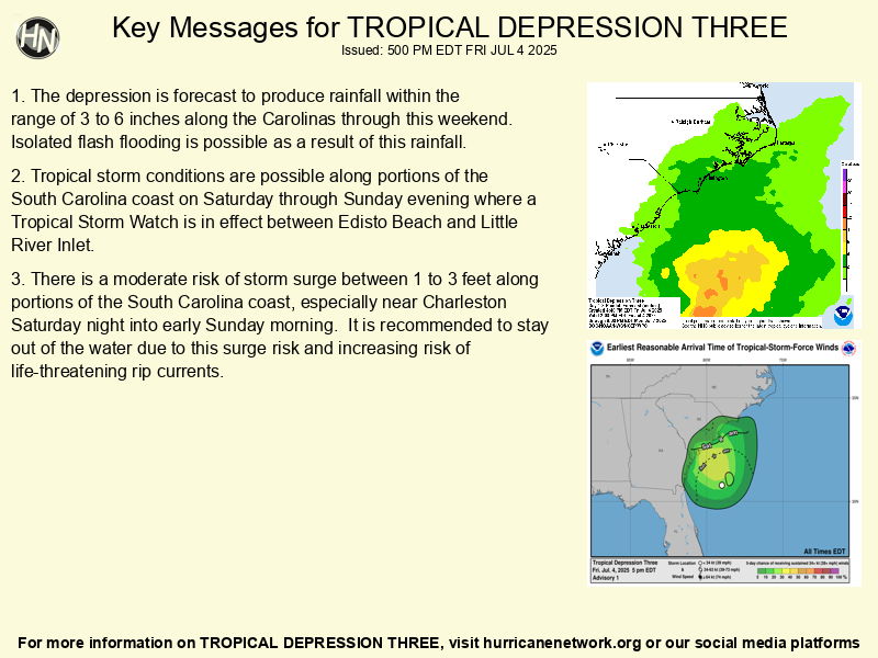
5 PM ET Advisory on T.D. #Three: TROPICAL DEPRESSION THREE FORMS OFF THE COAST OF GEORGIA, RISK OF TROPICAL STORM CONDITIONS FOR SOUTH CAROLINA INCREASING.
A Tropical Storm Watch is now in effect between Edisto Beach to Little River Inlet.
More: https://t.co/OOuCj1m9BE #SCwx
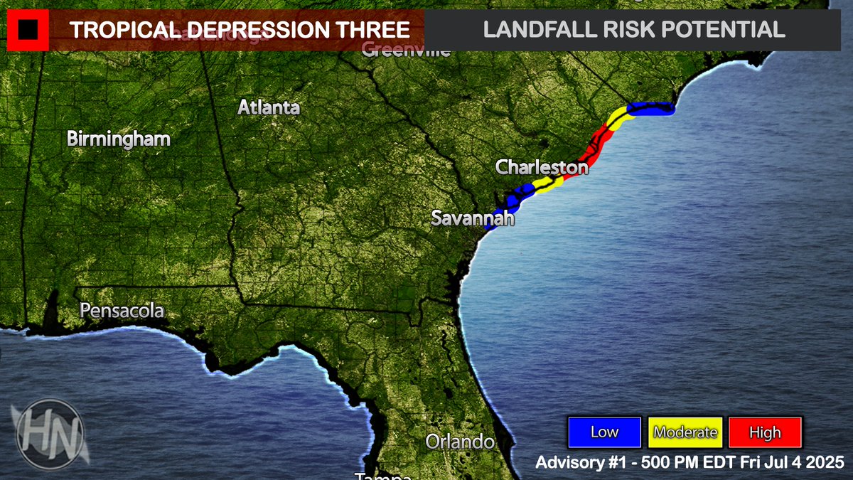
Here is the landfall risk of Tropical Depression #Three, the depression is forecast to become a tropical storm prior to landfall along the South Carolina coast early Sunday. Tropical storm watches and warnings are forthcoming for this region. #SCwx#03L
The Hurricane Network will initiate advisories on Subtropical Depression Three, located over a hundred miles east of Jacksonville, Florida, at 500 PM EDT (2100 UTC).
Interests along the Southeastern United States should monitor the progress of this low, tropical storm watches or warnings might be required later this evening or Saturday morning. (3/3) #FLwx#GAwx#scwx
More info: https://t.co/qqxW2nHK2B
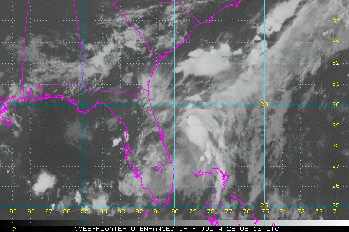
Overnight, a low pressure system has formed off the coast of Florida. Further development of this low is expected and there is now a high chance of a tropical depression forming over the next day or two, before the system moves inland over the Southeastern U.S. (2/3)
Regardless of development, heavy rainfall and some gusty winds will affect the Southeastern United States and propagate northward into the Carolinas this weekend. (2/3)
A tropical depression could form by Saturday off the U.S. Southeastern coast. Regardless of development, heavy rainfall and some gusty winds will affect the Southeastern United States and propagate northward into the Carolinas this weekend.
More info: https://t.co/OOuCj1lBM6
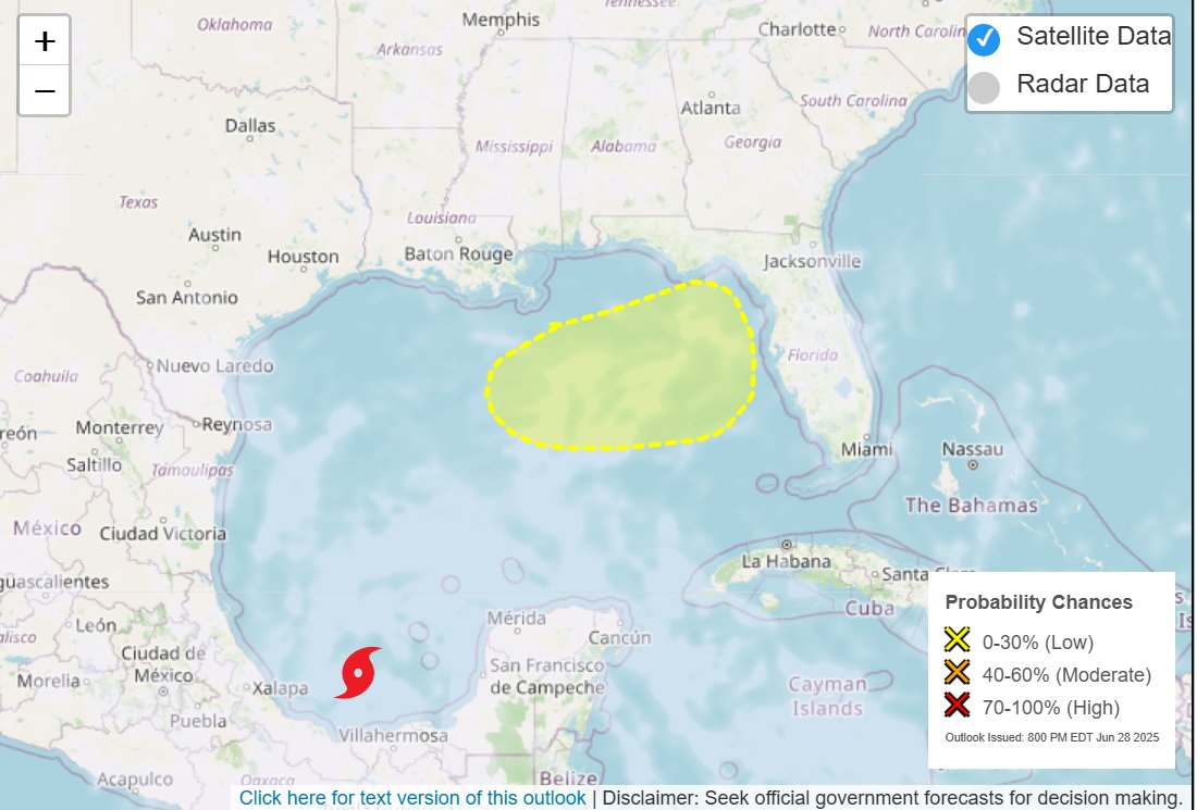
📷 There is a low (20%) chance of tropical cyclone formation in the next 7 days in the Gulf: A broad area of low pressure located near the northeastern Gulf coast could form later next week. Conditions could be favorable for tropical cyclone formation. https://t.co/9fTXaWGOwv
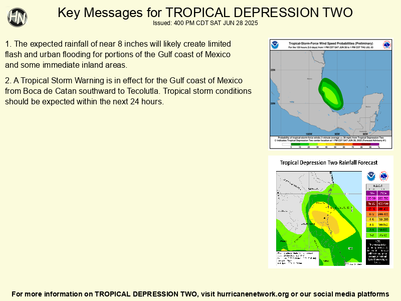
7 PM CDT Advisory on #TWO: DEPRESSION EXPECTED TO BECOME A TROPICAL STORM ON SUNDAY PRIOR TO LANDFALL.
The depression is forecast to become a tropical storm before landfall and dissipate later Sunday evening into Monday. More info: https://t.co/qqxW2nHcd3
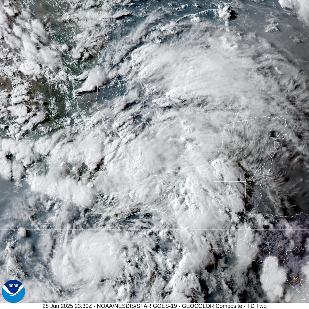
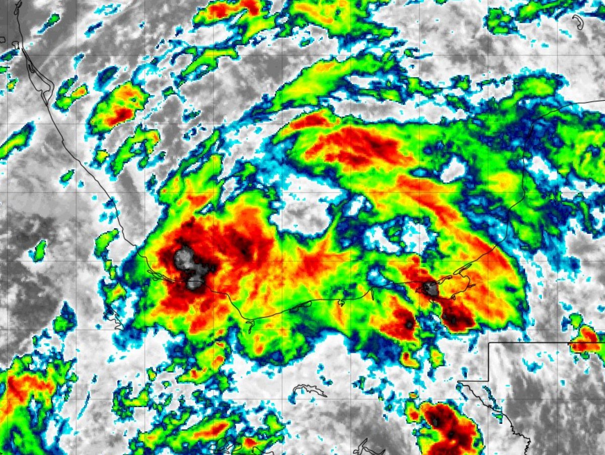
4 PM CDT Advisory on Tropical Depression #TWO: DEPRESSION FORMS AND EXPECTED TO MAKE LANDFALL SUNDAY ALONG MEXICO GULF COAST.
The government of Mexico has issued Tropical Storm Warnings for the Gulf coast of Mexico.
More info: https://t.co/qqxW2nHK2B
The Hurricane Network will initiate advisories on Tropical Depression #Two, located over the Bay of Campeche, at 5 PM EDT. Tropical storm watches and warnings are forthcoming for the Mexican Gulf coast.
11 AM AST Advisory on #Andrea: FIRST NAMED STORM OF THE SEASON FORMS, EXPECTED TO BE SHORT-LIVED.
Satellite estimated winds of Tropical Storm Andrea were near 40 mph. Andrea is forecast to be short-lived and dissipate by Wednesday evening.
More Info: https://t.co/OOuCj1m9BE