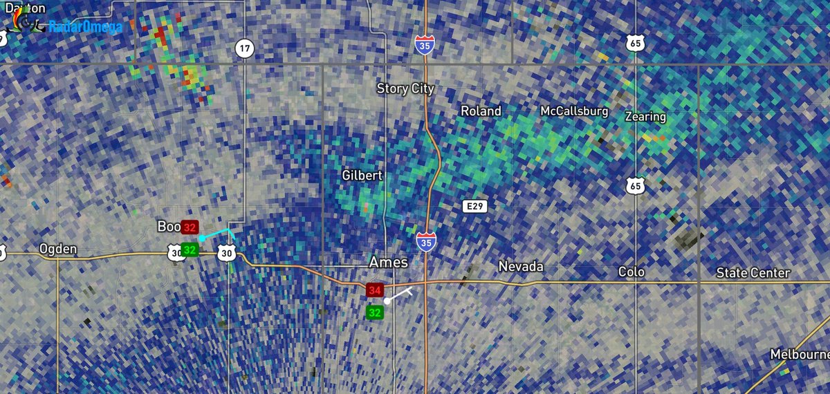
🌪️ NWS Des Moines Damage Survey Update 🌪️
15 tornadoes have been confirmed from May 15-18:
Please see the webpage below for more information: https://t.co/E3lkx28kn7
Expect further additions and/or adjustments as new info arrives. #iawx
Photo Credit: Dave Johnson
Blizzard conditions in rural areas. This is south of Ames, IA around 7 pm CDT. Roads have become ice making it worse. It doesn't take much snow for this to happen! @NWSDesMoines
A glimpse of @iowastatepatrol Trooper Moore on Interstate 80 in western Iowa last night! There is a reason the @NWSOmaha@NWSDesMoines and first responders warn in advance of these blizzard conditions and to STAY HOME. First responders had to rescue many and take to shelters!
There is a massive amount of dust being picked up by strong winds over KS, OK, TX, CO, NM currently and can be seen here in light brown. That dust will arrive over Iowa this evening. Any precipitation will use this dust as nuclei so expect dirt on your cars in the morning #iawx
The dates have officially been announced for the 2026 Severe Storms and Doppler Radar Conference. Make sure to add these dates to your calendar!
Be on the lookout for more information regarding registration, scholarships, and speakers. We hope to see you there!
#wxtwitter#iawx
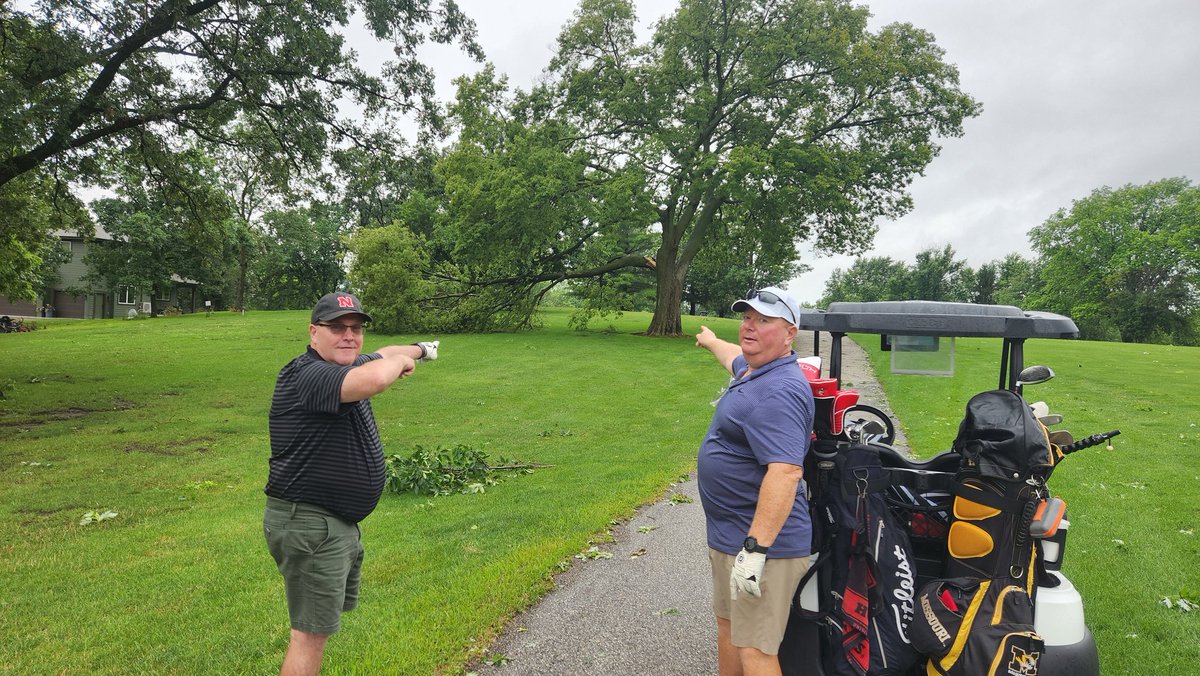
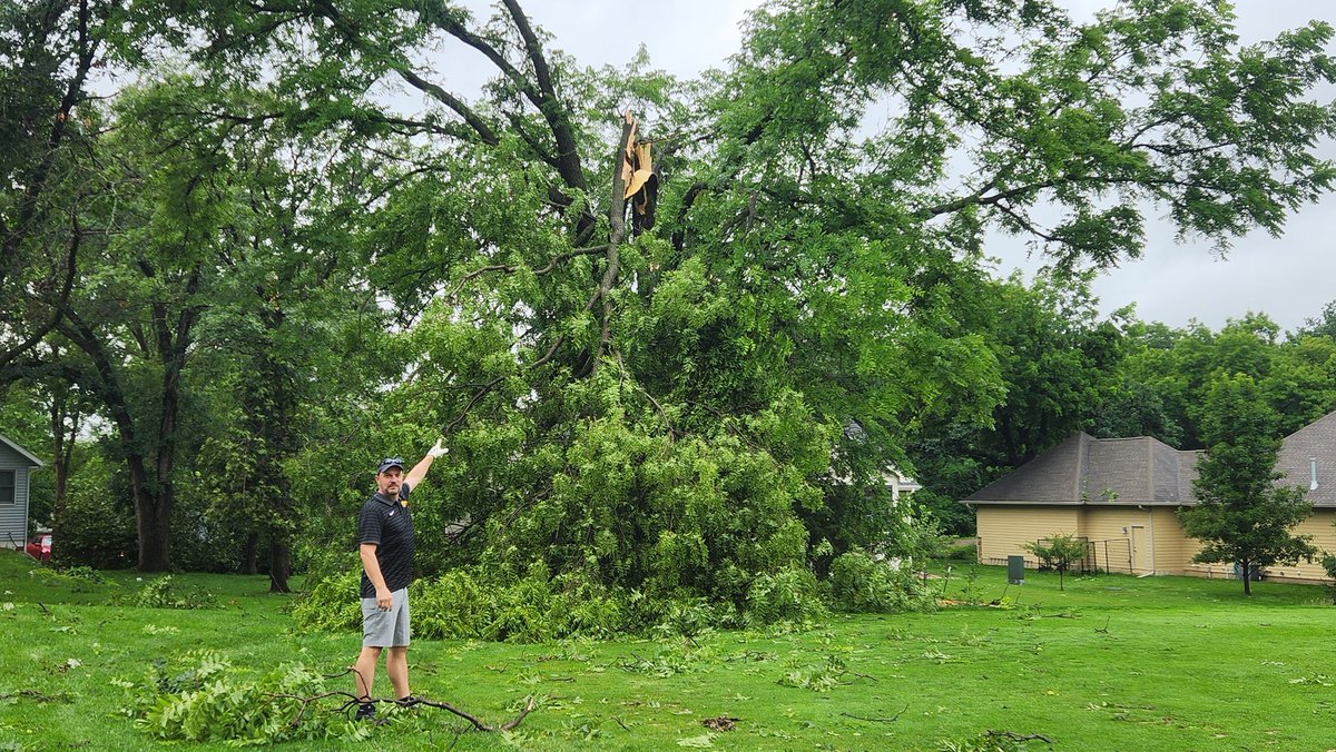
The annual Cogil golf classic only lasted 9 holes this year at the Lake Panorama Golf Course due to storms but 3 retired NWS employees and one current NWS employee got some quick storm surveying done. Note the damage was from the overnight storms.
Thanks so much to my old friend Rod Donovan at the US National Weather Service Des Moines Iowa for hosting us for the evening shows ahead of tomorrow’s storms. Such a great partnership and we’re lucky to get to collaborate with these folks. #iawx@NWSDesMoines
The large dendrites have arrived in west Ames. The radar imagery is differential reflectivity, with the higher band showing the area of stellar dendrites. 33 degrees, though, so SLR is lower. @NWSDesMoines
The wind potential for Tue night/Wed is the strongest signal we have seen since 12/15/2021. The exact timing the rain/snow transition Tue night is less certain and will impact snow amounts but 1" per hour rates may occur at times. Significant travel impacts are very possible.
We are also currently accepting abstracts for #ssdrc2025 through Friday, February 28! To submit your abstract, please email it to Dr. William Gallus ([email protected]), and indicate whether you prefer an oral of poster presentation. #iawx
Join us for a free AMS webinar on Jan 22nd at 1 pm CST as John and I give an overview of the NWS Central Region Convective Warning Improvement Project.
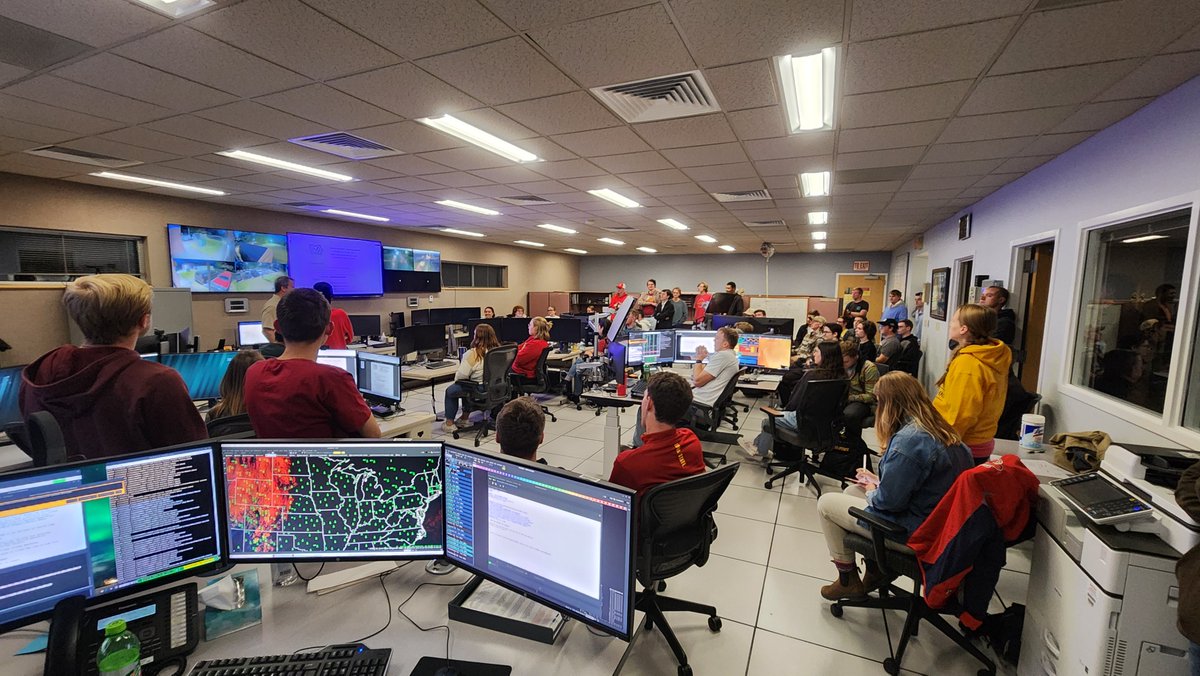
We had a full house hosting the Central Iowa National Weather Association meeting at our office this evening. The group consisted of NWS and broadcast meteorologists along with ISU meteorology professors and students. It was great to have everyone here! @CentralIowaNWA