We are out at 903_brewers. Come out and enjoy some outstanding food and take a look at the newest addition to our feet.
Bring your kiddos out and take their picture with our 3,000 gallon pumper/tanker.
.
.
#tbfd… https://t.co/umYrT42Dpi
Heat Advisory for all of #graysoncountytx untill 20:00 (8:00pm).
If you are going to be outside today be make sure you are drinking extra water!
https://t.co/vpUzUZV2Ca
.
.
.
.
#graysoncounty… https://t.co/86TAiu2LR7
There is an outflow boundary visible on Terminal doppler radar for DFW airport, but not visible on @NWSFortWorth radar. Something to watch. #txwx#dfwwx
6:58pm: All warnings in our area have expired at this time. We are expecting a second line of storms to develop in the next few hours. Stay aware and have a way to receive warnings. #txwx#dfwwx#ctxwx#texomawx
Please share this and help us get the word out about the #tbfd first ever #softballtournament
The QR Code in the picture will link you strait to the FB event page with all the information.
.
.
.
#fundraising… https://t.co/zSuutGc3EF
With the rain continuing on throughout the night #turnarounddontdrown if you see water across a roadway.
The couple of minutes you save by trying to cross instead of finding an… https://t.co/R3rEu3dMm3
With tomorrow's upcoming storms make sure you you aren't driving when the hail starts. Pulling over under a bridge like pictured is dangerous!! @ Tom Bean Fire Rescue https://t.co/ifeHXEOuPM
After this wet Sunday.... the evening/night will stay mostly dry and cloudy. Low temperatures will stay in the low 60s. Enjoy the evening! #dfwwx#ctxwx#txwx
106am- Foggy conditions continue across parts of North and Central TX. Be sure to slow down and use your low-beam headlights if driving about early this morning. #dfwwx#ctxwx#texomawx#abilene#etxwx
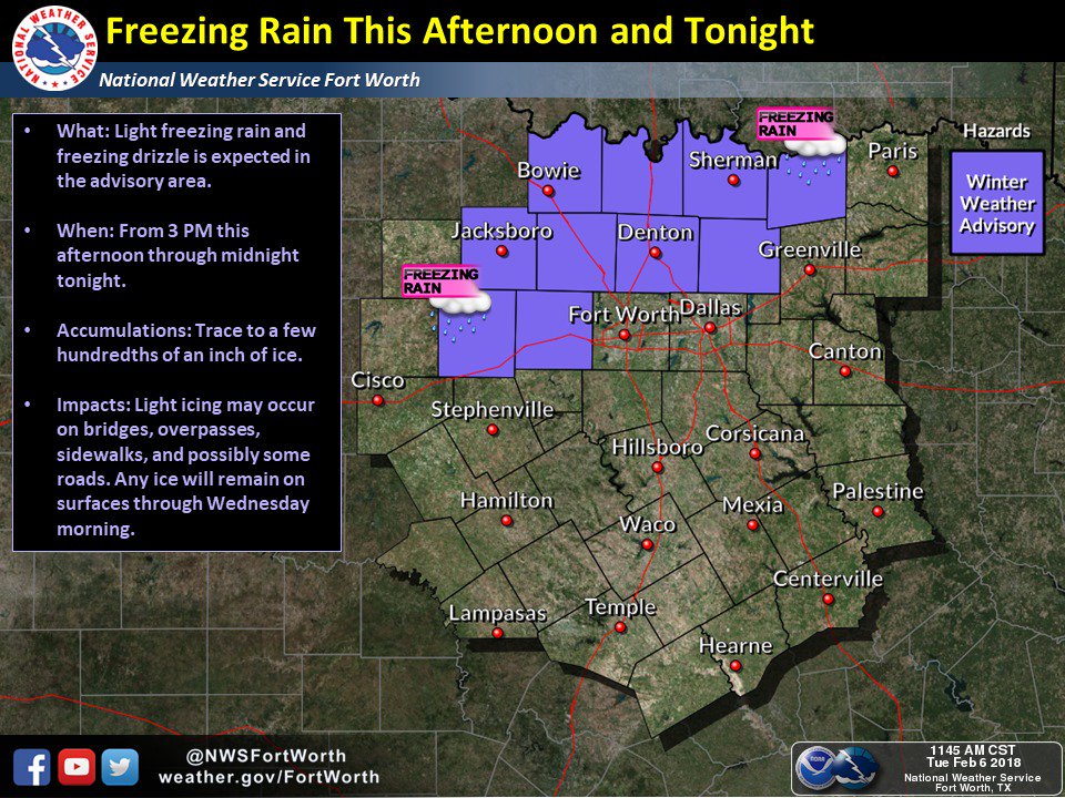
Winter Weather Advisory has been expanded to include Collin, Denton, Fannin, Palo Pinto, and Parker Counties, and is in effect through midnight tonight. #txwx#dfwwx#texomawx
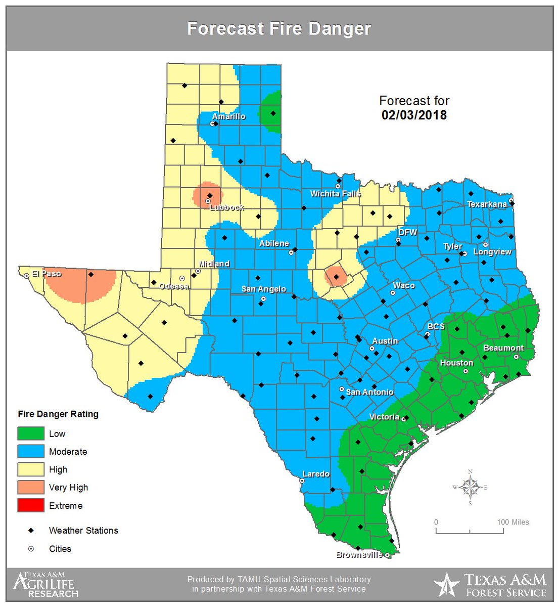
High to very high wildfire danger returns to the western Texas Panhandle and West Texas. An area to north and west of DFW is also in high to very high. #txfire#txwx
Cooler tonight & Friday, then a warming trend ahead of the next cold front that will arrive Sunday night. A slight chance of rain east of a Bonham-Temple line Sat. & Sat. night. Patchy fog Sat. night. #dfwwx#ctxwx#texomawx
High to extreme wildfire danger in the forecast for today for the northern two thirds of Texas. Report any wildfires immediately to local officials by dialing 911. #txfire#txwx