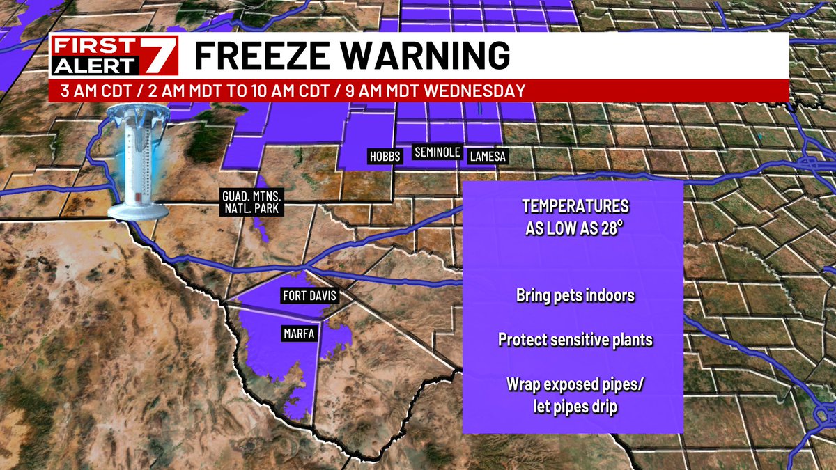
FREEZING TEMPERATURES: For parts of the northern and eastern Permian Basin and the mountains of West Texas. This does include the city of Big Spring and is close enough to the Midland and Odessa area that I would take freeze precautions just to be safe. ;)
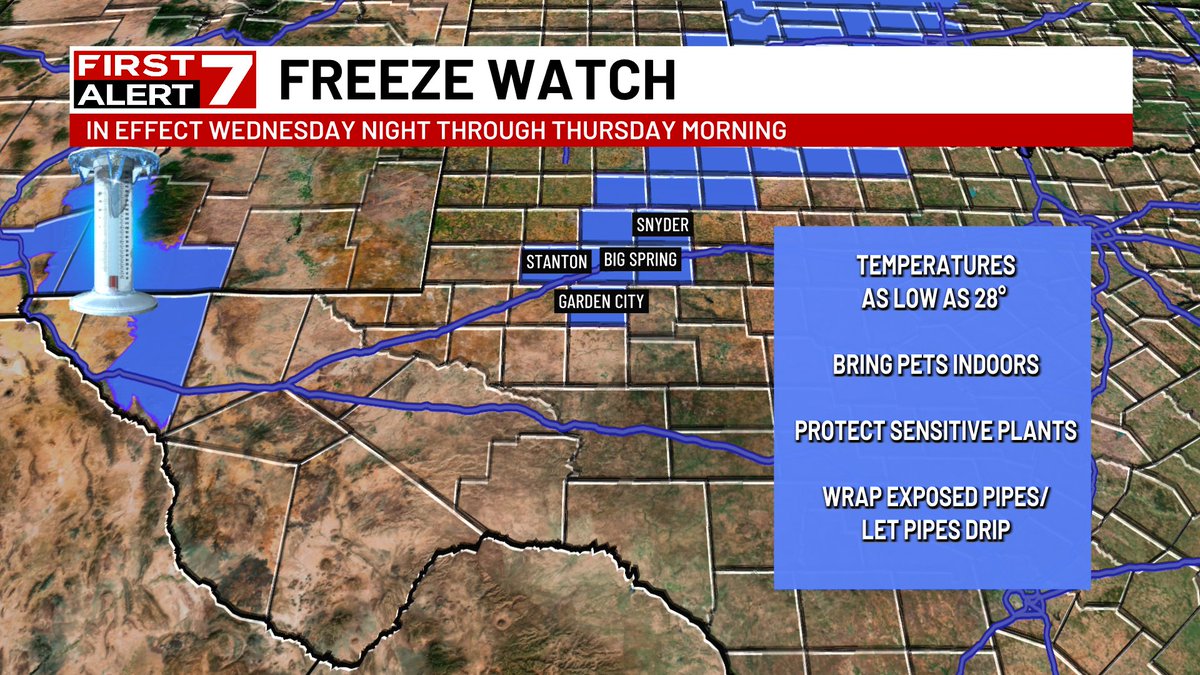
FIRST FREEZE OF THE SEASON: Parts of West Texas could see freezing temperatures on Wednesday and Thursday morning. Be sure to bring the pets inside...wrap any exposed pipes and protect those sensitive plants!
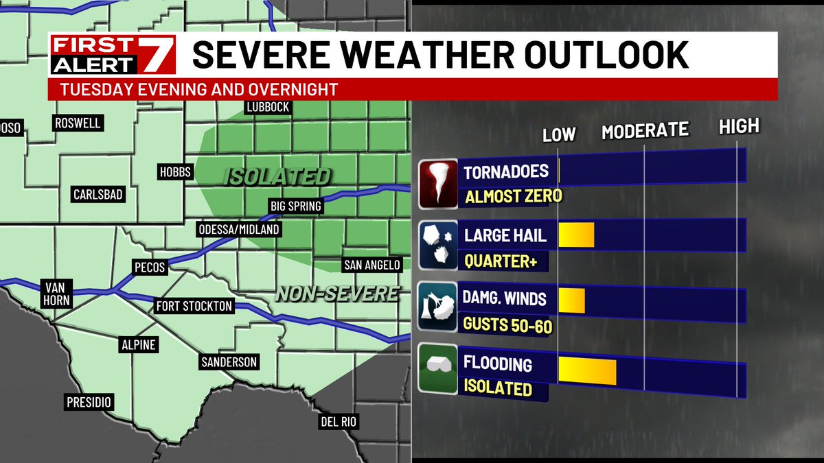
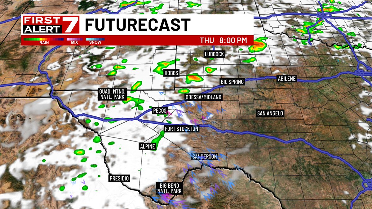
SEVERE STORMS POSSIBLE: With the approach of another cold front and storm system on Thursday...isolated to widely scattered strong to severe storms will develop. Stay with the FIRST ALERT 7 team of meteorologists for the latest!
STRONG WINDS: A line of strong thunderstorms was producing wind gusts up to 50+ mph across the Permian Basin. These storms will affect Odessa..Midland and Big Spring over the next 30 minutes.
YOUR FIRST ALERT FOR SEVERE WEATHER: A strong cold front will move through the Permian Basin this evening kicking off a few thunderstorms. A few strong to severe storms will be possible. Stay with the FIRST ALERT 7 team of meteorologists for the latest!
FLOOD WATCH: Overnight showers and thunderstorms will continue the threat of flooding across parts of West Texas. Stay with FIRST ALERT 7 for the latest.
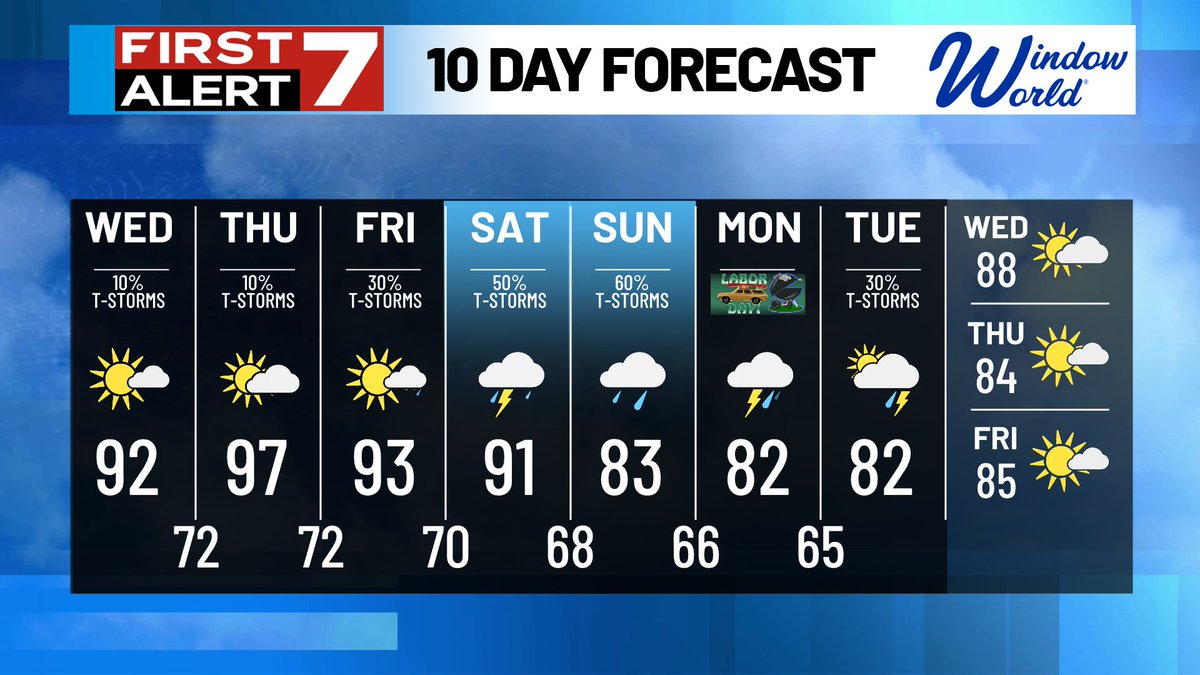
HOLIDAY PLANNER: A lot is happening this weekend and it looks like we will be dodging a few showers and thunderstorms. Please keep that in mind this Labor day weekend!
WEEKEND UPDATE: Look for your "typical" summer weather this weekend with hot and dry conditions. Don't get too used to it...some nicer changes are on the way next week!
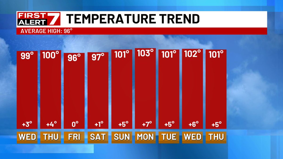
RECORD HEAT TODAY: The temperature at the Midland In'l Air and Space port reached 105° today beating the old record of 104° set back in 2003 and 1943. The hottest temperature in West Texas was 113° today was at Rio Grande Village!
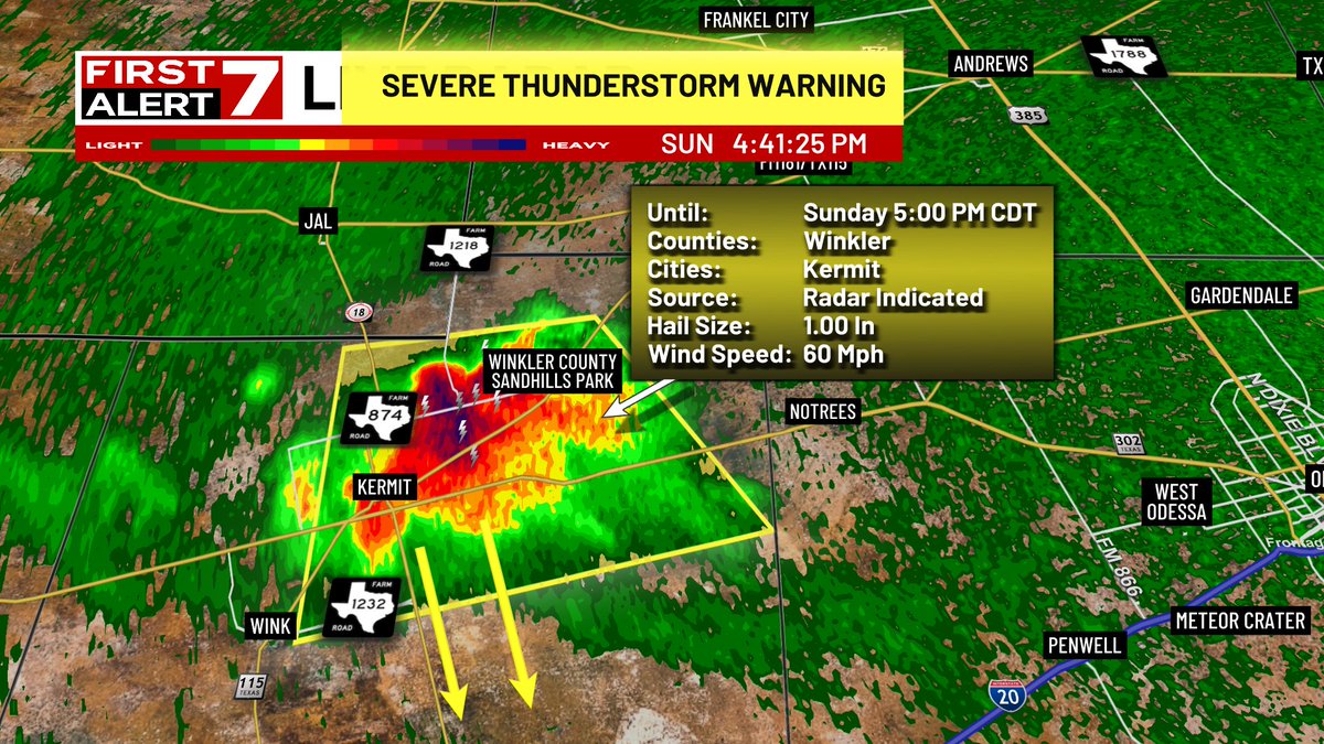
SEVERE THUNDERSTORM WARNING: A severe thunderstorm was located near Kermit with larger than quarter-sized hail and wind gusts to 60 mph. The storm was moving south at 10-15 mph. Take cover from this storm!
SEVERE THUNDERSTORM ALERT: Scattered strong to severe thunderstorms will be possible across parts of the northeastern and eastern Permian Basin. Look for these storms after 4 PM