Meteorologist by trade and weather presenter for @7NewsBrisbane. // Learning husband // 'Father' to 2 pugs // Aspiring surfer and golfer with little success
While we wait to figure out the specifics of what Alfred will bring later this week, here’s my best effort to summarise where we are now, and what could happen in coming days. 🌀
https://t.co/U8GWfaijOa
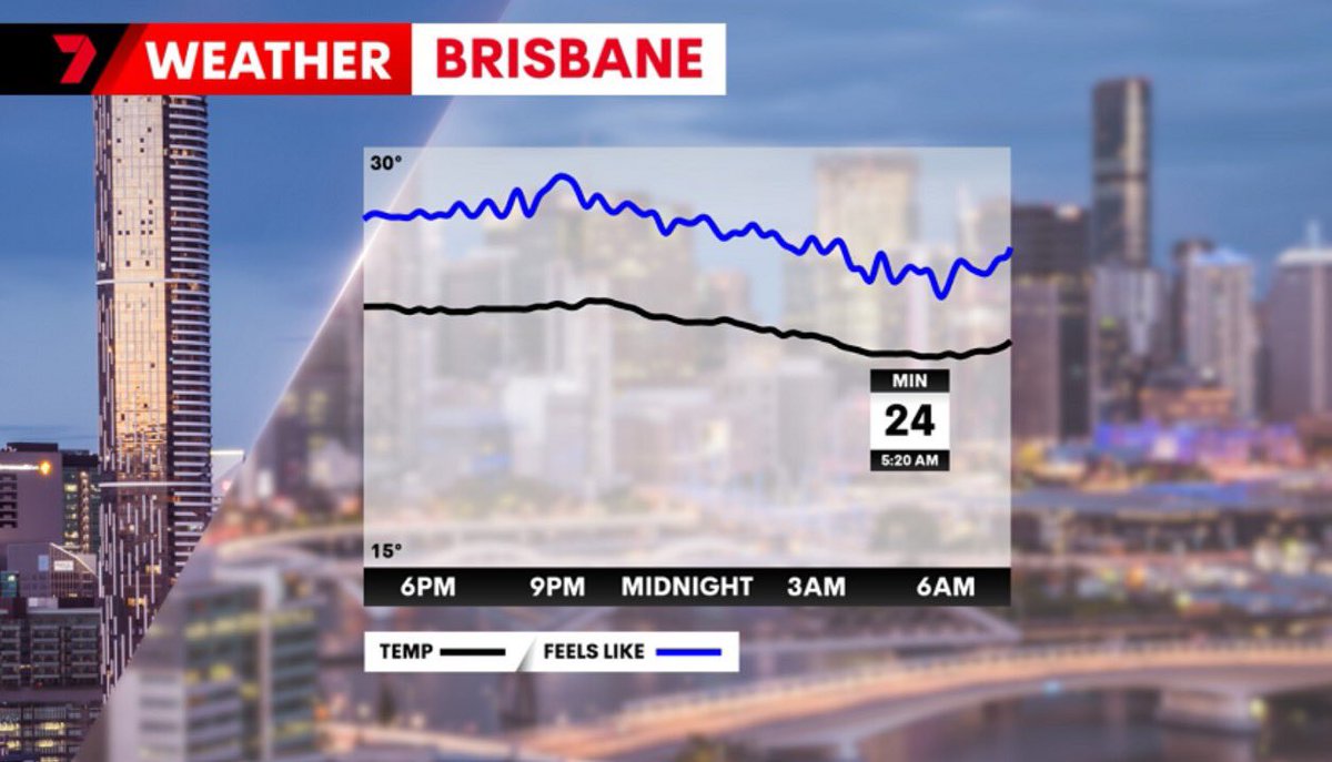
Well that was a steamy old night! 🥵
Brisbane had a minimum of 24.4 degrees, with the "feels like" values up closer to 28 or 29 degrees. (that's the blue line on the chart below)
That's the warmest November night since 2008.
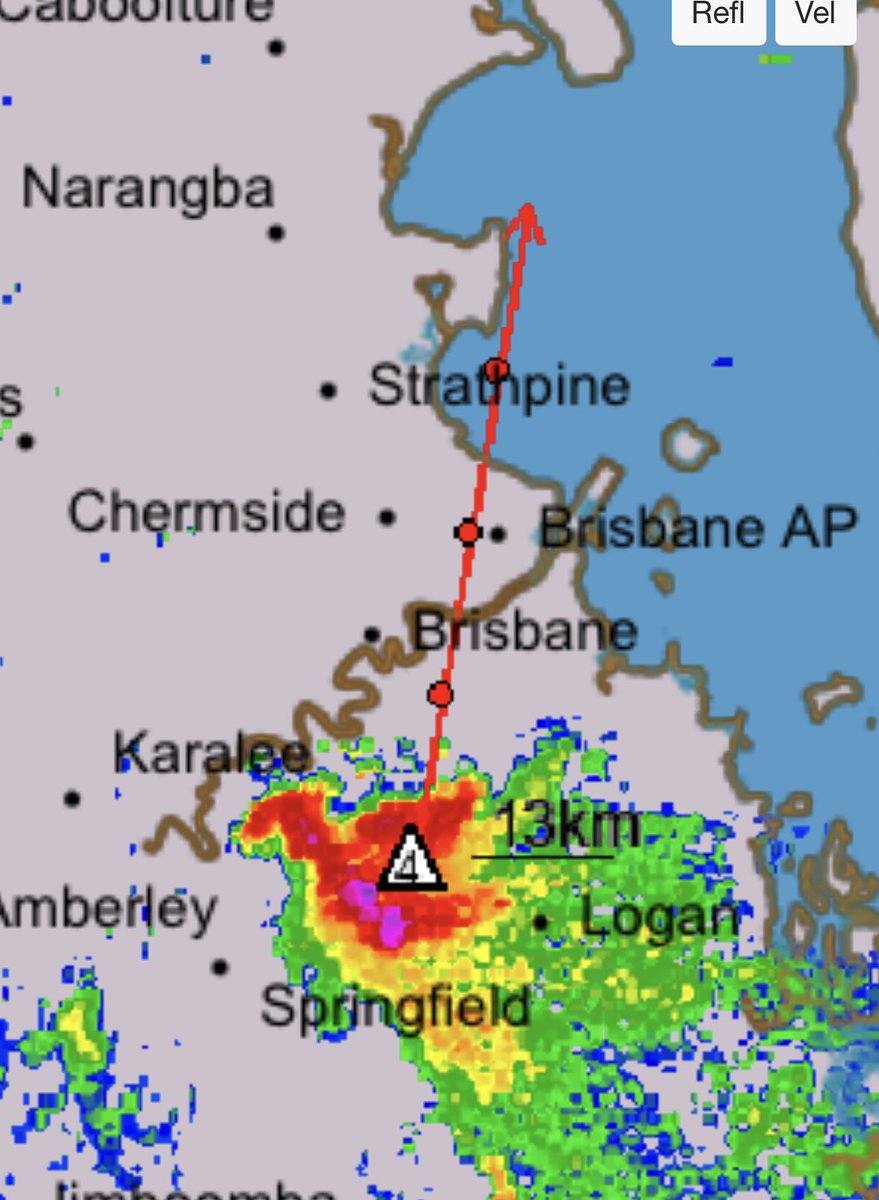
Twister on the Brisbane River!!! 🌪️
From what I can tell this isn’t a fully fledged tornado, but more likely a “gustnado” that is a more transient feature on the leading edge of the storm.
Still looked like it had some strong winds in it though!
Credit: Hayden Oakley
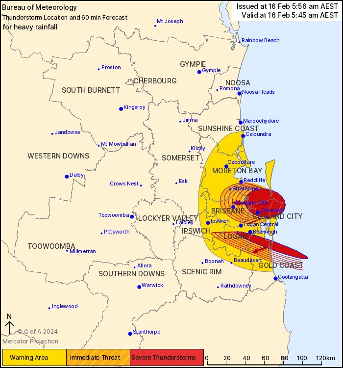
Brisbane, take cover now!!
A supercell thunderstorm with a history of producing giant hail is closing in!
Stay off the roads and get inside for the next hours or so. It should hopefully clear quickly.
📸 Radar 3:44pm. With radar derived hail size in cm and forecast track.
It’s Fun Weather Friday! (Not withstanding any “fun” from storms later on).
This week’s theme, as if she isn’t taking over the world already, is Bluey!
What should I do next?!?
#FunWeatherFriday#7NEWS
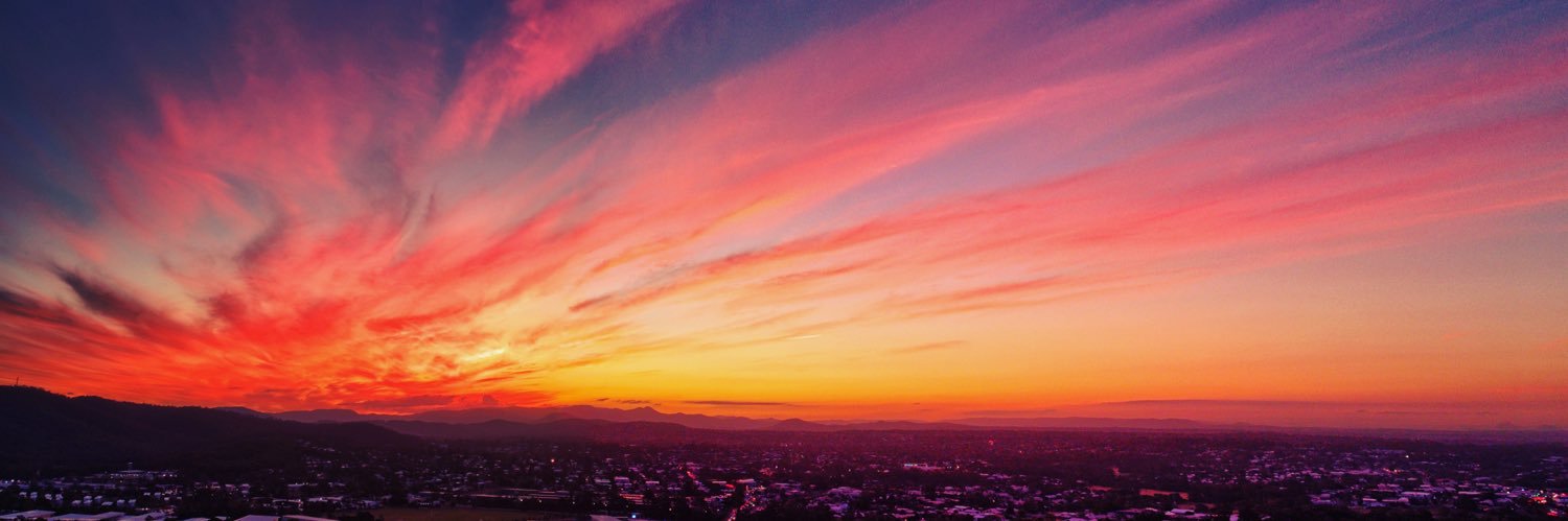
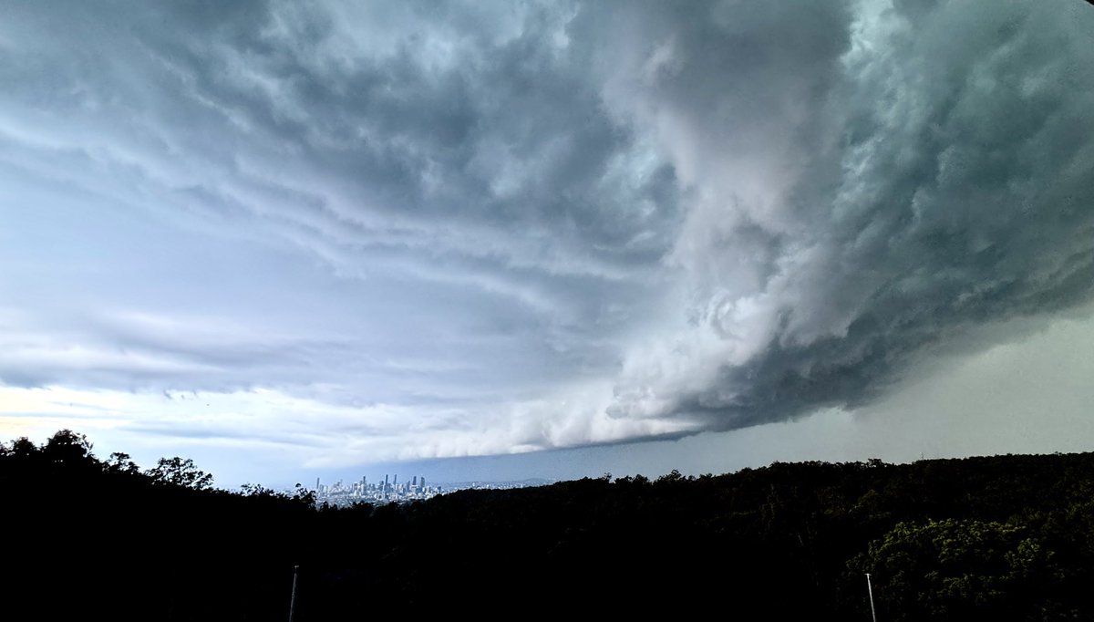
Storms rolling across Brisbane this evening, this was the view from the newsroom a short time ago.
Warnings are current from Brisbane up towards Redcliffe.
Please be careful on the roads folks! 🚗
They bloody did it! 🦁🏆
In honour of the @brisbanelions 2024 AFL Grand Final win, here’s the weather.. including a few of those goal celebration tunes we’ve been singing all year at the Gabba.
Head outside any time after dark, get away from light as best you can, and look to the south.
Good luck!
📸1: Forecast Kp values spiking again this evening.
📸2: Forecast cloud, 11pm, ACCESS C model
It looks promising for a repeat appearance from the Aurora Australia in Queensland tonight! 🤞
Official forecasts now have geomagnetic conditions bumping up (similar values to last night) after dark tonight.
And this time.. cloud should clear rapidly after dark in SE QLD.
With @taylorswift13’s Australian tour coming to a close, here’s my tribute to the queen of the hidden “Easter egg”.
53 TS references in 100 seconds!
Thanks to @samheathwood7 for playing along!
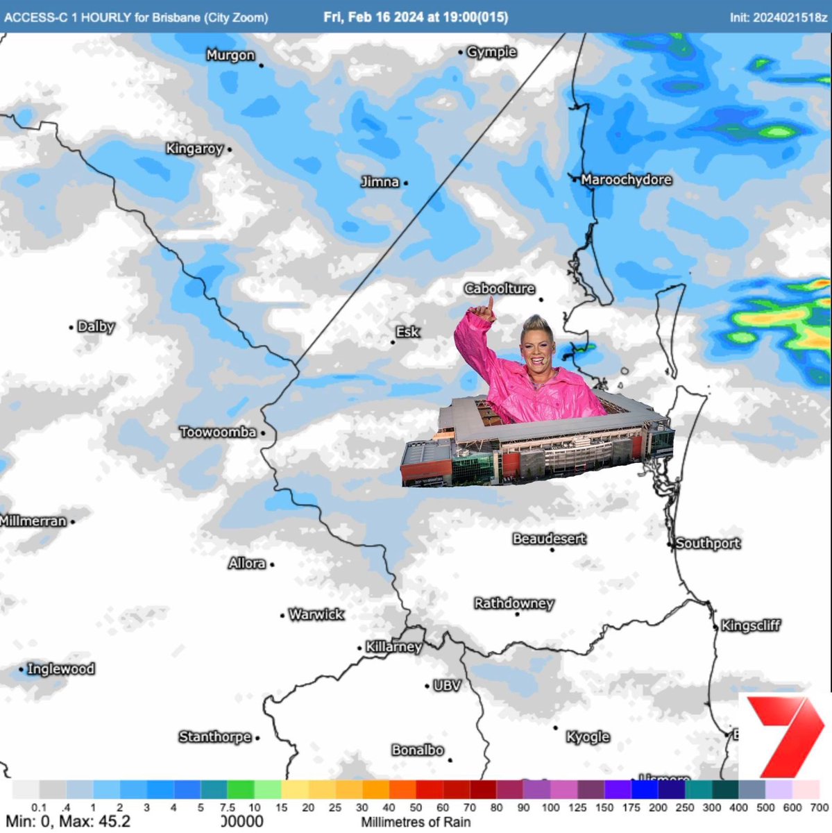
P!NK fans.. it's not all bad news.
The rain is likely to ease back this evening at Suncorp Stadium.
Expect some lighter showers or rain.
Still worth taking some form of raincoat, but it shouldn't be as torrential as this morning.
📸: Forecast rain, 7pm, ACCESS C model
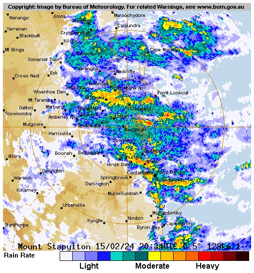
Well that rain really set in overnight!
Warnings are current for heavy rain and flash flooding for much of the southeast, so please be very careful on the roads this morning! 🚗
The rain should clear inland and ease to showers later into the afternoon and evening.
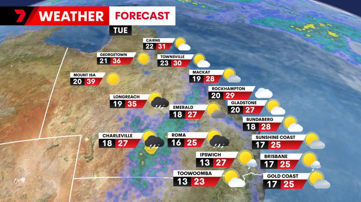
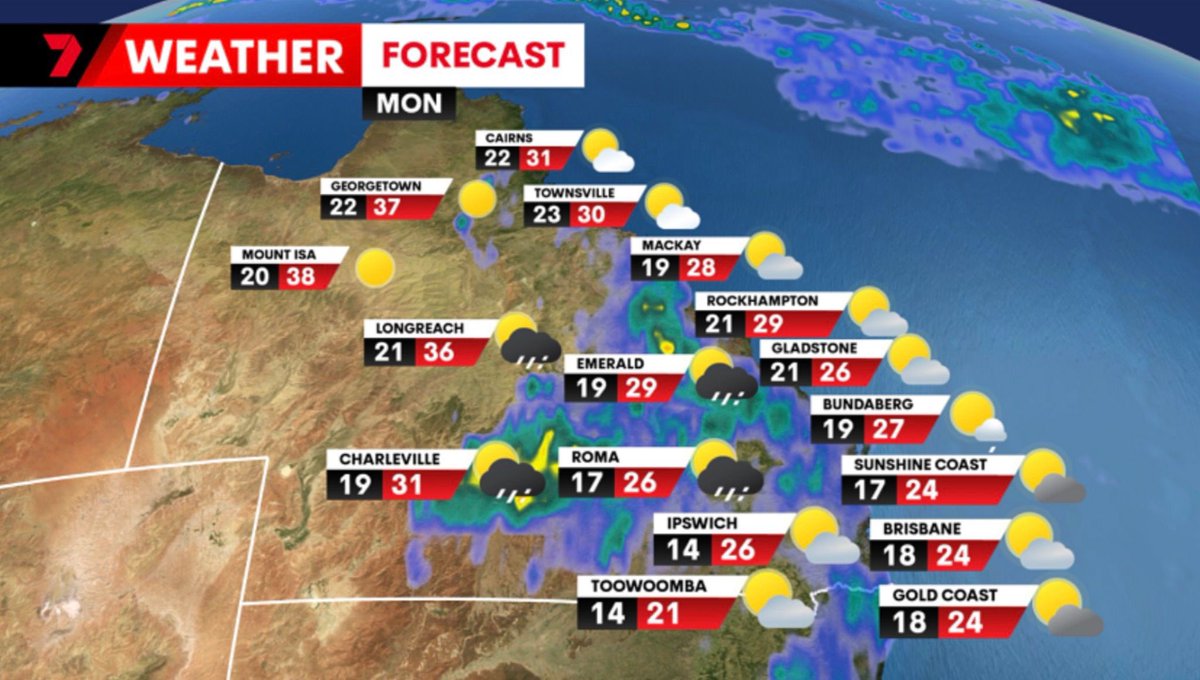
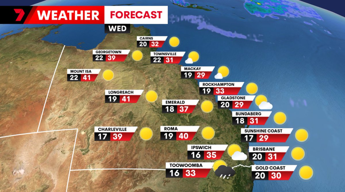
Your Monday forecast..
Still a few showers across the southeast and along the coast, as storms continue inland. Some severe cells are possible with welcome rain continuing in many spots.
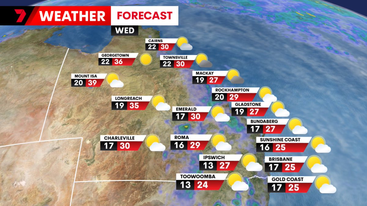
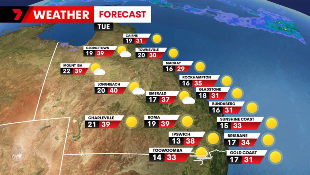
It's Tuesday, and it's going to be a hot one!
Western QLD close to 40 degrees with strong winds and extreme fire dangers over the Darling Downs.
Seabreezes will keep coastal parts of the SE in the low to mid 30s.
Keep those fluids up folks, and don't forget your pets!
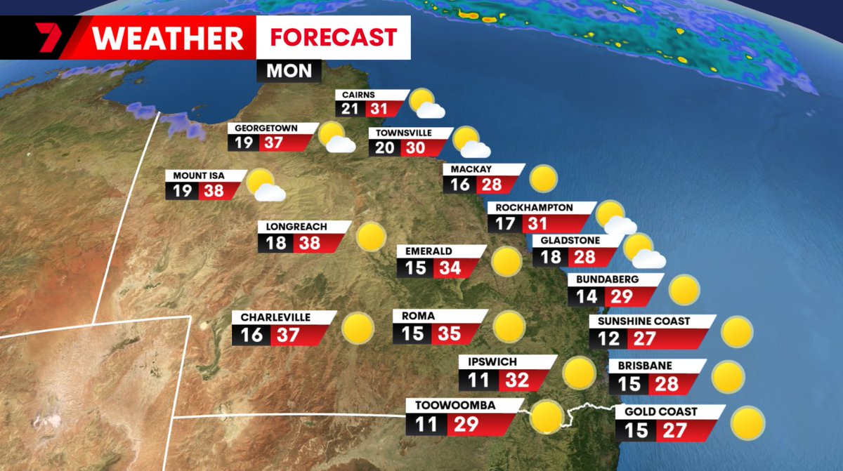
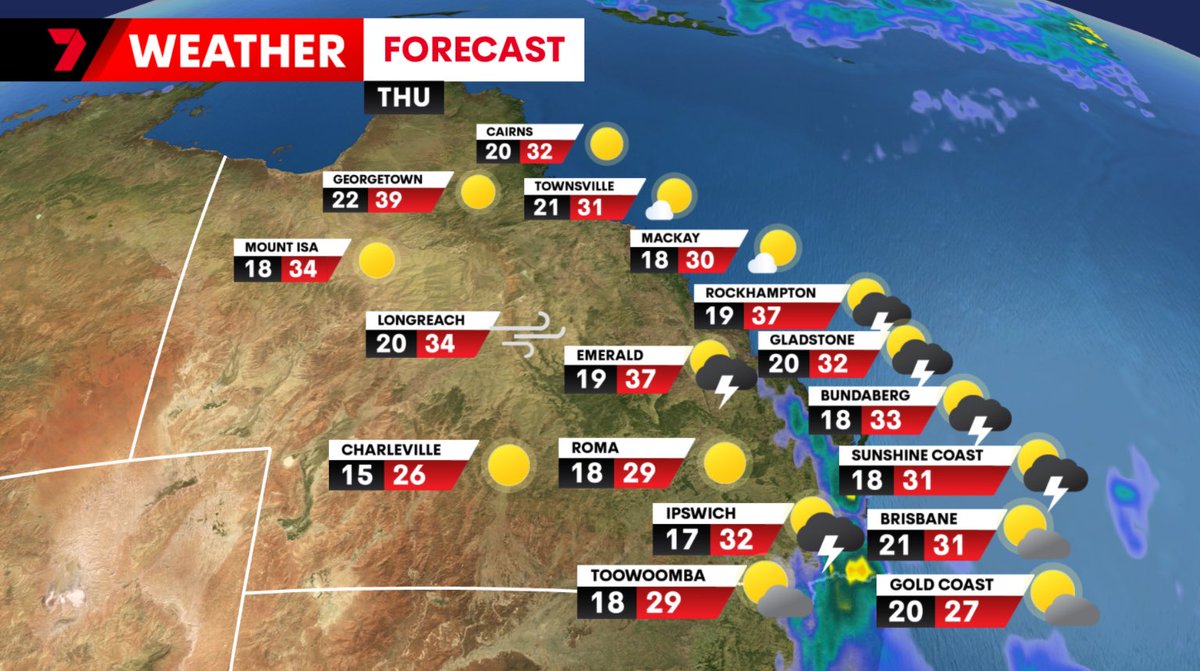
Your Thursday forecast..
Some wet weather on the way!
Afternoon storms, with the biggest cells from the Sunshine Coast up to the Capricornia. Weaker showers and storms, then some later thundery rain around Brisbane and the Gold Coast.
Extreme fire dangers in the west.