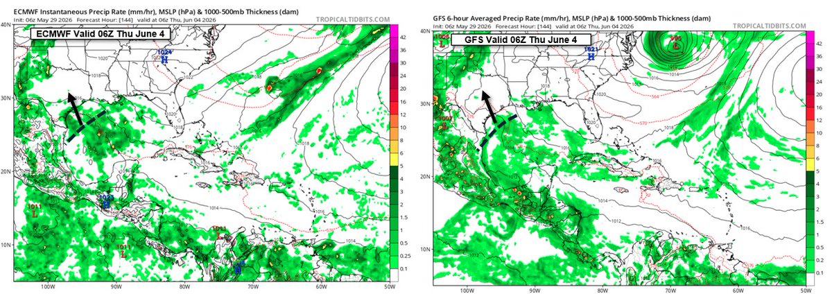
In the 12Z GFS run on the 26th, it had a major hurricane striking SW Florida on June 5th. Current 06Z run of the GFS & EC both have a weak tropical wave over the NW Gulf late next week. Don't ever trust the GFS beyond 4-5 days for TC development. It's quite bad in every basin.
Very quiet tropical season in the Northern Hemisphere. Atlantic basin activity is only 77% of normal. West Pacific activity is only 37% of normal. Across the Northern Hemisphere, ACE is only 60% of normal. The only basin close to normal is the East Pacific.
We're watching every model run for a potential Arctic outbreak around the 7th. Here's a plot of all models for Houston. Previous ECMWF operational had teens here. Latest run says "what cold?" Way too soon to be confident.
@freedomonfire There is no comparison between Milton & Katrina. Katrina was much larger and more powerful. Milton could not even carry hurricane-force sustained wind inland from the immediate coast. It's strong winds became elevated at landfall, appearing only in gusts.
Three 50 mph tropical storms in the East & Central Pacific, but one of them is not like the others. Gilma has no convection. It's just an open swirl of clouds. Objective Dvorak is 1.5, yet apparently one agency has it at 3.5, which is why the NHC went with 50 mph, apparently.
@NWSCPC@NWSNHC I'm curious as to what this outlook is based on? Currently, no global model indicates any development through early September. The MDR is dominated by dry, sinking air. It's very stable there.
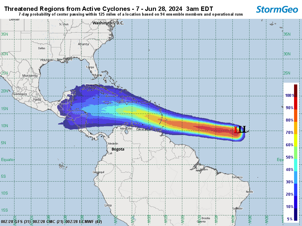
Our 7-day TRAC guidance indicates a landfall in Belize or northern Honduras next Friday. Less than a 5% chance it comes within 200km (125 mi) of the southern Gulf. Still could survive and make it into the southern Bay of Campeche in 8 days.
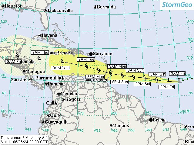
We began issuing advisories on what we call Disturbance 7 (Invest 95L) yesterday morning. Could become a hurricane threat to Barbados Monday. Long range looks like landfall in Central America next Friday. Doesn't appear to be a threat to the Gulf of Mexico.
The entire Northern Hemisphere is below-normal in terms of ACE so far. Not a single TS in the East Pac, and only one typhoon in the NW Pac. Northern Hemisphere ACE is only 21% of normal. The Atlantic remains quiet, despite predictions of hyperactivity. What's going on?
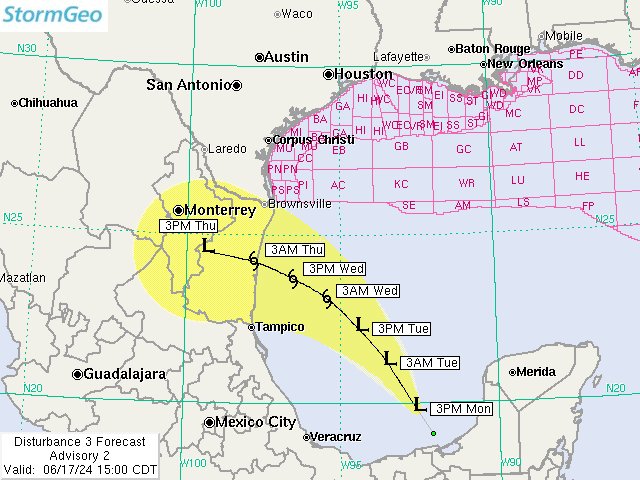
We have issued our second advisory on what we are calling Disturbance 3 (Invest 91L). I expect NHC to initiate PTC advisories on PTC One soon. It's within 48 hrs of causing TS wind in NE Mexico or south TX.