The Tornado Watch has been CANCELLED for the following counties... Blount, Calhoun, Cherokee, Clay, Cleburne, Etowah, Jefferson, Pickens, Randolph, Shelby, St. Clair, Talladega, Tuscaloosa. A few storms may linger, but the severe threat has ended.
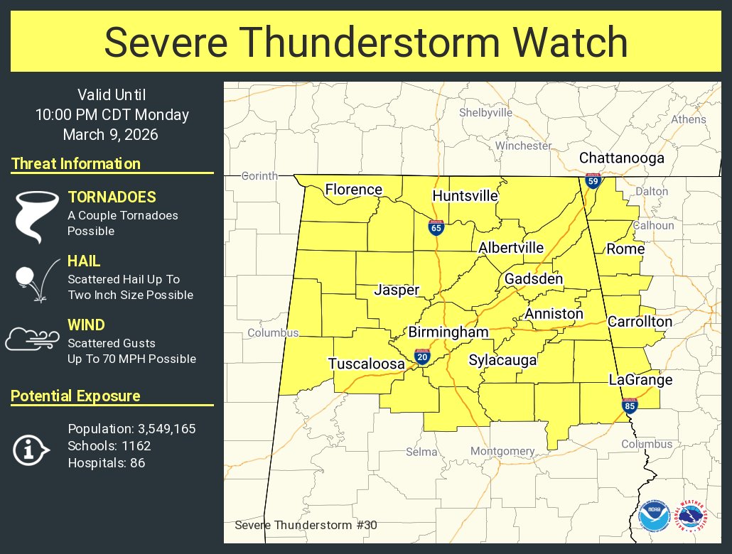
Showers &t'storms are inbound to AL Hazards include damaging wind gusts, hail to half-dollar size (1.25" in diameter), and perhaps a tornado.
We're launching a weather balloon to better peer into the makeup of the atmosphere.
Be alert for changing weather conditions this PM.
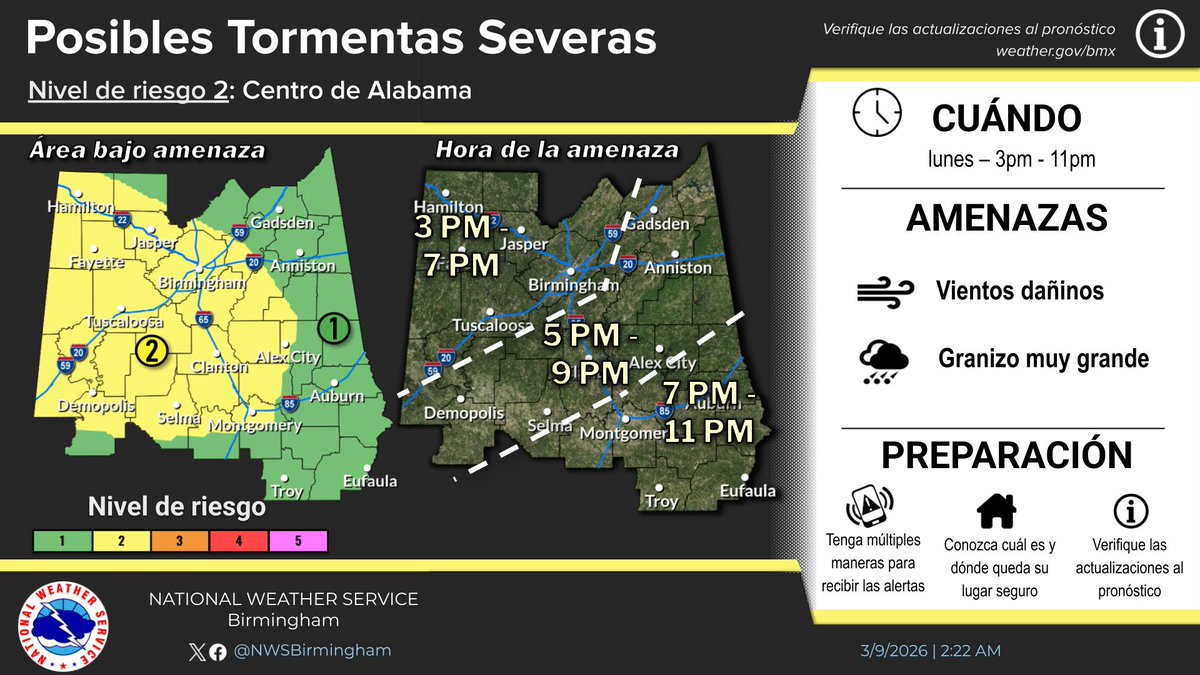
Thunderstorms will move through the area this afternoon through evening, 3 pm to 11 pm. The main threats are large hail up to half dollar size hail and damaging winds up to 60 mph. Heavy rainfall and localized flooding is possible in any strong storms. Stay weather aware today!
With two rounds of severe weather expected this week, make sure you have multiple ways to receive warnings. We say "multiple" because if one method fails, you still have a backup. Plan now so you don't have to figure this out when weather is moving into your county
Brrrrr! This weekend is going to be very cold! A few points from us:
1. Central Alabama will be below freezing for nearly the whole weekend.
2. A northwest wind will add an *extra* chill to the air, pushing wind chill values as low as the single digits. Remember: wind chill is...
Due to the potential for power outages, with a frigid air mass coming in behind the system (low temperatures in the single digits and teens), it is very important that you plan ahead. Have alternative sources of heat for you and your pets!
The severe threat has ended for today. Rain will gradually diminish from west to east, and we can expect sunshine to return during the morning hours tomorrow. Colder air will move into the area with overnight lows in the 30s/40s and highs tomorrow afternoon in the 40s/50s. #alwx
Strong to severe storms will continue through 3 pm today. Threats include damaging winds up to 60 mph and brief tornadoes. The storms are moving quickly, and over areas that have already received high rainfall totals, which may cause a few trees down outside of any warning.
A Flood Advisory has been issued for much of Jefferson and Tuscaloosa counties until 5:45 pm, including the cities of Birmingham and Tuscaloosa. Up to 1 inch of rain has fallen with up to another inch possible in the advisory area. #alwx