Here’s my forecast for the lowell area for the next 5 days (including today). You can read the discussion for my forecast and see all future forecasts the other @UMLWeatherCTR student forecasters and I make at: https://t.co/Fw5lroW1os
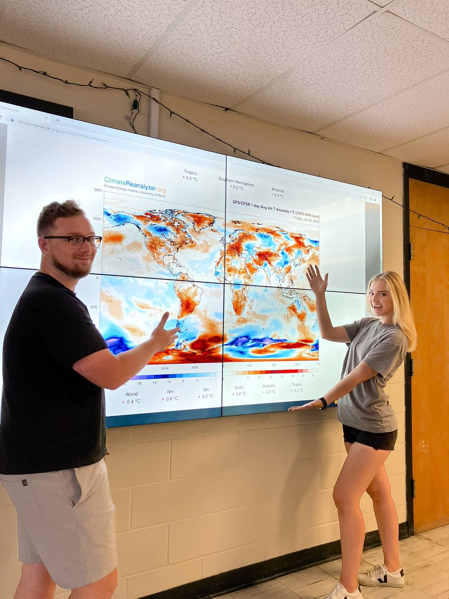
Can you find anyone enjoying this heatwave? Well I did…@UMassLowell meteorology students in UML Weather Lab love monitoring & learning about X-treme weather conditions. #Heatwave#UML#UMassLowell#Lowell
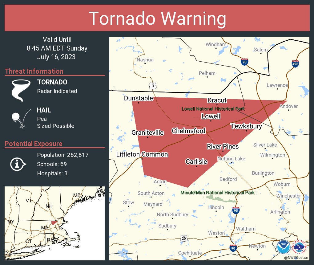
A tiny slice of Lowell is actually covered by this warning (northernmost sections of Pawtucketville and Centralville). Vast majority of Dracut and Tyngsboro are in this warning.
[4:15 PM 7/21/22]
Tornado warning has been allowed to expire. Severe Thunderstorm Warning until 4:45 pm for towns north of Lowell including Dracut and Tyngsboro.
[4:12 PM - 7/21/22]
Standard velocity couplet has weakened, but there has just been another reduction in CC values co-located with the couplet and SRV values are higher than one would expect. Interesting. Need to monitor.
[4:05 PM - 7/21/22]
Definitely quite a bit of weakening with this cell over the last little bit. Still definitely rotating though and need to monitor closely. Tornado warning, as of now, expires at 4:15.
Also note there is a secondary area of weak rotation on a nearby cell in Ashby. While that is not the main area of concern, it's worth keeping an eye on as that cell passes through Ashby and approaches Mason, Townsend, and Brookline.
[3:46 PM - 7/21/22]
Reduced correlation coefficient values are present at roughly the same location as the rotation couplet. Not the most clear cut case ever but a tornado might be ongoing near Templeton/Baldwinville/Gardner.
[3:40 PM - 7/21/22]
Strong rotation near Templeton, Phillipston, Baldwinville ... storm headed toward Fitchburg and Gardner. Tornado Warning on the cell until 4:15 pm.
Tornado Warning in north central MA including Fitchburg area until 4:15 PM. No immediate hazards for Lowell area, but this cell may be in our area around 5 pm. Stay tuned.
We at the UML AMS student chapter send our condolences to the friends, family, classmates, and colleagues of the three OU meteorology students who tragically passed away last night.
You are all in our hearts today and they will be missed dearly.
@OU_SCAN@ousom#RIPOU3
[Thu 2.24.22 - 9:45 AM]
6-12" of mainly/all snow tomorrow north of the Mass Pike (including the Lowell area), with less to the south where mixing with sleet is expected.
Snow lasts most of tomorrow, but is heaviest from mid morning to late afternoon. #mawx
[10:50 AM 1.29.22]
Heavy snow bands have overspread all of eastern MA. Dark green areas are already impressive on their own ... but look at all the yellow.
[Fri 1.28.22 8:00 PM]
New map: 15-27" for eastern/central MA. Why the wide gap? Two heavy bands deliver the big totals with most towns seeing at least 20-25" and some higher. In between, area of subsistence brings slightly lower amounts. Some towns in peak banding could see 30".
@BOS25Weather It's impossible to win. Part of why I didn't dare put the number 30 on the map (as isolated as those readings may be, it was considered.)
Short of trying to pinpoint the exact location of bands, this was decided to be the next-best solution.







![UMLWeatherCTR's tweet photo. [4:15 PM 7/21/22]
Tornado warning has been allowed to expire. Severe Thunderstorm Warning until 4:45 pm for towns north of Lowell including Dracut and Tyngsboro. https://t.co/5UkcF2F26c](https://pbs.twimg.com/media/FYN2erKX0AEVI4W.jpg)
![UMLWeatherCTR's tweet photo. [4:12 PM - 7/21/22]
Standard velocity couplet has weakened, but there has just been another reduction in CC values co-located with the couplet and SRV values are higher than one would expect. Interesting. Need to monitor. https://t.co/OLGKtvk31t](https://pbs.twimg.com/media/FYN2CEkXkAQrvDn.jpg)
![UMLWeatherCTR's tweet photo. [4:05 PM - 7/21/22]
Definitely quite a bit of weakening with this cell over the last little bit. Still definitely rotating though and need to monitor closely. Tornado warning, as of now, expires at 4:15. https://t.co/gRLZyR2mCe](https://pbs.twimg.com/media/FYN0j2BXkAIHhoy.jpg)
![UMLWeatherCTR's tweet photo. [3:46 PM - 7/21/22]
Reduced correlation coefficient values are present at roughly the same location as the rotation couplet. Not the most clear cut case ever but a tornado might be ongoing near Templeton/Baldwinville/Gardner. https://t.co/lPOnB2j4mN](https://pbs.twimg.com/media/FYNwE4SXoAMa89s.jpg)
![UMLWeatherCTR's tweet photo. [3:40 PM - 7/21/22]
Strong rotation near Templeton, Phillipston, Baldwinville ... storm headed toward Fitchburg and Gardner. Tornado Warning on the cell until 4:15 pm. https://t.co/wqEJReX7pQ](https://pbs.twimg.com/media/FYNvArYXwAEZT3n.jpg)


![UMLWeatherCTR's tweet photo. [Thu 2.24.22 - 9:45 AM]
6-12" of mainly/all snow tomorrow north of the Mass Pike (including the Lowell area), with less to the south where mixing with sleet is expected.
Snow lasts most of tomorrow, but is heaviest from mid morning to late afternoon. #mawx https://t.co/9ZfVSphWMr](https://pbs.twimg.com/media/FMXq2grVUAA5U9S.jpg)
![UMLWeatherCTR's tweet photo. [10:50 AM 1.29.22]
Heavy snow bands have overspread all of eastern MA. Dark green areas are already impressive on their own ... but look at all the yellow. https://t.co/F70euKDGSC](https://pbs.twimg.com/media/FKR_P9CXEAEBcDD.jpg)
![UMLWeatherCTR's tweet photo. [Fri 1.28.22 8:00 PM]
New map: 15-27" for eastern/central MA. Why the wide gap? Two heavy bands deliver the big totals with most towns seeing at least 20-25" and some higher. In between, area of subsistence brings slightly lower amounts. Some towns in peak banding could see 30". https://t.co/htSLIRyMur](https://pbs.twimg.com/media/FKO4J8uXIAMgzju.jpg)


