October #streamflow conditions across the U.S. 💧
Dry conditions continued across much of the Eastern U.S., while parts of the West and South saw wet conditions.
#DataViz made with #rstats#dataRetrieval https://t.co/XNaJAymne7
We’re back, America. 🇺🇸
Today our full workforce is back advancing stewardship, powering America’s energy future, and carrying forward the story of our nation.
We’re honored to continue this work for our country.
Stay informed of flood events with the #USGS Real-Time Flood Impact Map 🗺️ This tool shows where specific infrastructure, like roads, bridges, and buildings, may be vulnerable to rising waters.
Explore the map: https://t.co/15UD6LNkGt
#Floods#BePrepared#PreparednessMonth
August #streamflow conditions across the U.S. 💧
Dry conditions persisted across much of the Northeast, Southeast and Southwest, while parts of the Midwest and South Atlantic saw wet conditions.
#DataViz made with #rstats#dataRetrieval
https://t.co/XNaJAymV3F
USGS brings #WaterQualityData from the field to you.
🌎 2,500 real-time water quality monitoring locations
🔬400,000+ monitoring locations where we collected water quality samples
How do you use #USGS water quality data?
#WorldWaterWeek#WaterQualityMonth
https://t.co/uXKzlh2fQL
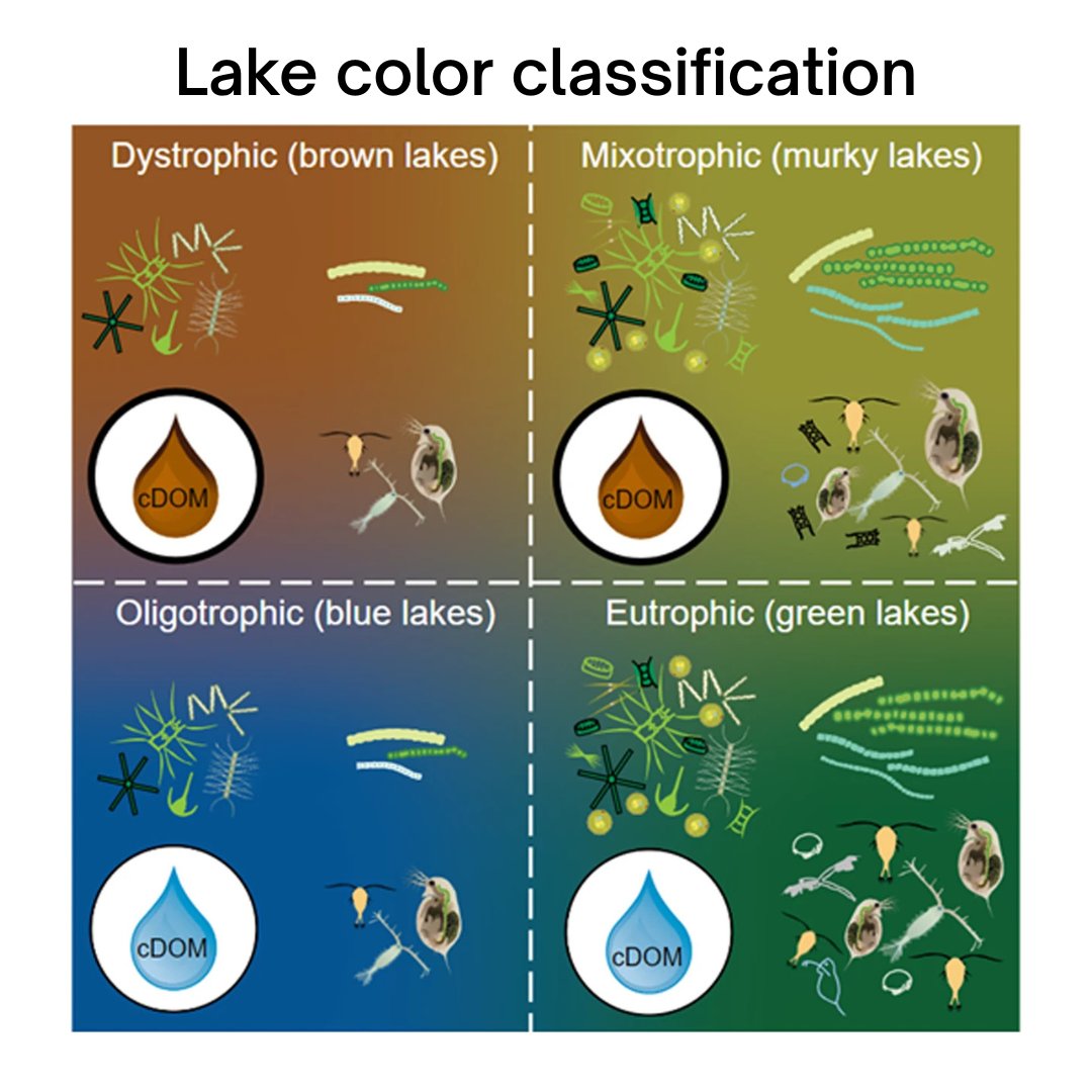
Unlocking lake secrets with @USGSLandsat ! 🛰️
We're using lake color & machine learning (trained with US EPA’s National Lakes Assessment data) to determine trophic state – a key water quality indicator.
Learn more - https://t.co/IzN5B8o4QT
#NationalWaterQualityMonth
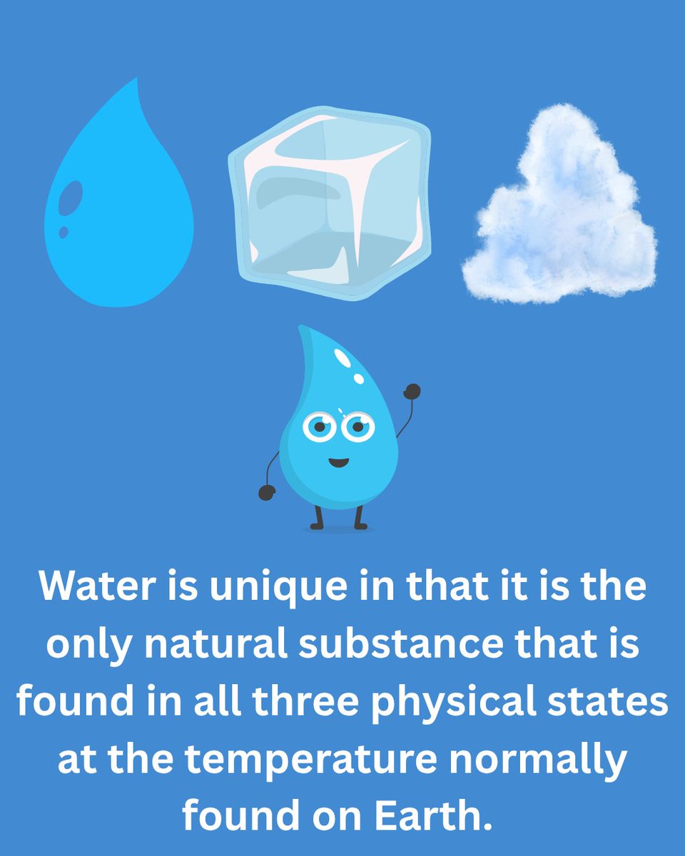
Water is everywhere, but how much do you really know about it? From the depths of the ocean to the water flowing from your tap, we’re sharing 5 fascinating facts that you may not know about water! #WaterScienceWednesday#USGSWaterScienceSchool
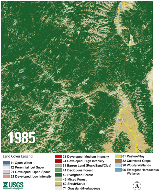
ICYMI: The newest version of Annual NLCD is available. Adding 2024 extends the Landsat-based U.S. land cover record to 40 years! That lets us see dramatic landscape changes over time, like this area in parts of Idaho and Montana. About the new release: https://t.co/MSpxWKtmYb
🌊 Happy #WorldOceanDay!
USGS science doesn’t stop at the shoreline. From coastal hazards to deep-sea mysteries, our work helps reveal the interconnected systems shaping Earth’s oceans.
Dive into our ocean science: https://t.co/79bJZyREEN
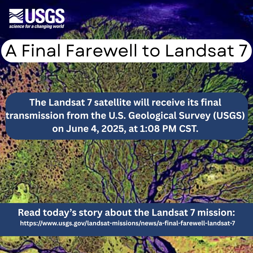
Remembering its 25 years of faithful Earth observation, the USGS and NASA announce the decommissioning of #Landsat 7 from active service June 4th.
Read more here: https://t.co/VYPMec1le7.
🚨New Publication Alert!🚨 This study estimated the magnitude and frequency of floods at ungaged locations on streams in Tennessee through the 2013 water year. Access the full publication and its associated data release here: https://t.co/er3X1Io1Ze.
#Tennessee#USGSLMG
During #PublicServiceRecognitionWeek we recognize #USGS public servants. Thank you for your service and for the positive impacts you make providing reliable science and science support to serve the nation. Your hard work and dedication are appreciated.
#FieldPhotoFriday#PSRW
Without the dedicated public servants at USGS, we’d have no information for flood warnings, bridge design, boating safety, or water availability for homes, businesses and farms. See the full infographic at https://t.co/r3ihO13pmU
#PublicServiceRecognitionWeek#PSRW
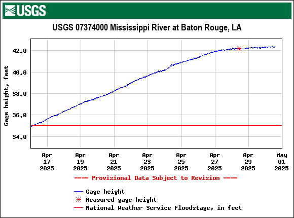
The Mississippi River at Baton Rouge is currently at major flood stage. An LMG crew went out on Monday and measured gage height at 42.31 ft. The river is expected to crest tomorrow and then fall over the next couple of weeks. For more info, visit https://t.co/PLho4ez1FZ