Are you a USGS Water API user? Check out this webinar today at 3 pm ET to learn the latest about changes to accessing USGS water data 🌊📈through APIs. Register here: https://t.co/vm6OhzAKdT #waterdata
There’s still time to register! Join our webinar today at 3pm ET to learn about the new @USGS_Water APIs. We'll go through new features, and when and how to migrate your workload from legacy APIs so you don’t miss a beat.
Register now: https://t.co/FalalFQutM
At 1 pm today, check out an interview with Zulimar Lucena, Supv. Hydrologist with the #USGS, on @KPRC2@HoustonLifeTV. Zuli will discuss #microplastics sampling 🌊🧪 in Galveston Bay and its tributaries -- work in collab with @TCEQ Galveston Bay Estuary Program and @UHCL_EIH.
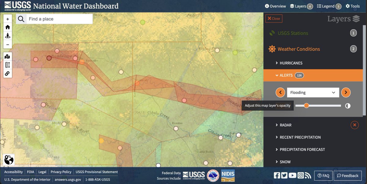
Monitor conditions through the holiday weekend including NWS flood status conditions at gages throughout TX. Include overlays of up-to-date radar as well as NWS flood alerts. Stay aware of conditons using the USGS National Water Dashboard and stay safe! https://t.co/jDc93s4mW9
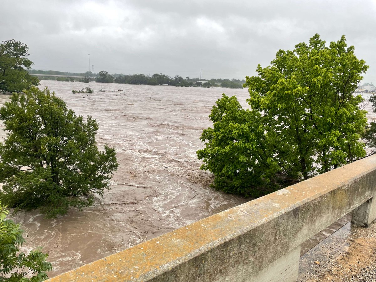
USGS crews were out today taking manual discharge measurements of flooding conditions on the Guadalupe River near Comfort, Texas among other locations. Stay safe and stay tuned to conditions using the USGS National Water Dashboard: https://t.co/ZDpdfaOE66 #flooding#WaterAlert
This #PublicServiceDay, we are grateful for our hard working USGS employees of the Oklahoma-Texas Water Science Center such as Surface Water Specialist Scott Grzyb and Austin Surface Water Data Chief Michael Scheider seen in this photo. 📈🌊
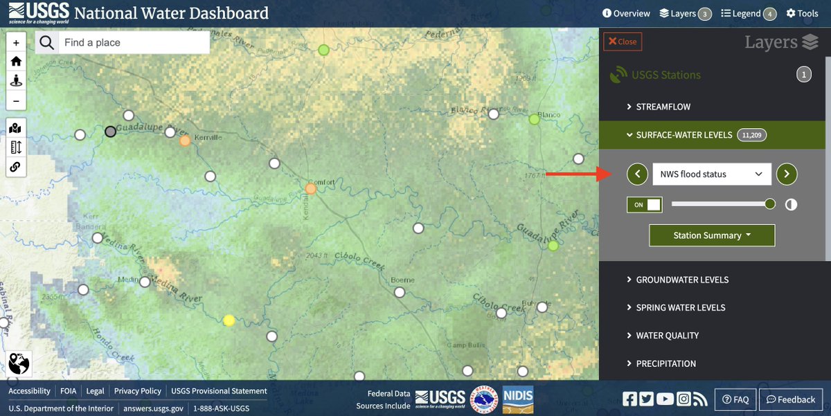
USGS is measuring flooding across Texas & Oklahoma after 3 days of heavy rain. 21 streamgages showing flood conditions along I-35 corridor. More rain expected over the weekend.
Stay safe & check conditions👉https://t.co/TGcLo0Mq5q
USGS crews in Texas will continue to take measurements and monitor stations as the rain moves through Texas this weekend. Explore monitoring locations in your area, as well as radar, on the National Water Dashboard here: https://t.co/SDAN8RuoTO https://t.co/OPCvfSubml
@NWSWGRFC Thx for following along as we 🥳 celebrate the 100th bday of site 08049500 W Fork Trinity River at Grand Prairie, TX! Follow @USGS_Water for more as we count down to the 1000th centennial gage. More data for this site can be found at https://t.co/I8gNFSNWka #100Years1000Gages
Today, we celebrate 100 years of 💦 #waterdata 📈 at monitoring location 08049500 West Fork Trinity River at Grand Prairie, TX. Please follow along for more about this #CentennialCelebration site as USGS counts down to our 1000th Centennial Streamgage in August! #100YearsofData
@NWSWGRFC Fun fact 📢: The highest recorded discharge measurement of 64,400 cfs was recorded on May 3, 1990. ‼️ That is more than double the streamflow of 25,600 cfs as seen here in this photo, taken on September 9, 2010. #MonitoringMilestone
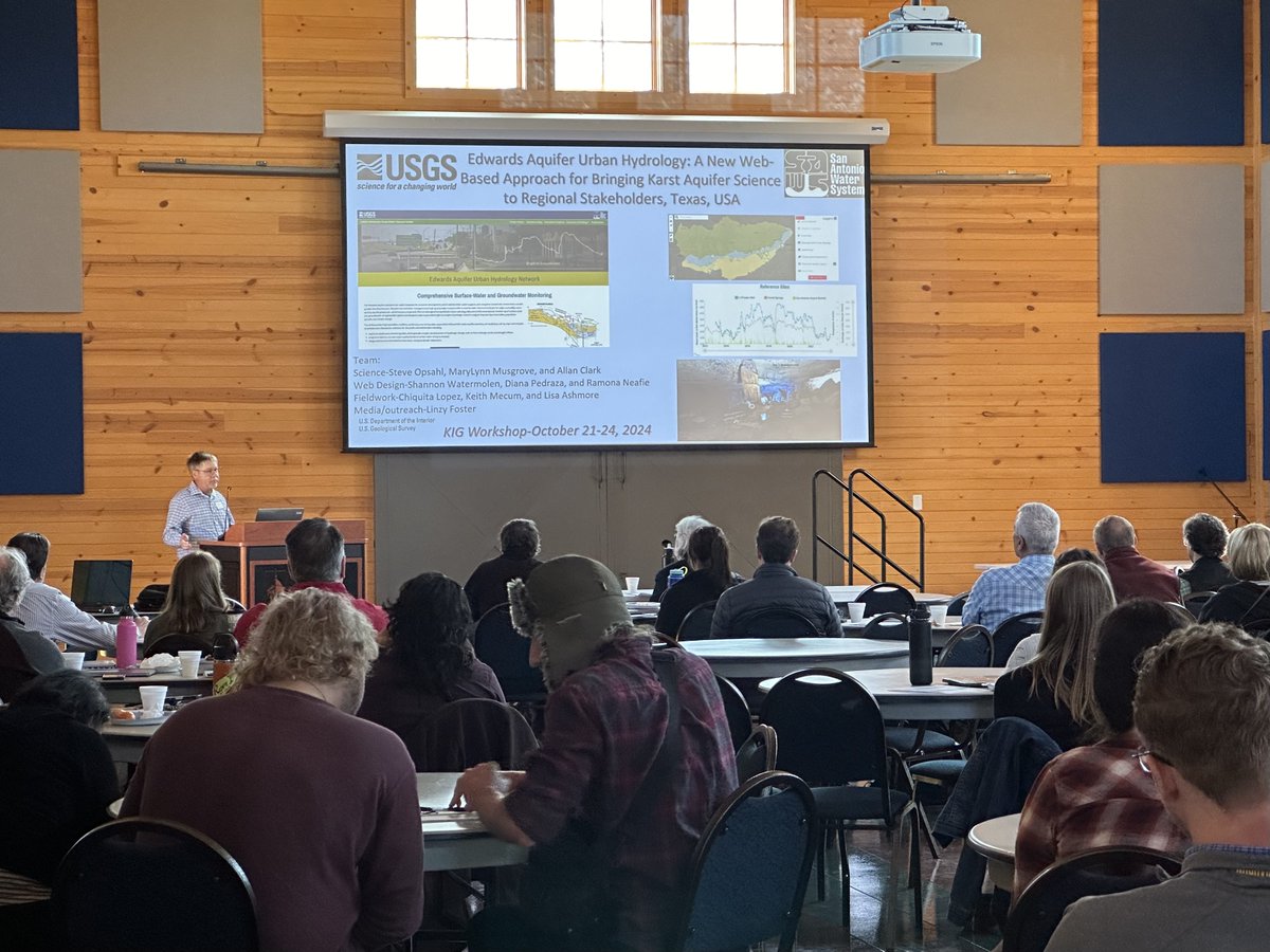
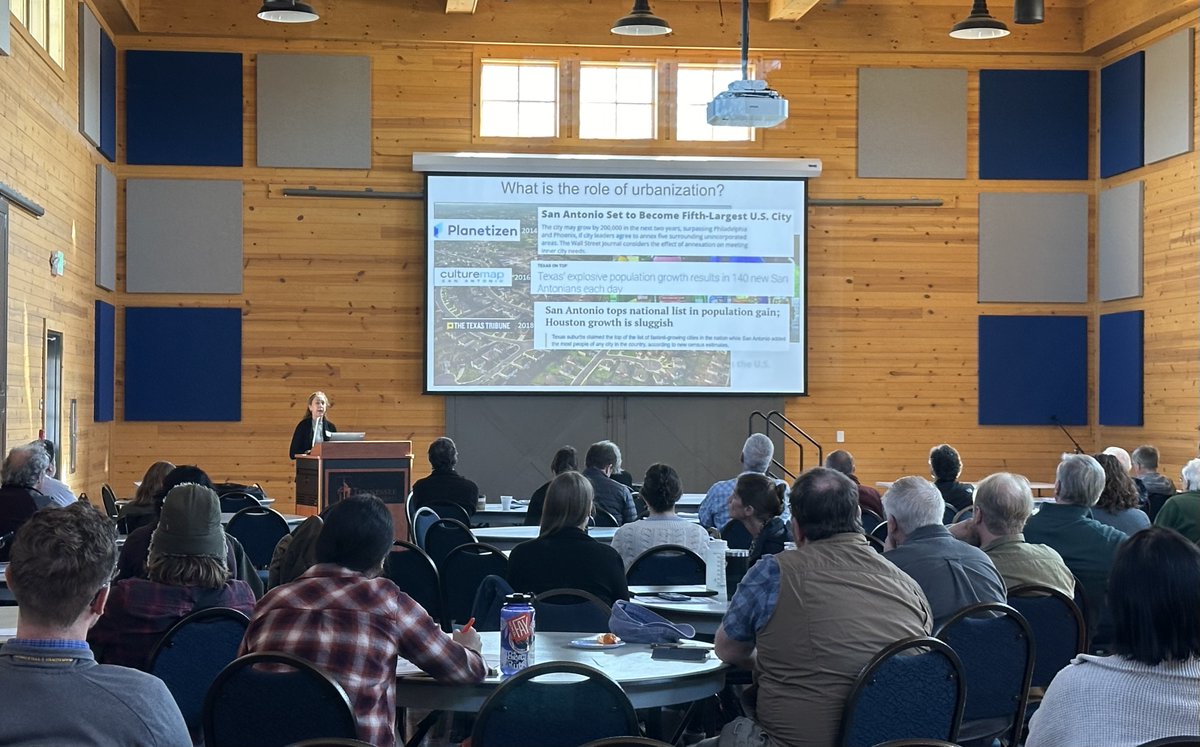
Join us on Thurs 1/23 11 am CST virtually to hear Dr. Steve Opsahl and Dr. MaryLynn Musgrove discuss their work in the next meeting of the Oklahoma-Texas Water Science Center webinar series: Edwards Aquifer Recharge Zone Monitoring Project. Register here: https://t.co/OeZ5KVq2FL
Dr Opsahl and Dr Musgrove spoke on #EdwardsAquifer hydrology/pesticide occurrence this morning. TX #karst was a big part of the AM session at the @USGS Karst Interest Group Workshop in Nashville. Thanks to @TSUedu for hosting! More info on workshop here: https://t.co/xiI8Owi1c8
Happy New (Water) Year! At the @USGS, a "water year" is defined as the 12-month period from October 1 through September 30 and it is designated by the calendar year in which it ends. Therefore, today is the first day of Water Year 2025! 🌊 #USGS#WaterYear#hydrology
Join us tomorrow! Are you a student or early-career professional and want to learn more about @USGS careers? USGS is hosting a virtual career fair on Sept 12 from 9:00 am to 3:00 pm CT. Hear from USGS employees and learn about the hiring process! REGISTER: https://t.co/NgcPkC03V1