Why do migratory waterbirds choose certain Great Basin wetlands? The USGS is tracking birds like the American Avocet to study habitat loss, restoration, and ecosystem balance. One Avocet’s 3,690-mile journey sheds light on these issues.
👉https://t.co/erp1wGMoST
The Great Salt Lake provides natural salt used across America, and we're working hard to understand and the resource that provides it! Because great cooking starts with great ingredients, and great ingredients start with science!
🦃 +🧂= 👉https://t.co/lPdJIrgeJa
#LakeToTable
🔗: https://t.co/KUKatp1hPr
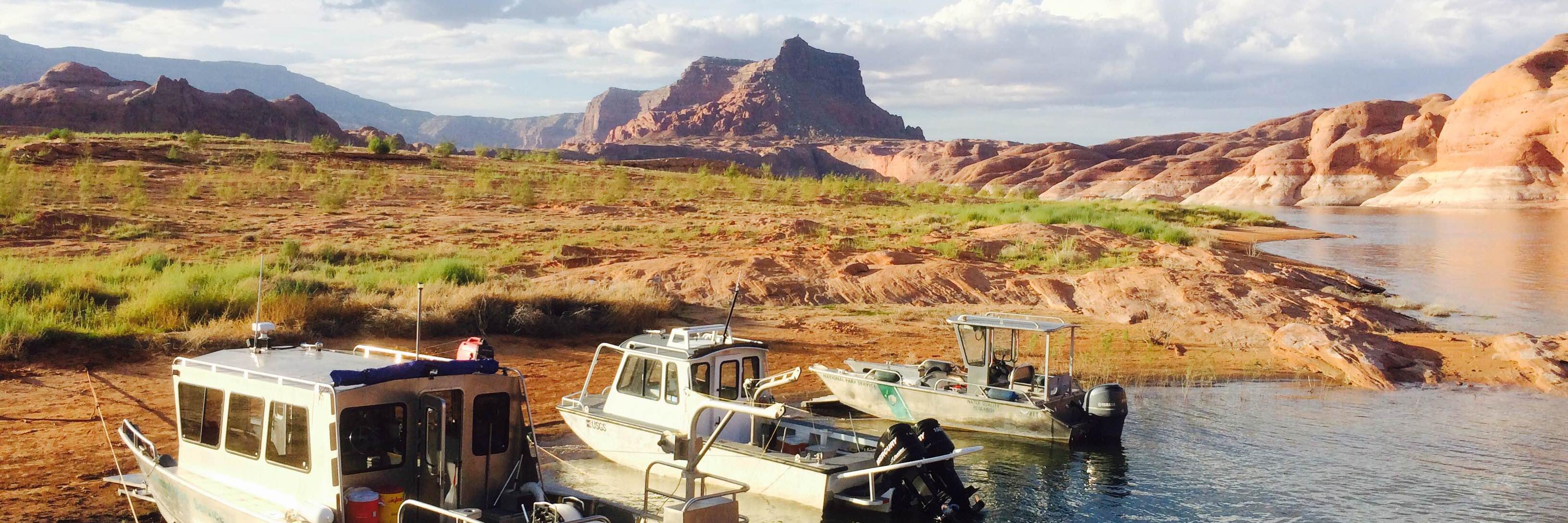
Sediment is filling Lake Powell at an alarming rate. What can be done to keep this water source viable? Will Lake Powell become Lake Mud?
Go inside the growing sediment crisis at the link above.
✏️: Emma Pitts, Deseret News
📸: Kristin Murphy, Deseret News
HIRING NOW!
Are you a student looking for an entry-level position in #hydrology? Come join our field office in #idaho Falls: https://t.co/c91pCpquce. #USGS
#uwcnf The Elizabeth Ridge Fire continues to burn near North Slope Road E of Elizabeth Pass, burning in heavy timber near Fish Lake, 132 acres, 10% contained, 85 people working on fire, including three hand crews, three engine crews and being supported by four helicopters.
As the Fourth of July holiday approaches, we’d like to remind you that all fireworks – including sparklers – are prohibited on all federal lands.
Let the night sky be your show! ✨
Photo at @ZionNPS by Jonatas Neiva
More than 5,000 cubic feet per second of water roared down Mill Creek in Moab, Utah after heavy rain fell over a short period of time on Sat, June 21. The USGS hydrograph tells the story. https://t.co/HtqIu5eUbc
#monsoons#flashfloods#moabutah
New report, "Low flows from drought and water use reduced total dissolved solids fluxes in the Lower Colorado River Basin between 1976 to 2008," informs salinity dynamics in arid and aridifying locations, including the #UpperColordaoRiverBasin. https://t.co/Mw8W9bVH50
What could eclipse the eclipse? The #GageGreatness finale!
This matchup between Montague, NJ and Andrew’s Creek, Colorado couldn’t be more exciting! Learn more about each gage and vote!
@USGS_NJ@USGS_CO
Engineers from @UTWaterRights' dam safety section were notified Monday about damage to the upper portion Panguitch Dam. Learn more: https://t.co/776fMePLOS
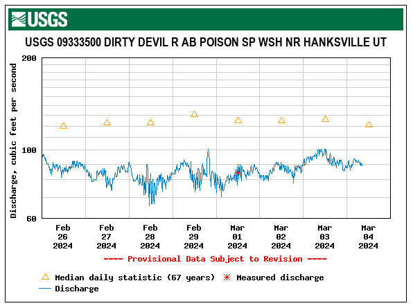
Measured #DirtyDevilRiver discharge was 84 cfs on 3/1. Previous provisional data was updated using adjusted rating curves. Complications from ice and/or channel fill (notorious in the #DirtyDevil) are good reasons to use provisional data cautiously. https://t.co/yicLxNd2iX
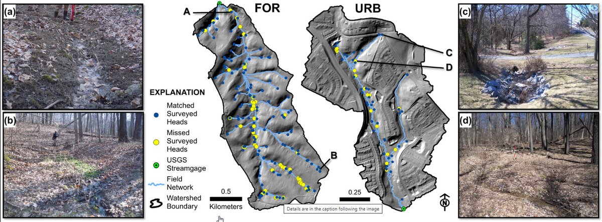
UT scientist, Dan Jones (https://t.co/SP2vcvzcmH) coauthors paper that receives National JAWRA Award. Paper describes new method of remotely mapping ephemeral headwater streams using wetness index and topographic openness derived from lidar. https://t.co/3y3xkbMNu2