For much more frequent crowd-sourced road and weather updates, join our Facebook group and interact with over 28,000 members providing real-time personal observations on the road. Please share this with others!
https://t.co/rl3cmhxVip
Here are the 25th and 75th percentile rainfall forecasts through Monday morning, which show a reasonable low end and reasonable high-end rainfall forecast. The wide range is due to uncertainty with the track of Rachel and how it interacts with a cold front.
🚨 BIG RAIN EVENT TAKING SHAPE FOR UTAH
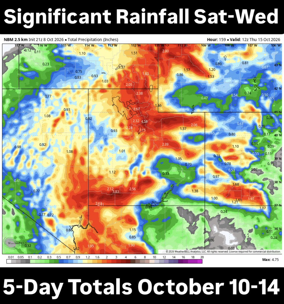
We’re looking at some significant rainfall totals across Utah from Saturday through Wednesday night as moisture from the remnants of Tropical Storm Rachel combines with an incoming fall storm system.
Here’s what we’re watching:
🌧️ Most areas could see 1–3 inches of rain over five days.
⛰️ Some of our mountains could pick up 4–5 inches of water.
🌊 The heaviest rain looks to arrive Sunday into Monday, with additional showers possible through Wednesday.
These are significant totals for Utah, and the concern goes beyond just how much rain falls. Streams, rivers, normally dry washes and slot canyons could see rapidly rising water, especially by Sunday evening.
Areas near waterways and recent burn scars should pay close attention to the forecast. Even additional rainfall early next week could create problems in areas that get soaked this weekend.
One important note: This rain will be spread out over several days, not all at once. The exact placement of the heaviest rain bands will determine where the biggest impacts occur.
I’ll continue tracking this system as we get closer and the forecast comes into better focus.
Tropical moisture will combine with an incoming cold front to produce heavy rain this weekend, beginning Sat and especially Sun. Widespread rainfall amounts of 1-2" are forecast, with local amounts up to 3." If planning outdoor activities, strongly consider alternatives.
Gusty south winds are expected from the combination of the remnants of Tropical Storm Rachel and an incoming cold front. Widespread wind gusts of 35-45 mph will occur on Sat for most of UT & SW WY, with a 40% chance for gusts to 50 mph for SW WY and high terrain areas of UT Sun.
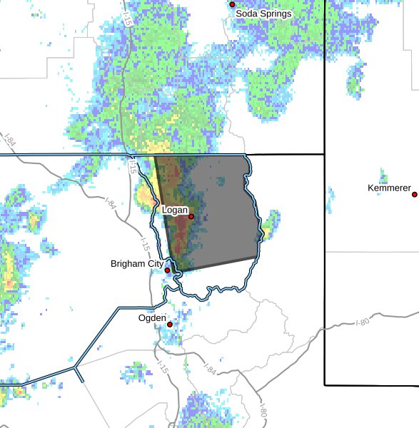
#OwenCanyonFire Update - Box Elder County- Firefighters made good progress today, bringing the fire to 100% containment. Updated mapping also puts the fire at just over 9 acres. #ffslkmg@BoxCounty
Fire units are still working the fire up near Temple Fork. US 89 is still closed, both directions. They are NOT allowing people up. Evacuations have not started at this time. We will update as new information comes in.
#JohnsonCanyonFire
August 2, 2026 | 10:45 a.m.
The Johnson Canyon Fire is estimated at 6,273 acres and 10% contained.
NO DRONE ZONE.
NO MEDIA OR PUBLIC IN BROADMOUTH CANYON, JOHNSON CANYON, WHITES VALLEY OR PORTAGE PARK AREAS.
UPDATES: https://t.co/B5svVOXokZ
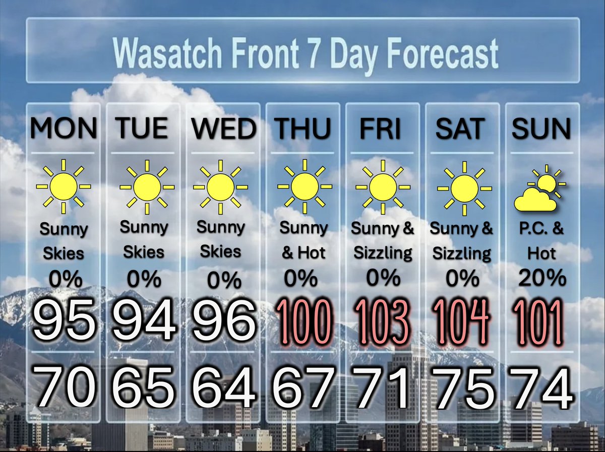
A Repreve From The Heat, But Not For Long
High pressure moves eastward and that allows for slight cooling into the mid 90s (if you can call that cooler). Another heat wave returns for the end of the week and the weekend. Plenty of sunshine all week. @DanPopeWeather#utwx
Update 8/2/26: #JohnsonCanyonFire
Box Elder Co. Burned very active through the night and is now estimated at 3,500–4,000 acres.
Fire crews worked through the night getting dozer line around the fire, but high winds pushed the fire and firefighters were not able to get around it. Today, resources will continue efforts and continue constructing containment lines as conditions allow.
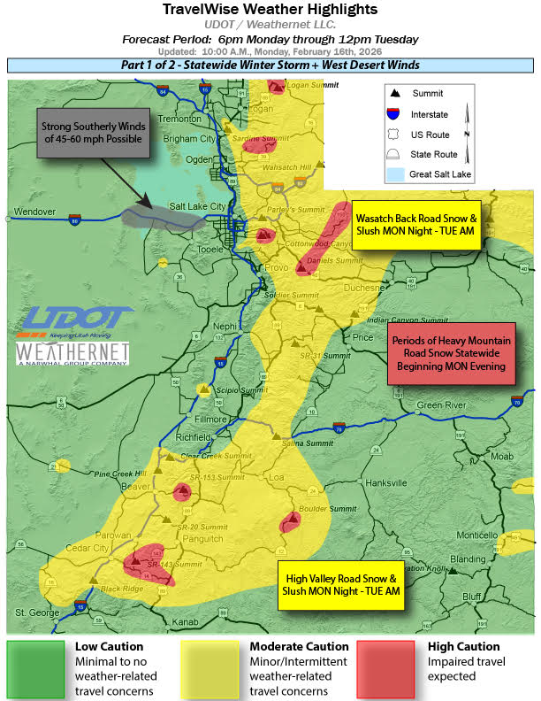
❄️ Road Weather Alert ❄️
📍WASATCH BACK FORECAST
6pm(2/16)-6am(2/17): Rain/snow after 9pm, snow after 12am becoming spottier after 2am. Road snow above Mountain Dell with 1-2" at Parleys Summit toward Park City, 1-3" at Mayflower, 2-4" at Ontario Mine.
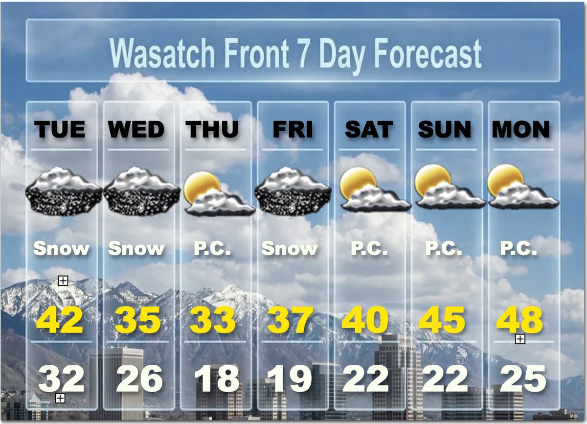
A Strong Cold Front Arrives Tonight
Ahead of the front, strong gusty southerly warm winds will blow today. Snow develops after midnight and continues into the morning commute tomorrow. Then snow showers persist through the day.
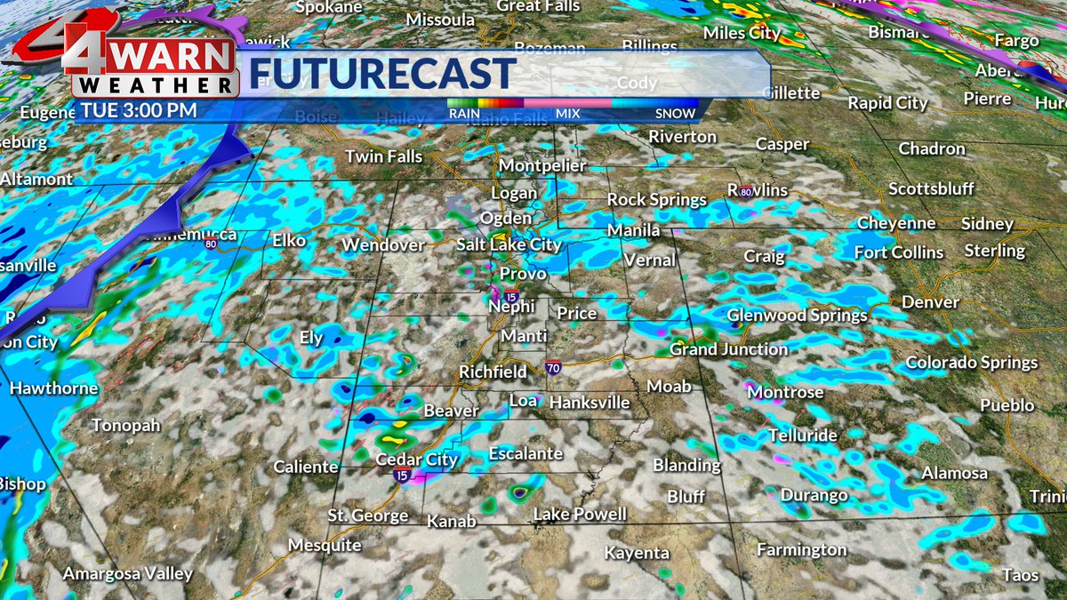
Another strong front hits early Wednesday and continues all day. Travel will be difficult in most of Utah. Two day accumulations will be 2 to 3 feet in the mountains, with locally 4 feet or more in the upper Cottonwoods. Valley's will see 2 to 5 inches and Benche 5 to 10 inches when you add both Tuesday and Wednesday together.
The next weaker storm arrives on Friday, but cold winter temperatures are expected. A slow warming trend is anticipated for this weekend, as skies turn partly cloudy. @weathercaster #utwx
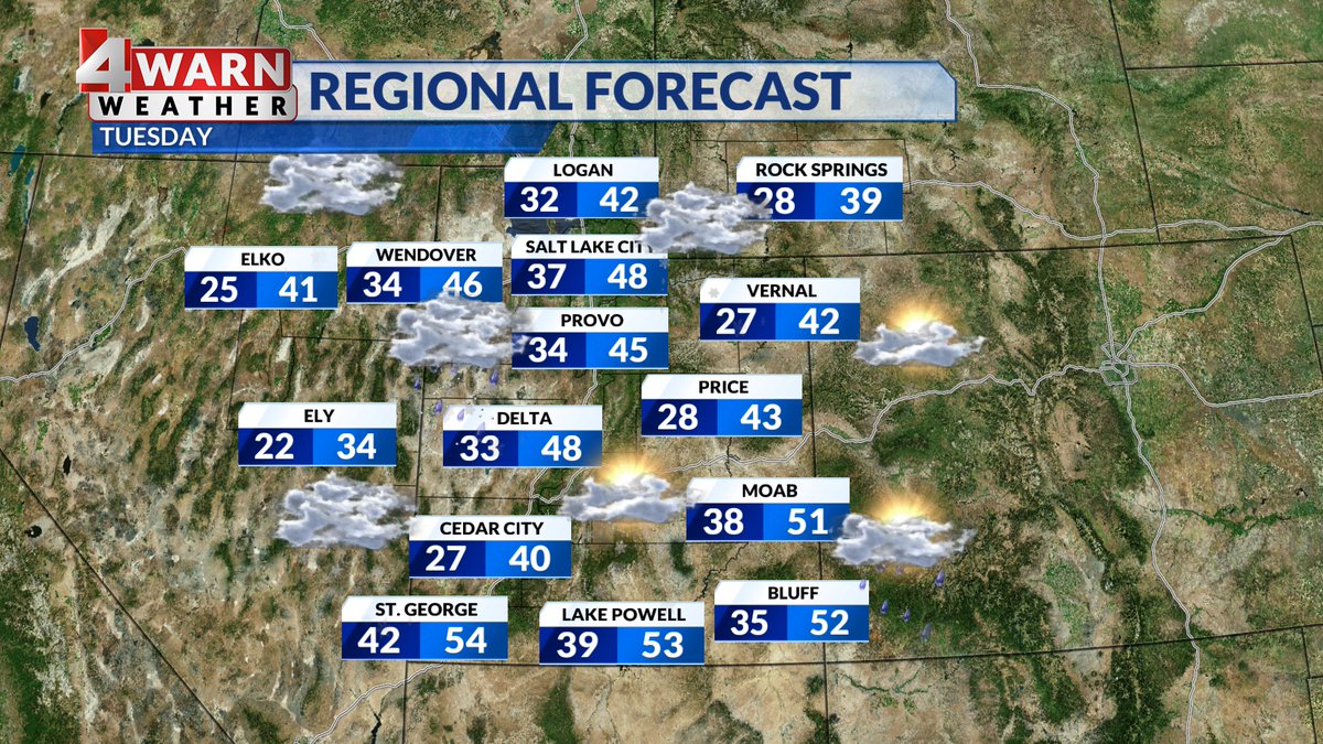
TUESDAY: Showers are expected today with snow levels falling to the Benches while valleys see a rain/snow mix. Temps will be cooler with highs in the 40s for most of the state. By Wednesday it'll cool enough to bring us periods of heavy valley snow!
Good snow in the Southern Mountains right now! This is a live view from Ruby's Inn in Bryce Canyon City, but if you were to look at radar you wouldn't see anything over the southern mountains. that's because it's snowing so hard we've lost conncetion to the dish #utwx
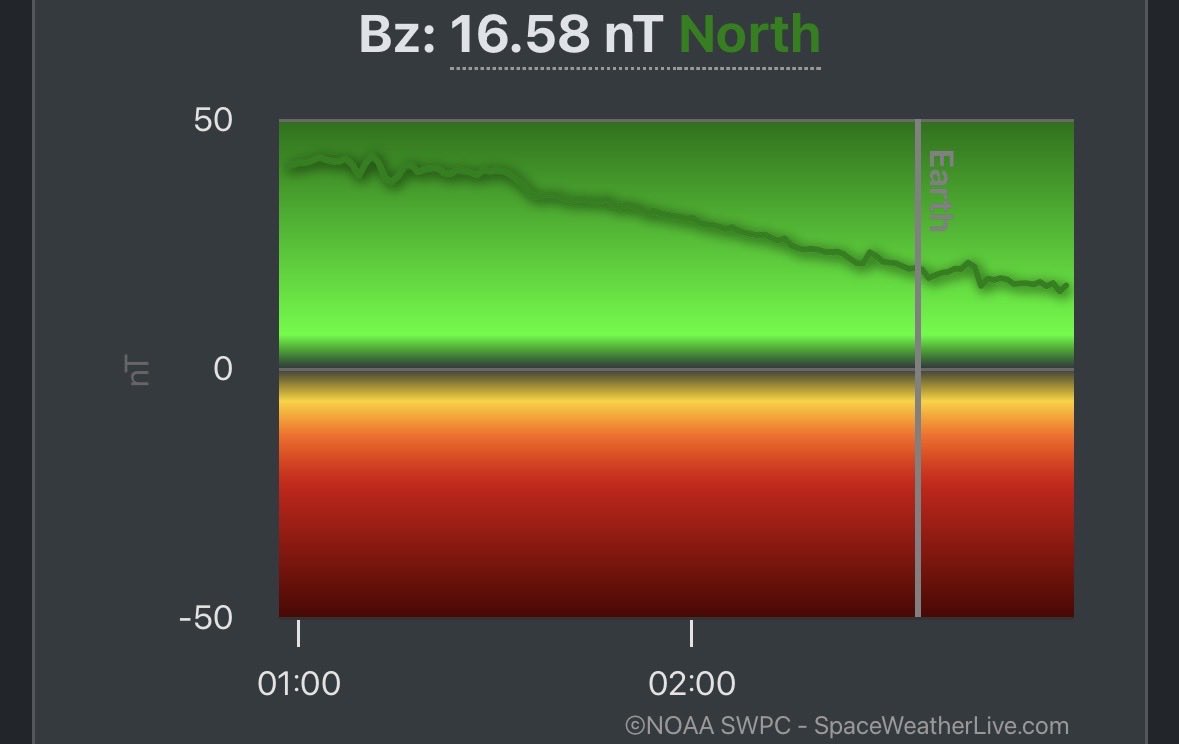
We’d really like to see the Bz – the direction of the magnetic field – flip negative. When it’s negative, it allows the aurora to move southward.
That would mean better viewing and a more impressive show for us here in Northern California.
#CAwx@ABC10