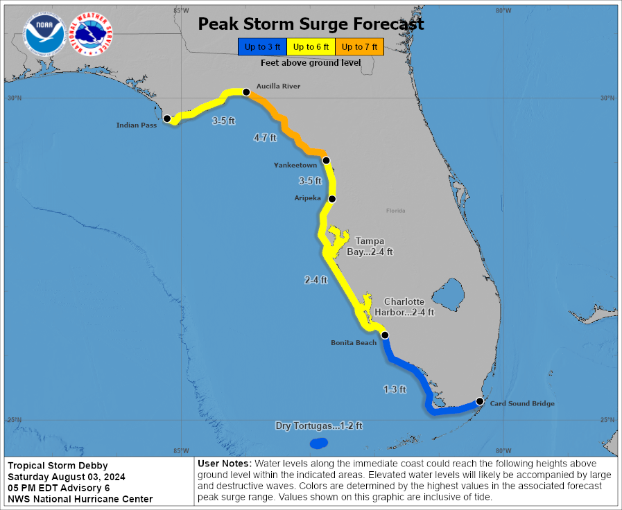
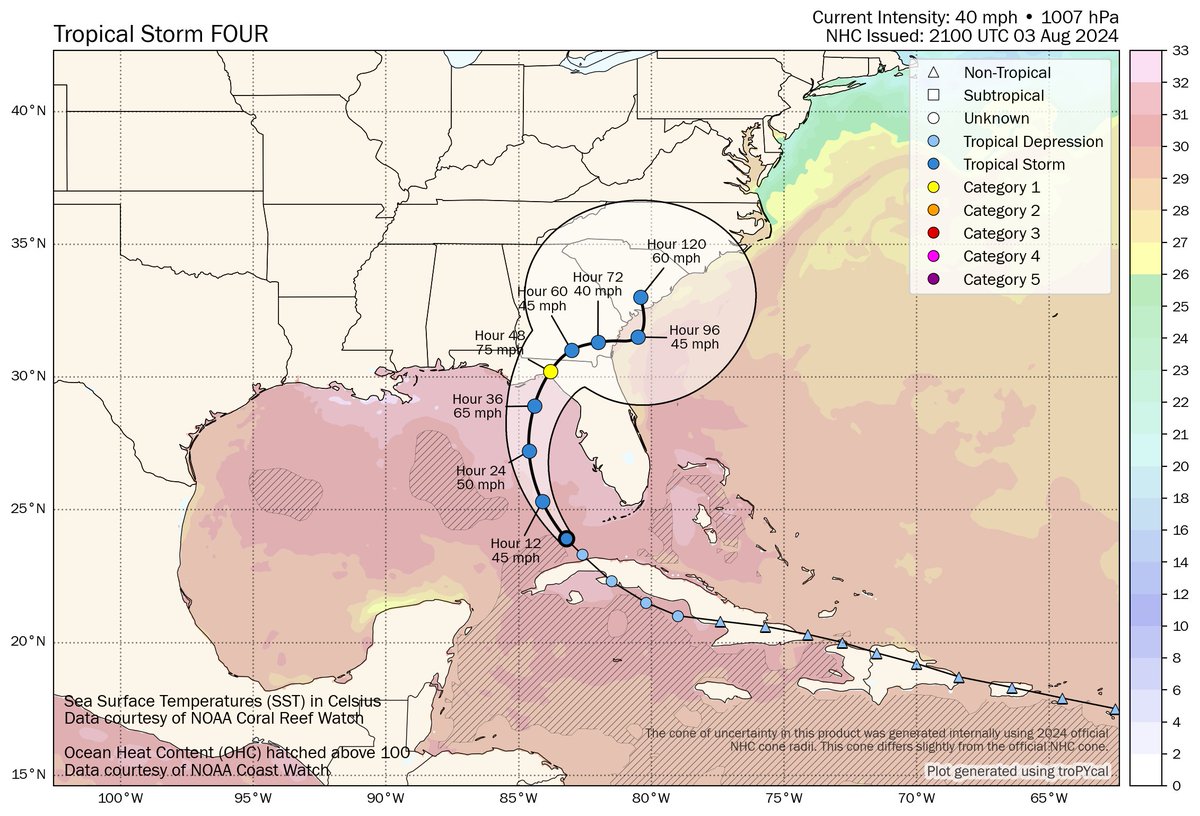
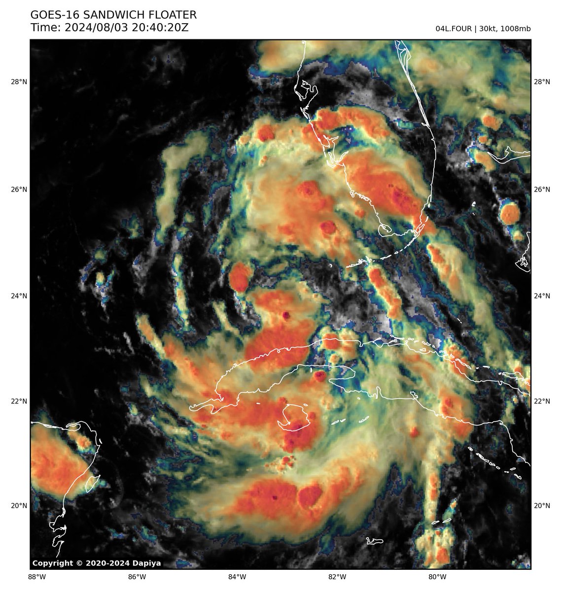
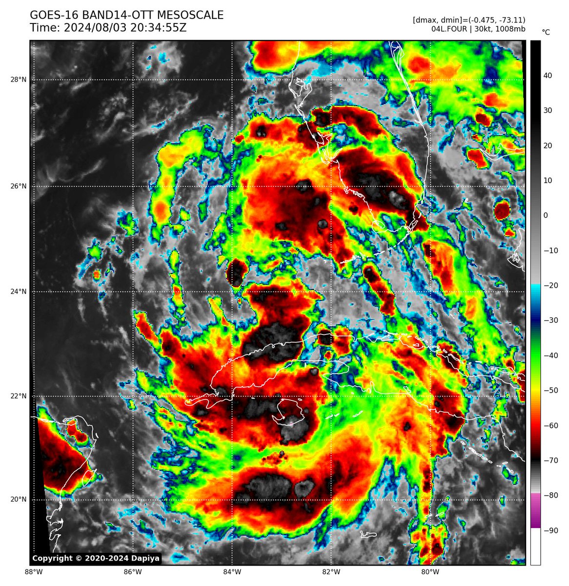
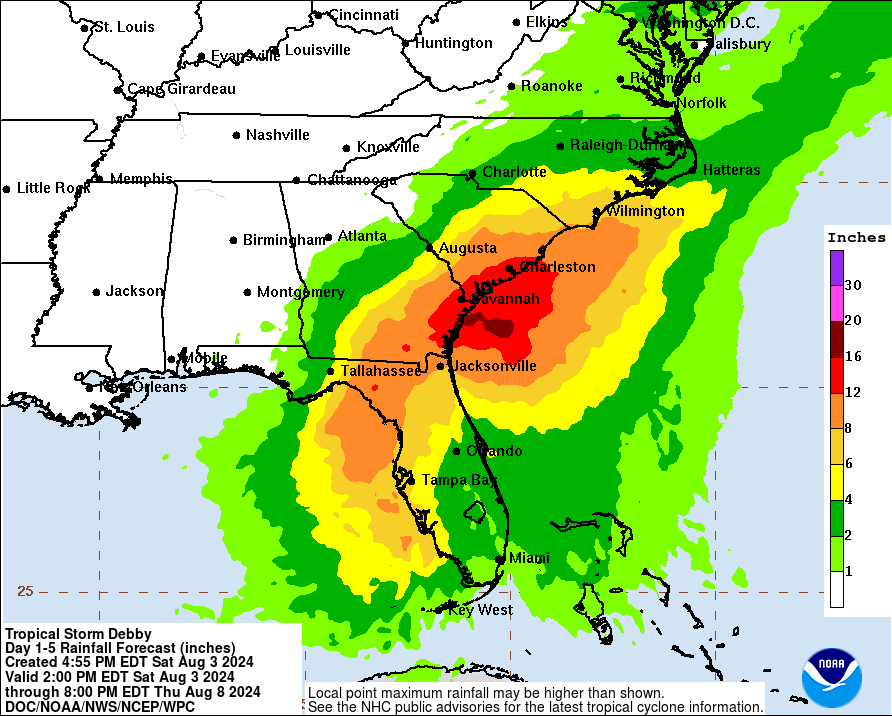
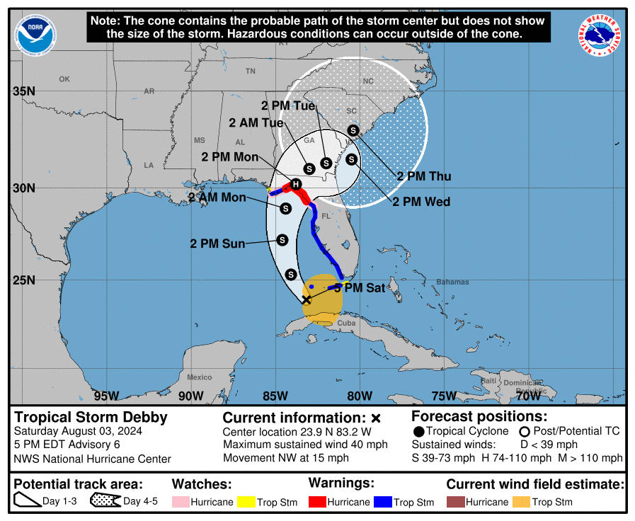
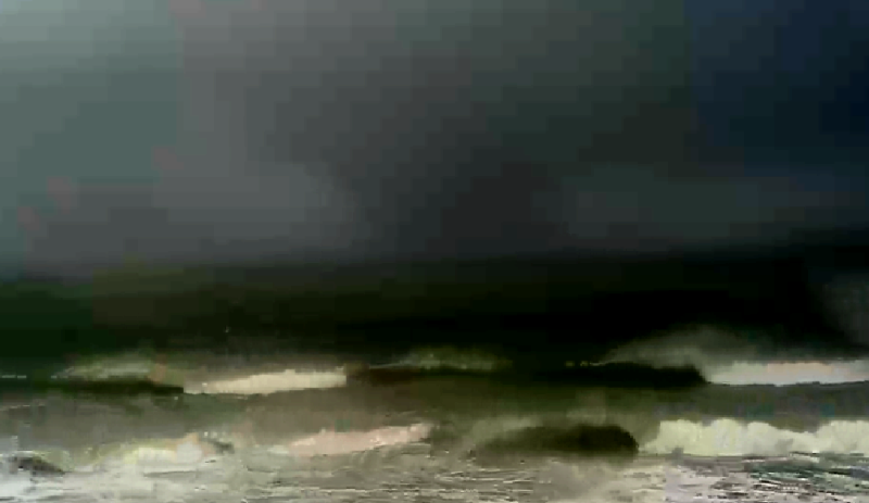
Multiple hazards expected from #Debby including possibly our first significant hurricane landfall of the year, with widespread flooding and storm surge. Catastrophic impacts possible across the carolinas.
#tropicswx#flwx
🧵
Called it, hurricane status expected at landfall, conditions expected to deteriorate in the #Florida Keys soon. Longer post incoming soon.
#tropicswx#hurricanedebby#debby
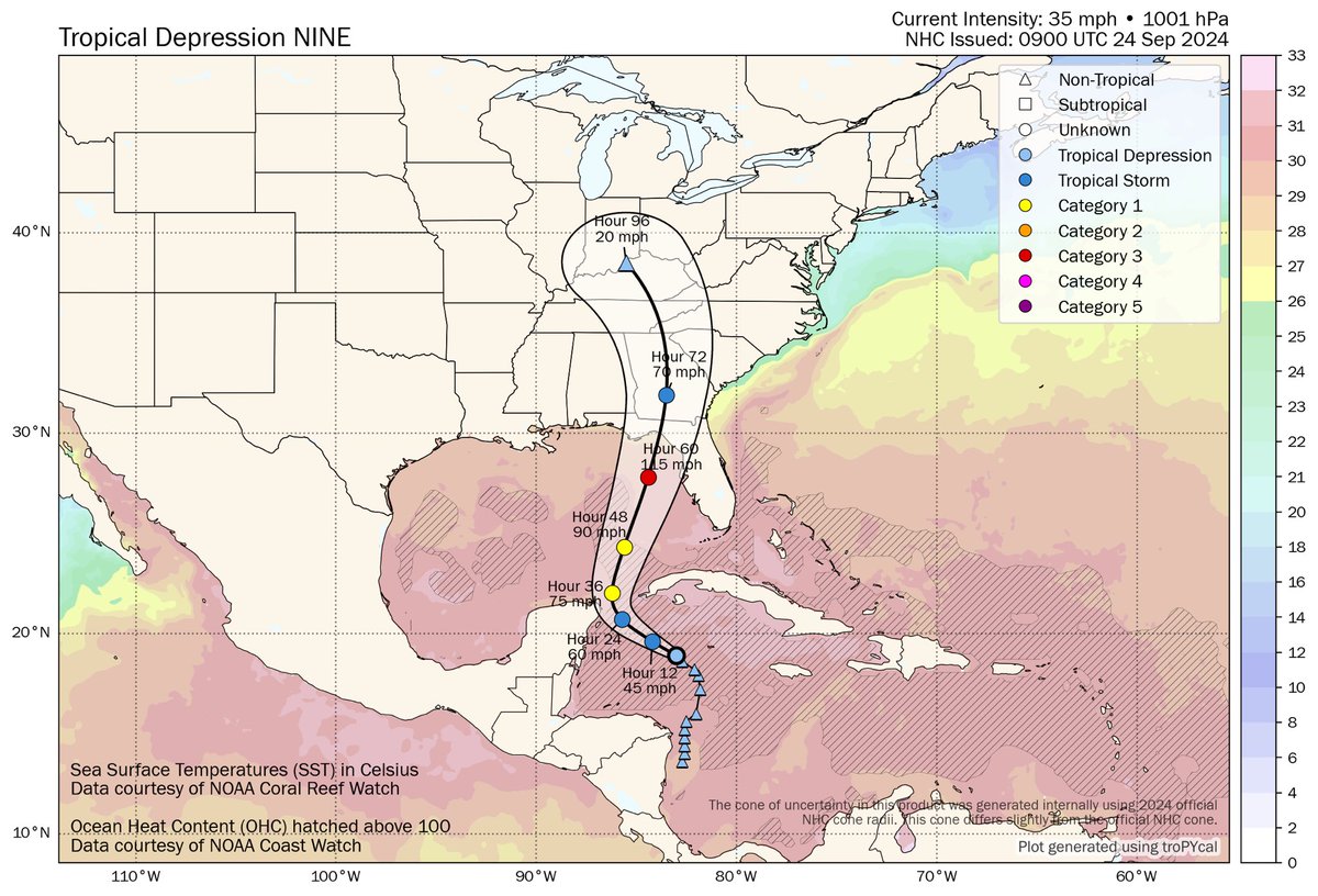
In the most recent advisory (Adv. 4) #PTC9 remains as a 35mph potential tropical cyclone with 1001mb, expected to become a hurricane and intensify, making landfall as a major somewhere in the northern portions of the Big Bend.
#Tropicswx#Helene
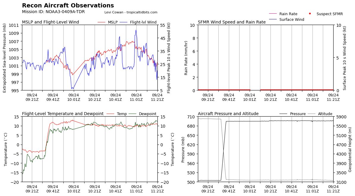
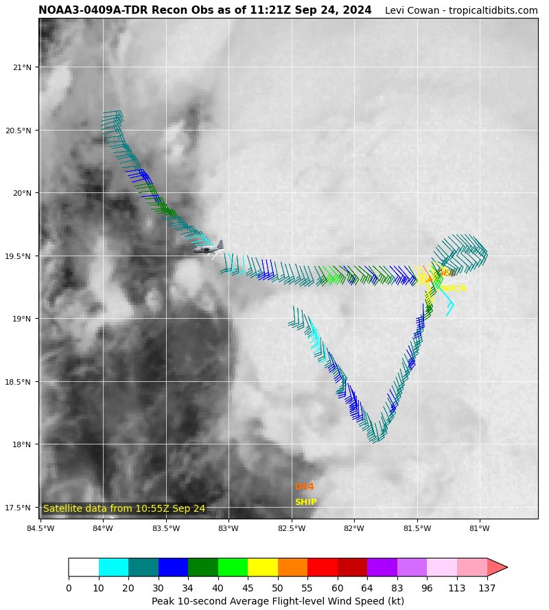
Seems like recon found 50kts of flight level wind ( around 40 when translated to ground ) within what appears to be a core, a pressure drop to around 1000mb was also observed. We may get TD #Helene soon.
#flwx#hurricane
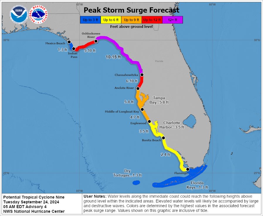
Catastrophic surge expected from #09L in most of the Florida big bend, this is very rare for a PTC to have such high forecasted values. Watching closely.
#flwx#tropicswx#Helene
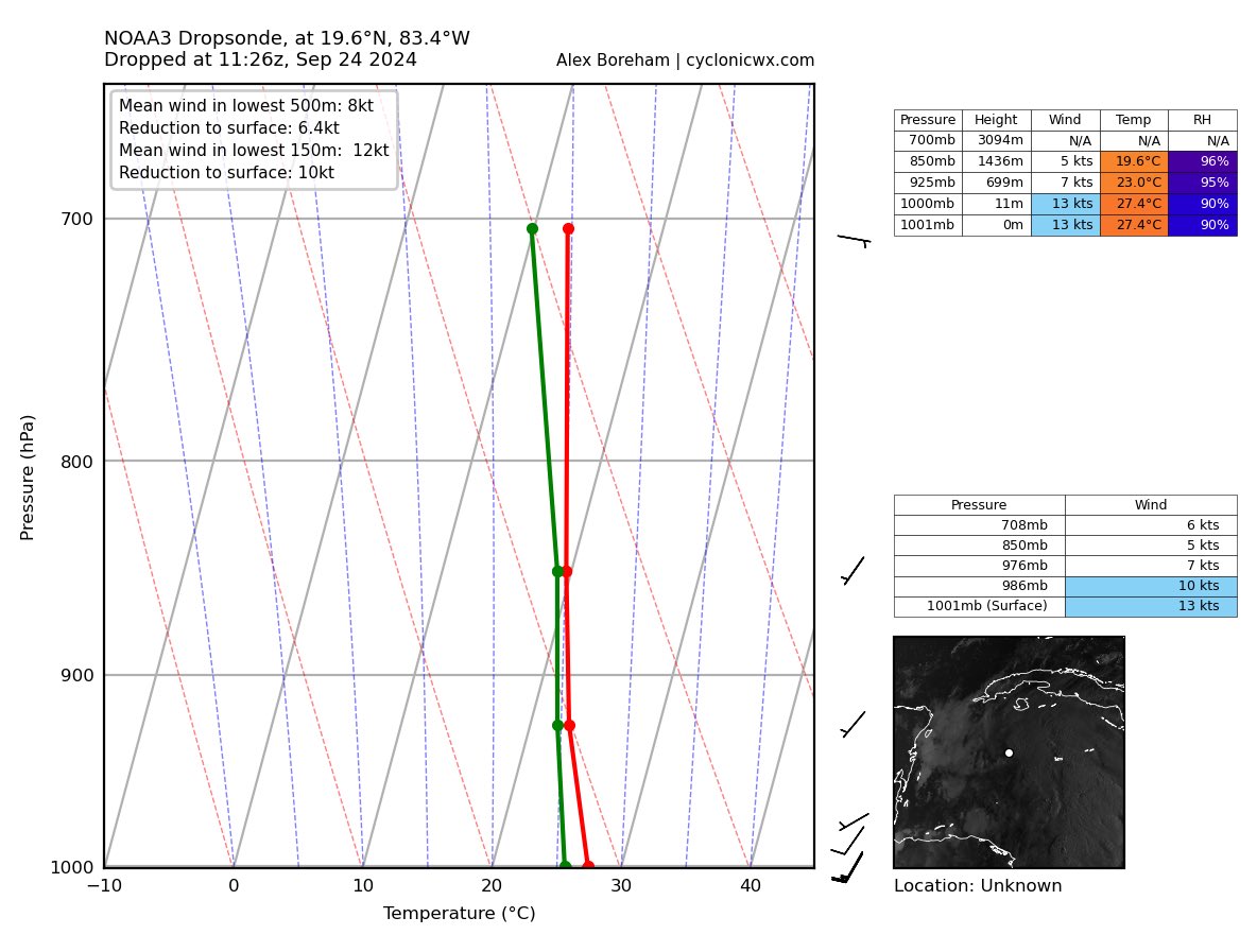
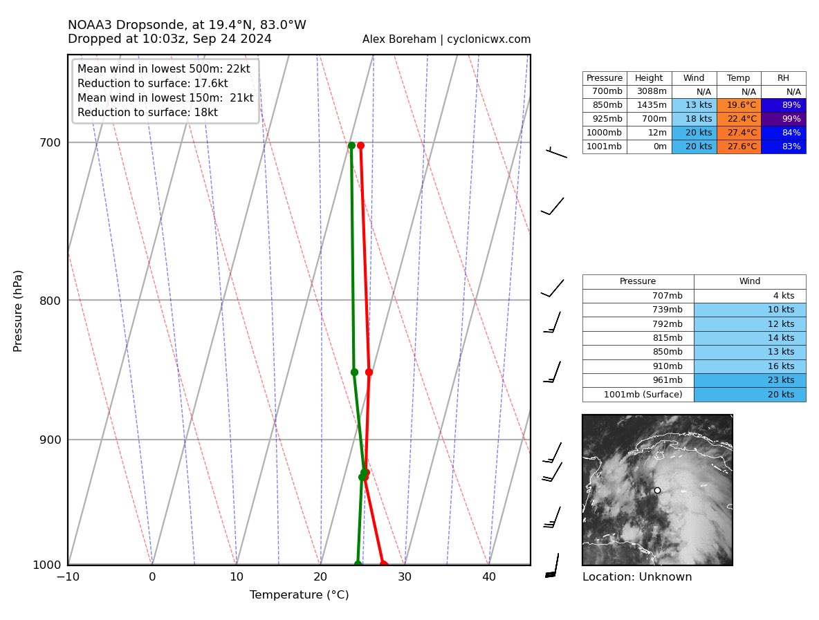
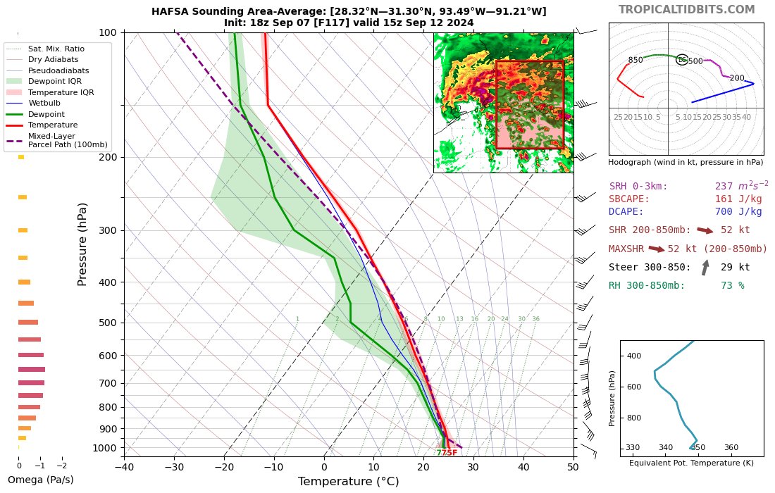
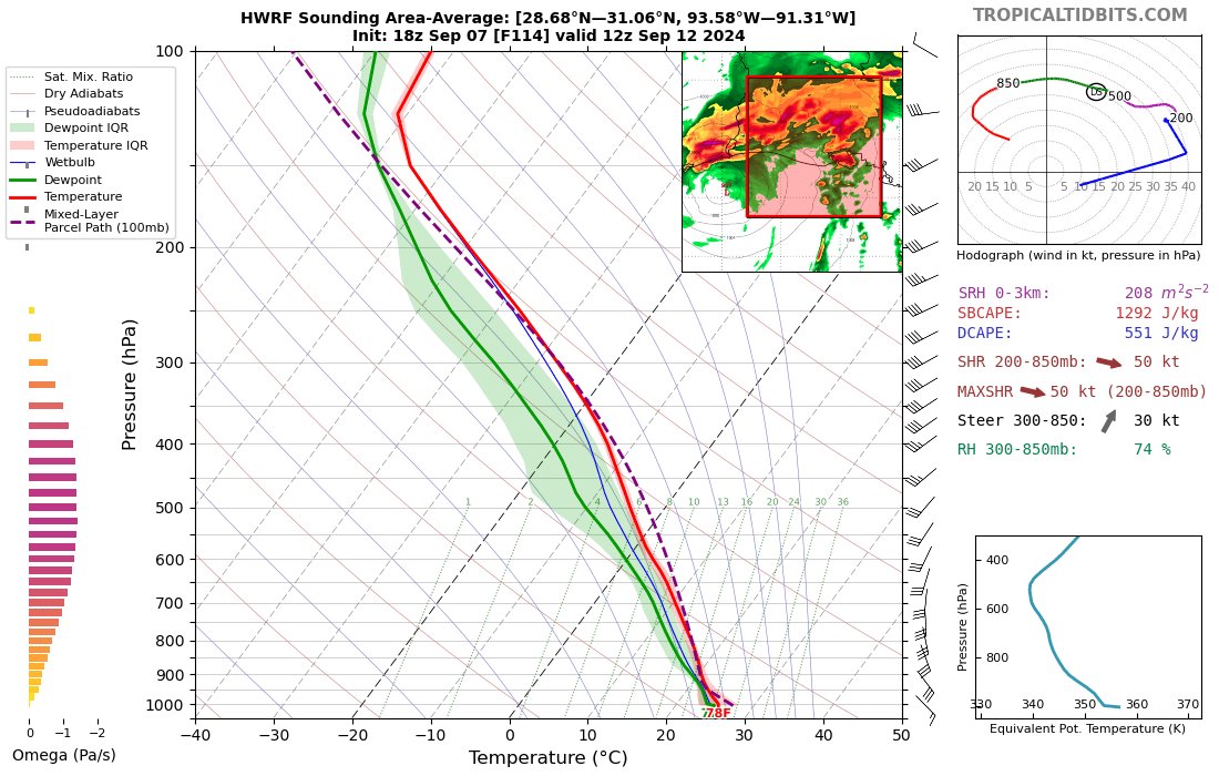
If you are wondering why is #PTC9 taking longer than expected to developed as well as having an asymmetrical structure, well we have an answer. By looking at these two soundings in the western side we can see some strong shear impeding organization in that side.
#Helene#flwx
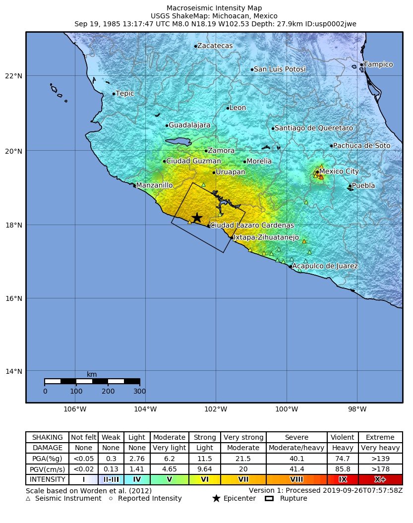
On this day 39 years ago:
- 30,000+ lives were lost.
- 50,000+ people were hurt.
- 400,000+ buildings were damaged.
- 20,000,000+ lives were changed.
All within 2 minutes, this is a small thread regarding one of the greatest disasters in mexican history.
#mxwx#19S#sismo
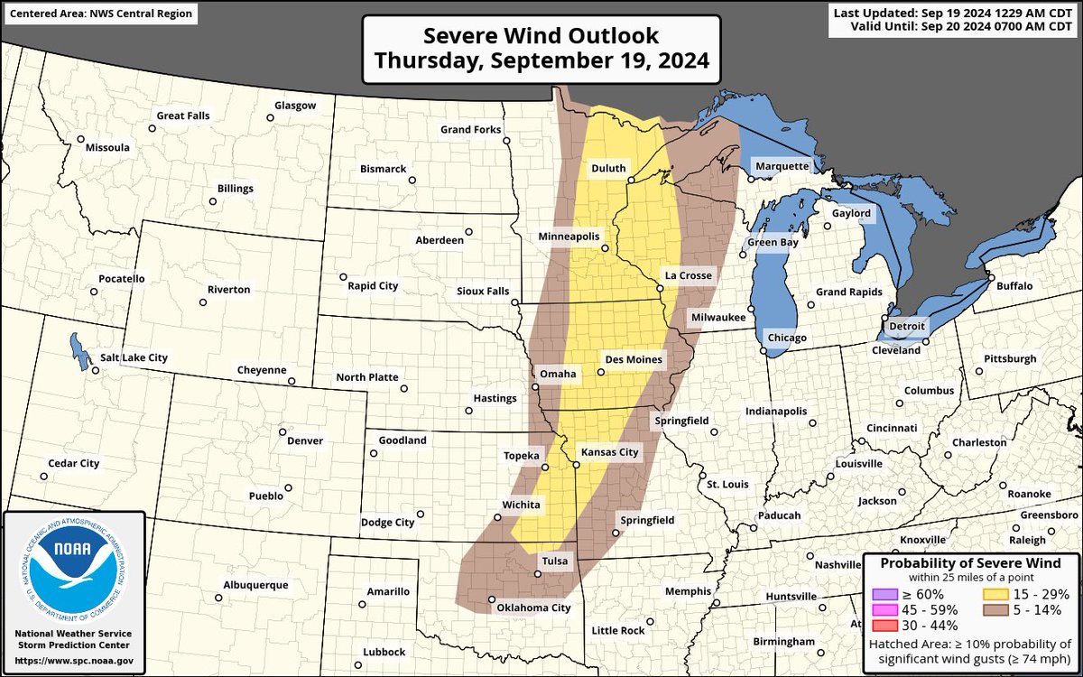
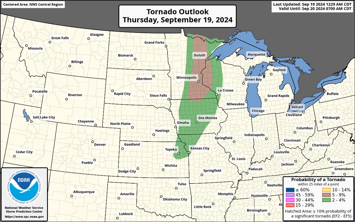
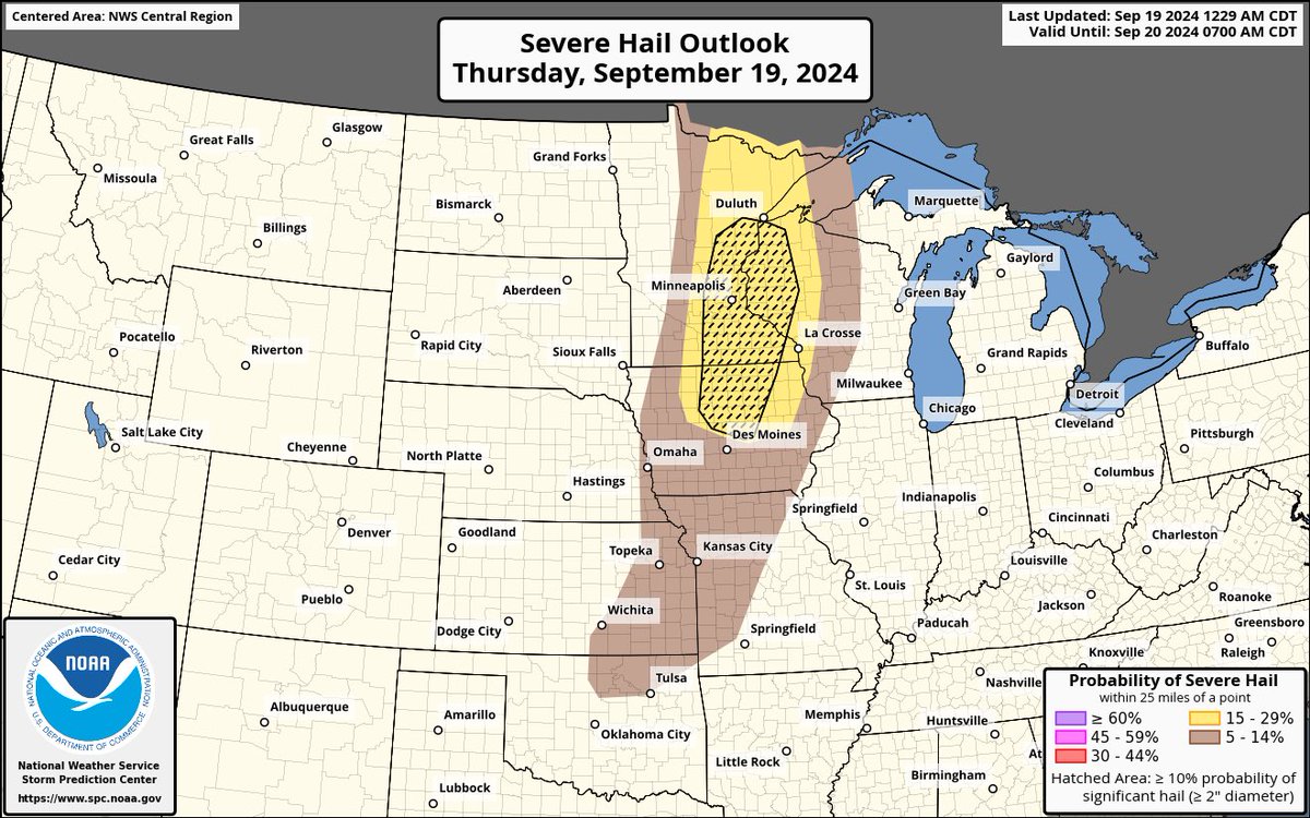
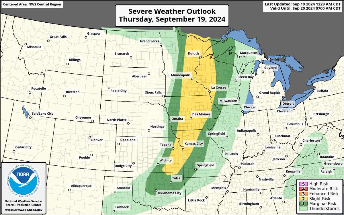
A threat for all hazards exists today across a broad area from Minnesota to Oklahoma where a couple tornadoes, large to very large hail and widespread wind damage is likely. We will be covering this on Twitter later today.
#severewx#mnwx#tornado
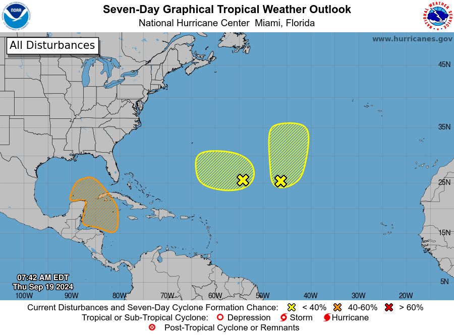
Currently three areas of interest for tropical activity exists across the Atlantic basin, with the most significant one near the Yucatan peninsula which poses a threat to land, more details later.
#tropicalwx#hurricane#Helene
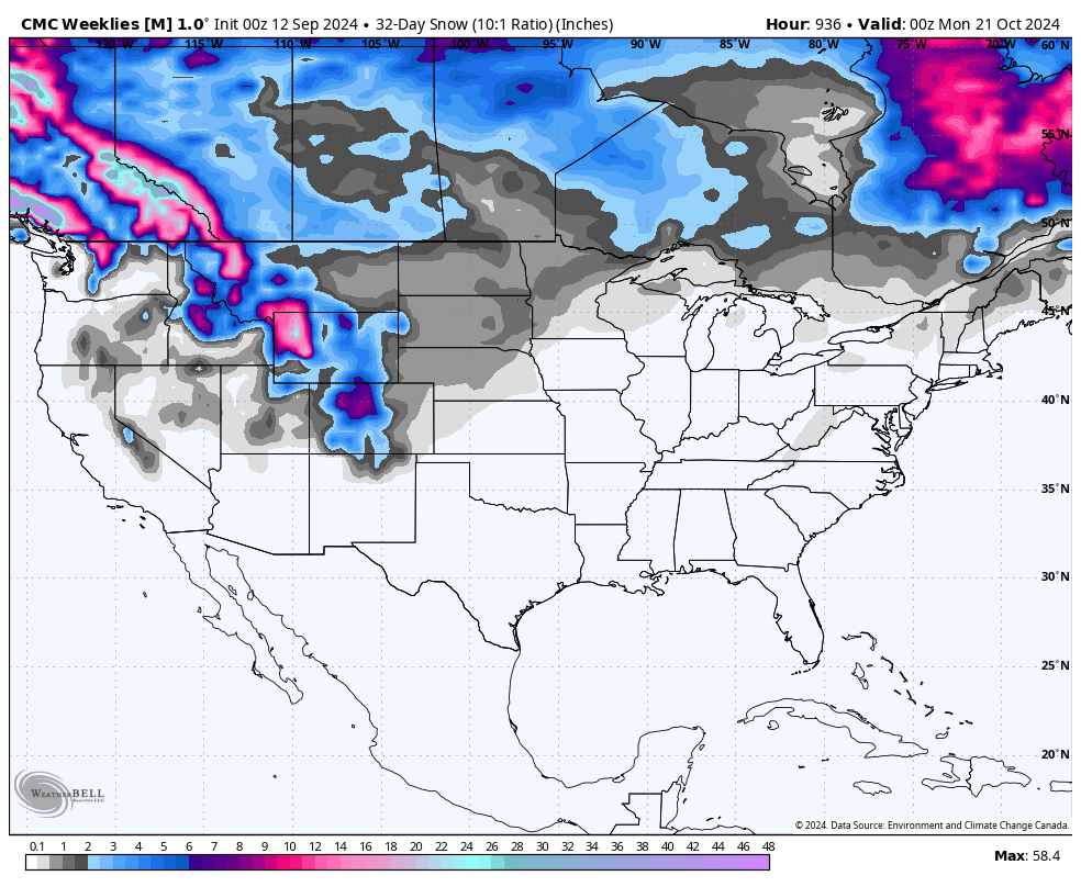
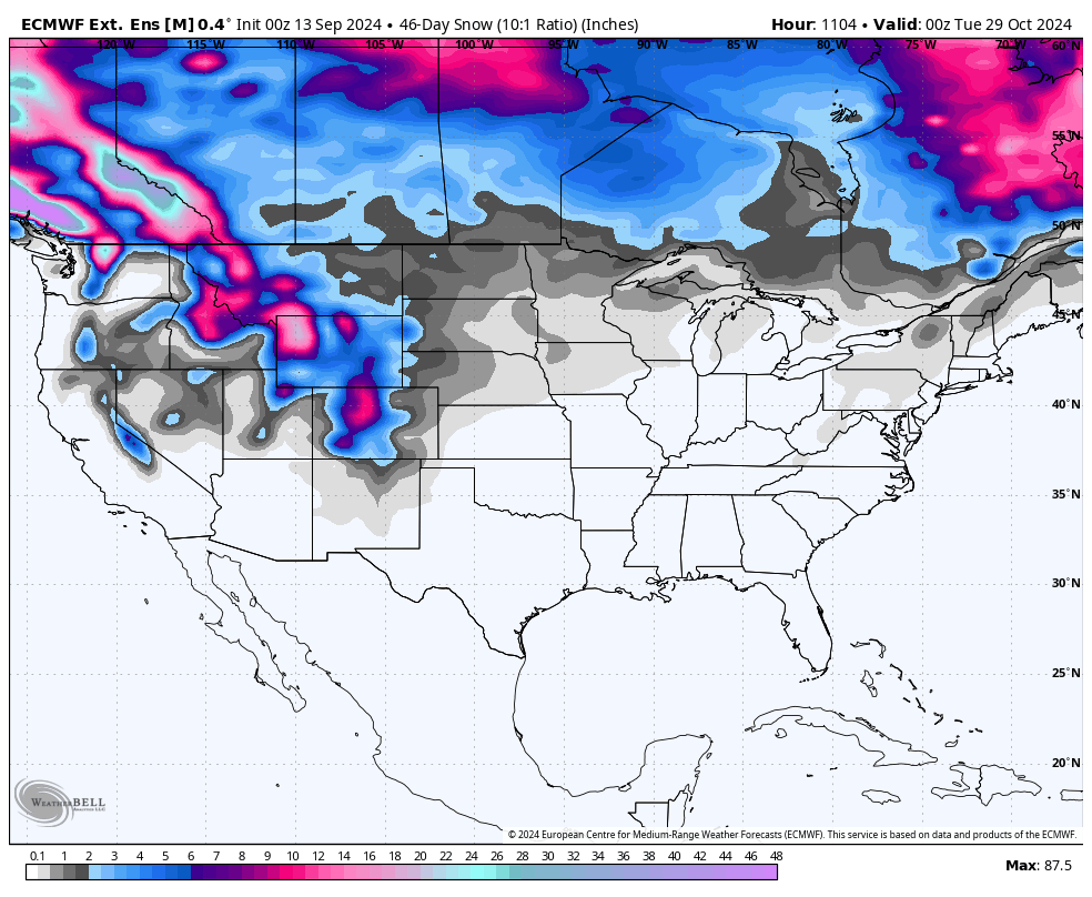
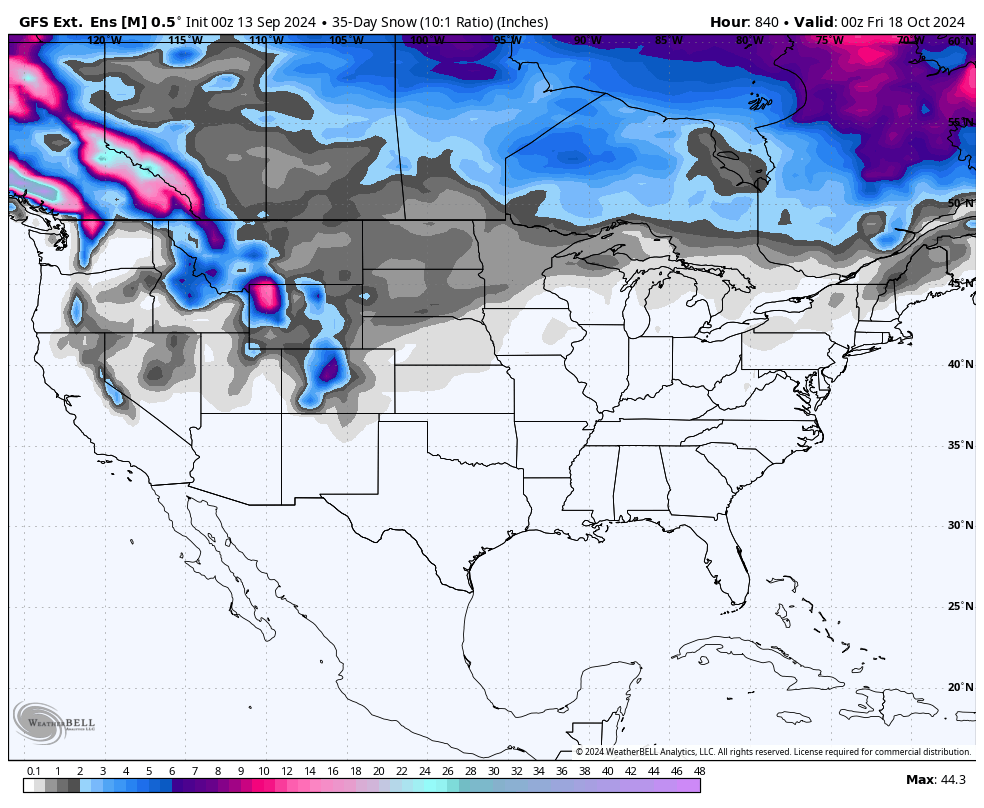
All long-range ensemble models are starting to pick up some sort of signal for our first snow storms this season in early October, this is still very far out, however it's a decent signal so far.
We are so back.
#winterwx#snow
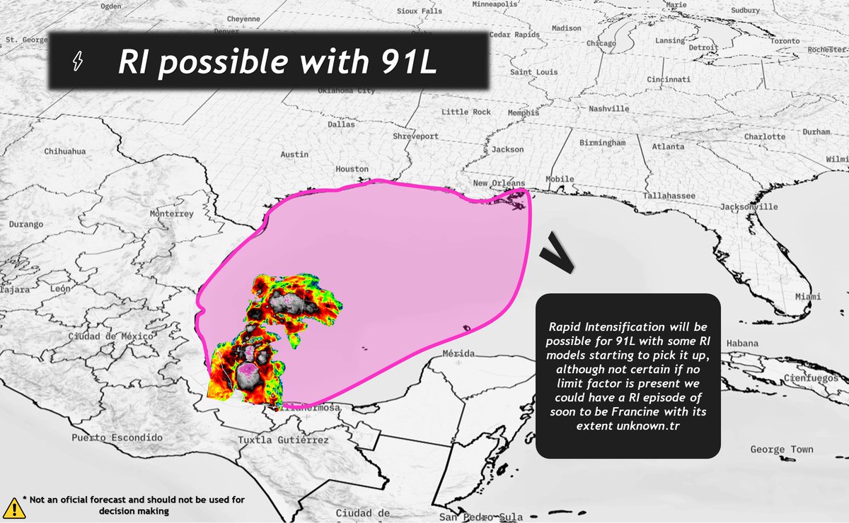
Rapid Intensification is a possibility with #91L due to being located in extremely warm waters, its extent and whether it will happen or not is unclear, however we are starting to get some sort of signal in model guidance and RI models.
Stay tuned…
#txwx#lawx#francine
Regarding temperatures across the US for the next few weeks, expect the cooler weather to continue for much of the central and eastern US, however very warm temperatures should continue across mainly western US.
#weather#us
Something that could turn out really interest as a threat from #91L is tropical tornadoes, future Francine does appear to have a favorable structure to allow multiple bands of supercells to make landfall in an extremely volatile environment.
#lawx
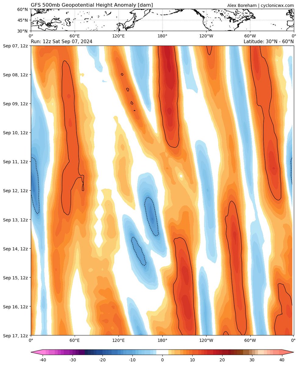
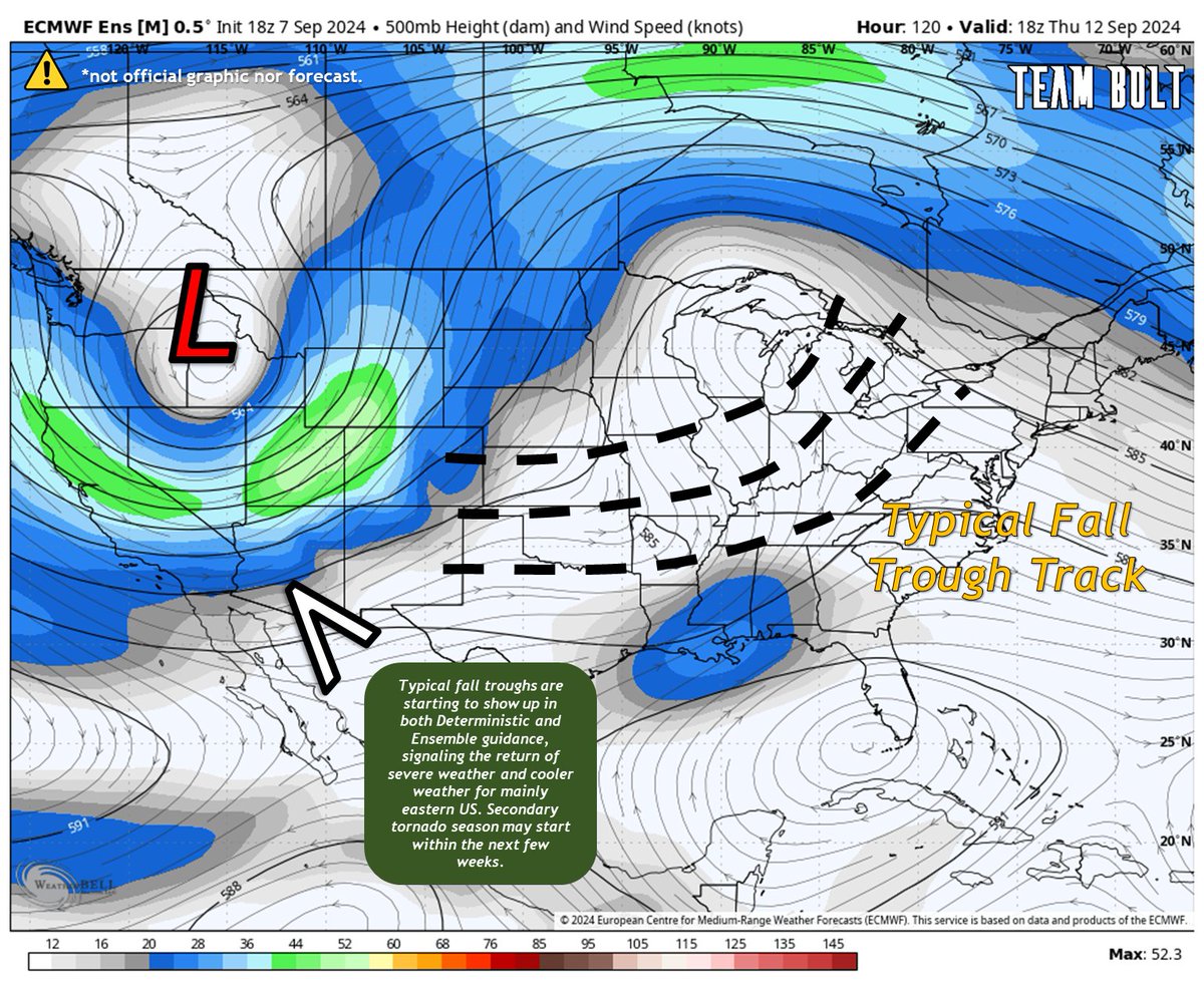
Trough season is back, that means that things should get back active now. Multiple troughs now showing on model guidance, showcasing the possibility for increased severe #weather events and even #tornado outbreaks across much of the Eastern #US.
Stay tuned for more updates…
Interesting how it wants to have a similar track as Franklin last year, which peaked as as a high end Category 4 hurricane around late August.
#hurricane#ernesto
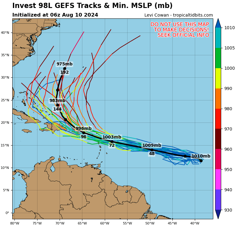
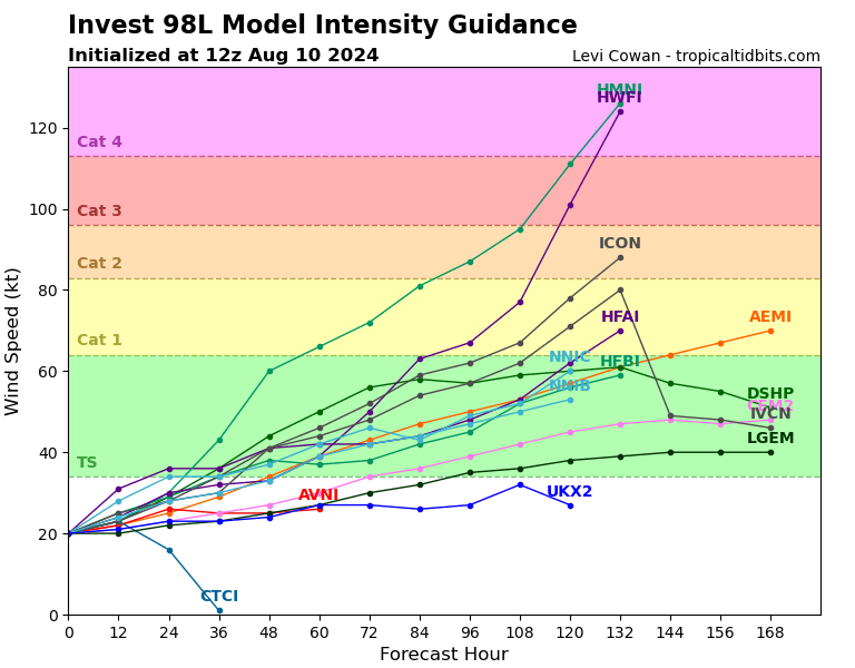
Interesting to see how strong does #98L truly gets, we know hurricanes in that area can get fairly strong around this time of the year, US landfall is unlikely but possible.
#tropicswx#hurrricane
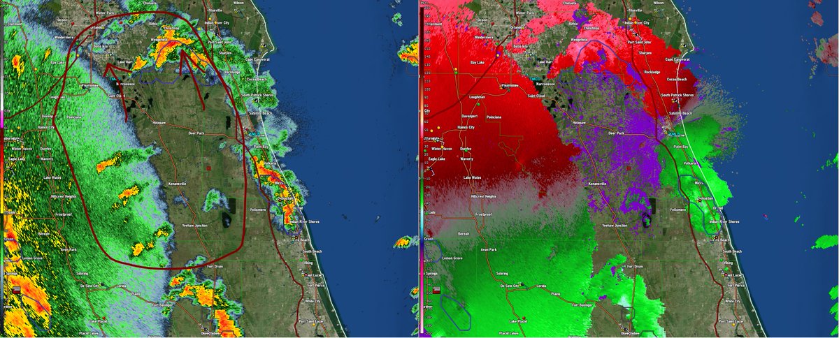
Now watching this complex of mini supercells for an increasing tornado threat as they continue to move N/NW moving into a favorable environment with a "cheat code" in place.
#debby#tornado#hurricane
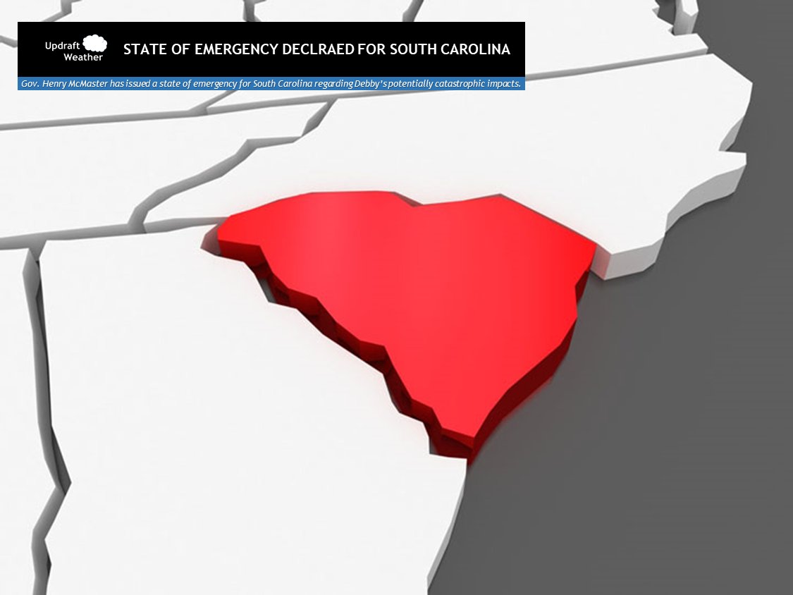
I have declared a State of Emergency to prepare for Tropical Storm Debby's potential impact on South Carolina. With potentially heavy rainfall forecast for the next few days, residents should start making preparations and plans today—in case it is necessary to take quick action.
State of emergency has been declared by the Governor of South Carolina due to potentially historic and catastrophic impacts from #Debby.
#tropicswx#scwx#flood
Once it manages to have a fully closed eye RI will be likely, as seen with models such as HRRR that show the eye closing shortly before landfall, having a C2 hurricane. Its unclear at what time will it fully close its eye, intensity depends on it.
#Debby#flwx
Our main factor that will determine #Debby intensity is how fast it manages to close its eye, it is expected to take a "comma" like structure with an semi closed eye in the SW quadrant, allowing dry air to disturb the circulation.
🧵