‼️36 spots left‼️
Join us for our FREE webinar in 2 hours ⏰ where we break down our forecast for the spring months and #plant23
➡️➡️ https://t.co/8Zb7mltKyB
Cant make it live? No worries! Register and get the recording sent
#oatt#agwx#corn#wheat#soybeans#agtwitter
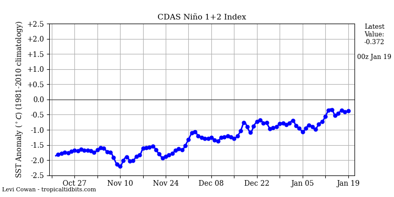
The forecast is changing for SA.
Where? Esp #Argentina where we've faced consistent #drought pressure all season.
Why? Finally losing the strong #LaNina influence, in a nutshell.
Takeaway: damage has been done, but relief next 2-4 weeks is likely.
#AGwx#OATT#corn#soybeans
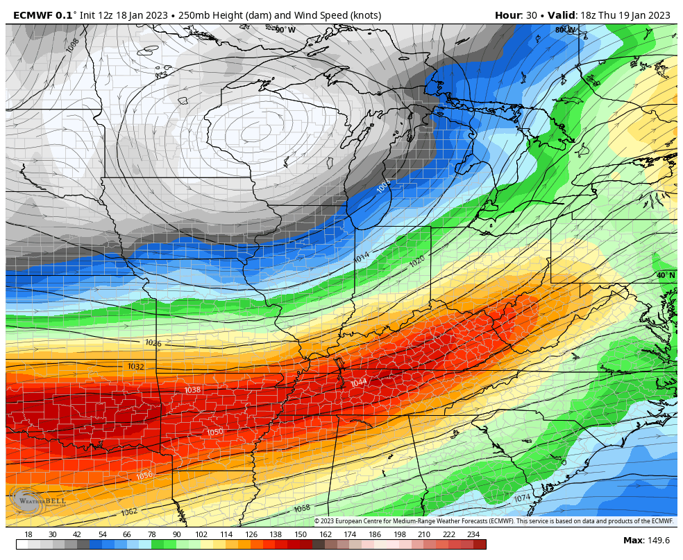
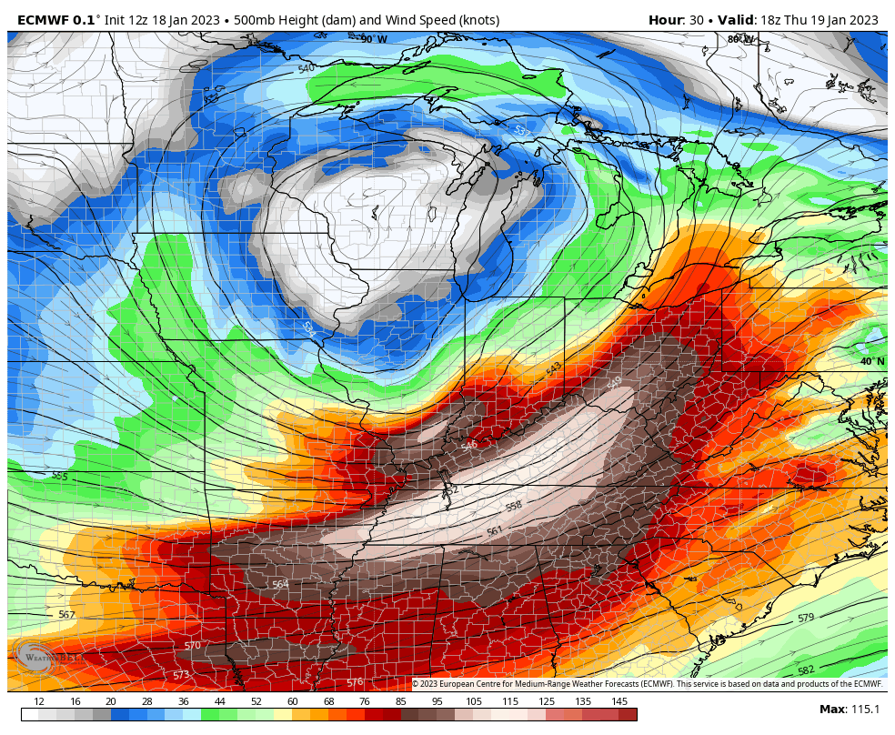
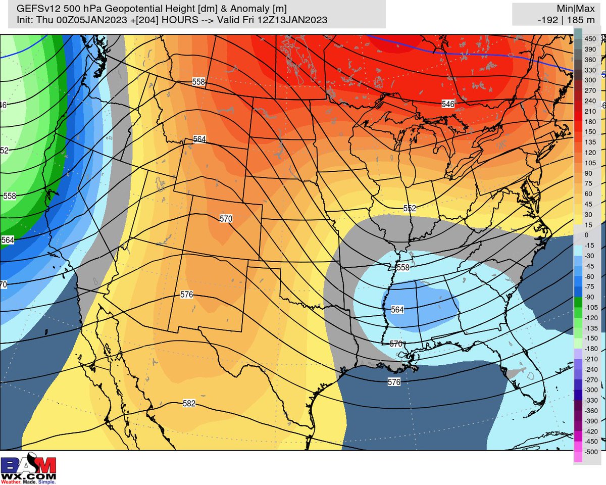
Interesting little setup here for E OH / W IN tomorrow
Trough going -ve tilt that's sitting in left exit of 250 & 500 mb jets
Not a bad sounding at all by mid-Jan standards with instability to work with and some rather steep lapse rates
#INwx#OHwx
Current thinking is for the upcoming winter storm to produce a general ~0.5 - 1.0" worth of liquid where the heaviest swath of snow is expected
I'm sure most in these areas will take any liquid they can get after how last summer played out
#agwx#NEwx#IAwx#KSwx#MNwx#SDwx
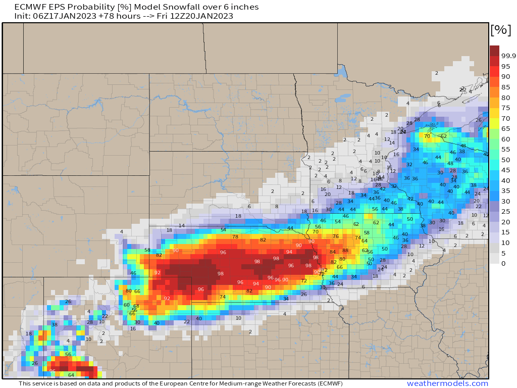
European data locked in to a widespread swath of 6+" of #snow across Nebraska and extending Northeast into N IA / S MN❄️
%'s for 12+" target Central part of NE for highest risk
Peak of the snow for these areas comes Wed AM - Thu AM before moving Northeast
#NEwx#IAwx#MNwx
Here's a American/European/Canadian blend for the rest of JAN in 5 day chunks:
➡️Warmth pushes E with time
➡️Coldest air of the month comes right at the end
➡️E Coast likely modeled too cold for last 5 day chunk
➡️Active pattern + colder risks = 📈 snow risks
#oott#natgas#oil
👀 Watching mid-late week for a strong winter storm across the Midwest
Still too early for exact totals, but risk of a widespread swath of accumulating ❄️ is increasing📈
Areas in dark blue hold best threat *for now* of seeing highest storm totals
#KSwx#NEwx#IAwx#WIwx#MIwx
@joe_belmonte2 If you’re just going to follow NWP, then sure. But when you look at pattern drivers/analogs/research…etc. and then see what support you have within guidance to back that up, you give yourself a much better chance
This outlook was not made solely on what data had.
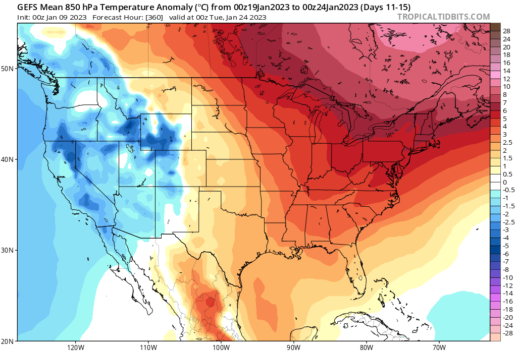
Here was our Jan 20 - Feb 2 forecast sent out Fri vs data this morning for the very start of that period.
Thinking is that we continue our "cool west warm east" pattern and keep heating demand below avg.
Eyeing 2nd or 3rd lowest HDD Jan on record (past 71 yrs)
#natgas#oott
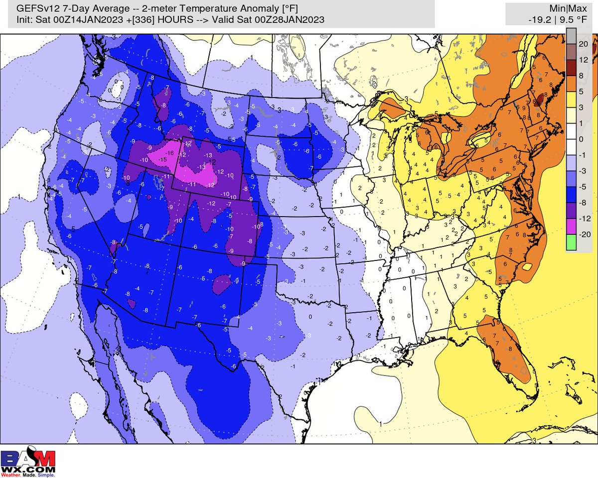
The thinking from early Jan is rolling forward nicely. Data this AM still on board with the widespread much above average warmth slowly pulling E with time and offering up more "seasonable" air for late Jan/ early Feb as a whole for the heart of the US
#oott#natgas#energy
Here was our Jan 20 - Feb 2 forecast sent out Fri vs data this morning for the very start of that period.
Thinking is that we continue our "cool west warm east" pattern and keep heating demand below avg.
Eyeing 2nd or 3rd lowest HDD Jan on record (past 71 yrs)
#natgas#oott
Always good to go back and verify from thinking 5-10 days out👇
While the system & majority of the precip with it verified a bit quicker & further north, the wintry risks checked out as we're still seeing snow for some of the areas mentioned
#TNwx#NCwx#KYwx#WVwx
Worth keeping eyes on the Lower OH Valley/ TN Valley/ Mid Atl. next weekend (~13-14th) for a system that *could* bring some wintry precip
Data in good agreement of this risk with good blocking North, opening the door for more of a "southern" track
#KYwx#TNwx#winter
Canadian/American/European data all in great agreement over the next 7 days for 📈 rain threats for the TN Valley
Maps are likely too widespread/"smoothed" with totals, but higher than average confidence there will be multiple shots of 💧 over the next several days
#TNwx#KYwx
Next week is going to be active across the Midwest/ Central US. Storm systems...
1.) Mon-Tue
2.) Wed-Thu
3.) Sat-Sun
will bring chances for....
✅heavy rain
✅accumulating snow
✅increasing winds
✅a few stronger storms
Details to be ironed out as we get closer!
#winter
Jan 16th - 26th pattern is looking active across the Midwest with ~4 targeted storms (something @BretWaltsWx has been discussing in Long Range Videos)
Exact timing/ amounts/ precip type....etc. all remain ?'s this far out, but precip chances 📈for mid-late JAN
#winter#snow
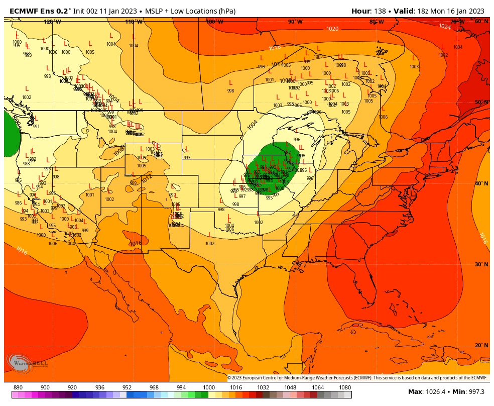
Modeled low pressure centers over the next 10 days show a rather active pattern ahead
The OH Valley/ Great Lakes should watch:
Thu 12th
Mon-Tue 16-17th
Thu-Fru 19-20th
While most locations see rain💧, the northern edge of these systems do hold a wintry risk❄️
#OHwx#ILwx#INwx
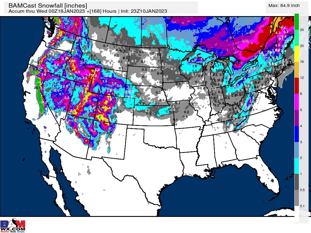
Next 7 day #snow across the US❄️
A late week/weekend system will provide some light snow to parts of the NE US, while the big story will continue to remain the heavy mountain snow for the W 1/3 of the country
#SierraNevada range cashing in on several more feet of snow!
#winter
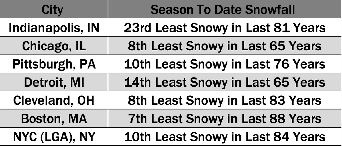
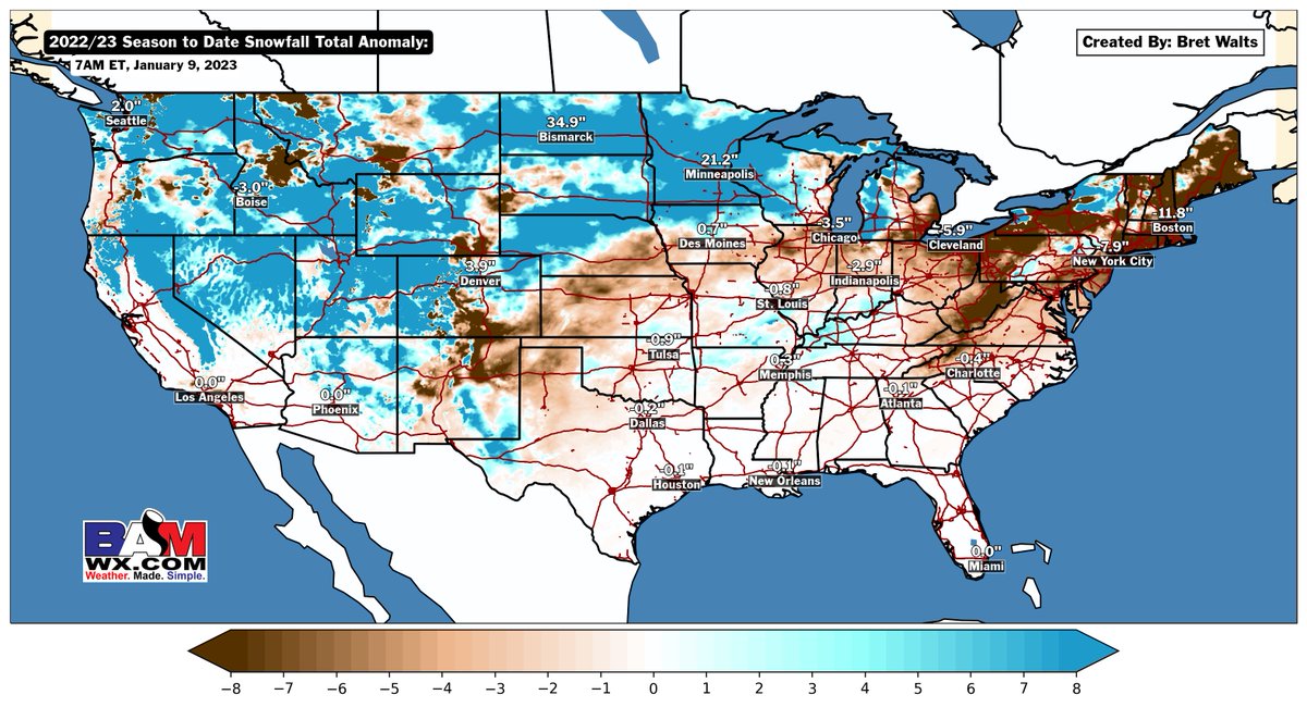
Digging into some Season To Date Snow ranks here across the Midwest and E US
Certainly nothing record breaking/ super noteworthy for these areas, but a good depiction of just how below average some of these bigger cities have been in the ❄️ department
#snow#winter
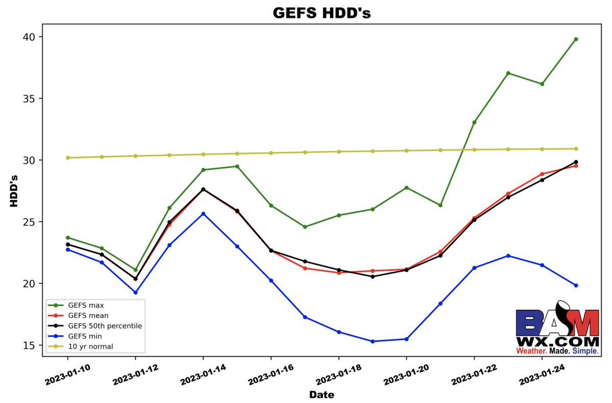
GEFS HDD data trying to pick up on this potential for a slight relax of the widespread warmth near the end of Jan
Note we are still below avg, however there is at least better opportunity to work near normal
More in our weeks 3/4 forecast later today!
#oott#natgas#energy
Here was our Jan 20 - Feb 2 forecast sent out Fri vs data this morning for the very start of that period.
Thinking is that we continue our "cool west warm east" pattern and keep heating demand below avg.
Eyeing 2nd or 3rd lowest HDD Jan on record (past 71 yrs)
#natgas#oott
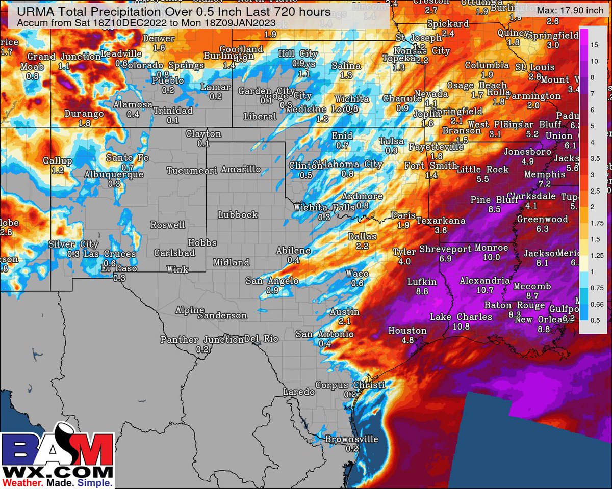
Rainfall over 0.5" during the past 30 days + latest drought monitor showing the Western portions of Texas/ Oklahoma/ Kansas continuing to face a moisture deficit
Combination of 100+ models showing ~Trace to 0.25" over the next 2 weeks will not bring much help
#OKwx#TXwx#KSwx
@PaulRoundy1 100%, especially when you start the month out like this🔥
Going to be hard to put any dent into this + the thinking the next 2 weeks even if we do get some more below average days to end the month
The temperature gradient also sets up an active precip pattern ahead💧❄️
Data likely too widespread here with the above avg "green's", but Upper Midwest/OH Valley/TN Valley looking at several moisture shots over the next 2-3 weeks
#agwx#oatt
Here was our Jan 20 - Feb 2 forecast sent out Fri vs data this morning for the very start of that period.
Thinking is that we continue our "cool west warm east" pattern and keep heating demand below avg.
Eyeing 2nd or 3rd lowest HDD Jan on record (past 71 yrs)
#natgas#oott