...In before the end of January! Here's what the State of Vermont's GIS groups were up to last year: 2022 Vermont GIS Year in Review: https://t.co/qFSWrZxrWJ
@aworthley@VTStateParks Hi Aaron - this was just public sector folks but we'll be reaching out to connect with private sector / academia soon re: our strategic plan.
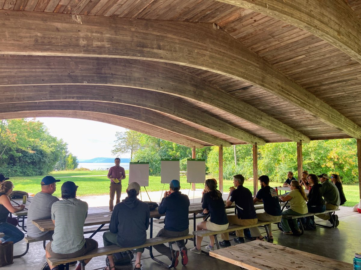
Great to see state, federal, and local partners coming together in person to think about the future of GIS in Vermont. Thanks to @VTStateParks for providing the perfect venue at Button Bay State Park!
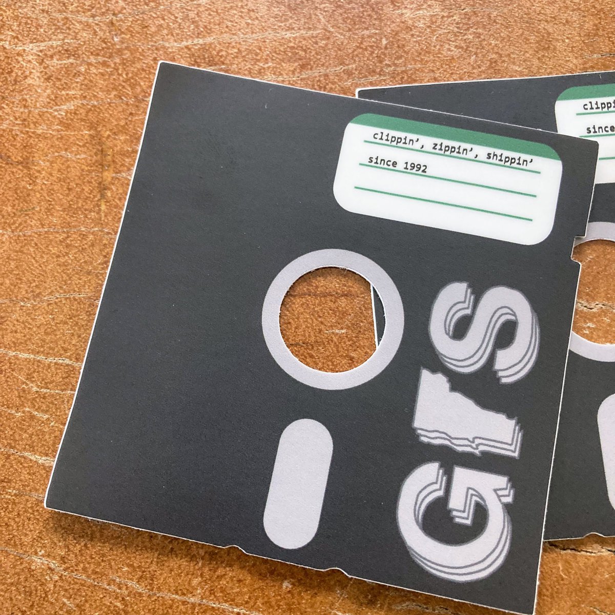
New sticker commemorating 30 years of clippin', zippin', & shippin'! Check out what we were up to in 1992: https://t.co/xjzcsfgrr1 Thank you @TownMeetingTV for making this incredible archive available.
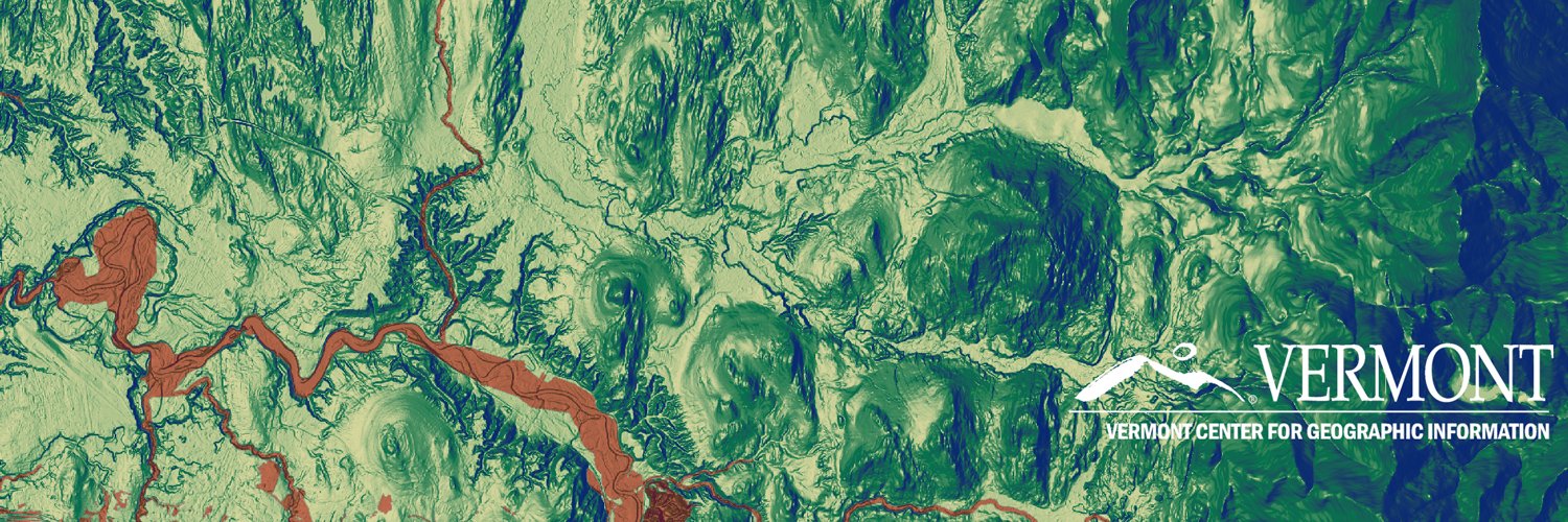
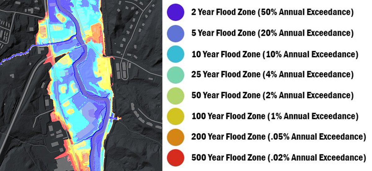
💧💧New Data Release💧💧 We're excited to announce that new lidar derived floodplain data are now available thanks to some amazing work by our partners @uvmvermont#OpenData
https://t.co/nlPiehhfIC
@mberg @vtcraghead Link with the state parks filtered: https://t.co/x5X3CdbQR2 Note - that other outdoor rec sites data might be pretty dusty (although state parks don't change much.) I believe it was a one time project and not actively managed. Metadata: https://t.co/mc13hOSF4a
@mberg @vtcraghead The 'ANR Lands' dataset is probably the best source (filter by ANR Unit type). It's designed for land management - not really park visitor oriented. We'll look into what's feeding the park finder and see if we can get it into the portal. https://t.co/aE4uxkncOJ
After much anticipation, @USGS Landsat 9 products are now available! Download data via EarthExplorer, M2M, and LandsatLook.
🕫 Read the full tech release at https://t.co/cfrlgQ1zmq
Landsat is a joint mission of the @USGS and @NASA_Landsat [🧵1/4]
Do you provide #GIS and GIS-related services for Vermonters? Fill out this survey and help those looking for GIS services in #VT: https://t.co/YGYbRbXd10
How far we've come! A look back at the 2021 GIS work of state agencies and partners in Vermont: https://t.co/Tv7HhpLz0s Thank you for all that you do. #gis#Vermont
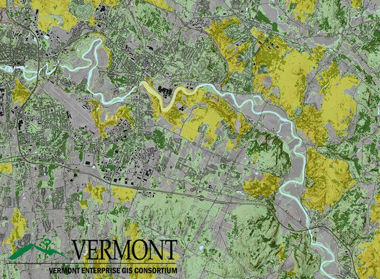
How do you use lidar derived elevation data to create better flood maps? We asked Rebecca Diehl of @UVMGeog@GundInstitute and Kristin Underwood @UVM_CEE https://t.co/6fkcUeQtg0
A great example of what is possible with historical imagery. Dreaming and scheming of something similar here in VT: Iowa statewide, 1930 digitized and orthorectified historical aerial imagery service. AGO Viewer: https://t.co/SinYlOZi9i REST Service: https://t.co/ARcIHNCkGI
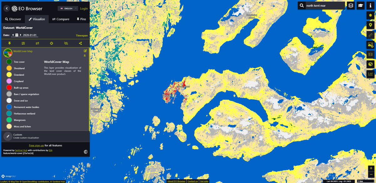
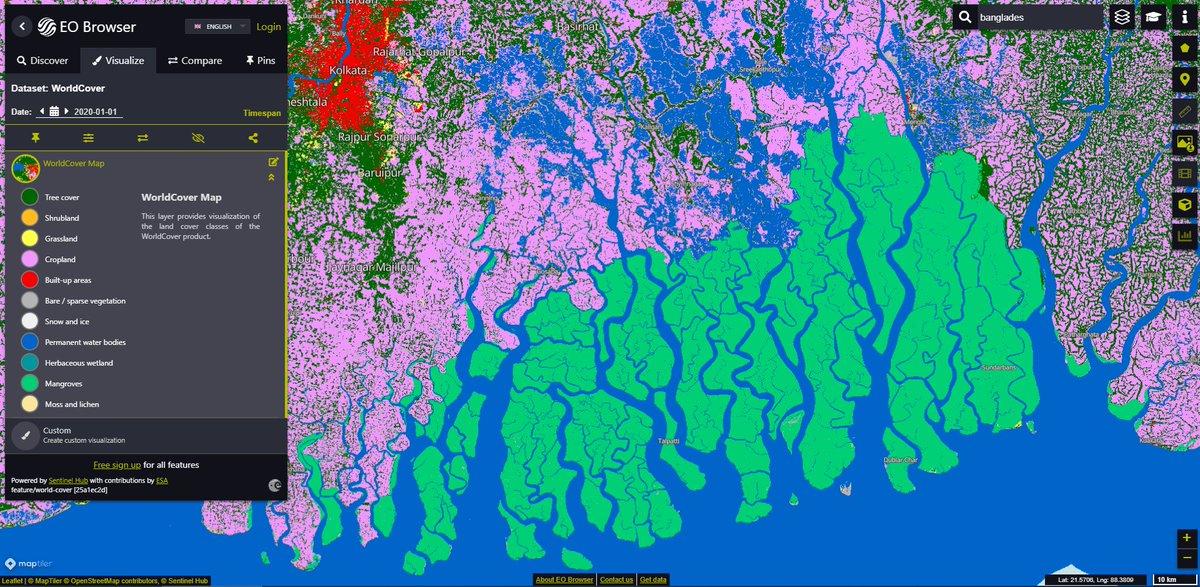
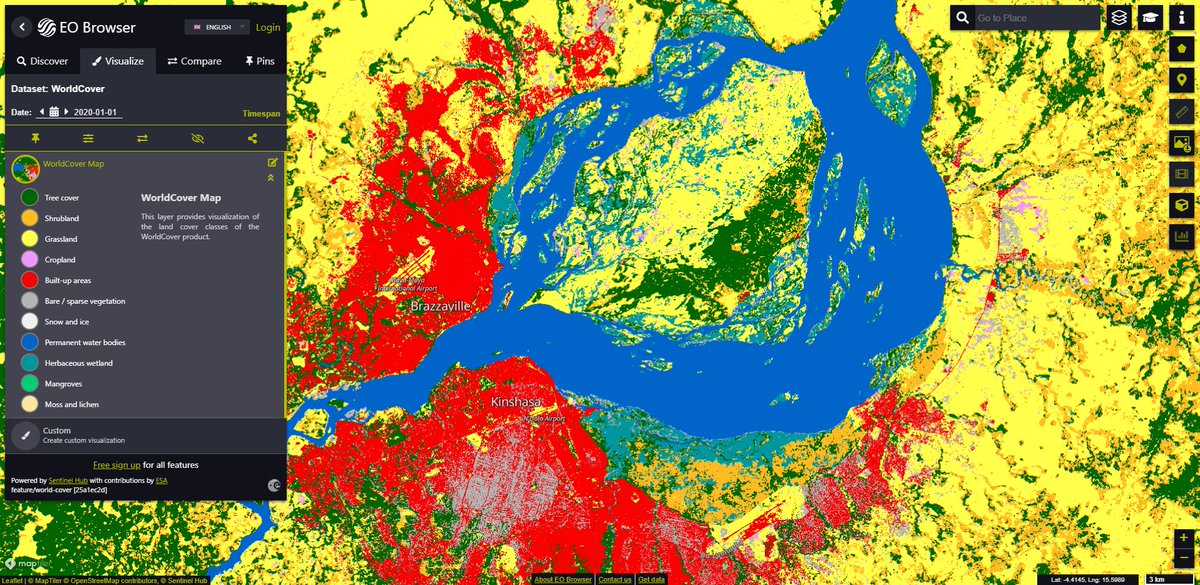
🎉🆕 #WorldCover map 🗺️ at 10 m resolution based on Sentinel-1/2 data is also available in #SentinelHub and #EOBrowser. Only one click away! ➡️ https://t.co/ceOy1Gzzo7
👀 Sentinel Hub Public Collections for more details ➡️ https://t.co/RMaUwxcf8G


![USGSLandsat's tweet photo. After much anticipation, @USGS Landsat 9 products are now available! Download data via EarthExplorer, M2M, and LandsatLook.
🕫 Read the full tech release at https://t.co/cfrlgQ1zmq
Landsat is a joint mission of the @USGS and @NASA_Landsat [🧵1/4] https://t.co/fiJA7De4b4](https://pbs.twimg.com/media/FLQG-b_WYAkoU_-.jpg)