8:54 PM- A Flood Advisory has been issued for western Foard County, where up to 2 inches of rainfall have fallen.
Be sure to avoid any flooded roadways. Turn around, don't drown! #txwx#texomawx
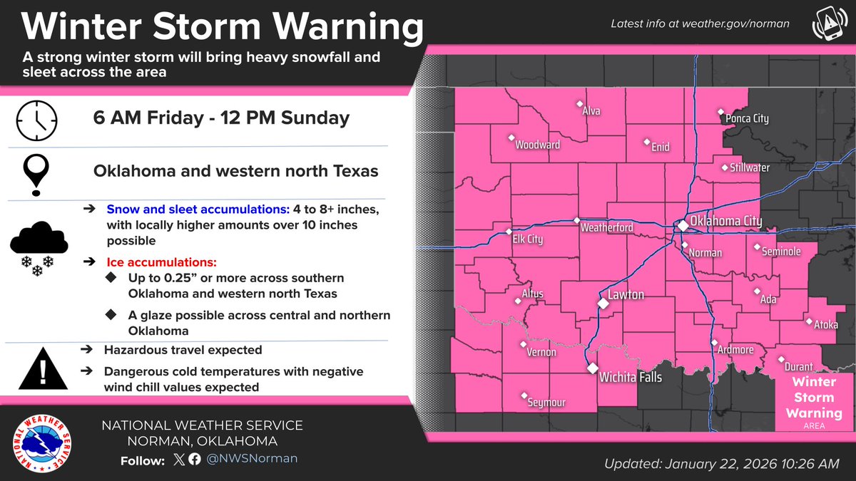
WINTER STORM WARNING
Estimated start times:
- Western OK: FRI morning
- Western north TX & Central OK: Mid-day to early FRI afternoon
- N OK & S OK: Mid-afternoon to early FRI evening
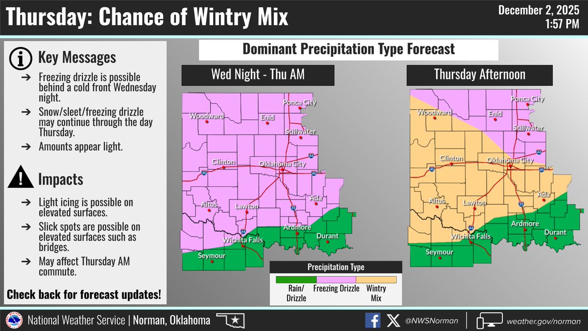
Light wintry mix during the day can lead to travel problems.
#okwx#texomawx
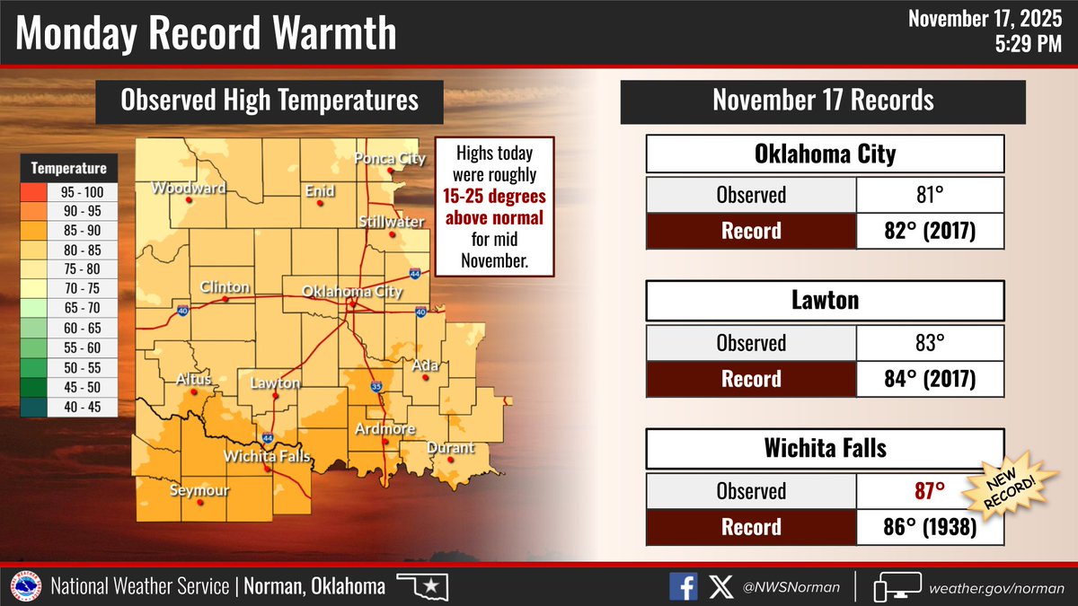
Another warm day is in store for us across the area with near-record temperatures expected. Although it will be much more warmer than normal, it will still be a beautiful day to spend outdoors! #okwx#txwx
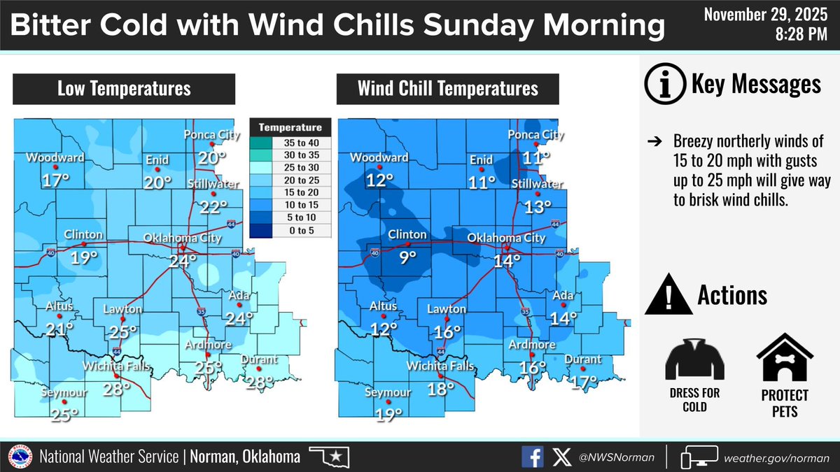
Cold air will continue to move into the area tonight on breezy northerly winds. Temperatures are expected to fall into the teens and 20s with even colder wind chills. #okwx#texomawx
Scattered showers and a few thunderstorms will continue to develop throughout the evening. Better chances of rain will be across south central and southeastern Oklahoma. #okwx#texomawx
Temperatures climbed to record or near-record highs this afternoon, with Wichita Falls setting a new record high temperature for Nov 17th! #okwx#texomawx
All three of our climate sites broke their respective records for high temperatures today! The most impressive was Wichita Falls - high of 88° this afternoon - broke the 1973 record of 84°.
More record heat possible tomorrow..
#okwx#texomawx
Severe storms are still possible across the entire area this afternoon and evening. Tornadoes and significant hail are possible with the initial storms. As storms evolve into a line, significant straight line winds, tornadoes and flooding will be the main hazards. #okwx#txwx