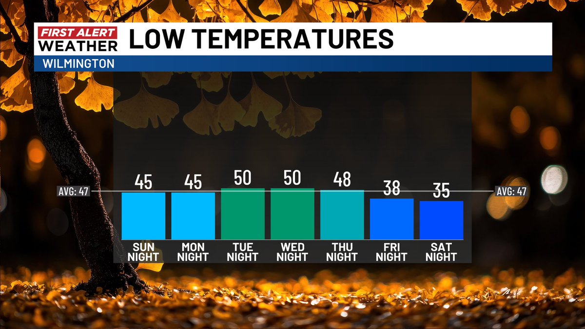
The Cape Fear's next batch of chilly air will slide in on breezy to blustery winds. Weekend frost formation will hinge on whether these winds slacken enough in the nights; temps certainly look like they'll get cold enough.
The Cape Fear's first widespread fall frosts are possible this weekend. Still a couple of boxes to check but, if you're a gardener, this should be on your radar at least.
The second week of November will certainly be more refrigerated than the first. By next weekend, there's even the potential for the Cape Fear's first widespread frost of the season. Lots of great fall weather to enjoy!
During one of our late summer heat waves, I recall watching the sun rise directly over the Cape Fear Bridge from this camera. On this November 8, both the sunrise direction and the temperature have shifted about 40 degrees lower!
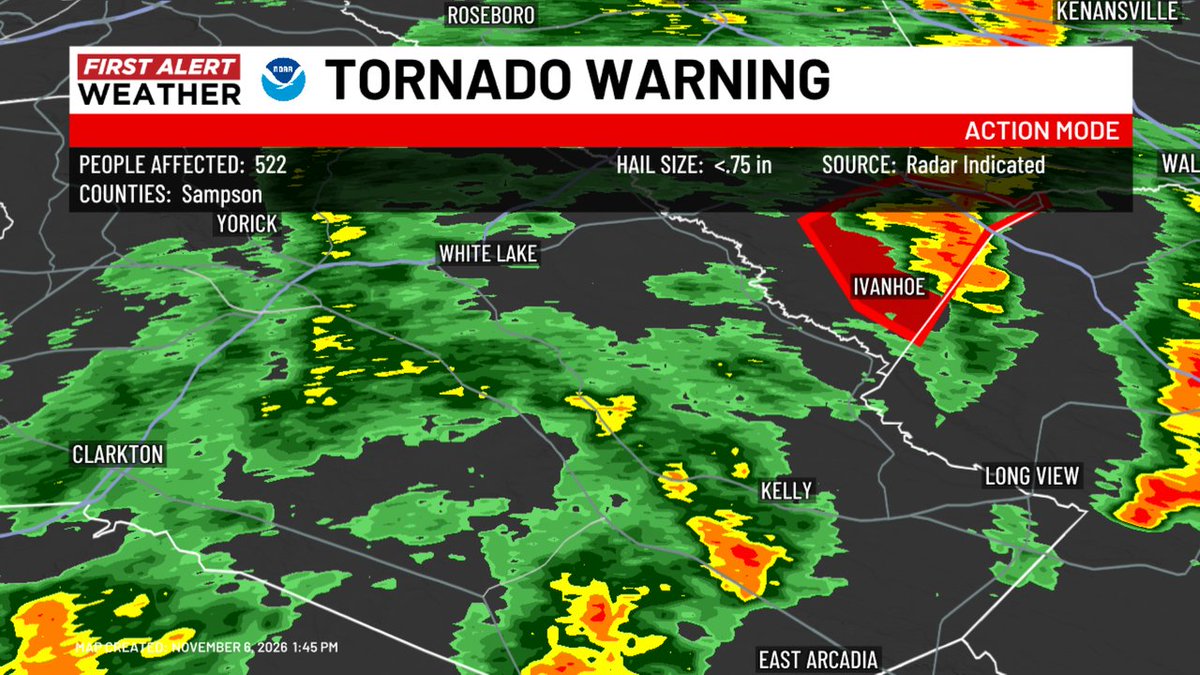
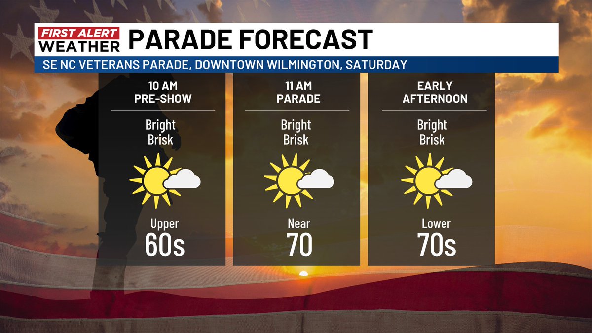
Showers and storms continue their march across the Cape Fear this Friday. Some cells may exhibit gusty winds and brief rotation through sunset. Careful braking on wet leaves and oily pavement (it hasn't rained much if at all in three weeks). Gorgeous weekend follows this line
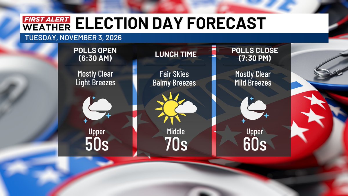
Rain chances will perk up this week, but the system in question is looking a bit disjointed so they're not 100%. Dry or mostly dry through Election Tuesday in any case...
Tuesday will make ten straight dry days in the Cape Fear, and rain chances will stay slim right through Halloween. NOAA's early November outlook, however, leans wetter at home and across the southern two-thirds of the nation collectively. Very El Ninoy...
Low pressure set to form off the Outer Banks is generating a worthy buzz, especially as its track may be erratic. For now I expect the low's main impacts to stay east of the Cape Fear Region, unless you count a persistent north breeze. We'll watch this feature all next week.
Windswept and colder raindrops on this First Alert Weather Day Saturday! Though the chances of rain will be high, rain rates will stay on the lighter to moderate side and there's no risk of severe storms.