Temperatures will get chilly for some overnight, as the Mountain Emipre and Highlands drop into the 40s. Temperatures will fall into the 50s elsewhere.
#vawx
Afternoon temperatures will be warm this Monday, but not as hot as what Southwest and Central Virginia has experienced recently. Highs will be in the 70s and lower 80s.
#vawx
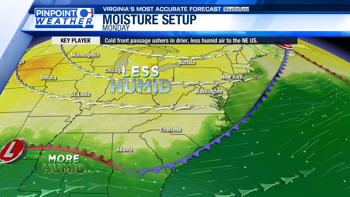
Northwesterly flow will carry cool, drier air into Southwest and Central Virginia on Monday, leading to lower humidity levels. It will feel more comfortable outside on Monday and Tuesday, with increasing moisture expected by Thursday.
#vawx
For Southwest and Central Virginia, morning temperatures will range from the upper 50s to the lower 70s on Monday. It will be a dry start to the day, with a mix of sun and clouds overhead.
#vawx
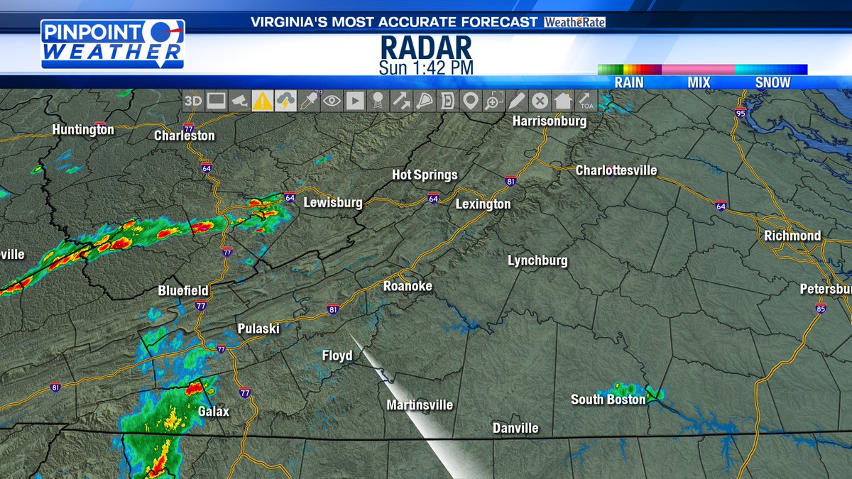
A Severe T'Storm Warning has been issued for the eastern portion of Appomattox co. Wind gusts up to 60 mph and 1" hail are possible as the storm tracks to the northeast.
#vawx
A Severe Thunderstorm Watch has been issued for those generally along and east of the Blue Ridge until 11 PM. Scattered storms may become strong to severe with damaging wind gusts as high as 60-70 mph possible. Isolated large hail cannot be ruled out either.
#vawx
Storm activity is expected to increase over the Blue Ridge and points east this afternoon and into the evening. With an unstable airmass in place, the severe risk will increase with damaging wind gusts being the main threat. A Severe T'Storm Watch is likely.
#vawx
A Severe T'Storm Warning has been issued for portions of Alleghany, Bath, Botetourt, & Rockbridge counties including the City of Covington. Wind gusts up to 60 mph and 1" hail are possible as the storm tracks to the east-northeast.
#vawx
A strong storm is moving east-northeast across Alleghany co. toward the city of Covington. Gusty winds up to 40 mph and peas sized hail are possible.
#vawx
Temperatures have returned to the 80s and low 90s this afternoon for most. With humidity rising, heat index values are in the upper over Southside. Some rain is moving into parts of the NRV as well. Expect more storms to develop through the afternoon and evening.
#vawx
Good Sunday morning! Today will again be hot and a touch more humid with high temperatures in the 80s to lower 90s.
A cold front arrives today sparking scattered showers and storms in the afternoon and evening. Some storms may be severe with damaging wind gusts.
#vawx
Before the rain arrives tomorrow, it will get hot outside with highs in the 80s to low 90s. Humidity does increase some, so heat index values will be elevated.
#vawx