12 years ago 🕘
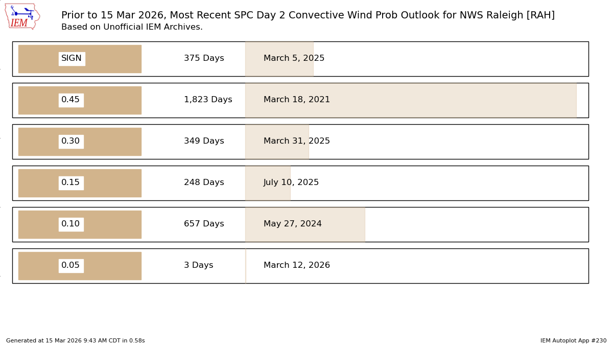
Digging through the warning history, the Feb 2014 storm was the last time all 7 NWS offices serving NC issued Winter Storm Warnings for one event. A couple AKQ counties missed out, Glennwood Ave… did not. #wxtwitter#ncwx
The @NWSEMC released an AI version of the GFS model and its ensemble system, based on GraphCast. This is NOAA's first operational foray into the era of machine-learning based weather prediction.
Plots for AIGFS are now available on Tropical Tidbits: https://t.co/zmpk2ZWC3c
I will eventually integrate some AI-GEFS products as well.
Read more about NOAA's new generation of AI models here:
https://t.co/67ULNkA4Gh
WOAH! The incredibly rare ORANGE aurora!
Auroras aren't "supposed" to be orange, since emission doesn't happen at that wavelength.
Instead, we're likely looking up at high-altitude auroras emitting at 630.0 nanometers, or red, overlapping with lower greens at 557.7 nanometers.
This evening's trace of snow in #Charlotte ties for the 5th-earliest on record and the earliest since 1991. ❄️ The earliest measurable snowfall on record, which is 0.10" or more, was on Nov 11th, 1968. #snOMG#cltwx#ncwx#wcnc
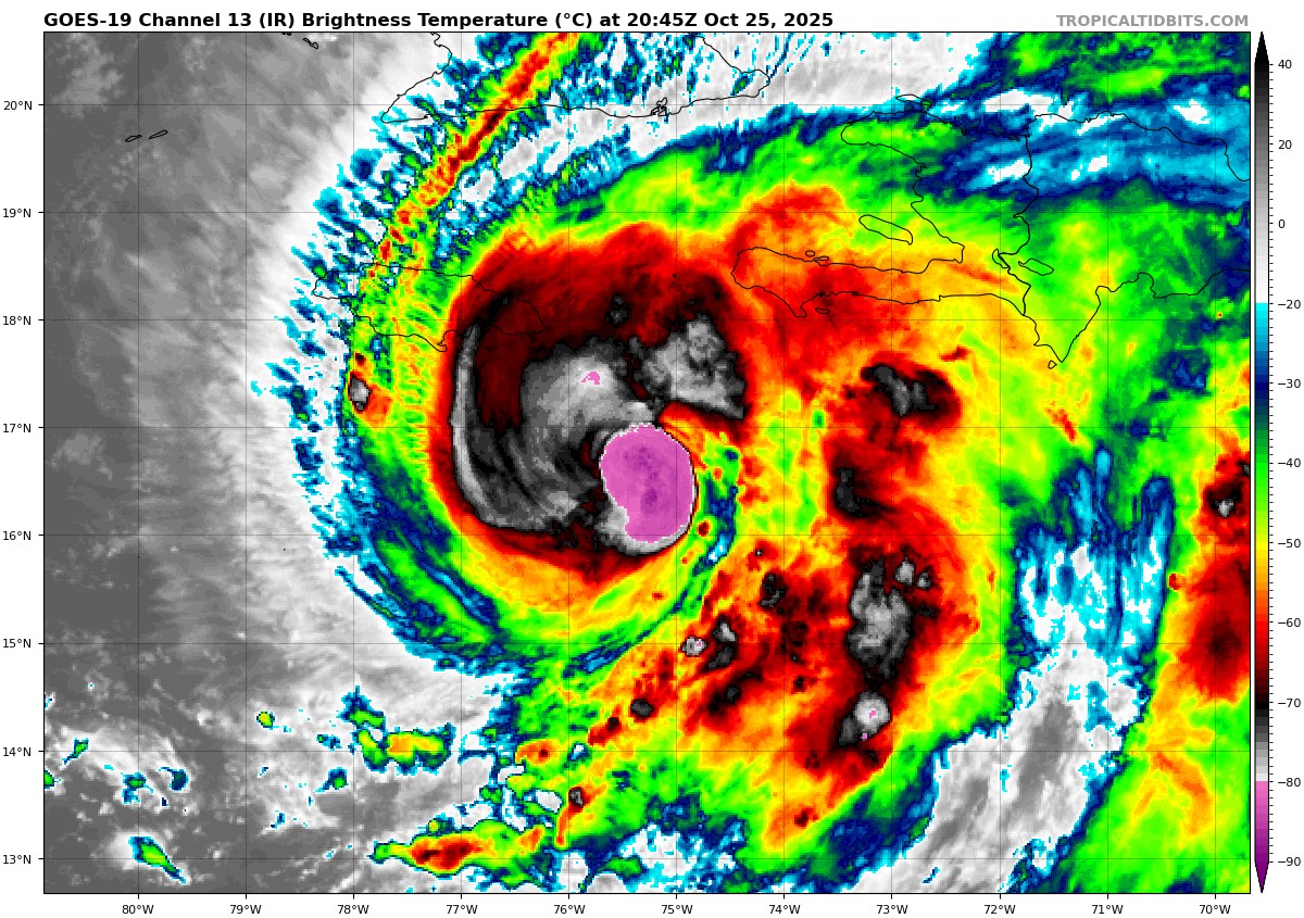
UNBELIEVABLE. ADT estimates put #MELISSA at T8.3 — one of the highest ever observed in the Atlantic. Satellite presentations don’t get much better than this in the Atlantic.
We’re witnessing history on satellite right now. MELISSA likely nearing/at Category 5 status.
BREAKING:
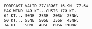
The National Hurricane Center has released their 5:00 PM (2100z) update on Hurricane #Melissa. Current peak intensity forecast suggests that Melissa likely reach of peak of Category 5 on October 27th, with sustained winds of 140 kt (160 mph)!
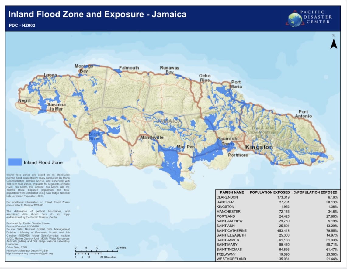
Jamaica Residents:
This is a great share. This is the 100-year flood map for riverine flooding.
If you live in a flood plain highlighted in blue, I urge you to consider relocating elsewhere for the duration of #Melissa.
If you know anyone who lives in these areas, alert them.
The interplay between #93L and #94L is gonna be interesting. Normally the lead system in the Atlantic is the more organized one, but in this case the eastern one (#93L) is. Yet you can tell shear from #94L is still impacting #93L on the west side.
Will these two systems really be able to maintain enough separation such that both can grow into formidable hurricanes, like models tonight suggest?
Usually with Fujiwhara events one system dominates and absorbs the other. Will models trend towards that?
Lots to sort out.
This is an unbelievable satellite loop. It looks like Babuyan Island will be taking a direct hit from this Category 5 monster. Anyone on the island will bear witness to the most unreal stadium effect. #RAGASA
UPDATE: Category 5 Super Typhoon Ragasa (NandoPH) has just hit a new peak intensity of 180 MPH sustained winds and a minimum central pressure of 905 MBAR.
This intensity is approaching the upper limits of what Earth is capable of producing.
The West Pacific has come alive with 2 active typhoons. Embedded in favorable conditions, both should intensify to 100kt+, having formed inner cores and clearing eyes. Areas from Northern Luzon to Taiwan will need to watch for a stronger #Ragasa while #Neoguri is not a major land threat for now