@TranBC These roads have been upgraded on our map during the Hwy 97 closure.
Users must enable use of unpaved roads in Settings (⚙️) -> Navigation in order to receive these routes.
Please drive safely, and turn on your headlights for visibility! ^as
@CO_Emerg The @Waze Crisis Team and local volunteer map editors are actively scanning for information on evacuation zones, related road closures, and emergency shelter information to help keep our users safe.
@DriveBC Could you provide clarity on where the "Brunette Ave entrance ramp" is? Trying to differentiate from the southbound Brunette exit ramp. Thanks ^jc
@SurreyTraffic We've noted your online road closure notifications have been discontinued. https://t.co/ATmdZUndj1
Is there a new way to find road closures in Surrey? Thanks
@1CanadaConsumer@wazeCANADA@wazeUSA@googlemaps@Uber Sorry for the late reply. This isn't a new feature. If you ignore the Where To? prompt , the app runs on your phone screen and you can see the map, traffic jams, police, railway crossings, etc. as you drive without any turn instructions or voice prompts.
@511ONCentral Can you explain the upcoming nightly closure on your website at 401 and 404? Which road segment is actually closed? There are 3 active lanes on 401W Express at 404, but only one in the closure details. Or did you mean the ramp from 404 to 401W Express?
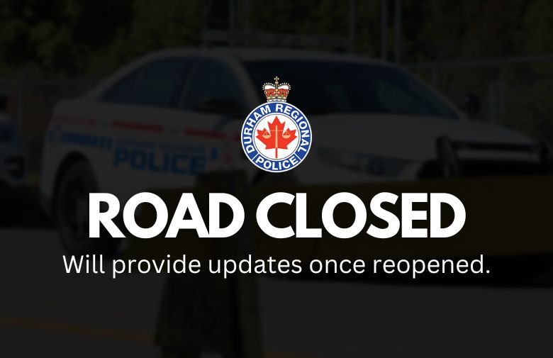
Police are on scene at Taunton Rd E and Harmony Rd N in Oshawa for a collision investigation. The intersection will be closed for a period of time. Please avoid the area and consider alternate routes.
Updates to follow.