🥵 Hot weather returns to Iowa this weekend!
Starting Sunday, temperatures will heat up across much of the state, with highs climbing into the upper 80s and 90s. The heat looks to continue into Monday, when many areas could see low to mid 90s and elevated HeatRisk. 🌡️☀️
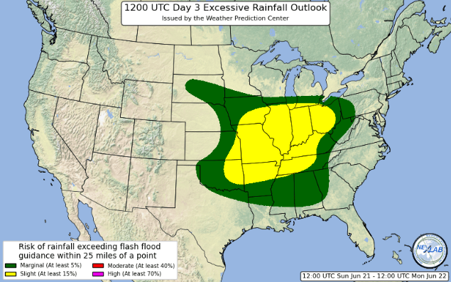
🌧️ Showers and storms will ramp up later this evening and continue into Wednesday morning as a cold front sweeps southeast across Iowa. ⚡
#WeatherIowa#IAwx#IowaWeather
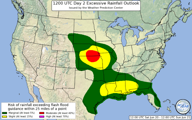
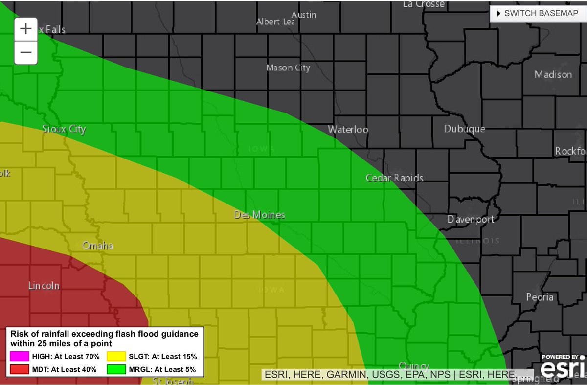
Heavy rain is looking possible this weekend, especially Saturday night into Sunday and again later Sunday. Areas across southern Iowa, especially closer to the Missouri border, could see several inches of rain in spots. ⛈️💧
🌪️🚨 The Storm Prediction Center has issued a Tornado Watch for portions of:
📍 Southeast Iowa
📍 Far west-central Illinois
📍 Northeast Missouri
⏰ Effective 4:00 PM until 11:00 PM CDT this Wednesday afternoon and evening.
The National Weather Service in Des Moines has issued a Tornado Warning for parts of south central Iowa, including: 📍 Southeastern Lucas County 📍 Northeastern Decatur County 📍 Northern Wayne County ⏰ Until 4:30 PM CDT
The National Weather Service in Des Moines has issued a Severe Thunderstorm Warning for parts of south central Iowa, including:
📍 Lucas County
📍 Western Monroe County
📍 Southern Marion County
📍 Southeastern Clarke County
⏰ Until 4:00 PM CDT
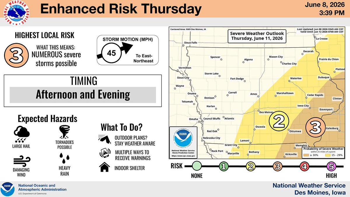
The National Weather Service has placed parts of Iowa under an Enhanced Risk — Level 3 out of 5 — for severe weather today and again Thursday. 🟠⚠️ The highest risk today is across eastern and southern Iowa, with the main round expected this afternoon into the evening. 🕓🌆
⚠️Heat, Storms & Heavy Rain This Week ⚠️
We’re looking at a very active weather pattern across Iowa this week, with summer heat, multiple rounds of storms, and heavy rain possible. 🌡️⛈️
🐾 A friendly reminder from Magnolia 🐾
With highs expected to climb into the 90s on Tuesday and Wednesday, Magnolia wants to remind everyone to take good care of their pets during the heat! ☀️🐶
🔥🥵 Hot weather is on the way for Iowa! 🥵🔥
Tuesday and Wednesday are looking very hot and humid, with afternoon heat index values climbing into the upper 90s to low/mid 100s across much of the state.