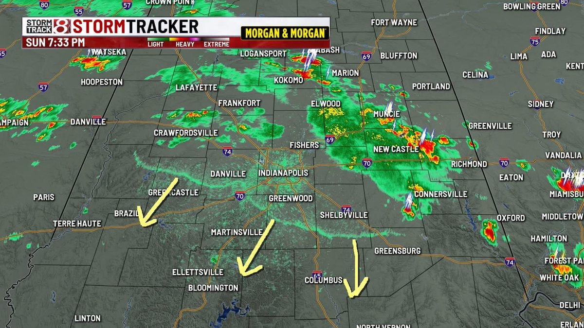
7:30 PM SUNDAY: an outflow boundary is moving from N to S across Central Indiana. This may bring refreshing breezes to areas south of Indy that have been so warm & humid all day long.
#inwx https://t.co/45Aqi6Xgu3
3:45 PM SUNDAY: the storms north of Indy are slow moving. They are producing torrential rain that may lead to more flooding over the coming hours.
#inwx https://t.co/45Aqi6Xgu3
BLINDING RAIN: this is the view along I-65 just south of Lebanon as of 3 PM as a gully washer of a storm meanders over this area.
#inwx https://t.co/45Aqi6Xgu3
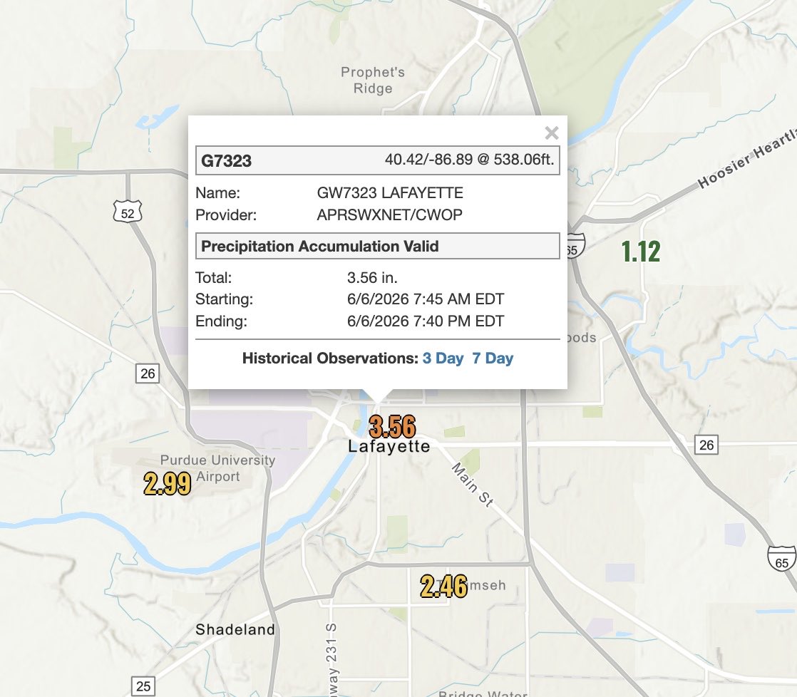
9:30 PM SATURDAY 6-6: flash flood warnings have been issued for the areas west of Crawfordsville. Radar estimates 4-5”+ in some areas and actual measurements in the surrounding areas are near 3.5”. #inwx
A G3 geomagnetic storm Watch has been issued for 8 Jun, and a G2 geomagnetic storm Watch has been issued for 9 Jun for the anticipated arrival of the CME that left the Sun on 6 Jun. Stay tuned for updates!
T-STORM WATCH until 10 PM for parts of Central Indiana. Large hail, damaging wind gusts, torrential rainfall, and dangerous lightning remain possible with any storm that develops today. #inwx
T-STORM WARNING until 4:15 PM for this batch of storms near Lafayette. This storm is also producing torrential rainfall and dangerous lightning. Almost 2” of rain has fallen at the Lafayette airport. #inwx
T-STORM WARNING until 3:30 PM for this storm near Lafayette. 1” hail, gusty winds, and torrential rainfall is possible in addition to frequent lightning.
FLOODING THREAT THIS AFTERNOON: developing storms with heavy rain potential could produce areas of flooding this afternoon in this juiced up atmosphere. (Posted 230 PM 6-6-26) #inwx
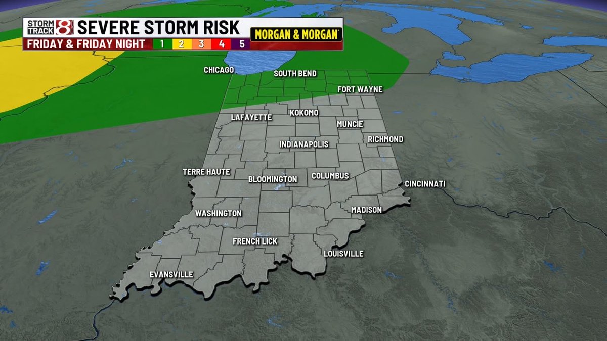
3:20 PM FRIDAY: the best chance of a few showers/storms this evening is going to remain north of Central Indiana it appears. Most of us will enjoy a warm and quiet Friday evening.
#inwx https://t.co/45Aqi6Xgu3
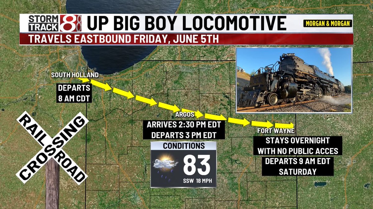
The @UnionPacific Big Boy locomotive will be moving across Northern Indiana on Friday. Conditions are looking pretty good overall but some rain/storms could be around during the afternoon hours.
#inwx
FUTURECAST: quiet and mild tonight with lows in the 60s. Breezy & warm on Friday with a chance of showers & storms across NW & N Indiana. Most of Central Indiana looks like it'll remain dry.
#inwx https://t.co/45Aqi6Xgu3
12:45 PM THURSDAY (6-4): we have a lot more puffy cumulus clouds developing today as compared to the last few days. This is a sign of moisture moving back into Indiana. #inwx