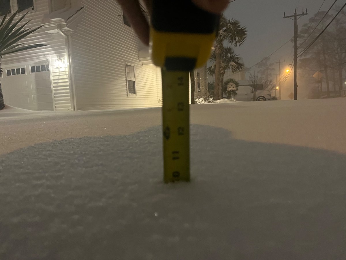
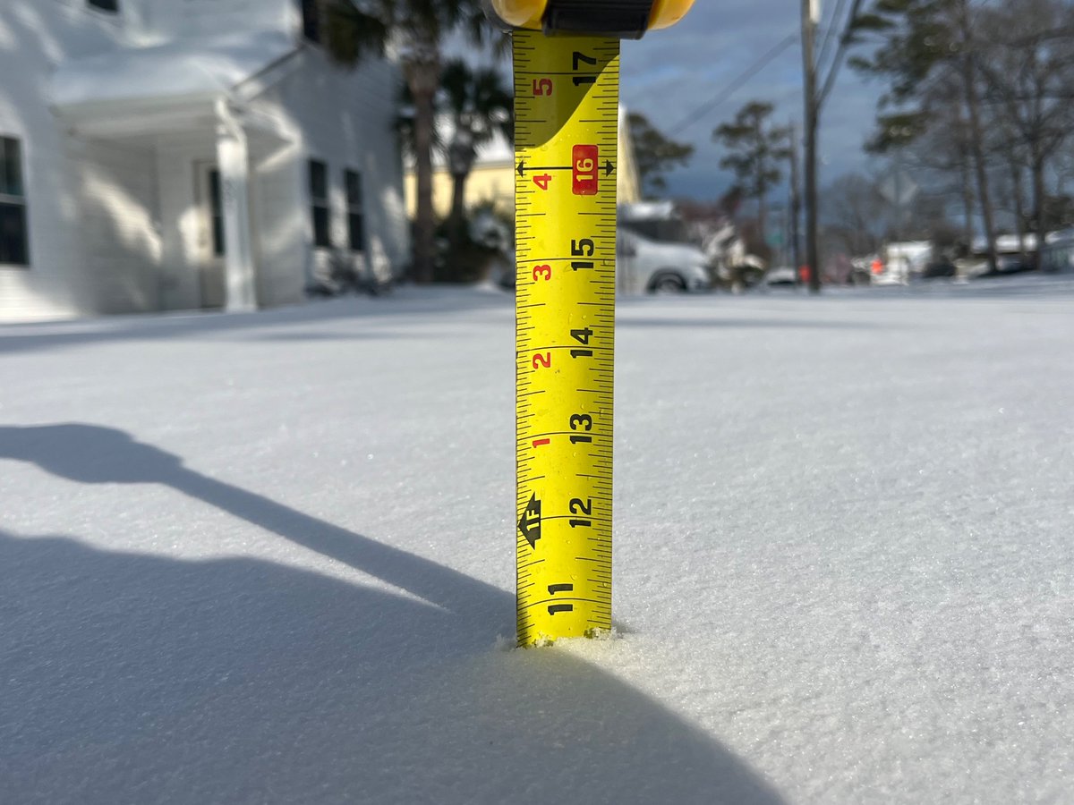
Things are picking up at the oceanfront, snow is becoming heavier and visibility is significantly reduced from blowing snow. Interested as to how long these bands hang around, which will determine snow totals. #Vawx@NWSWakefieldVA
Am I the only one who thinks this party is going to get started a little early? Already seeing some signs of lift/moisture being thrown into the cold air mass from the low offshore, things could get going earlier than most think after seeing this. #Scwx#Ncwx
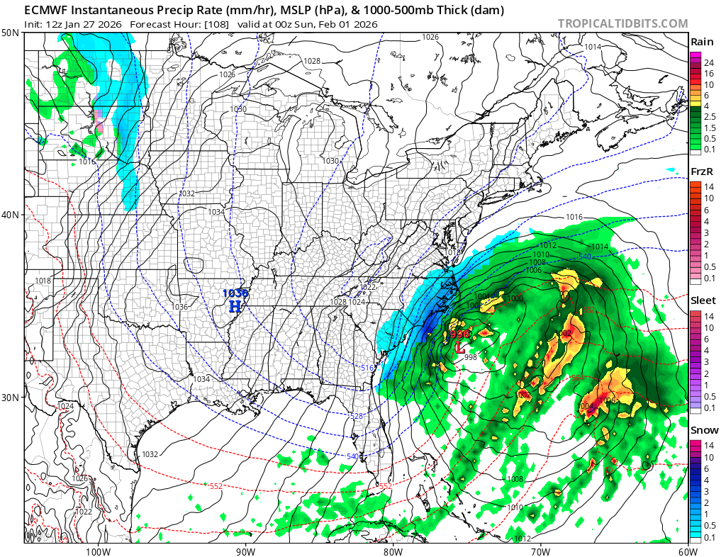
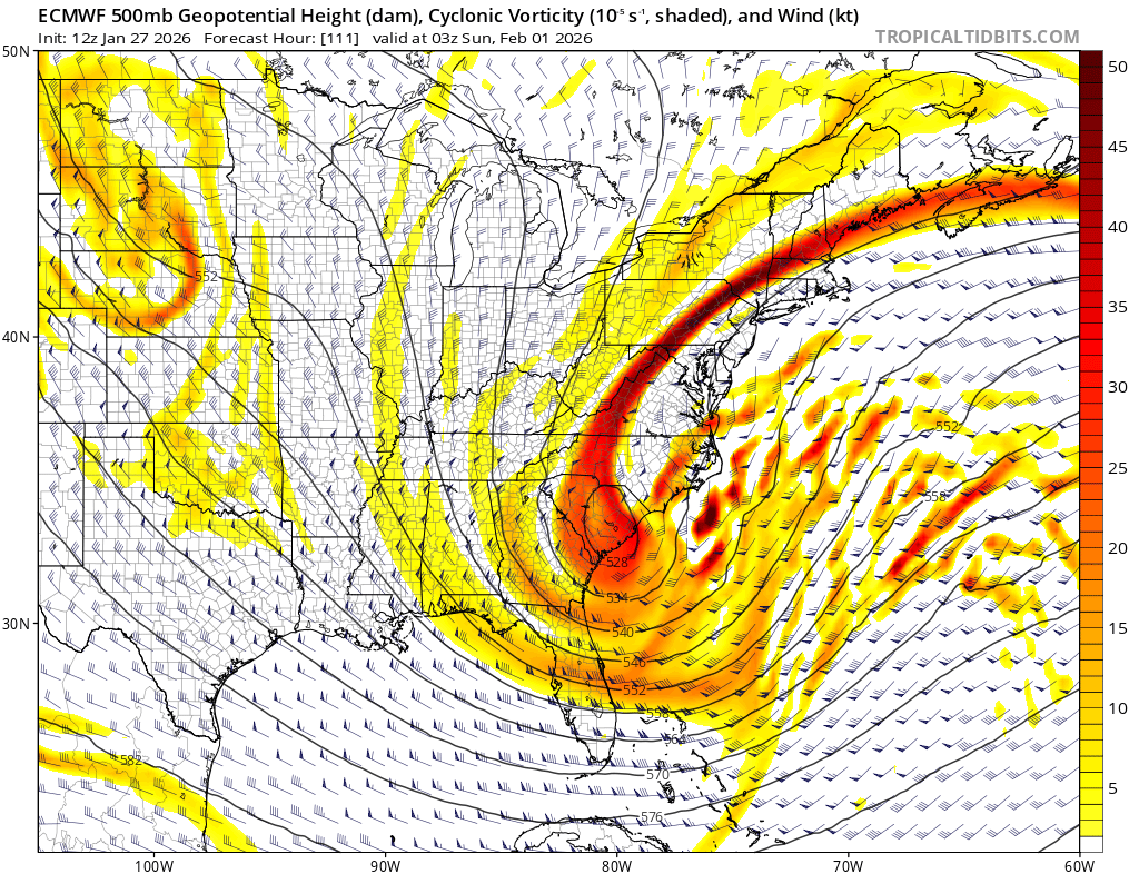
Not sure if you could get a better look for a significant winter storm across the Mid-Atlantic (parts of NC/SC as well). The forecasted storm, which is now 4-5 days out on the EURO, positioned roughly 100 miles Southeast of Cape Hatteras. You can bet on that NW trend around here.
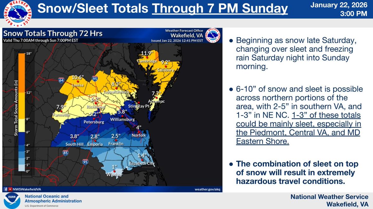
Here's the latest forecast for snow and sleet through Sunday evening. We expect snow to start late on Saturday changing over to mixed precip Saturday night into Sunday. The combination of sleet on top of snow will result in extremely hazardous travel conditions.
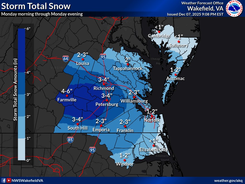
The upward trend continues with snow totals and 3-6" is now expected for portions of central & eastern VA. Winter Storm Warnings have been issued for portions of the Piedmont & Richmond metro/Tri-Cities. A Winter Weather Advisory is in effect elsewhere, except the MD East. Shore.
Galatians 2:20- "I have been crucified with Christ and I no longer live, but Christ lives in me. The life I now live in the body, I live by faith in the Son of God, who loved me and gave himself for me."
Jesus loves YOU so much he gave his life so you could walk eternally.
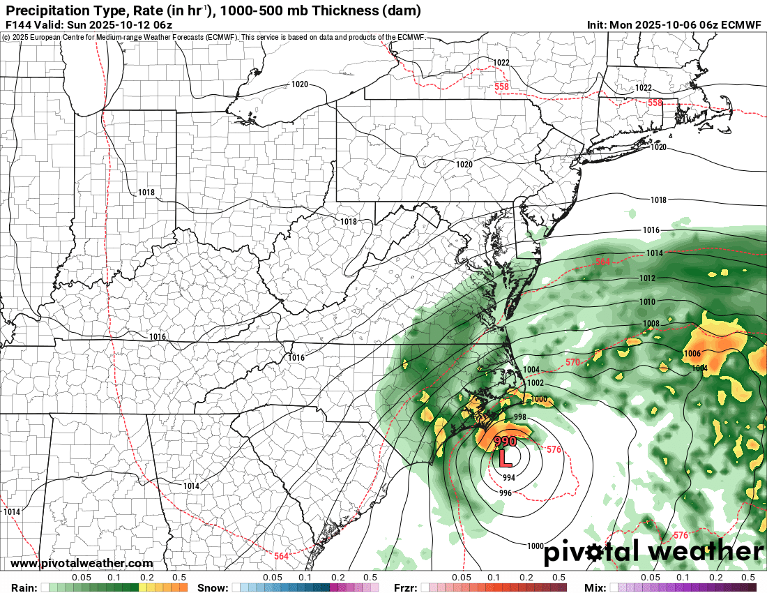
Tropical or not, that is one heck of a storm potential brewing off the coast of the Carolinas. Everyone up the Eastern coastline needs to watch this one.
Latest 06z Euro below showing a 990 mb low & the storm is still going. Expect this to become a bigger weather topic over the next 24 hours if trends continue. This could cause issues for the Outer banks this weekend.. but could also bring widespread impacts further North up the coast.
Streets flooded in several neighborhoods throughout Virginia Beach. This is just from heavy rainfall thus far. With high tide at 5:30pm and more heavy rain on the way, this will likely get worse. @weatherchannel
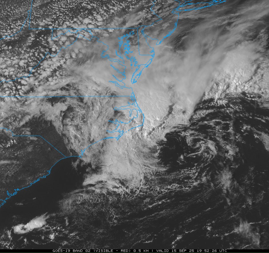
@darin_deveauWX Yes, I agree I think this could take most people by surprise. CAMs nearly stall the center of the low just offshore w/ very heavy bands training over VB/Norfolk. Have already had some gusts over 50 at Cape Henry too.
Coastal low really starting to ramp up along the beach fronts. We'll see how high we can get at the Cape. Wind advisory for gusts to 40, already seeing 50+. #Vawx
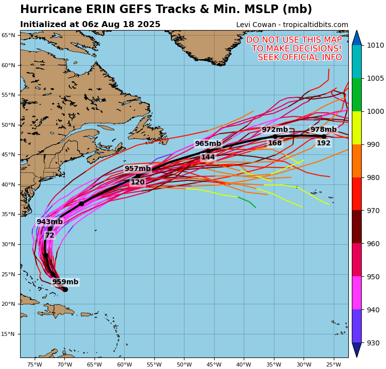
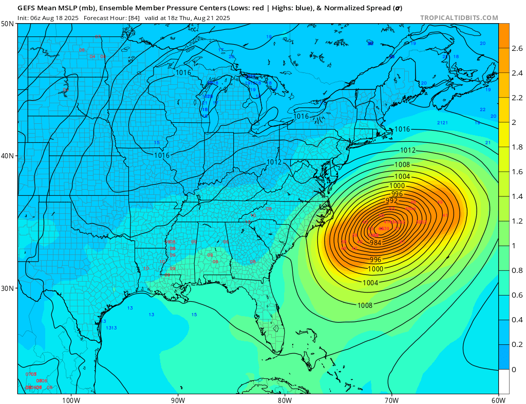
With these members alone, you can already expect significant impacts to the OBX. However, models continue to slow to timing of the trough, allowing #Erin to creep further west. The more west the storm goes, even barely, impacts significantly increase. Not the best situation.