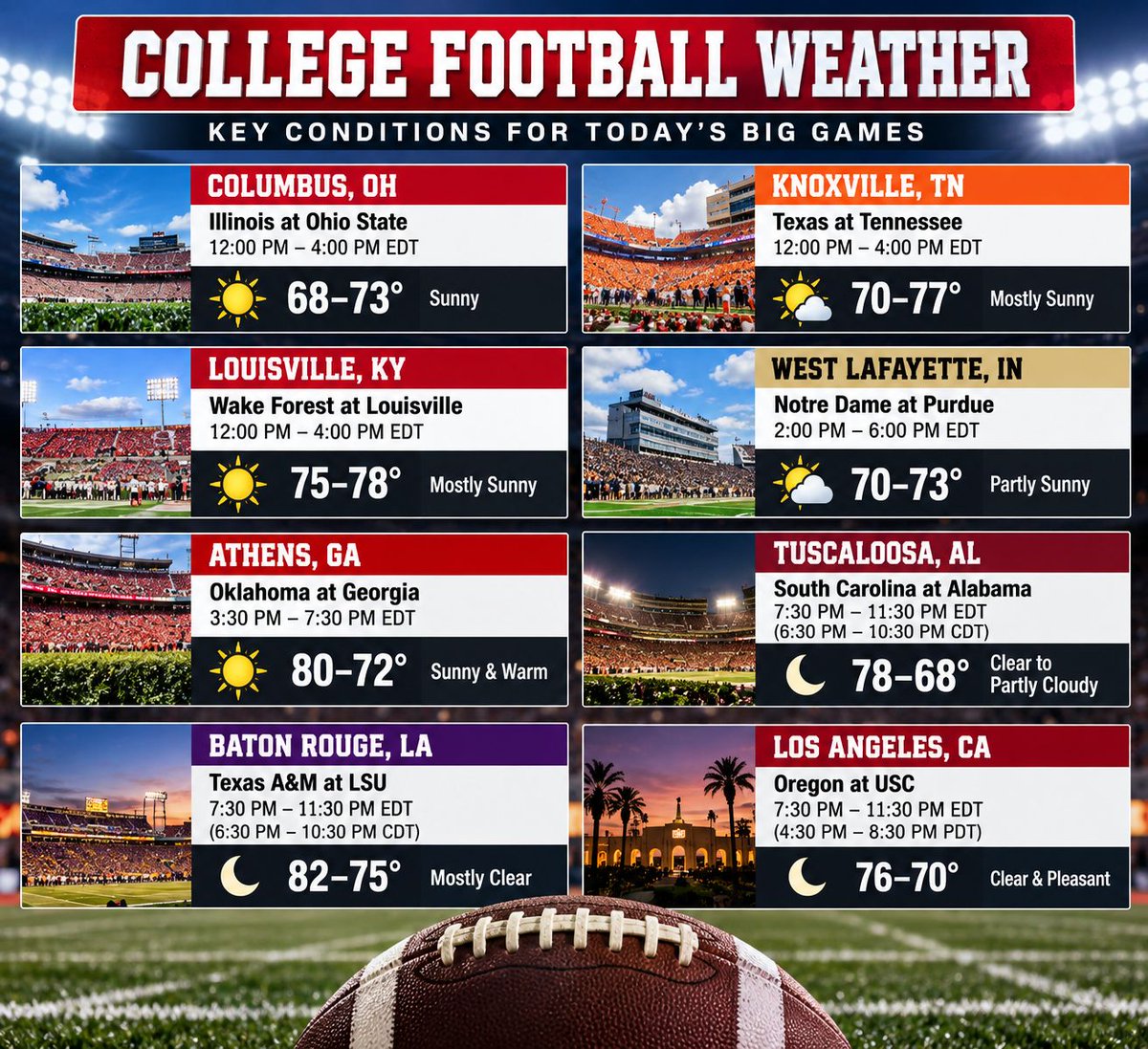
Are you ready for some football today?
We’ve got a GREAT Saturday of college football ahead, and the weather is looking pretty nice for many of the biggest games across the country.
Who are you watching today?
Don't get used to these cool, Fall temperatures just yet. We are expecting warmer than average temperatures to return over the next couple of weeks. The 80's are not out of the question in early October this year!
What we will be watching...
The main weather concern is today into Monday: thunderstorms and locally heavy rain as the front crosses Indiana.
And the temperature change is substantial.
Fall officially arrives this week, and the weather will cooperate!
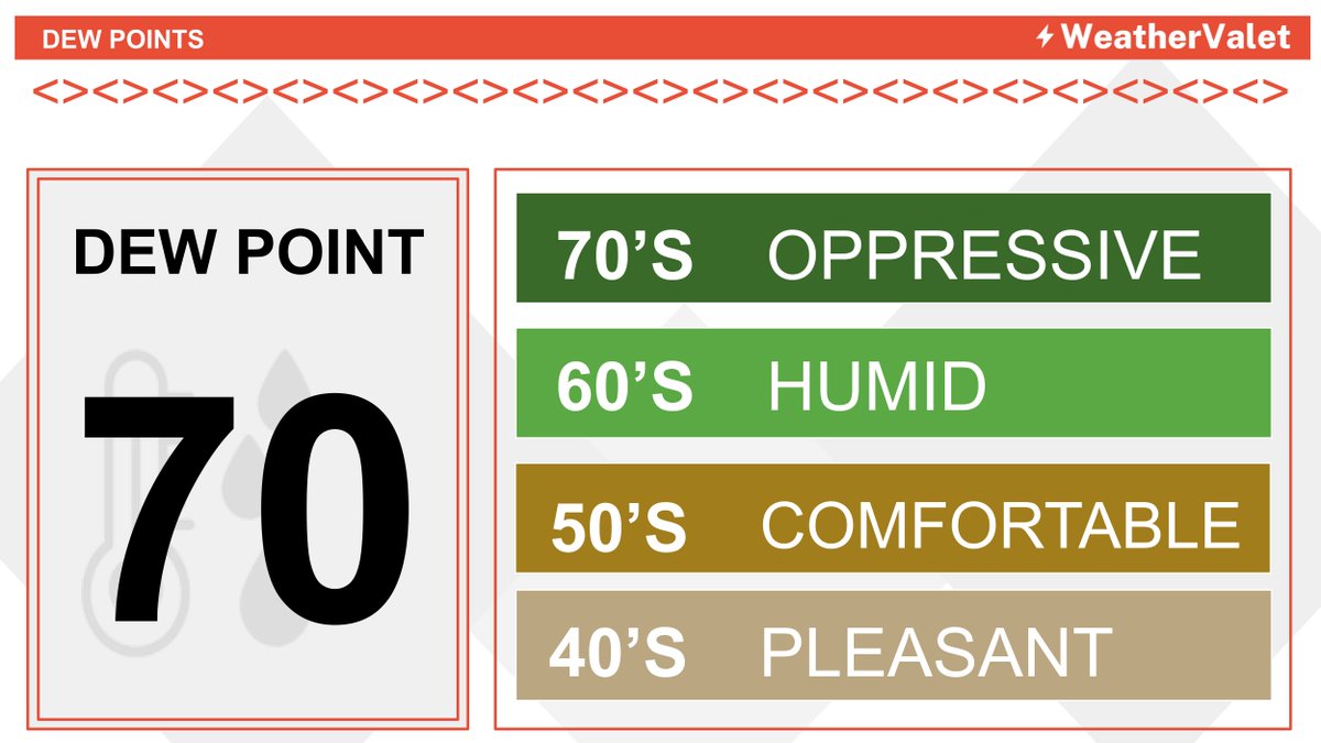
After a stunning Labor Day, we will heat up and increase humidity levels until our next cold front moves through. Expect a hot and humid Tuesday & Wednesday.
Thunderstorms will make a return on Wednesday into Thursday as the cold front moves through our state.
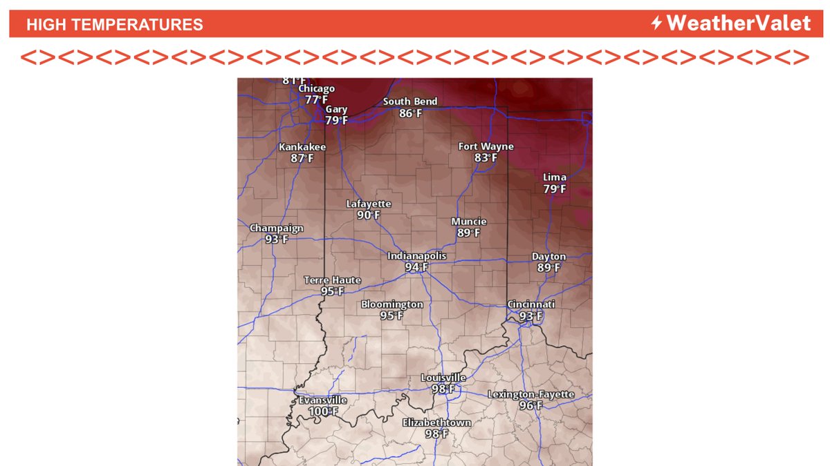
A cold front moves through Indiana during the course of the day. A Heat Advisory is still in effect for central and southern Indiana with heat indexes above 100 this afternoon. Isolated showers and thunderstorms are possible throughout the day, but most people will stay dry.
Another chance for severe thunderstorms in Northeastern Indiana today. Damaging winds will be the main threat with these storms. If you're in Fort Wayne, South Bend, or anywhere Northeast, be weather aware for a few storms in the area later today.
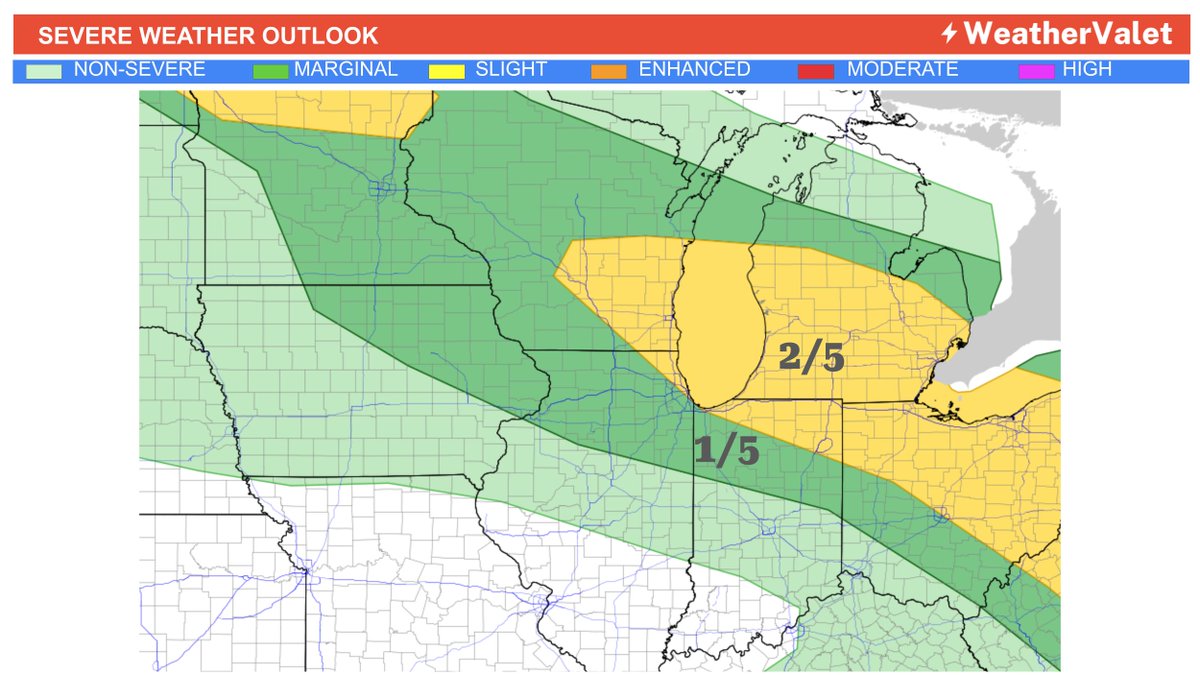
Northern and Northeastern Indiana under a Slight Risk (2 of 5) for severe thunderstorms today. Damaging winds is the primary threat. Storms will move through this afternoon until the early evening hours.
Extreme Heat is expected again today for much of Indiana. Expect a little higher humidity as well. This heat will peak tomorrow and you'll feel true relief come Sunday when winds shift to the north/northwest behind the cold front. Hang in there!
It’s going to be a HOT one in Bloomington Saturday!
Indiana kicks off at noon, with temps expected to climb during the game and potentially approach 90° by the final whistle.
The hottest kickoff temperature we’ve been able to document at Memorial Stadium is 91°, set in 2015.
Could Friday night be one of the hottest Purdue football games ever?
Purdue kicks off at 7 PM Friday at Ross-Ade Stadium, and temperatures could still be near 90° at kickoff.
The hottest kickoff temperature we’ve been able to document at Ross-Ade is 90°, set back in 2011.
Are you ready for the summertime heat & humidity to return?
You will feel it this week when you step outside. Be sure to take care of yourself if you need to be outside. Expect extreme heat conditions if you have to be outside for a prolonged period of time.
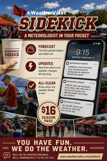
Saturday in Bloomington. Focus on your day, not your weather app!
A real Meteorologist is on call all day. Live text messages with weather info.
WeatherValet Sidekick: $5 for the day, $16 for the season.
https://t.co/6b12rtT2Sp
Not affiliated with any school or venue.
Start hydrating now!
Wednesday looks dangerously hot across Indiana, with the greatest heat concerns across western and southwestern portions of the state. Limit prolonged outdoor activity, stay hydrated, and take frequent breaks in air conditioning. Plan ahead.
Severe Weather Possible Wednesday:
A cold front moving through tomorrow afternoon and evening brings a renewed risk for scattered severe storms across parts of Indiana.
Keep your weather alerts turned on tomorrow afternoon!
Severe weather is possible Wednesday afternoon through the evening hours with all modes of severe weather possible. Damaging winds and large hail are the main threats, but also a threat for tornadoes. We'll be watching this develop and keep you updated.
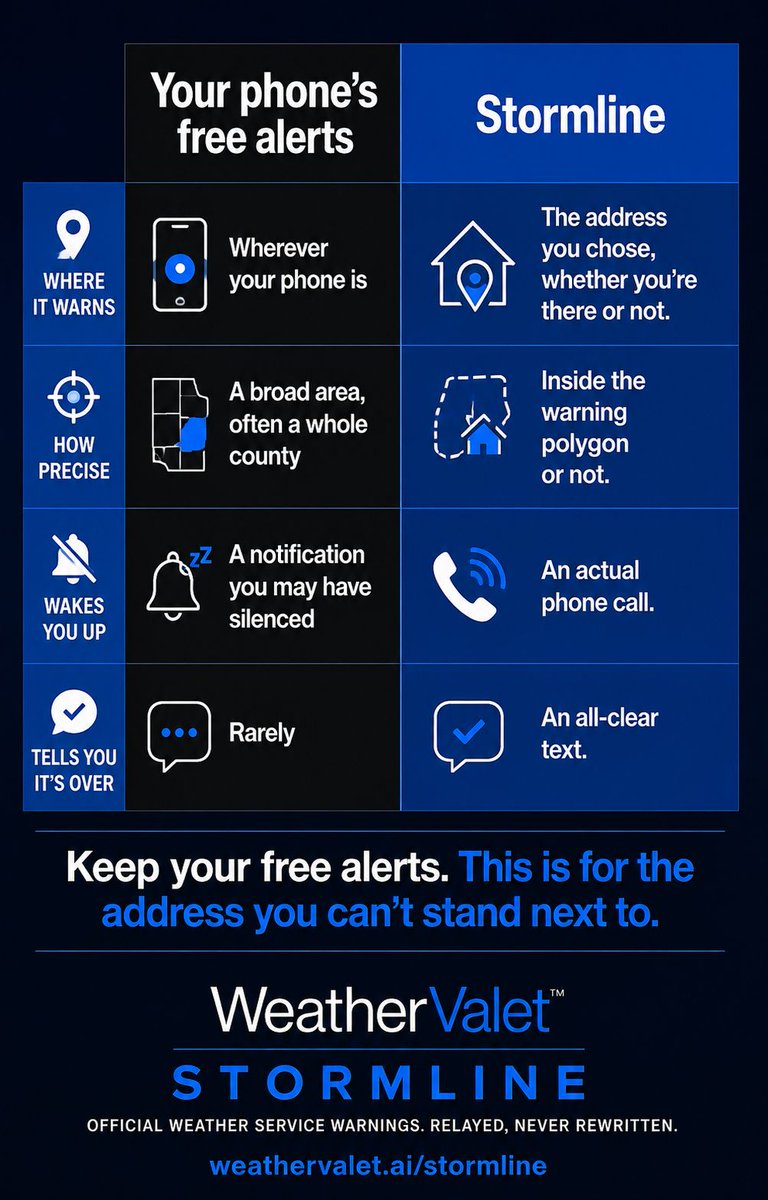
WeatherValet Stormline sends weather alerts for your exact address for just $1 a month.
If your address goes under a Tornado Warning, **we even call you.**
Sign up your family today for a little extra peace of mind when severe weather hits.
One address. Watched every day.
Expect storms to start firing late afternoon into the evening hours, mostly in the northern half of Indiana, and then move south later tonight and overnight. Expect around a half inch of rain, with isolated local spots getting up to 2+ inches of rain.
Meet WeatherValet Meteorologist Chris Sramek!
Chris has been with WeatherValet from the beginning and truly enjoys communicating weather information directly to customers. The personalized, easy-to-understand information is what makes Chris such a great Meteorologist.