We now offer a fully automated weather API service. For Adfree Plus users a hobby API Key is included and can be immediately used for smart-home automation, hobby or your own widget.
For more information check out: https://t.co/CLfHkrp4HS
#weatherAPI
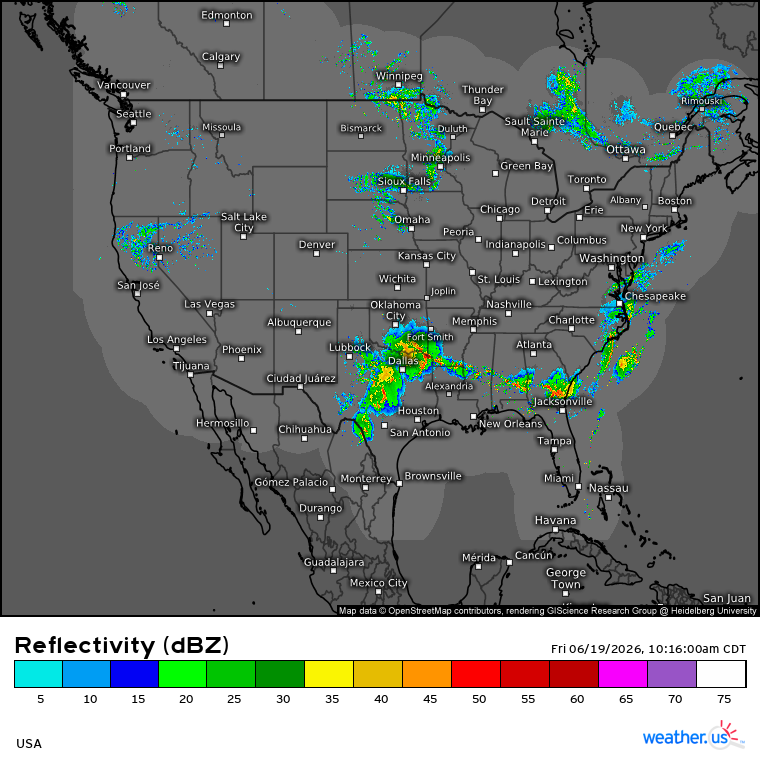
The continental radar composite is showing a lot of activity this morning with thunderstorms stretching (with breaks) from Texas through the Deep South into the Atlantic Ocean.
https://t.co/XTpV7fwx9t
TT
Remnants of Tropical Storm Arthur are continuing to impact the Deep South with heavy rain and severe thunderstorms capable of producing tornadoes. Elsewhere in the country, severe weather has shifted to the East Coast.
https://t.co/fV5RBOvxMt
TT
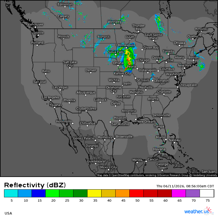
Here's a radar composite from Illinois as the SPC has highlighted a level 4 out of 5 risk of severe weather for parts of Illinois and Indiana. Intense tornadoes(that's the SPC's wording!), swaths of damaging gusts over 75 mph and damaging wind-driven hail are possible.
TT
The NHC has initiated advisories on Potential Tropical Cyclone One which may soon move offshore and become a tropical storm before an another landfall. Meanwhile, a severe weather outbreak is possible in Illinois and Indiana on Wednesday.
https://t.co/wdwzSYiisn
TT
Here's a look at the continental USA during the past few hours in visible imagery from GOES 19 along with lightning data from GLM.
https://t.co/BA9fNwggNb
TT
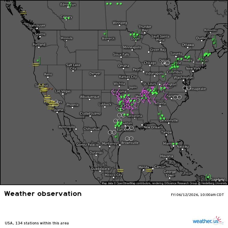
Here's a look at observed weather across the continental USA this forenoon. Severe thunderstorms are possible today across the East as well as in the south-central High Plains.
https://t.co/AQ4lkvCjAh
TT
Here's a look at the continental radar composite this morning as severe weather risk continues, focusing on Midwest and Great Lakes. Risks include widespread damaging/intense winds, large hail, tornadoes. The SPC has highlighted a level 4/5 risk area.
https://t.co/XTpV7fwx9t
TT
Here's a look at the continental radar composite as severe weather risk continues in the US. Large hail, a few strong tornadoes and damaging winds are possible across parts of Midwest and Upper Missisippi Valley.
https://t.co/XTpV7fwx9t
TT
Today looks to be a serious day for much of the Plains with a risk of severe winds, large hail, and even tornadoes. Severe weather risk isn't limited to the US, impacts are also possible in neighboring Canada.
Scenario from CONUS Swiss HD 4x4:
https://t.co/1ytVhOmN1r
TT
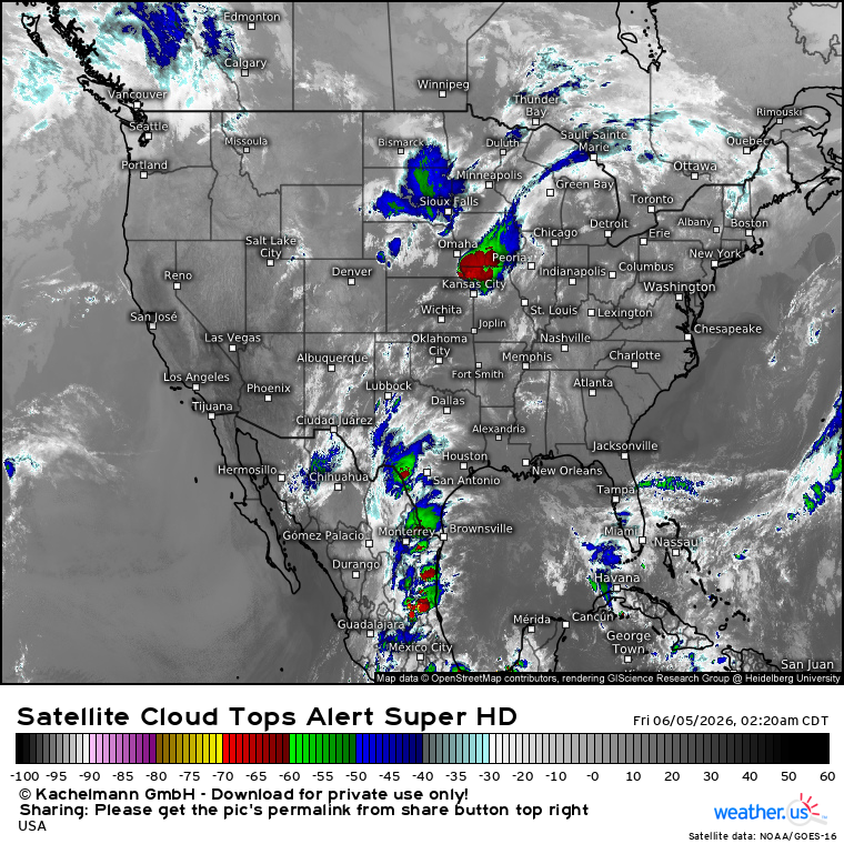
Here's a look at the infrared satellite imagery from GOES-19 this nighttime, showing also the complex causing flood alerts in parts of the Midwest.
https://t.co/lleFWcKqYe
TT
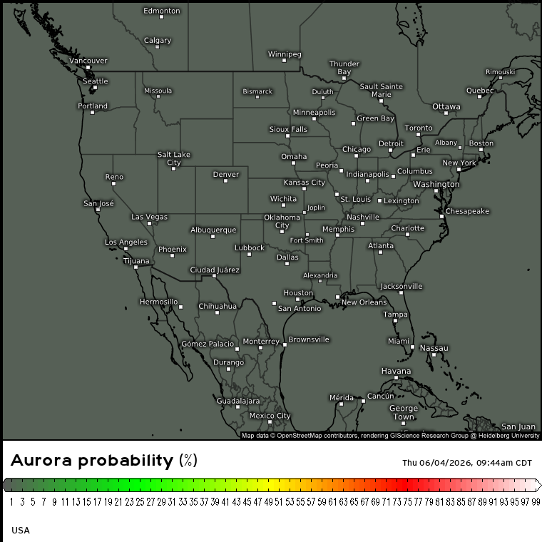
If you happen to have a clear sky tonight, be on the lookout for auroras. You can follow the latest OVATION model runs at
https://t.co/qQUPwmtzQy
If the values at high latitudes get very high, auroras could be at least photographed even outside the highlighted area.
TT
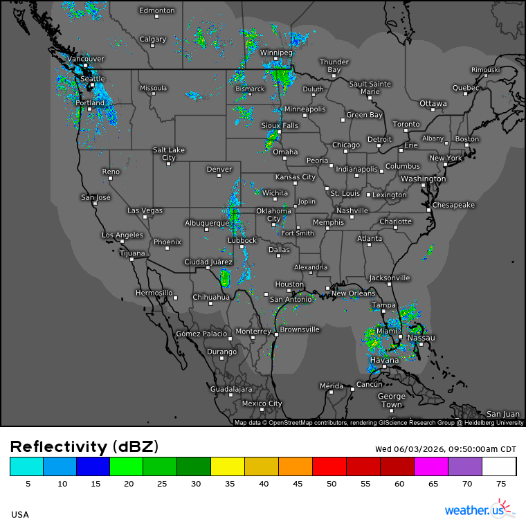
Here's a look at the continental USA radar composite this morning as risk of severe thunderstorms continues today, primarily in the Plains:
https://t.co/XTpV7fwx9t
TT
Here's a look at the latest observed temperatures across the CONUS as yet another active weather day is ahead. Severe thunderstorms with large hail, severe wind gusts and possibly a few tornadoes are possible in the northern Plains this PM/evening.
https://t.co/5ksxAB7s8v
TT
Shown is a scenario of significant weather across the continental US through 11 PM CDT according to the CONUS Swiss HD 4x4 model as severe thunderstorms are possible in parts of the central Plains as well as from the Ozarks into parts of the Southeast
https://t.co/if6D7iGzr4
TT
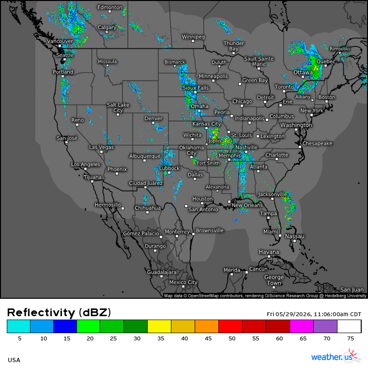
Here's a look at the continental USA radar composite this noontime as heavy rainfall continues to be a topic in the Southeast while there is a risk of severe thunderstorms in West Texas:
https://t.co/XTpV7fwx9t
TT
Here's a look at the continental USA in the visible imagery based on data from the CONUS sector of GOES-19's ABI instrument this noontime. The geographical coverage is smaller compared to the full disk, but the images update every 5 minutes:
https://t.co/zG7mXYe12F
TT
Here's a look at thunderstorms over Texas in 1 minute imagery from GOES-19 as the SPC has highlighted a level 2 out of 5 severe weather risk for parts of the state. Risks include large hail, severe wind gusts and a couple of tornadoes:
https://t.co/WaGiXFeIaN
TT