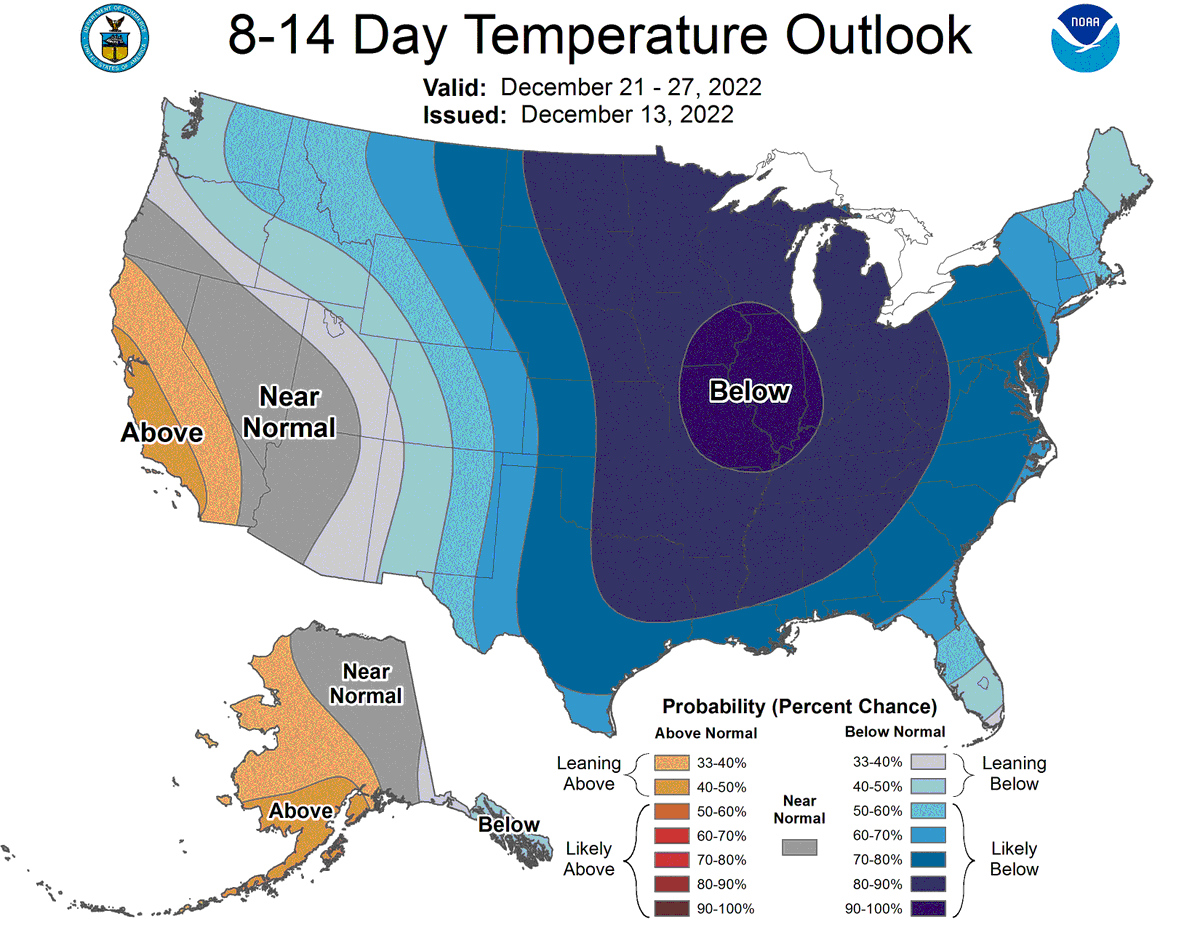
While attention currently remains on the late week storm, the next main weather story will likely be the very cold weather anticipated late next week and into the holiday weekend. The @NWSCPC has much of our area with a 70% chance of below normal temps. 🥶 #PAwx#NJwx#DEwx#MDwx
This is insane.
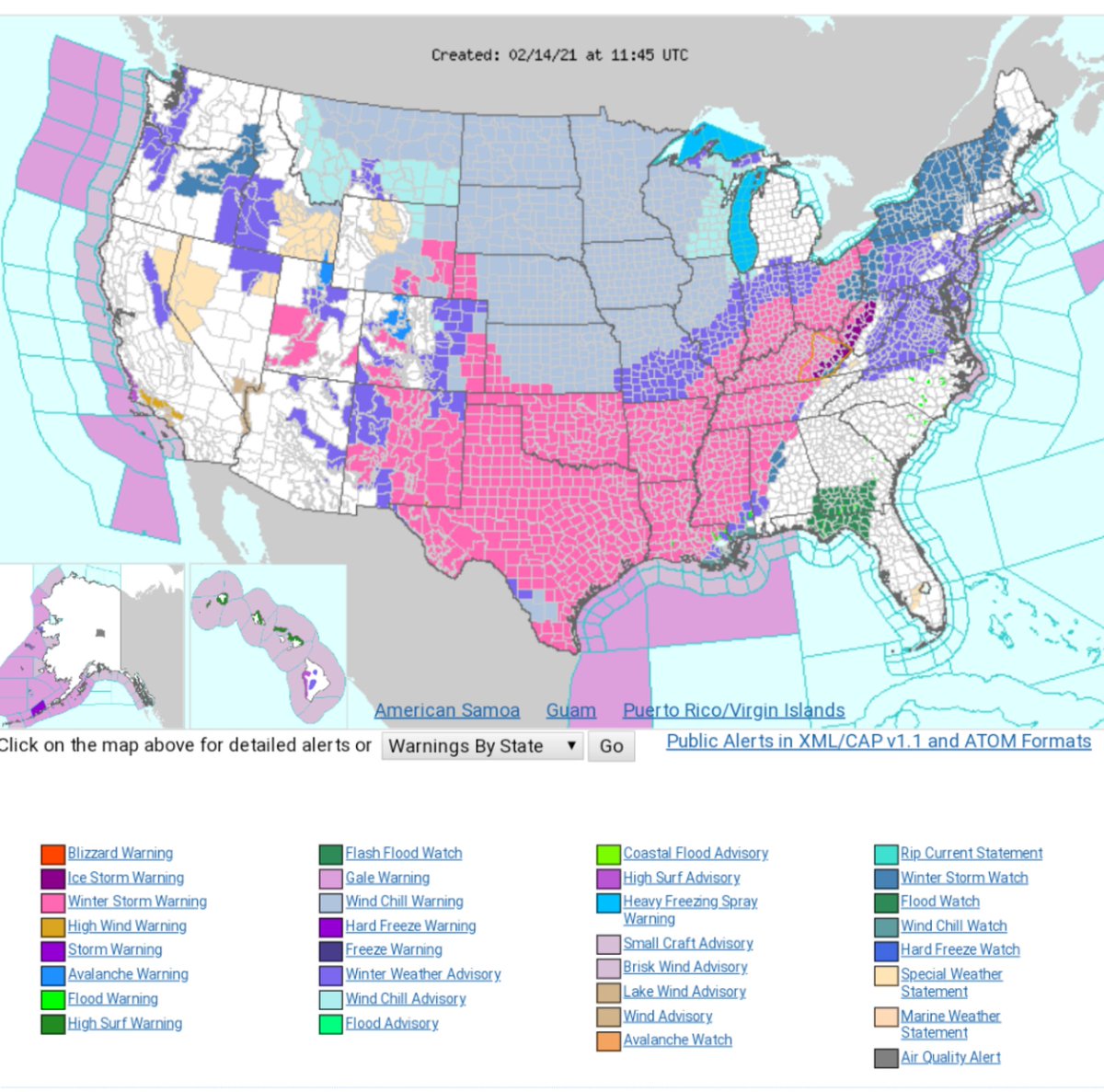
50°F below normal for the time of year and just look at the size of that winter storm warning 🥶
Europe has been cold recently but this is beyond the next level.
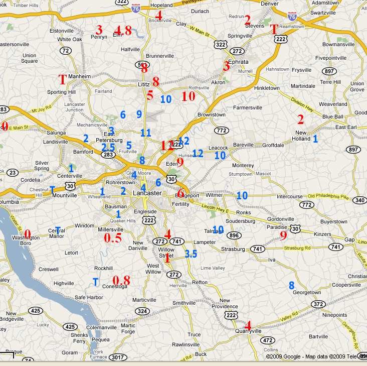
Today in 2009 Lancaster County had one of the most unusual snow events since record-keeping began. Anyone remember this "mesoscale" snow that dumped around a foot of now in the central to southeast part of the county and virtually none around it? @HorstWeather@LancasterOnline
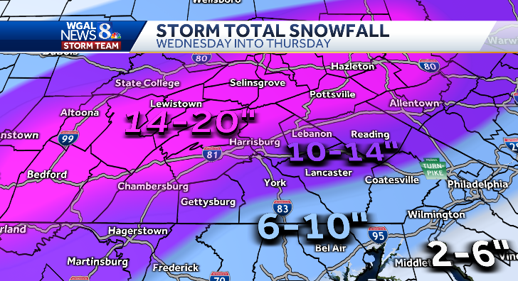
Evening thundersnow (or sleet) is possible, along w/ gusty NE winds, and near whiteout conditions at places that stay mostly snow. No changes to yesterday's snowfall map...w/ 12-18" likely near Turnpike, 8-12" along/north of Route-30, and 4-8 nearer MD border. Stay safe. Enjoy!
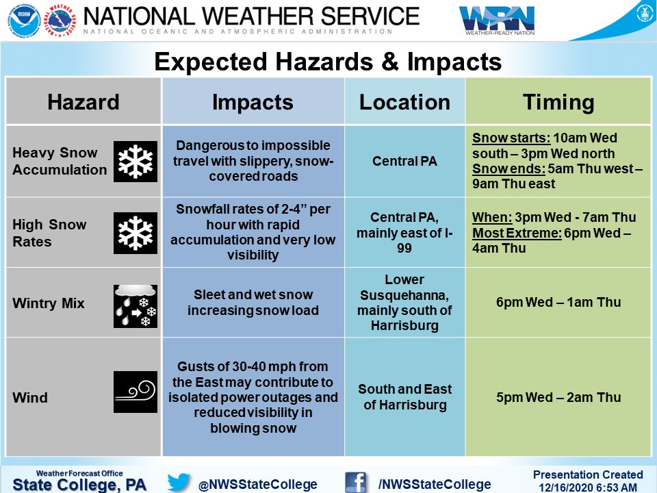
Good morning Central PA! Here's the latest info on today's storm. Snow will move in from south-north through the late morning & afternoon. Snow rates of locally 2-4 inches this evening-overnight will make travel difficult/impossible. Expecting 1-2 ft of snow for most. #PAwx
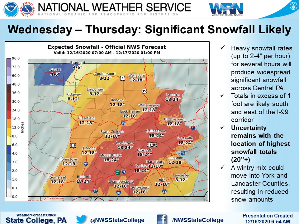
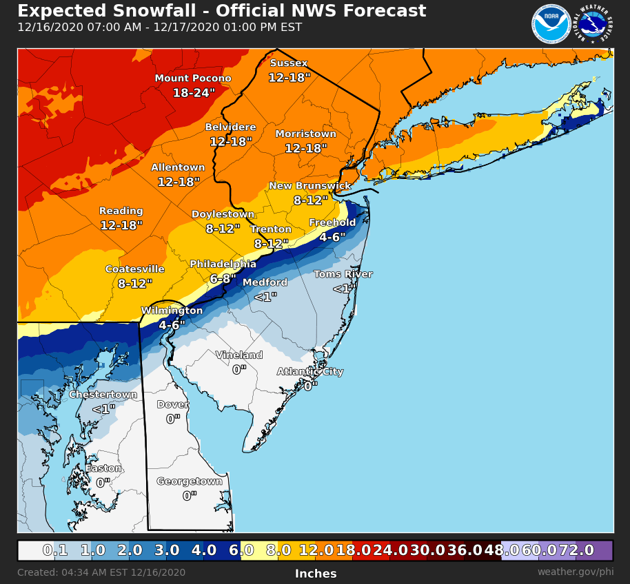
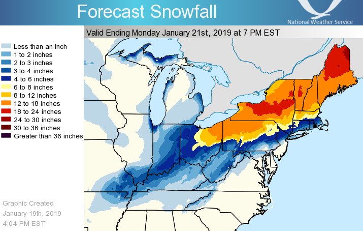
We'll have a full briefing package out soon, but in the mean time, here are this morning's forecast snow totals. Please note, there will likely be a very sharp gradient between large snow accumulations and mostly rain.
SNOW arrives between 10 AM-1 PM from SW to NE. Heaviest snow will fall tonight, so travel will become difficult or impossible. Latest thinking still has highest totals along and north of I-81 with lower totals south due to sleet mixing in tonight. Stay safe! @WGAL
This NWS graphic matches my thoughts from earlier...that the southern half of Lanco is at greater risk for gutter-gushing downpours this afternoon/night.
LIFE OF A METEOROLOGIST
-Predict no snow
-Bogus forecast for snow goes viral on Facebook
-Continue to predict no snow
-Brace for a week's worth of "meteorologists are the only people who can be wrong and still get paid" when no snow falls
Here is the approximate 24-hour snowfall map produced by NOHRSC! The highest totals were along the I-99 corridor and across northern PA:
13.0" - 7 SE Coudersport
12.0" - Wellsboro
10.1" - 1 NNE Kane
10.0" - 1 SE Chandlers Valley
Full list: https://t.co/BoqLp2UJYX #PAwx
We are looking at some really crazy snow gradients over SE PA. 50 miles the difference between 3" to a foot of snow. Where this gradient sets up will be crucial to the forecast.
(1/8): Confidence continues to increase in a significant winter storm this weekend. Precipitation will start as snow for everyone and arrive from west to east Saturday morning through mid-afternoon. Snow will start out light and gradually increase in intensity. #PAwx