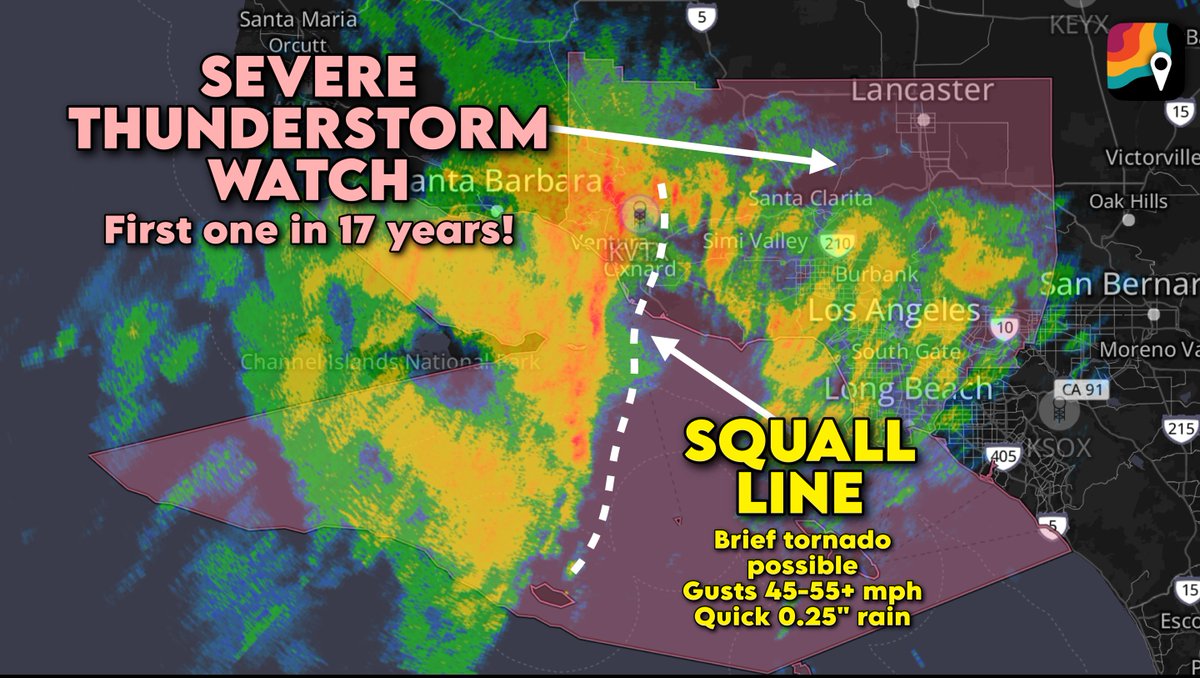
California gang – this is what's been giving y'all the wicked weather! Burbank's Bob Hope airport is up to 2.44 inches of rain, and downtown Los Angeles saw about 1.5 inches. Y'all even got the first severe thunderstorm watch since 2008!
What you're watching is an upper-level low, or a bowling ball of cold air, low pressure and spin, swing down the coast. That frigid air upstairs is helping to destabilize the atmosphere, allowing warmer air from below to rise. That made for a few thundershowers.
There were even a few reports of damaging gusts in the Los Angeles and Ventura County Mountains. A gust to 73 mph was reported up in Mesa Vincent, and 71 mph on Magic Mountain.
The bowling ball low has kinked the jet stream south, bending it such that it's been scooping a conveyor belt of moisture eastward and aiming it at the coast. A couple feet of snow fell in the highest summits of the Sierra Nevada.
Los Angeles folks – heads up! We have the first severe thunderstorm WATCH in 17 years for the metro, and a WARNING may be issued soon as a squall line closes in on the city.
A brief tornado can't be ruled out, and we're expecting occasional 45-60 mph gusts as well.