A Severe Thunderstorm Watch is posted until 9 p.m. from the southern tier of New York eastward to the mid-Hudson Valley and Capital Region. Storms will be widely scattered but could pack a punch with damaging wind gusts and hail. #NYwx
Today will be the last completely dry day until Monday as hazy sunshine pushes temperatures well into the 80s. A cold front will trigger a round of scattered thunderstorms Saturday afternoon and evening, some of which could turn severe with damaging winds and hail (Level 2 out of 5 threat). Saturday morning and midday should be mainly dry (maybe a passing shower in spots) before the storms develop in the early to mid-afternoon. #NYwx
Today is the start of meteorological summer, which runs through Aug. 31, marking the warmest three-month period of the year. The latest projections from NOAA’s Climate Prediction Center suggest upstate New York will have a warmer- and wetter-than-average summer.
The summer solstice on June 21 at 4:24 a.m. marks the start of astronomical summer. However, our earliest sunrises of the year occur before the summer solstice in mid-June, and our latest sunsets happen after the solstice in late June and early July. #NYwx
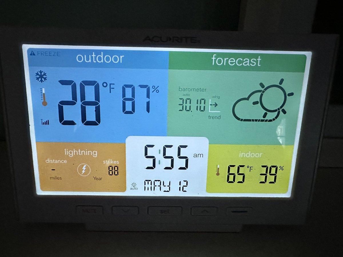
It’s going to be a cold start to the final morning of meteorological spring. There could even be some patchy frost in the deeper valleys of the Catskills. #NYwx
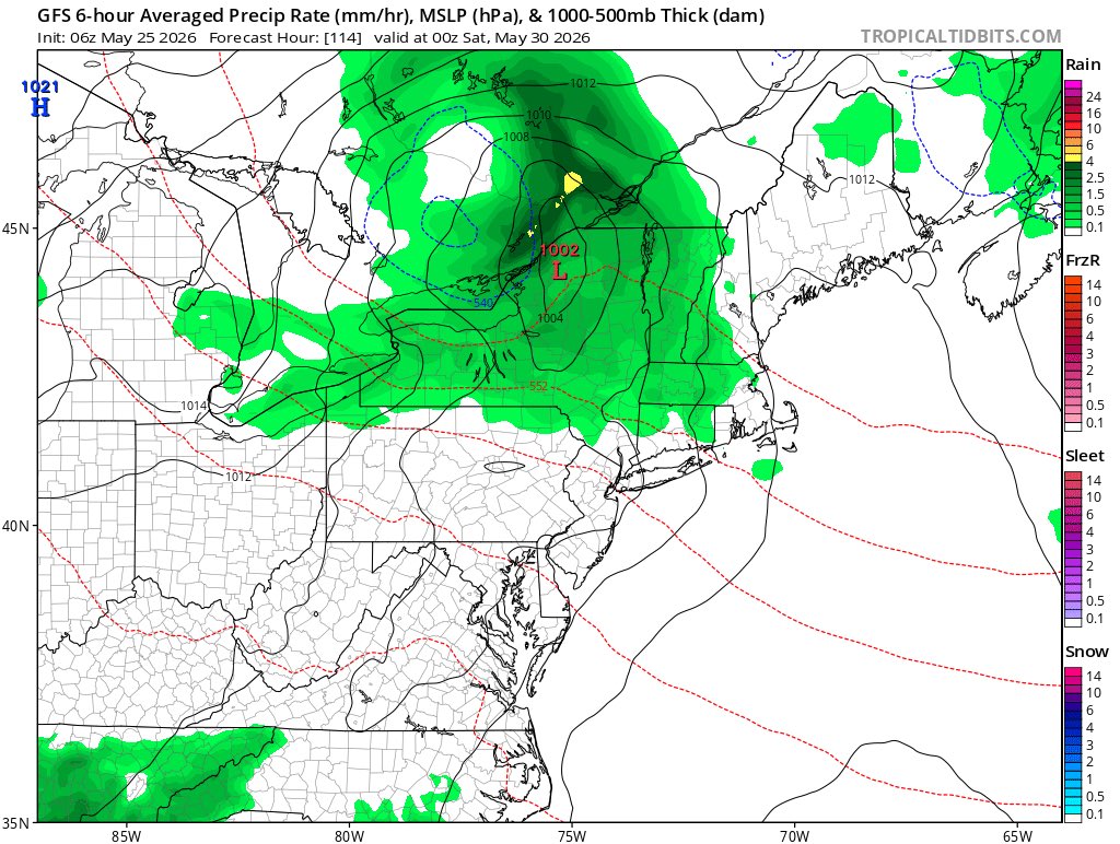
If you liked the rainy, cool weather this Memorial Day weekend in upstate New York, there’s a chance you could love next weekend’s weather too. Highs will likely be stuck in the 50s with plenty of clouds and occasional showers. In the meantime, it’ll feel like summer for the first half of the upcoming workweek. #NYwx
Good evening! A cool, rainy Saturday is ahead. 🌧️ Rain moves SW to NE through the day (see map for timing).
Expected Rainfall:
Central NY: 0.5"–1"
NE PA: 0.5"–1.5"
Highs in the upper 40s to mid-50s (near 60° north). Details: https://t.co/CwgRZvRlmx
Today marked the first 90-degree day of the year from the Finger Lakes to the Mohawk Valley. Highs today included 91 in Syracuse, Ithaca and Elmira, 90 in Rome, 90 in Oneonta, 88 in Norwich and 87 in Binghamton. Tuesday will be similarly hot and a touch more humid. #NYwx
The weather pattern flips straight to summer starting today and lasting through midweek before a sharp cooldown late in the week ahead. That means we need to introduce the first notable heat risk of the season.
On Tuesday, the National Weather Service’s HeatRisk product shows most of central New York faces a moderate risk (Level 2 out of 4) of excessive heat. Temperatures will climb into the upper 80s and lower 90s, with a bit of humidity making it feel even hotter than that as dew points reach the lower to mid-60s.
As of now, Memorial Day weekend looks much cooler with highs in the 60s and a risk of showers. #NYwx
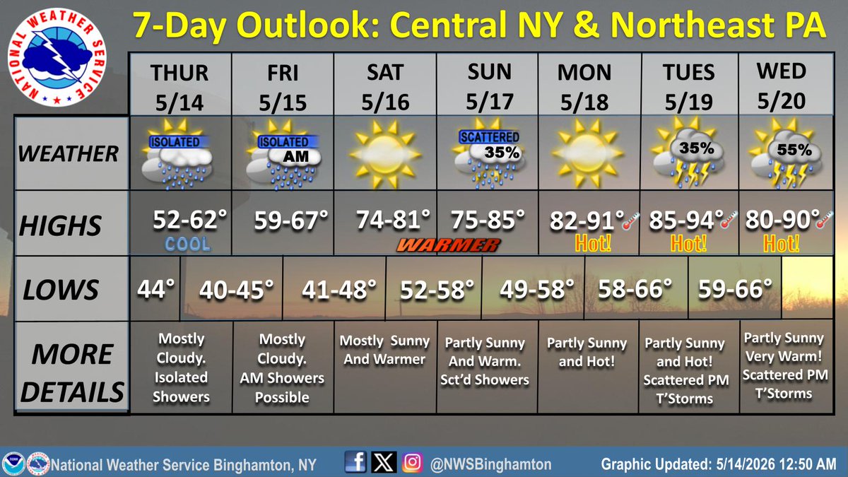
Good morning! Cool and mainly cloudy weather will continue today along with a few isolated showers. For those who like warmer weather, temperatures will significantly warm-up the second half of the upcoming weekend, and especially the beginning of next week. #NYwx#PAwx
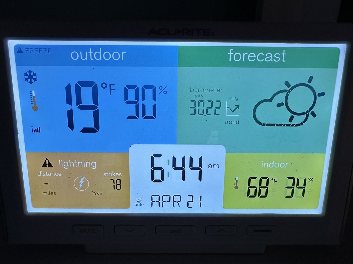
Upper 20s with frost to start May. We’re stuck in a cooler-than-average pattern for the next few weeks.
The good news is we’ve entered the longest days of the year with sunrises before 6 a.m. and sunsets after 8 p.m. for the next three and a half months.
Sunrises won’t be after 6 a.m. again until about the second week of August, while sunsets wont be before 8 p.m. until about the third week of August. #NYwx
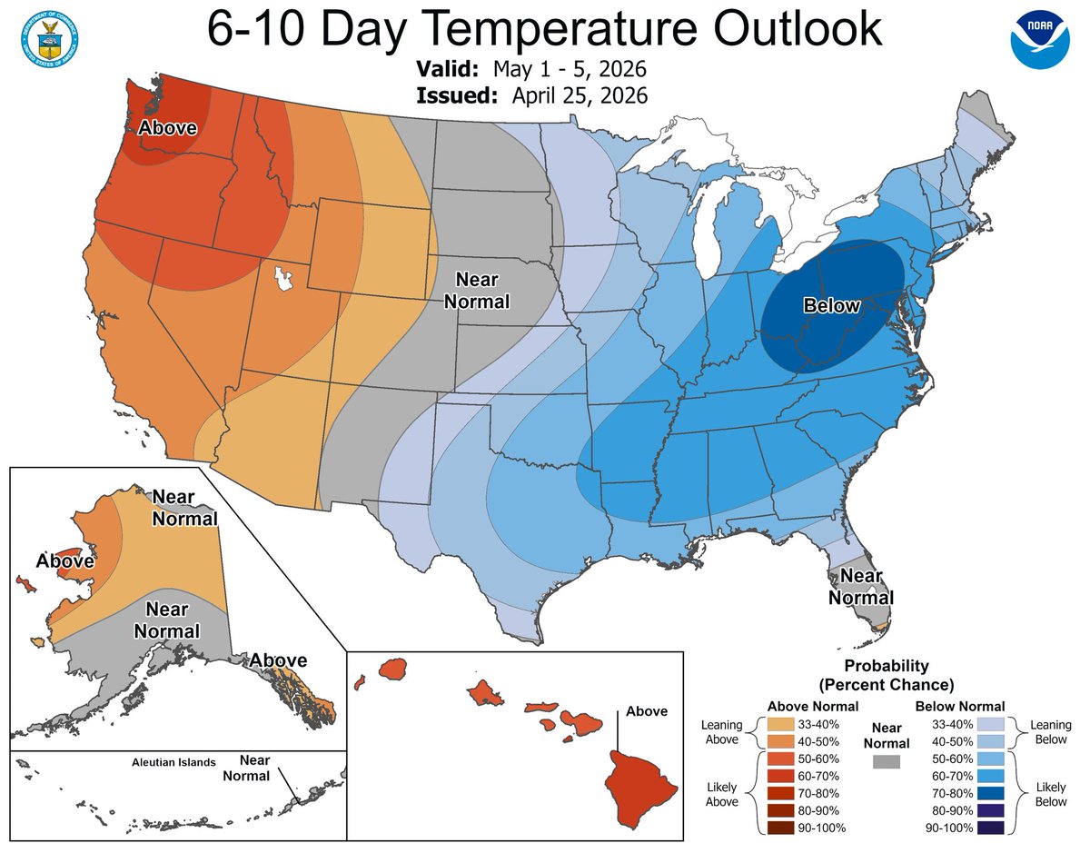
How would you feel about daytime highs in the mid- to upper 40s and overnight lows near freezing for the first weekend of May? What if snow showers and flurries were possible too? 😵 #NYwx
SUMMER FADES, SPRING RETURNS, THEN A FINAL TASTE OF WINTER
Summer’s over for now as more springlike weather is expected today and Saturday with highs in the mid-60s to mid-70s.
But we aren’t done with winter yet as much of central New York faces about 50-50 odds of measurable snow (at least 0.1 inches) between Sunday and Monday morning.
The good news is we won’t be dealing with a power grid-crippling snowstorm like we did four years ago in late-April 2022 when tens of thousands lost power for multiple days.
After a hard freeze Monday night, temperatures will reach the 60s again by the middle of next week. However, the general trend for the rest of April is cooler than average, so expect more days in the 50s and 60s rather than the 70s.
You’ll want to hold off on planting any sensitive vegetation until Mother’s Day weekend. #NYwx