There will be a risk for locally heavy rainfall and flash flooding across the northern half of the region today and this evening. New rainfall accumulations of 0.5 to 1.5 inches are possible. #lawx#arwx#txwx#okwx
A Marginal Risk for a few strong to severe thunderstorms has been introduced for portions of the area. Main threats will be strong winds, but an isolated tornado also can't be ruled out.
We will continue the wet period with our next storm system poised to impact our region on Thursday. The wet period will likely continue through the upcoming weekend and possibly beyond. Rainfall accumulations through the weekend could become excessive. #Okwx#Arwx#Lawx#Txwx
Strong to severe thunderstorms are forecast to develop later this afternoon and move rapidly south and east through the Four State Region through the late evening hours. Damaging wind gusts will be the primary threat, followed by a large hail threat. #okwx#arwx#txwx#lawx
An active weather pattern will take shape on Tuesday into Wednesday with rounds of convection across much of the ArkLaTex leading to an Excessive Heavy Rainfall threat on Thursday.
Strong to severe thunderstorms will be possible again across the entire region late this afternoon, continuing into the evening and overnight hours. Damaging wind gusts, large hail and an isolated tornado or two will be the main threats. #okwx#txwx#arwx#lawx
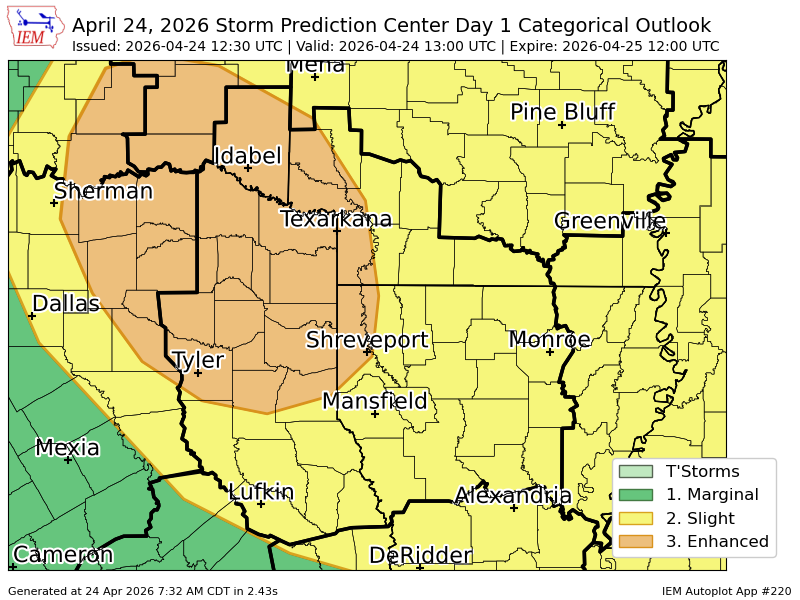
Severe weather is still on track to return this evening across northwest parts of our Four-State region, primarily along and north of I-30. Thunderstorms will develop in the warm sector ahead of a cold front and may quickly become severe into this evening. #arwx#lawx#okwx#txwx
The threat of severe weather still appears to return by the middle of this week with the arrival of our next cold front. Thunderstorms will increase Tuesday night into Wednesday with strong to severe thunderstorms expanding southeast throughout the event. #arwx#lawx#okwx#txwx
(Sun. 5/3/2026 - 10 PM)
Here's an updated graphic on the severe weather outlook for the midweek. Strong to severe thunderstorms are still expected Tuesday night through Wednesday, as another spring cold front will shift south into the Four State Region. #arwx#lawx#okwx#txwx
Severe weather looks to return by the middle of next week as another late spring cold front takes aim on the region. A deep trough will assist in thunderstorms increasing by Tuesday night continuing into Wednesday, roughly the timeframe for severe weather. #arwx#lawx#okwx#txwx
There will be a continued threat for severe thunderstorms this evening through the overnight hours across much of the Four State Region. Large hail, damaging wind gusts, and some will be possible.
We're watching for storm development in South Central Oklahoma this afternoon and evening. A watch is likely by this afternoon. All hazards are possible with a higher risk for large hail. Bring those cars inside! right now is 2 PM - 10 PM.
Showers and thunderstorms increase through Friday, well ahead of an approaching cold front. The potential for strong to severe storms will reside over most of our Four-State area, with all modes of severe weather possible.
Isolated to scattered strong to severe thunderstorms are likely this afternoon through late evening across parts of Southeast Oklahoma, East Texas, and Northwest Louisiana. #Okwx#Arwx#Lawx#Txwx