Know a Kurdish word the atlas is missing, or one that needs fixing?
Add it, say it, or record it:
1. Search for the word, or browse the Lexicon
2. Open the editor: click the green pen on desktop, or tap ⋯ then Edit word on your phone
#Kurdish#Kurdistan#Kurmanji#Sorani
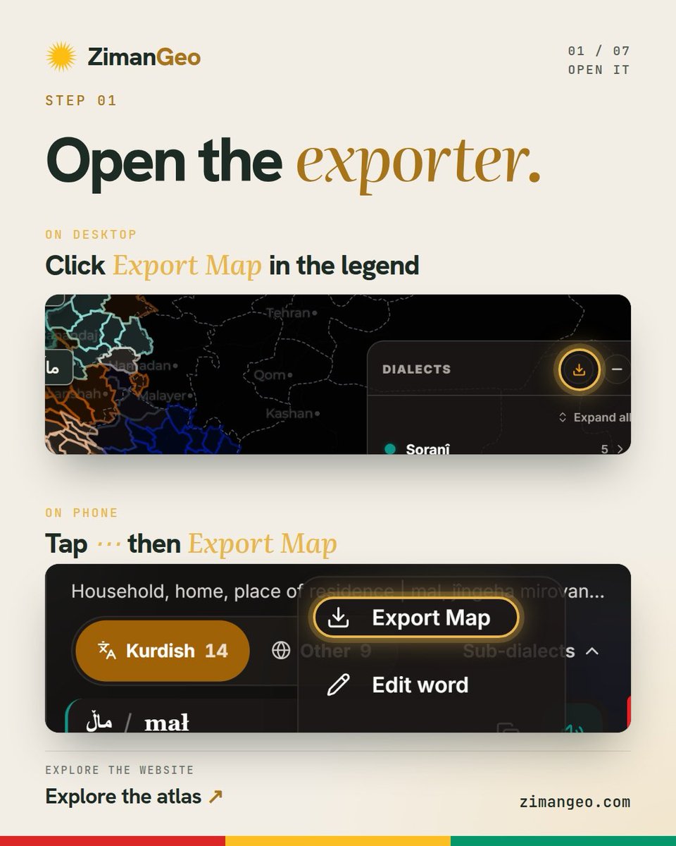
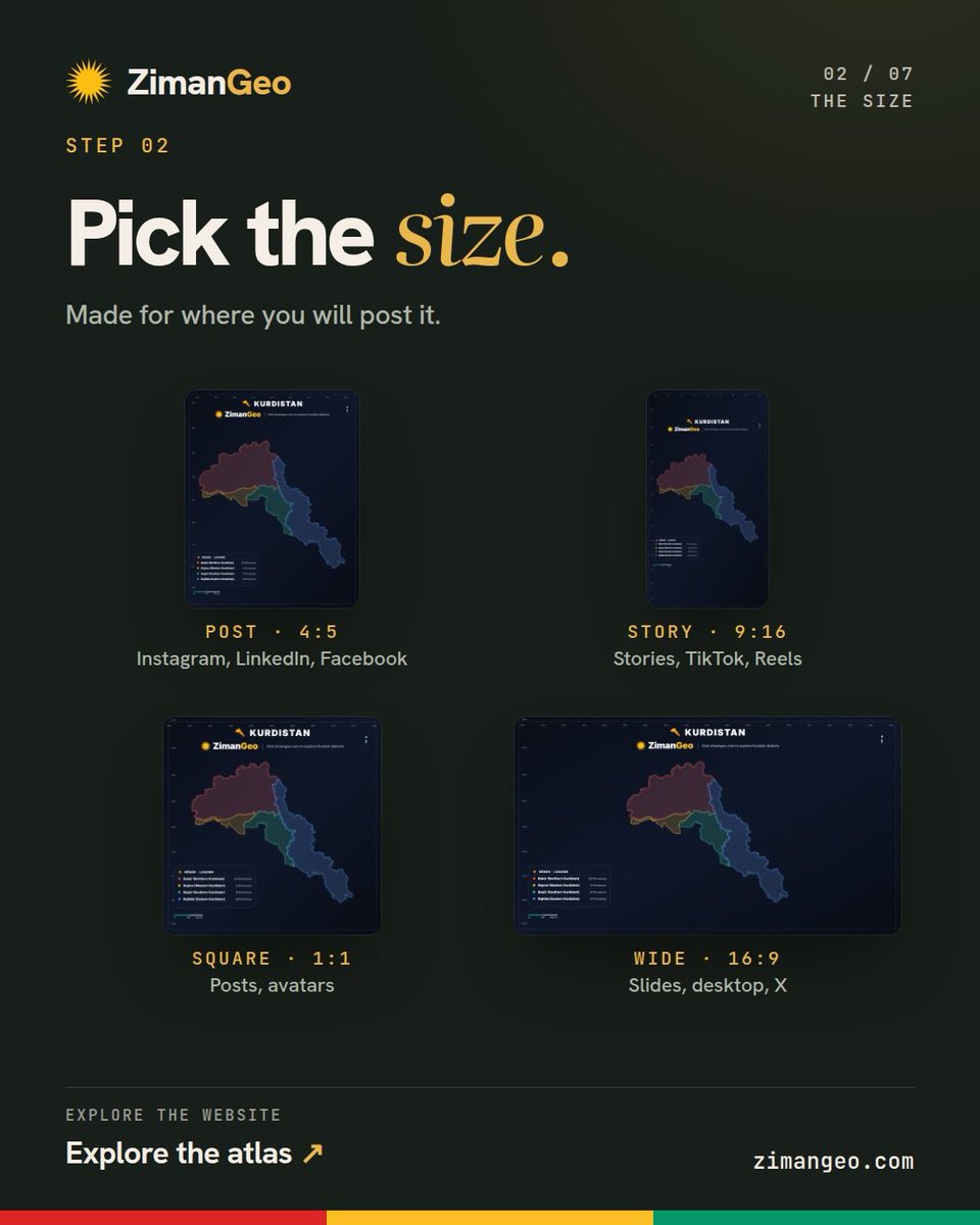
You can now make your own map of Kurdistan on ZimanGeo, and it’s FREE! 🗺️
Open Export Map, choose a size for your post or story, and select regions, provinces or districts. Turn on Ala Rengîn to see all four parts as one, glowing gold.
https://t.co/xqq4yJ6VjS
#Kurdistan#Kurds
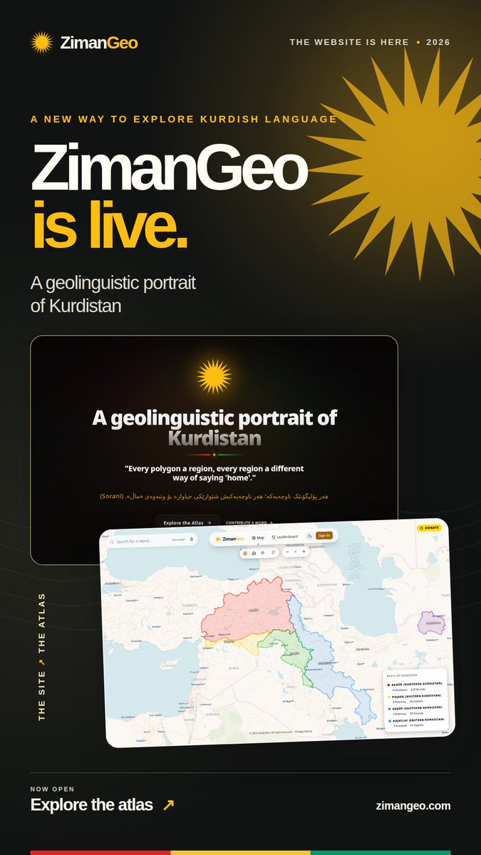
Kurdistan was split into four parts, but it is still one.
Discover its flag, songs, peoples, languages and mountains on ZimanGeo.
Kurdistan li çar parçeyan hat parvekirin, lê dîsa jî yek e.
Ala wê, stranên wê, gelên wê, zimanên wê û çiyayên wê li ZimanGeo vekolîne.
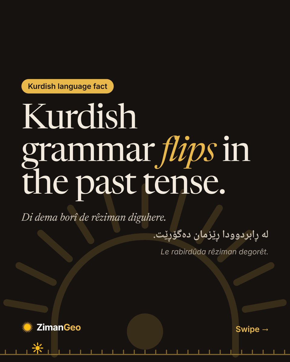
Past tense
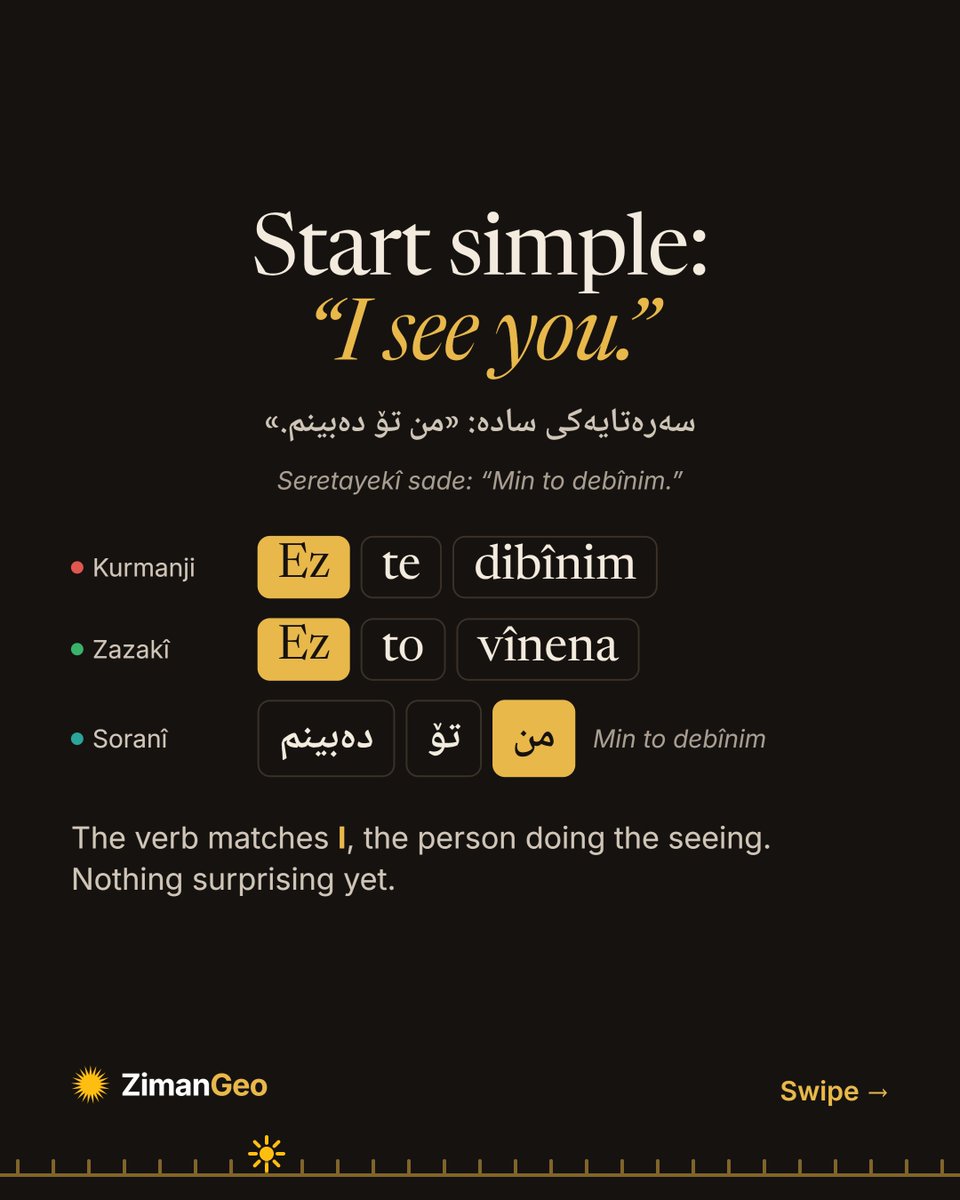
Ez te dibînim: I see you.
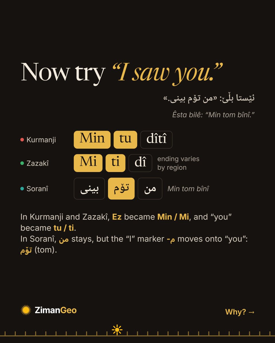
Min tu dîtî: I saw you.
In Kurdish, even “I” changes in the past tense. It’s called split ergativity. Swipe to see it in Kurmanji, Zazakî and Soranî 👉
Di dema borî de rêziman diguhere.
لە ڕابردوودا ڕێزمان دەگۆڕێت.
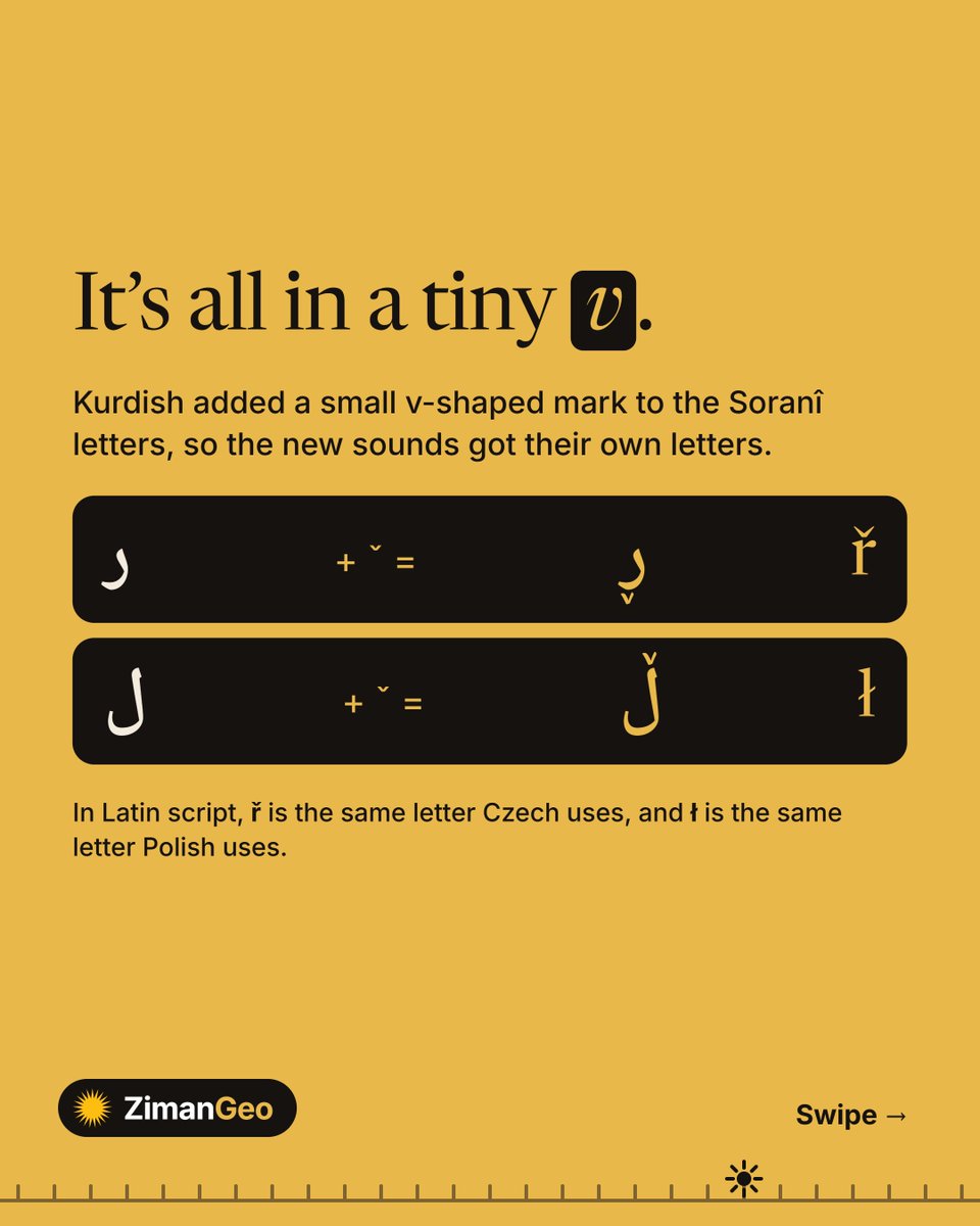
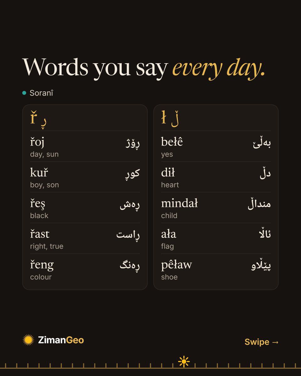
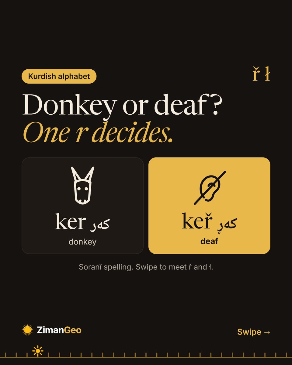
ř and ł
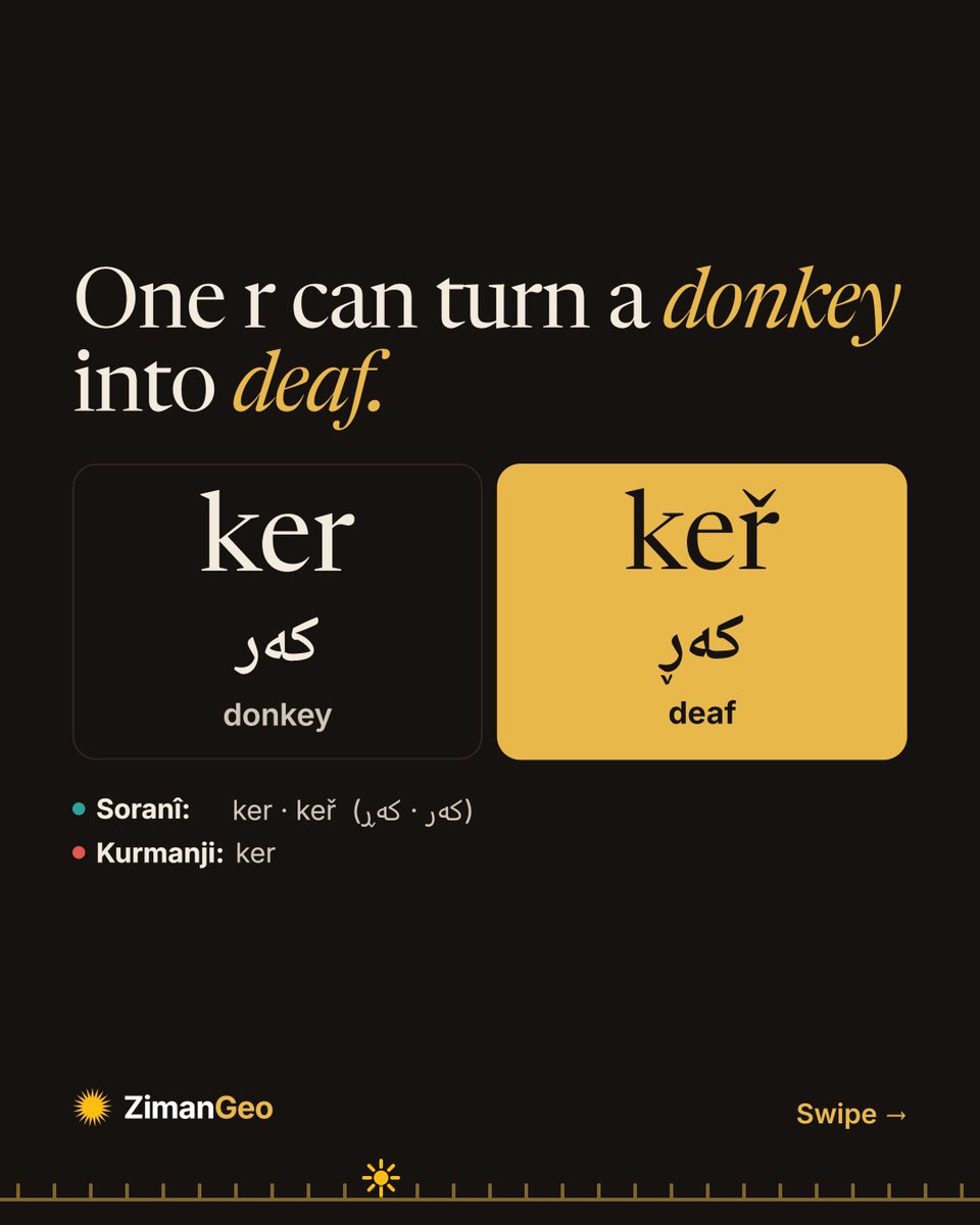
ker کەر = donkey 🫏
keř کەڕ = deaf 👂
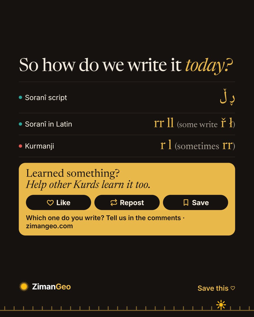
One letter changes everything. Meet ř (ڕ) and ł (ڵ). How do you write them? 👇
Ker an kerr? Tenê tîpek cudahiyê çêdike!
کەر یان کەڕ؟ تەنها یەک پیت جیاوازی دروست دەکات!
📍 https://t.co/xqq4yJ6nuk
#Kurdî#کوردی#KurdishAlphabet
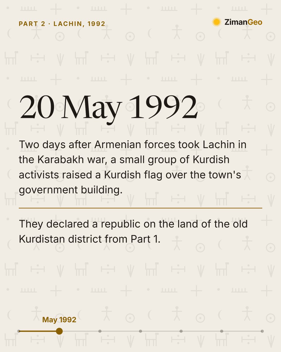
In May 1992, during the Karabakh war, a Kurdish republic was declared in Lachin. It lasted about six months, and no country recognised it. Its leader, Wekîl Mustafayev, was born in exile in Samarkand.
Part 2 of 3.
#Kurdistan#KurdishHistory#Lachin#Karabakh#ZimanGeo
In 1923 the Soviet Union drew a Kurdish district on the map of Azerbaijan, with Lachin as its center. By 1930 it was gone. Most of its Kurds already spoke Azerbaijani at home.
Part 1 of 3.
#Kurdistan#KurdishHistory#Lachin#Karabakh#ZimanGeo
In May 1992, during the Karabakh war, a Kurdish republic was declared in Lachin. It lasted about six months, and no country recognised it. Its leader, Wekîl Mustafayev, was born in exile in Samarkand.
Part 2 of 3.
#Kurdistan#KurdishHistory#Lachin#Karabakh#ZimanGeo
In 1923 the Soviet Union drew a Kurdish district on the map of Azerbaijan, with Lachin as its center. By 1930 it was gone. Most of its Kurds already spoke Azerbaijani at home.
Part 1 of 3.
#Kurdistan#KurdishHistory#Lachin#Karabakh#ZimanGeo
ř and ł
ker کەر = donkey 🫏
keř کەڕ = deaf 👂
One letter changes everything. Meet ř (ڕ) and ł (ڵ). How do you write them? 👇
Ker an kerr? Tenê tîpek cudahiyê çêdike!
کەر یان کەڕ؟ تەنها یەک پیت جیاوازی دروست دەکات!
📍 https://t.co/xqq4yJ6nuk
#Kurdî#کوردی#KurdishAlphabet
Past tense
Ez te dibînim: I see you.
Min tu dîtî: I saw you.
In Kurdish, even “I” changes in the past tense. It’s called split ergativity. Swipe to see it in Kurmanji, Zazakî and Soranî 👉
Di dema borî de rêziman diguhere.
لە ڕابردوودا ڕێزمان دەگۆڕێت.
Kurdistan was split into four parts, but it is still one.
Discover its flag, songs, peoples, languages and mountains on ZimanGeo.
Kurdistan li çar parçeyan hat parvekirin, lê dîsa jî yek e.
Ala wê, stranên wê, gelên wê, zimanên wê û çiyayên wê li ZimanGeo vekolîne.
Nexşeya xwe ya Kurdistanê çêke, belaş! Ala Rengîn veke, çar parçeyan wekî yek bibîne û bi Kilim, Deq, Roj an 2+2=1 xemilîne.
#ZimanGeo#Kurdistan#AlaRengin
You can now make your own map of Kurdistan on ZimanGeo, and it’s FREE! 🗺️
Open Export Map, choose a size for your post or story, and select regions, provinces or districts. Turn on Ala Rengîn to see all four parts as one, glowing gold.
https://t.co/xqq4yJ6VjS
#Kurdistan#Kurds