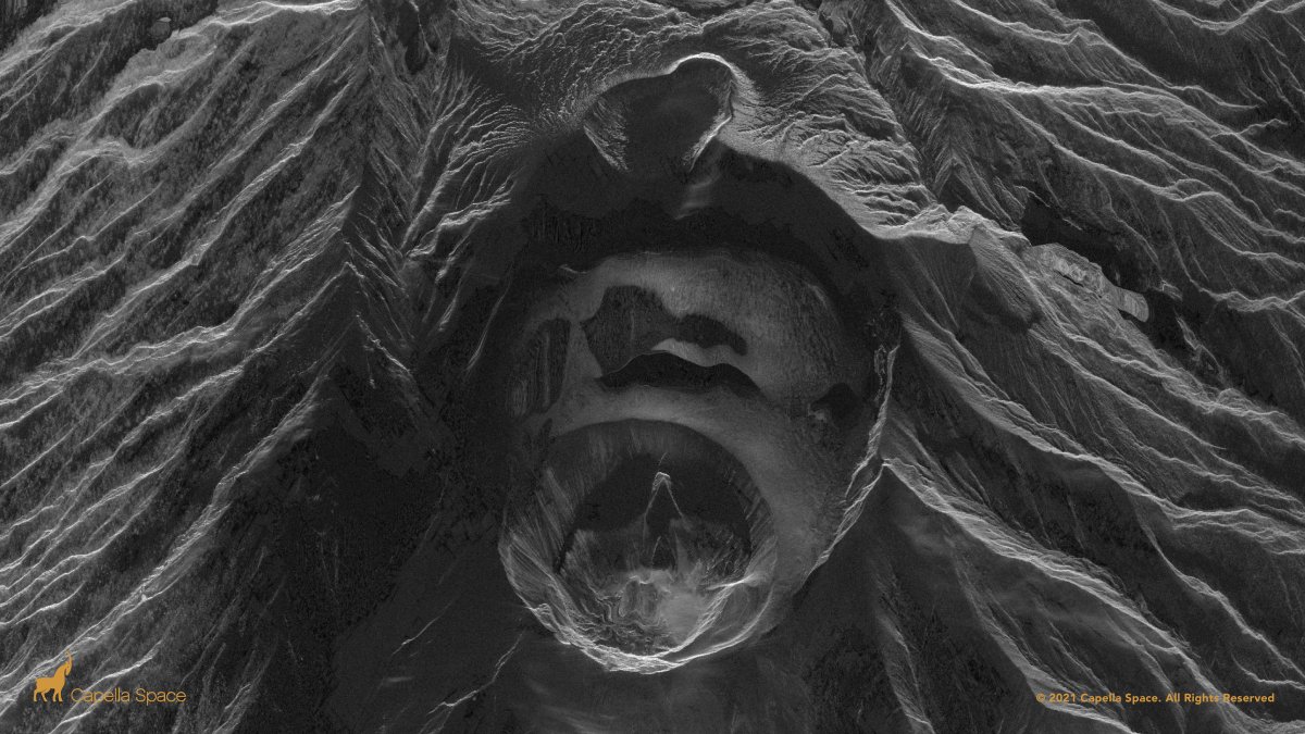
UPDATE: Capella's 3D radar imaging captures the #LaSoufriere#Volcano dome collapse on St. Vincent. #SAR satellites can see through smoke and volcanic ash for 24/7 disaster response data. This 50cm very high-resolution image is from April 14, 2021 - 3:21pm UTC.
St. Vincent (April 10, 12:10am) - Our #SAR satellites see through miles of volcanic ash and smoke plumes to capture a 3D image the crater lake atop #LaSoufriere#volcano.