A cold late-season system is set to bring rounds of rain, gusty winds, thunderstorms, and fresh Sierra/Tahoe snow above the higher elevations. Travel over passes could get messy fast, with winter-like conditions making a May comeback. #CAwx#NVwx
The next stronger system will be Friday night, as a strong cold front will impact the Bay Area. A Wind Advisory will go into effect on 1pm Friday to 1pm Saturday for strong southerly winds of 15-25 mph with gusts up to 50 mph. #CAwx
Power Outages as of 3:00am:
- Sonoma County: 19,647
- San Mateo County: 14,537
- Santa Cruz County: 12,387
- Monterey County: 12,169
- Mendocino County: 8,632
- Santa Clara County: 7,444
#CAwx
Tonight, the Bay Area is experiencing strong winds. Satellite imagery shows a rapidly strengthening low-pressure system off the coast, currently centered at 982mb. Here are the peak wind gusts so far:
Mt Umunhum: 62 mph
Point Reyes: 68 mph
San Francisco: 36 mph
San Pedro Mountain: 73 mph
Point Sur: 79 mph
#CAwx
High Wind Warning is in effect from 4 pm Tuesday to 4 am Wednesday for coastal regions, including Coastal North Bay, Point Reyes National Seashore, and San Francisco Peninsula Coast. #CAwx
An evacuation warning has been issued for burn scars of Palisades and Eaton Fires as there is a chance for rain rates as high as 1.5" per hour. Debris flows and widespread urban flooding are possible. #CAwx
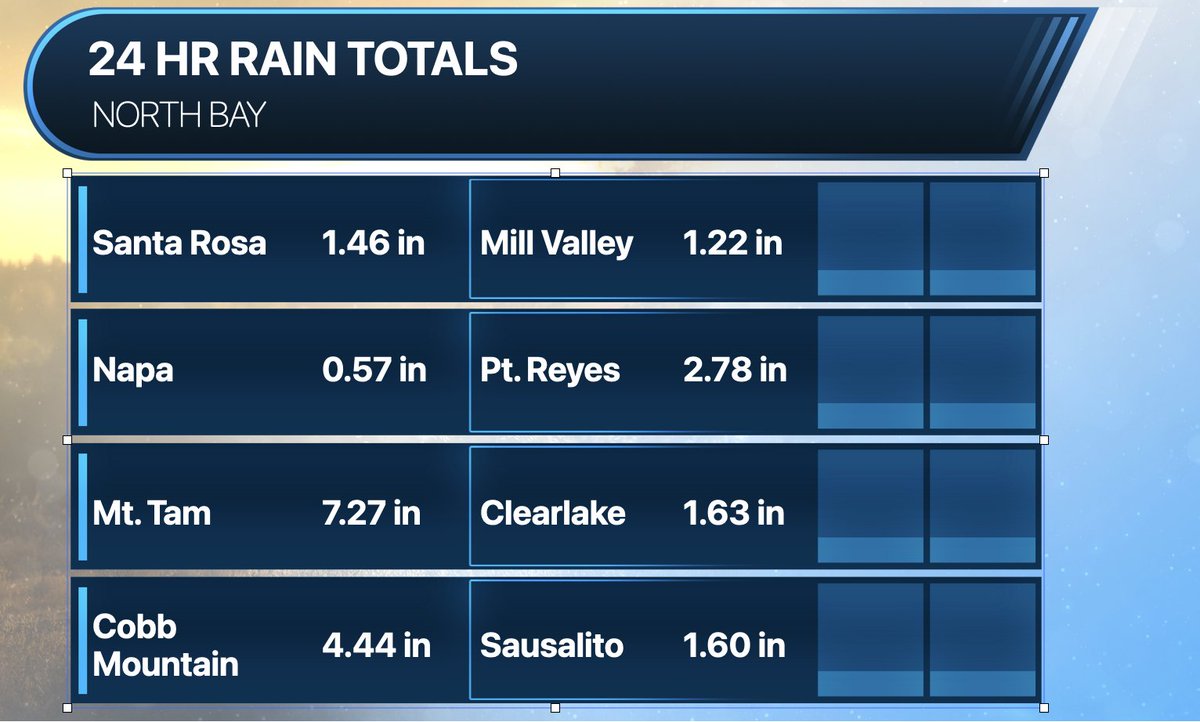
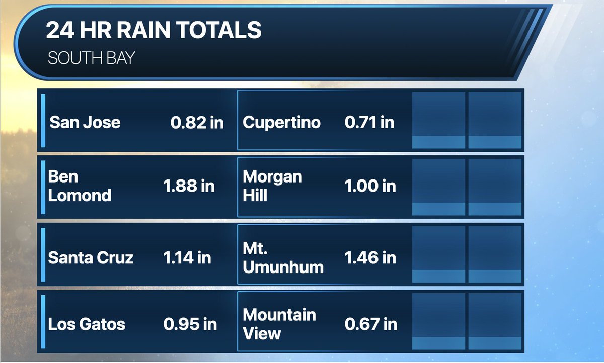
Taking a look at rainfall totals across the Bay Area, North Bay and the SF Peninsula experienced the most significant impact, as the system stalled. Meanwhile, the South Bay was spared from the heavy rainfall. Notably, Mt Tam continues to be the winner with 7.27 inches. #CAwx