Fast ein Drittel der Fläche Deutschlands ist von Wäldern bedeckt, doch Schädlinge und Extremwetter gefährden das Grün. Finden Sie hier heraus, wie es um die Bäume vor Ihrer Haustür steht. https://t.co/VpkSlYBS8q
🎙️Last fall, @forestpaths_eu partner Alba Viana-Soto gave an interview on the next generation of forest disturbance maps in Europe that she helped develop.
👀 Find out more about the interview here: https://t.co/3U232xj2aP
#FutureForests#Biodiversity#EcosystemServices
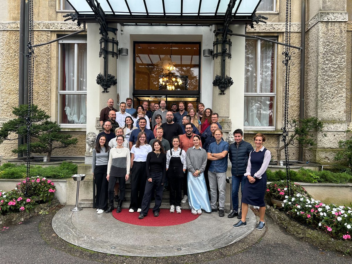
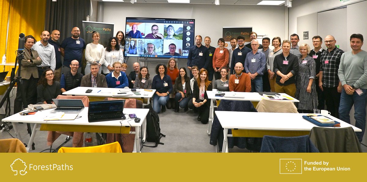
🙏 We want to thank each partner who joined this year's ForestPaths Annual General Meeting, both in-person and online, and for all their achievements in the past year!
While the AGM is over, we still have more work to do - with future results coming in hot in the next months 🤯
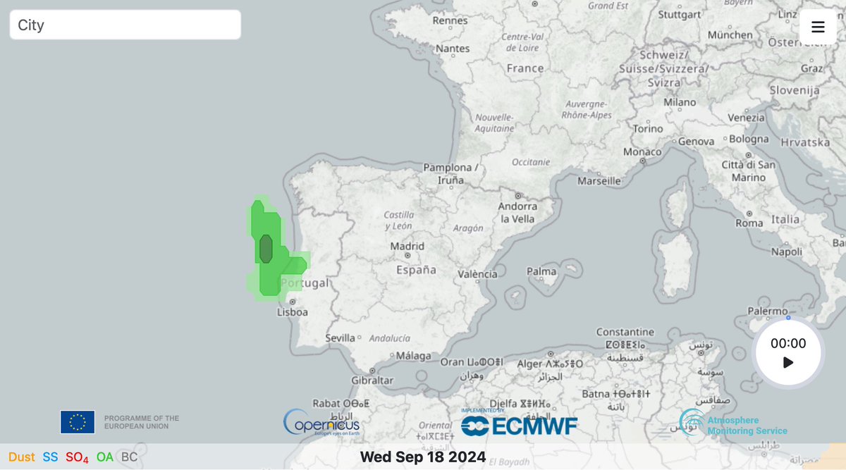
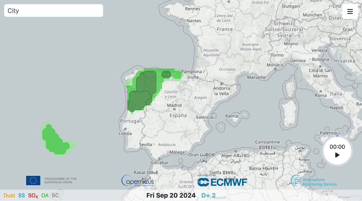
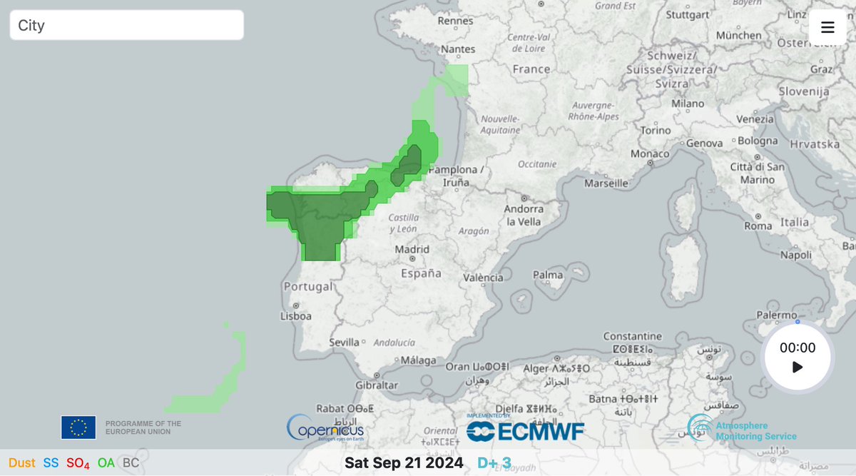
#CopernicusAtmosphere aerosol alerts for 18 Sept 2024 showing an anomaly in organic matter aerosol optical depth (green) for the coming days indicating the predicted smoke transport from the deadly #wildfires in northern Portugal https://t.co/4nEDjjqFEq
Our paper "Estimating Canopy Height at Scale" has been accepted to #ICML24, where we significantly advance global canopy height mapping.
w/ @maxzimmerberlin, U. Kelly, M. Schwartz, S. Saatchi, @ciais_philippe , @spokutta , @matin_brandt, F. Gieseke
https://t.co/5vn882Zvtf
🧵 1/5
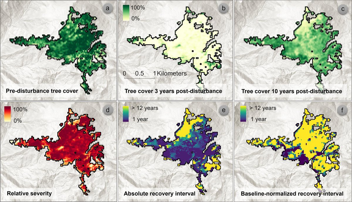
Forest recovery success or failure? Remote sensing can help answer this question. Take a look at our new RSE paper: https://t.co/00TSTBL9bS
Big thanks to my amazing co-authors @albaa_vs , @AnaStritih , @RupertSeidl and especially @corneliussenf for the great support!
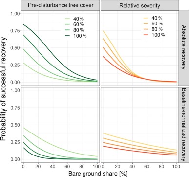
Can we predict long-term forest recovery success using post-disturbance characteristics? 🛰️🌲Check out the latest paper, using spectral unmixing of Landsat/Sentinel2 data, brilliantly led by @_lisamandl !! https://t.co/YjbGk5SHAO
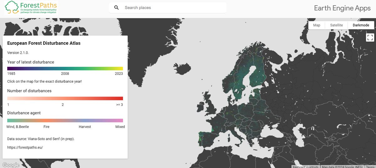
Introducing the latest European forest disturbance maps 🗺️🌲!
They have been upgraded to detect multiple disturbance events per series & cause attribution workflow, now spanning 1985-2023 🎉.
Read more about the maps here: https://t.co/nxBtaGSpTX
#forest#forestdisturbancemaps
(1) Did you know that forest disturbances have caused losses between 52.4 Mm3 and 62.1 Mm3 of timber each year over the past 70 years 🌲?
For this reason, ForestPaths is cooking up something exciting related to extending existing #forestdisturbance maps 👀👇
#Ecosystemservices are at risk from forest disturbances in Europe 💨🪳🔥Which ecosystem services are most at risk, where, and from which disturbances?
Check it out👉https://t.co/fWCtO1hgvG Extremely happy to see this one out😁@edfm_tum@RupertSeidl
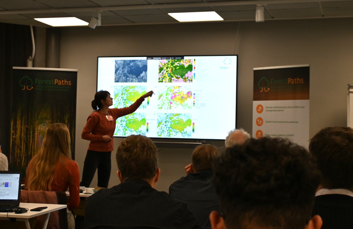
#ForestPaths2023 annual meeting took place this week ⭐️highlighting the progress we have made so far and✔️marking our next steps
Dive into the highlights of the meeting 👇https://t.co/s1M7TaSm3S
Next🆙in #ForestPaths2023 annual meeting
🗺️@albaa_vs (@edfm_tum) presents the development of next generation European forest disturbance maps - to be made public soon
🗺️Wanda De Keersmaecker (@VITO_RS_) presents the progress on modeling forest structure and composition
¿Es cierto que los pinos dan lugar a los peores incendios? ¿Son más inflamables que otras especies?
No, pero para entender porqué, debemos conocer cómo propagan los incendios.
Lo explicamos, en 119 segundos👇
#martesForestales
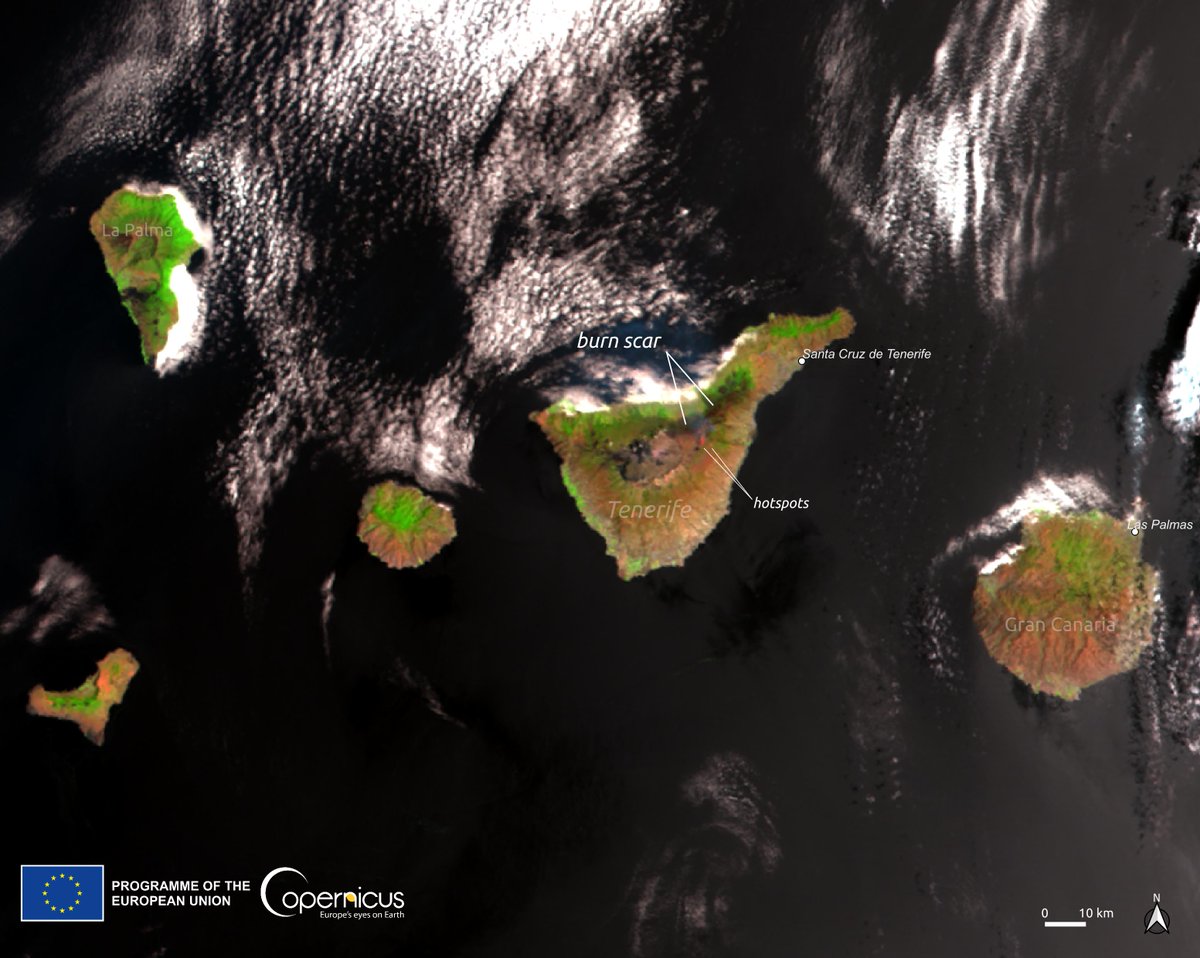
El #IFArafoCandelaria avanza en #Tenerife🇪🇸
Las altas temperaturas y los vientos han reavivado focos anteriormente controlados
Las autoridades sanitarias aconsejan a los ciudadanos permanecer en casa por la desfavorable calidad del aire 😷
Imagen #Sentinel3🇪🇺🛰️ el 21 de Agosto
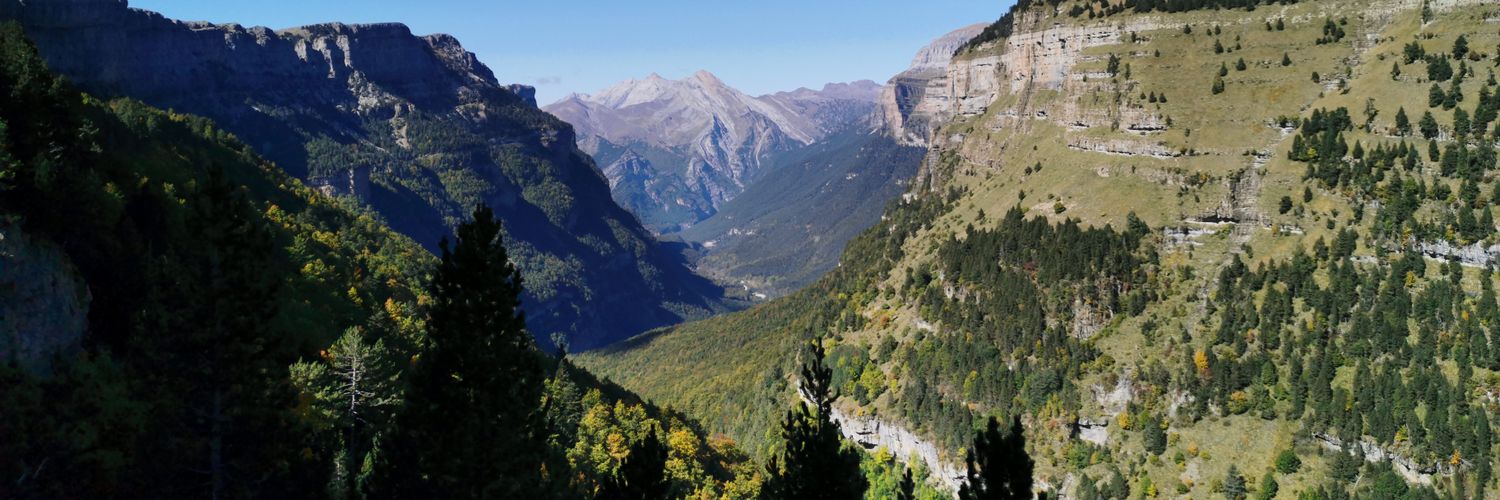
Huge diversity in disturbance size and regeneration in West Germany. Great days with @KirstenKrg & @albaa_vs, also fighting with brambles, thistles and nettles 😄🌱🫣
In Spain, a drought turns the world’s largest olive oil producing region brown.
NASA’s Terra satellite shows where green vegetation in May 2022 (left) turned brown by May 2023 (right). The drought dried up reservoirs, parched olive groves, and led to water restrictions.