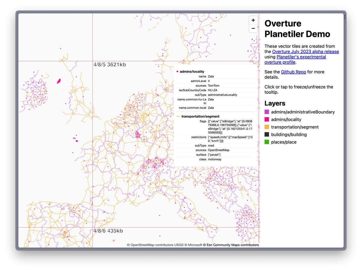
Check out Mike's slippy map of all @OvertureMaps themes - admins, localities, road networks, buildings, places! 47GB of tiles for the whole planet
https://t.co/UouHcwgcKX
build instructions using a planetiler branch for Parquet support:
https://t.co/hSqOiEAbqX
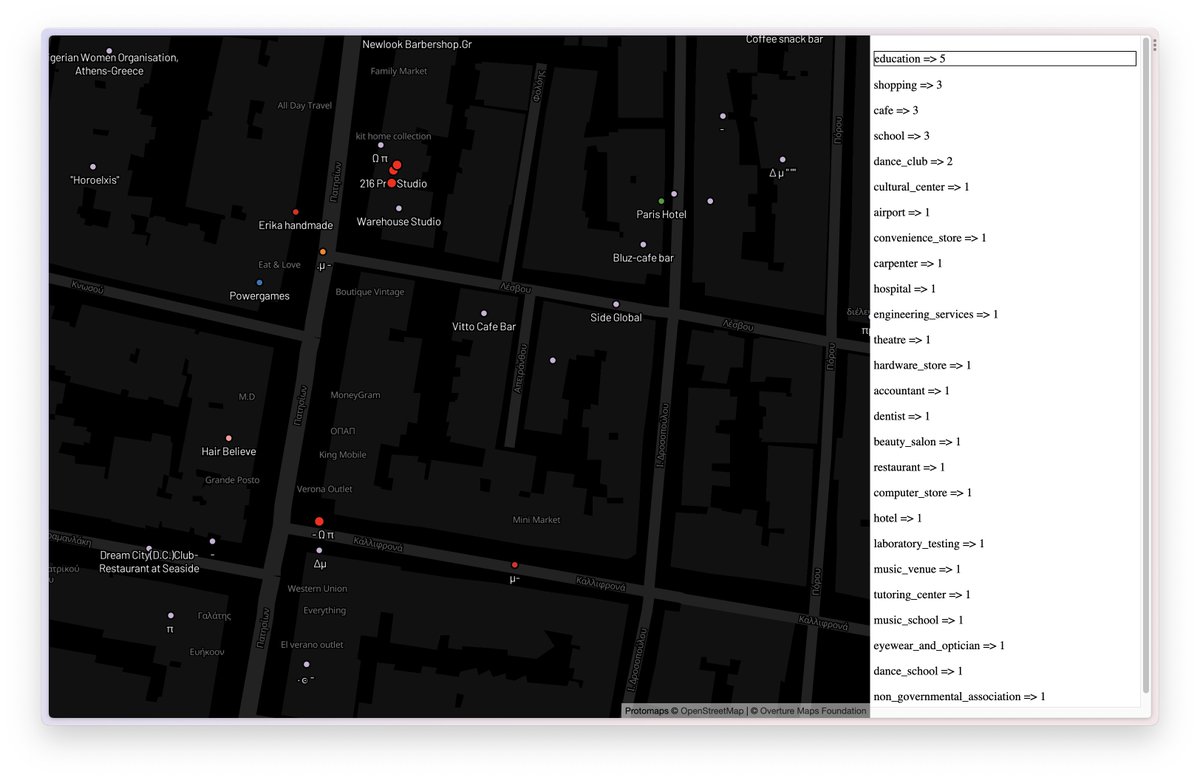
@bdon@OvertureMaps@maplibre@duckdb@felt@Maxxen_@opencholmes I took your map and added a column on the side that displays place counts by category of what is rendered on every map move, available at https://t.co/oFuTRadiV1
If you click on the category, it will highlight rendered places.
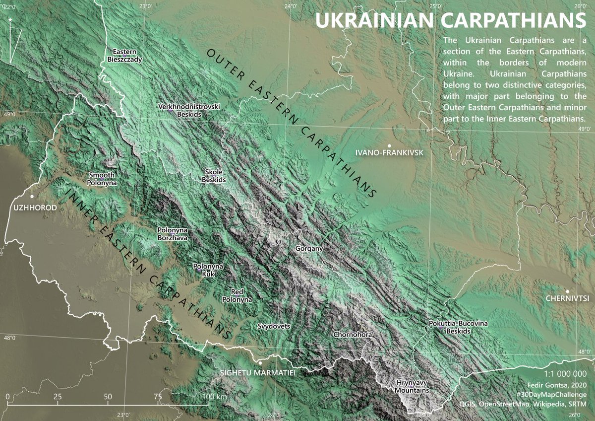
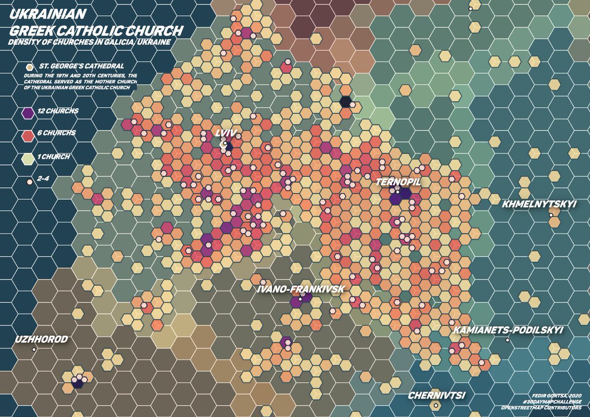
Hi, I'm Fedir Gontsa, and I'm a cartographic designer from Ukraine. I create maps on different topics and purposes using opensource tools.
My Portfolio: https://t.co/1HTT10gUjq
#PortfolioDay#cartography#map#qgis
Один житомирець завів відеоблог «100 тижнів до рок-зірки», де документував шлях до мрії: збирав гурт, писав музику, просував її. На 56 тижні блог замовк. Тепер автор виробляє й продає на фб маринований буряк (35 грн за баночку) і вже збирає замовлення на маринований оселедець.
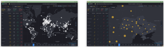
Ukraine's National Security & Defense Council map provides daily updated stats on lab-confirmed cases; the number of patients; the number of those who recovered; the number of dead; the number of suspected infections in Ukraine https://t.co/9DomD4Q4GY - amazing mapping @nsdc_ua
For more than 7 years already Kottans ( https://t.co/WEfzX6tQzF ) support beginners on their ways to IT industry delivering educational initiatives, meetups, and workshops.
Now Kottans feel the power to host a bigger national event. Meet the event team!
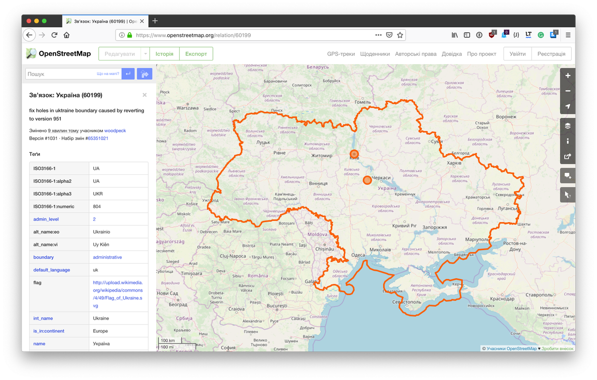
Українська спільнота @openstreetmap вітає рішення ОСМФ щодо неділимості та теріторіальної цілісності України / The Ukrainian #OSM community welcomes the decision of the #OSMF on the indivisibility and territorial integrity of Ukraine
#crimeaisukraine https://t.co/nGqdAvdMVi
It's a new #Plotmypaws story kind of day 🐶. The project started with tracking Bryn in a cornfield (orange tracers), now it's gone does his pattern change (blue tracers)? Not an awful lot, he is still crazy! #dog#map#dataviz#3d
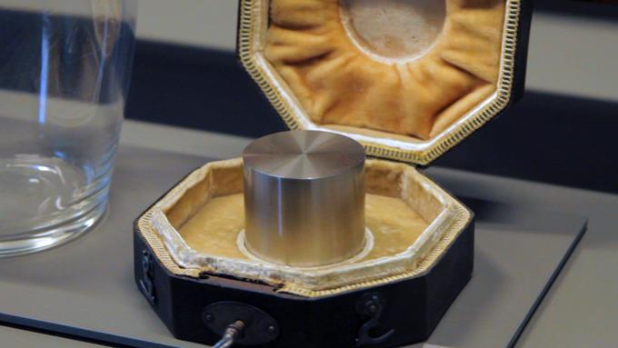
November is here, and that means a massive shift is coming. And by "massive" I am of course referring to the redefinition of the kilogram unit of mass that the world has been building up to for more than 100 years. Let me explain:
Another great talks from #pyconde, now by @MartinChristen and @alekzvik about working with geodata in Python. All I want now to spend few days in creating some maps only interested for me. Thanks, Martin & Alex